- Saldanha, Western Cape
-
Saldanha — Town — Location of the town in Western Cape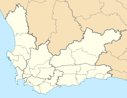
 SaldanhaLocation of the town in South Africa
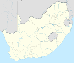 Saldanha
Coordinates: 32°59′52″S 17°56′44″E / 32.99778°S 17.94556°ECoordinates: 32°59′52″S 17°56′44″E / 32.99778°S 17.94556°E[1] Country  South Africa
Province Western Cape District West Coast Municipality Saldanha Bay Named for Saldanha Bay Area[2] – Total 10.3 km2 (4 sq mi) Census main place Population (2001)[2] – Total 21,636 – Density 2,100.6/km2 (5,440.5/sq mi) Time zone SAST (UTC+2) Postal code 7395 Area code 022 This article is about the town. For other uses, see Saldanha.Saldanha, also known as Saldanha Bay, is a town of 22,000 people, located 110 kilometres (68 mi) north of Cape Town on the northern shore of Saldanha Bay, in the Western Cape province of South Africa. Its situation as a natural sheltered harbour has led to development as a port for the export of iron ore from Sishen in the Northern Cape, which is transported on the Sishen–Saldanha railway line. The port is one of the largest exporting ports of ore in the whole of Africa, and it is able to handle ships as large as 200 000 tons deadweight. [3]
References
- ^ "Saldanha". South African Geographical Names System. Department of Arts and Culture. http://sagns.dac.gov.za/public/PlaceNameInfo.aspx?id=72260. Retrieved 22 March 2010.
- ^ a b "Main Place 'Saldanha'". Census 2001. http://census.adrianfrith.com/place/10407. Retrieved 1 April 2011.
- ^ "Saldanha". Saldanha Bay Local Municipality. http://www.saldanhabay.co.za/pages/about/Saldanha.pdf. Retrieved 22 March 2010.

Matzikama • Cederberg • Bergrivier • Saldanha Bay • Swartland
Cities and towns Abbotsdale • Aurora • Bitterfontein • Chatsworth • Citrusdal • Clanwilliam • Darling • Doringbaai • Dwarskersbos • Ebenhaeser • Eendekuil • Elands Bay • Goedverwacht • Graafwater • Grotto Bay • Hopefield • Jacobsbaai • Jakkalsfontein • Kalbaskraal • Klawer • Koekenaap • Koringberg • Lamberts Bay • Langebaan • Langebaanweg • Lutzville • Malmesbury • Moorreesburg • Paternoster • Piketberg • Porterville • Redelinghuys • Riebeek-Kasteel • Riebeek West • Saldanha • St Helena Bay • Strandfontein • Vanrhynsdorp • Velddrif • Vredenburg • Vredendal • Wupperthal • Yzerfontein
Categories:- Port cities in South Africa
- Populated places in the West Coast District Municipality
- Western Cape geography stubs


Wikimedia Foundation. 2010.