- Caja de Muertos, Puerto Rico
-
Coordinates: 17°53′41″N 66°31′8″W / 17.89472°N 66.51889°W
Caja de Muertos 
Beachgoers enjoy Pelicano Beach in Caja de Muertos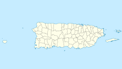
 Caja de Muertos, Puerto Rico (Puerto Rico)
Geography Location Ponce, Puerto Rico Coordinates 17°53′41″N 66°31′8″W / 17.89472°N 66.51889°W Area 1.54 km2 (0.595 sq mi) Length 2.75 km (1.709 mi) Width 0.86 km (0.534 mi) Highest elevation 52 m (171 ft) Country United StatesCommonwealth  Puerto Rico
Municipality Ponce Demographics Population 0 Density 0 /km2 (0 /sq mi) Caja de Muertos (English: Coffin Island) is an uninhabited island off the southern coast of Puerto Rico, in the municipality of Ponce. The island is protected by the Reserva Natural Caja de Muertos natural reserve, because of its native turtle traffic. Hikers and beachgoers are often seen in the island, which can be reached by ferry from the La Guancha Boardwalk sector of Ponce Playa. Together with Cardona, Ratones, Morrillito, Isla del Frio, Gatas, and Isla de Jueyes, Caja de Muertos is one of seven islands ascribed to the municipality of Ponce.[1][2]
Contents
Location
Caja de Muertos is located 8.4 km south of the Puerto Rican mainland and is part of the Playa[3][4] barrio of Ponce, Puerto Rico, municipality.
Geography and climate
The island measures 2.75 km long northeast-southwest, and up to 860 meters wide (560 meters on the average). It has an area of 1.54 km². Close by are Morrillito Key (180 m off the southwest point, 0.04 km²) and Berbería Key (6.2 km to the northeast, 0.30 km²), both part of the Caja de Muertos Natural Reserve. Berbería Key belongs to Rio Canas Abajo barrio of Juana Diaz municipality.
The climate is dry and the island supports dry forest. A still-functioning lighthouse, Caja de Muertos Light, established in 1887 and automated in 1945, sits atop the highest hill on the island. This 170 feet high hill is located at the southwest extreme of the island.[5]
Features
The island has four beaches: Pelicano, Playa Larga, Carrucho, and Coast Guard. The island also possesses fauna and flora not found anywhere else in the world.[6]
Name
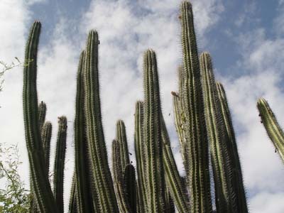
 Cactus in the island's dry forest
Though there is no consensus on how the island got its name, one story given by Kurt Pitzer and Tara Stevens is that of a Portuguese pirate, Jose Almeida.[7] A former merchant sailor, Almeida fell in love with a Basque lady in Curaçao, married her in St. Thomas, US Virgin Islands and took her pirating with him around the Caribbean. On the first raid, however she was killed by a stray bullet. Distraught, Almeida had her embalmed and placed in a glass box inside a copper coffin. He buried her in a cave in a deserted island near Ponce.[8] He would come every month to gaze over her preserved body and leave half of his treasure in her grave. Almeida, however, was caught in the Puerto Rico mainland, tried, and executed in El Morro in 1832. Many years later, a Spanish engineer discovered the glass and copper coffin, and identifying the cay on a map gave it its present name.[9] The treasure found, if any, was kept secret.[10]
Another possibility is that the island got its name because it resembles someone lying down when seen from the main island. Caja de Muertos can be translated into English as "Coffin" or "Dead Man's Chest".
Other than the aforementioned meaning of the name, it has also been suggested by A. W. Van Buren of Yale University that the island's name may be related to the sea shanty "Dead man's chest", probably first written by Robert Louis Stevenson for his novel Treasure Island.[11]
The official version of the origin of the name, as given by the Puerto Rico Department of Natural Resources, and under whose care the island is currently entrusted, is as follows: "Its name is attributed to the 18th century French writer Jean Baptist Labat who called it Coffre A’morr (Caja de Muertos), making reference to the fact that when the island is seen from certain places in southern Puerto Rico, it gives the impression of seeing a dead person laying on a plateau."[12]
Natural reserve
 Playa Larga, above, is part of the protected area of the island
The island was designated as a nature reserve in 1980 after a meeting was held in Puerto Rico by the Puerto Rico Planning Board wherein they considered the recommendation set forth by the Coastal Management Zone Program to turn the island into a protected wilderness area. The island has remained a protected area ever since.[13] The protection is mainly due to its heavy turtle traffic which is an endangered species.
References
- ^ Neysa Rodriguez Deynes. Brevario Sobre la Historia de Ponce. Second Edition. Government of the Autonomous Municipality of Ponce. 2002. Page 9. Printed by Impress Quality Printing, Bayamon, Puerto Rico.
- ^ CityMelt. Retrieved 17 May 2011.
- ^ General Purpose Population Data, Census 2000. Unidad de Sistemas de Información Geográfica, Área de Tecnología de Información Gubernamental, Oficina de Gerencia y Presupuesto. Gobierno de Puerto Rico. Retrieved February 16, 2010.
- ^ US Census. 1930 Federal Census Team Transcription. Retrieved February 22, 2010.
- ^ Coast Pilot Nr. 5
- ^ Por algo le llaman 'El Edén del Caribe'. Carmen Cila Rodríguez. La Perla del Sur. 20 April 2011. Retrieved 3 May 2011.
- ^ Adventure Guide to Puerto Rico. By Kurt Pitzer and Tara Stevens.
- ^ Travel and Sports: Puerto Rico Reserva Natural Caja de Muertos.
- ^ Lighthouse Friends
- ^ Adventure Guide to Puerto Rico. By Kurt Pitzer and Tara Stevens.
- ^ Mail Bag Hints: Stevenson's "Dead Man's Chest." By A. W. Van Buren. The New York Times, June 29, 1901.
- ^ Puerto Rico Department of Natural and Environmental Resources. The Isla Caja de Muertos Natural Reserve. From: Hojas de Nuestro Ambiente series. October 2006, Revised July 2009. Page P-009. Retrieved March 2, 2010.
- ^ Puerto Rico.com: The Puerto Rico Channel. Visiting Caja de Muertos Island Nature Reserve.
External links
Categories:- Uninhabited islands of Puerto Rico
- Lighthouses in Puerto Rico
- National Register of Historic Places in Puerto Rico
- Ponce, Puerto Rico
- Protected areas of Puerto Rico
- Beaches of Puerto Rico
- Islands of Ponce


Wikimedia Foundation. 2010.