- Dallas–Fort Worth metroplex
-
"Dallas–Fort Worth" redirects here. For the airport, see Dallas/Fort Worth International Airport."Metroplex" redirects here. For other uses of the term, see Metroplex (disambiguation).
Dallas–Fort Worth–Arlington — MSA — Dallas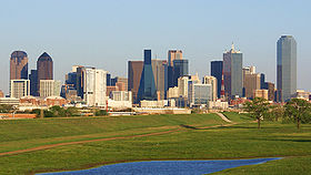 Fort Worth
 Arlington
Country  United States
State  Texas
TexasPrincipal cities - Dallas
- Fort Worth
- Arlington
- Plano
- Irving
- Carrollton
- Denton
- McKinney
- RichardsonArea - Urban 1,407 sq mi (3,644.2 km2) - Metro 9,286 sq mi (24,059 km2) Elevation 606 - 1,368 ft (184 - 417 m) Population (2010)[1][2] - Density 634/sq mi (245/km2) - Urban 4,145,659 (6th) - MSA 6,371,773 (4th) - CSA 6,731,317 (7th) MSA/CSA: 2010
Urban: 2000Time zone CST (UTC-6) - Summer (DST) CDT (UTC-5) The Dallas–Fort Worth–Arlington Metropolitan Statistical Area, a title designated by the U.S. Census as of 2003, encompasses 12 counties within the U.S. state of Texas. The area is divided into two metropolitan divisions: Dallas–Plano–Irving and Fort Worth–Arlington. Residents of the area informally refer to it as the Dallas/Fort Worth Metroplex, DFW, or The Metroplex. It is the economic and cultural hub of the region commonly called North Texas or North Central Texas and is the largest land-locked metropolitan area in the United States.[3]
The 2010 official U.S. Census real counts has the Dallas-Fort Worth Metroplex at 6,371,773.[4] During the 12-month period from July 2008 to July 2009, the Dallas-Fort Worth-Arlington metropolitan area gained 146,530 new residents, more than any other metropolitan area in the United States.[5][6] The area's population has grown by about one million since the last census was administered in 2000.[7] The Dallas–Fort Worth–Arlington MSA is, by population, the largest metropolitan area in Texas, the largest in the South, the fourth-largest in the United States, and the tenth-largest in the Americas. The metroplex encompasses 9,286 square miles (24,100 km2) of total area: 8,991 sq mi (23,290 km2) is land, while 295 sq mi (760 km2) is water, making it larger in area than the U.S. states of Rhode Island and Connecticut combined. It is also the sixth largest gross metropolitan product (GMP) in the United States,[8] and approximately tenth largest by GMP in the world.
Contents
Origin of the term
According to the North Texas Commission (NTC), the term originated from an ad agency's combination of the terms "metropolitan" and "complex". The NTC copyrighted[citation needed] the term "Dallas/Fort Worth Metroplex" in 1972 as a replacement for the previously-ubiquitous "North Texas", which studies had shown lacked identifiability outside the state. In fact, only 38 percent of a survey group identified Dallas and Fort Worth as part of "North Texas", with the Texas Panhandle also a perceived correct answer, being the northernmost region of Texas.[9]
Metroplex counties
US Government Designated
 D/FW Counties
- Collin County
- Dallas County
- Delta County
- Denton County
- Ellis County
- Hunt County
- Johnson County
- Kaufman County
- Parker County
- Rockwall County
- Tarrant County
- Wise County
Metroplex cities, towns, and CDPs

 Fort Worth is the 17th largest city in the United States.
Note: Cities and towns are categorized based on the latest population estimates from the North Central Texas Council of Governments (as of January 1, 2010).[10] No population estimates are released for Census-designated places (CDPs), which are marked with an asterisk (*). These places are categorized based on their 2000 census population.
Places with more than 100,000 inhabitants
Places designated "principal cities" by the Office of Management and Budget (OMB) are italicized in bold.[11]
- Places with 1,000,000+ inhabitants
- Places with 500,000 to 999,999 inhabitants
- Places with 100,000 to 199,999 inhabitants
Places with 10,000 to 99,999 inhabitants
Places with fewer than 10,000 inhabitants
Unincorporated places
Demographics
As of the 2000 United States census[12], there were 5,161,544 people, 1,881,056 households, and 1,301,993 families residing within the MSA. The racial makeup of the MSA was 69.3% White, 13.9% African American, 0.6% Native American, 3.8% Asian, 0.1% Pacific Islander, 10.0% from other races, and 2.4% from two or more races. Hispanic or Latino of any race were 21.7% of the population.
The median income for a household in the MSA was $48,062, and the median income for a family was $55,263. Males had a median income of $39,581 versus $27,446 for females. The per capita income for the MSA was $21,839.
Combined Statistical Area
The Dallas–Fort Worth Combined Statistical Area is made up of 19 counties in north central Texas. The statistical area includes two metropolitan areas and five micropolitan areas. As of the 2000 Census, the CSA had a population of 5,487,956 (though a July 1, 2009 estimate placed the population at 6,805,275).[13] The CSA definition encompasses 14,628 sq mi (37,890 km2) of area, of which 14,126 sq mi (36,590 km2) is land and 502 sq mi (1,300 km2) is water.
Components
- Metropolitan Statistical Areas (MSAs)
- Dallas–Fort Worth–Arlington (Collin, Dallas, Delta, Denton, Ellis, Hunt, Johnson, Kaufman, Parker, Rockwall, Tarrant, and Wise counties)
- Sherman-Denison (Grayson County)
- Micropolitan Statistical Areas
- Athens (Henderson County)
- Bonham (Fannin County)
- Gainesville (Cooke County)
- Granbury (Hood and Somervell counties)
- Mineral Wells (Palo Pinto County)
Demographics
As of the census[12] of 2000, there were 5,487,956 people, 2,006,665 households, and 1,392,540 families residing within the CSA. The racial makeup of the CSA was 70.41% White, 13.34% African American, 0.59% Native American, 3.58% Asian, 0.08% Pacific Islander, 9.62% from other races, and 2.39% from two or more races. Hispanic or Latino of any race were 20.83% of the population.
The median income for a household in the CSA was $43,836, and the median income for a family was $50,898. Males had a median income of $37,002 versus $25,553 for females. The per capita income for the CSA was $20,460.
Geography
The Metroplex overlooks mostly prairie land with a few rolling hills dotted by man-made lakes cut by streams, creeks and rivers surrounded by forest land. The Metroplex is situated in the Texas blackland prairies region, so named for its fertile black soil found especially in the rural areas of Collin, Dallas, Ellis, Hunt, Kaufman, and Rockwall counties.
Many areas of Denton, Johnson, Parker, Tarrant, and Wise counties are located in the Fort Worth Prairie[14] region of North Texas, which has less fertile and more rocky soil than that of the Texas blackland prairie; most of the rural land on the Fort Worth Prairie is ranch land. A large onshore natural gas field, the Barnett Shale, lies underneath this area; Denton, Tarrant and Wise counties feature many natural gas wells. Continuing land use change results in scattered crop fields surrounded by residential or commercial development.
South of Dallas and Fort Worth is a line of rugged hills that goes north to south about 15 miles (24 km) that looks similar to the Texas Hill Country 200 miles (320 km) to the south.
Economy
See also: List of major companies in Dallas/Ft.Worth
The cities of Dallas and Fort Worth are the anchor cities of the Metroplex. Dallas and its suburbs have one of the highest concentrations of corporate headquarters in the United States. As such, one of the largest industries in the Metroplex is conducting business. The Metroplex also contains the largest Information Technology industry base in the state (often referred to as Silicon Prairie or the Telecom Corridor), owing to the large number of corporate IT projects and the presence of numerous electronics, computing and telecommunication firms such as Texas Instruments, HP Enterprise Services, Dell Services, i2, AT&T, Ericsson, CA and Verizon in and around Dallas. On the other end of the business spectrum, and on the other side of the Metroplex, the Texas farming and ranching industry is based in Fort Worth. According to the Dallas Business Journal's 2006 Book of Lists, American Airlines is the largest employer in the Metroplex. Several major defense manufacturers, including Lockheed Martin, Bell Helicopter Textron, and Raytheon, maintain significant operations in the Metroplex. ExxonMobil, the #1 corporation on the Fortune 500 listings, is headquartered in Irving, Texas.
Transportation
The Dallas-Fort Worth International Airport (IATA airport code: DFW), located between Dallas and Fort Worth, is the largest and busiest airport in the state of Texas. It is the third busiest airport in the world in terms of aircraft movements and the seventh busiest airport in the world in terms of passenger traffic, transporting 59,784,876 passengers in 2007.[15] American Airlines, based in Fort Worth, has its headquarters next to DFW Airport. American, formerly the largest airline in the world in terms of passengers transported and fleet size, is a predominant leader in domestic routes and operations.[16]
Love Field Airport (IATA airport code: DAL) is located in Dallas. Southwest Airlines, the largest carrier in the world in terms of passengers carried, is based in Dallas next to Love Field.
Public transit options continue to expand significantly, though in several outlying suburbs, it remains limited. Dallas County and parts of Collin and Rockwall Counties have bus service and light rail operated by Dallas Area Rapid Transit, (DART), covering thirteen member cities. With the completion of projects currently under construction, DART's rail network will grow to 90 miles of track by 2014. The Red Line extends north to Plano and southwest to Westmoreland Road. The Blue Line reaches from Garland in the northeast (with an additional 4.5 mile expansion east to Rowlett scheduled to be complete in December 2012) to Ledbetter Road in south Dallas (with an additional 3 miles south to the University of North Texas near I-20 scheduled to open in 2019). DART's most recent addition, the 28-mile Green Line, which opened in December 2010, connects Carrolton in the northwest through Downtown Dallas to Pleasant Grove in the southeast. The Orange Line, which currently parallels the Red Line from Plano to Downtown Dallas and the Green Line from Downtown Dallas to Northwest Hwy, will be extended in phases from Northwest Hwy. to Las Colinas (Irving) in 2012 and finally to DFW International Airport in 2014.
Denton County has bus service limited to Denton, Highland Village, and Lewisville (with commuter service to downtown Dallas) provided by the Denton County Transportation Authority (DCTA). The A-train, a diesel commuter rail line, parallels I-35E to connect Denton, Highland Village, Lewisville, and Carrollton. Several smaller towns along this line, Corinth, Shady Shores, and Lake Dallas, voted to abstain from DCTA and do not have stations. There is an across-the-platform transfer in Carrollton to the DART Green Line. A-Train service began June 20, 2011.[17]
Tarrant County has bus service operated by the Fort Worth Transportation Authority (known as 'The T'), available only in Fort Worth. The diesel commuter train that serves Fort Worth and its eastern suburbs is operated as the Trinity Railway Express; it connects downtown Fort Worth to downtown Dallas, where it links to the DART light rail system. A station near its midpoint, Centerport, serves DFW Airport via a free airport shuttle bus. The TRE is jointly owned by FWTA and DART.[18] AMTRAK serves Dallas and Fort Worth once daily in each direction on a route from Chicago to Austin to San Antonio, with connections at San Antonio to New Orleans, Houston, El Paso, Phoenix, and Los Angeles.
The Dallas-Fort Worth area has thousands of lane-miles of freeways and interstates. The Metroplex has the second largest number of freeway-miles per capita in the nation, behind only the Kansas City Metropolitan Area. Like most major metropolitan areas in Texas, most interstates and freeways have access roads where most of the businesses are located; these access roads have slip ramps that merge onto the freeways and interstates. North-south Interstates include I-35 and I-45. East-west routes include I-30 and I-20. I-35 splits into I-35E and I-35W from Denton to Hillsboro: I-35W goes through Fort Worth while I-35E goes through Dallas. I-30 connects Dallas and Fort Worth, and I-45 connects Dallas to Houston. HOV lanes currently exist along I-35E, I-30, I-635, US 67, and US 75. I-20 bypasses both Dallas and Fort Worth to the south while its loop, I-820, loops around Fort Worth. I-635 splits to the north of I-20 and loops around east and north Dallas, ending at SH 121 north of DFW Airport. I-35E, Loop 12, and Spur 408 ultimately connect to I-20 southwest of Dallas, completing the west bypass loop around Dallas. A large number of construction projects are planned or are already underway in the region to alleviate congestion. Due largely to funding issues, many of the new projects involve building new tollways or adding tolled express lanes to existing highways.[citation needed]
Largest area private-sector employers
Source: Dallas Business Journal Book of Lists 2006 company # of employees locally type of business American Airlines 22,077 Commercial airline Wal-Mart Stores, Inc. 21,133 Retail Texas Health Resources 16,289 Health care Lockheed Martin Aeronautics Company 15,900 Military aircraft design and production Baylor Health Care System 15,200 Health care Citigroup 15,000 Financial Services AT&T, Inc. 13,729 Data, voice, networking and internet services Verizon Communications 12,500 Telecommunications Texas Instruments 10,600 Semiconductor manufacturing Albertsons 10,100 Retail grocery Brinker International 10,000 Restaurants HCA Healthcare 9,896 Health care JPMorgan Chase 8,800 Financial services J.C. Penney Company, Inc. 7,900 Retail Kroger Food Stores 7,600 Retail grocery Target Corporation 7,554 Retail Electronic Data Systems (EDS) 7,300 Information technology services Bank of America 7,000 Financial services Tom Thumb Food & Pharmacy (Safeway Inc.) 6,314 Retail grocery Southwest Airlines 5,543 Commercial airline Bell Helicopter Textron 5,301 Aircraft manufacturing Minyard Food Stores, Inc. 5,091 Retail grocery Blockbuster, Inc. 4,500 Retail video and games General Motors 4,030 Automotive manufacturer RadioShack Corp. 3,896 Electronics retailer Sprint 3,500 Communications products Media
The cities of Dallas and Fort Worth have their own newspapers, The Dallas Morning News and the Fort Worth Star-Telegram, respectively. Historically, the two papers were restricted in readership to their own counties; Tarrant County households would never read the Morning News and vice versa. As the two cities' suburbs have grown together in recent years, it is now common to find locations where both of the newspapers are sold. This pattern has been repeated in other print media, radio, and television, but since the 1970s all of the television stations and most of the FM radio stations have chosen to transmit from Cedar Hill so as to serve the entire market, and are programmed likewise. A recent phenomenon seen most clearly in the DFW market has been the rise of "80-90 move-ins", whereby stations have been moved from distant markets, in some cases as far away as Oklahoma, and relicensed to anonymous small towns in the Metroplex to serve as additional DFW stations. According to RadioTime, the market has 38 AM stations, 58 FM stations (many of them class Cs), and 18 full-power television stations. Dallas-Fort Worth is the 5th largest television market in the United States, behind only New York City, Los Angeles, Chicago and Philadelphia.
Two Metroplex AM radio stations, 820 WBAP and 1080 KRLD, are 50,000-watt stations with coverage of much of the North American continent and beyond during nighttime hours.
See Also:
- Category:Radio stations in the Dallas – Fort Worth Metroplex
- Category:Television stations in the Dallas – Fort Worth Metroplex
Sports
The Metroplex is one of just twelve American metropolitan areas that has a team in each of the four major professional sports leagues. Major professional sports first came to the area in 1960, when the Dallas Cowboys began competing in the National Football League and the Dallas Texans began competing in the American Football League (the Texans would later relocate to Kansas City and become the Chiefs). In 1972, Major League Baseball's Washington Senators moved to Arlington to become the Texas Rangers. The National Basketball Association expanded into North Texas in 1980 when the Dallas Mavericks were added to the league. The fourth piece was added in 1993 when the Minnesota North Stars of the National Hockey League became the Dallas Stars. The area is also home to many other minor-league professional teams, four colleges that compete in NCAA Division I athletics, and has played host to many premiere sports events on both an annual and one-time basis.
Major professional sports teams
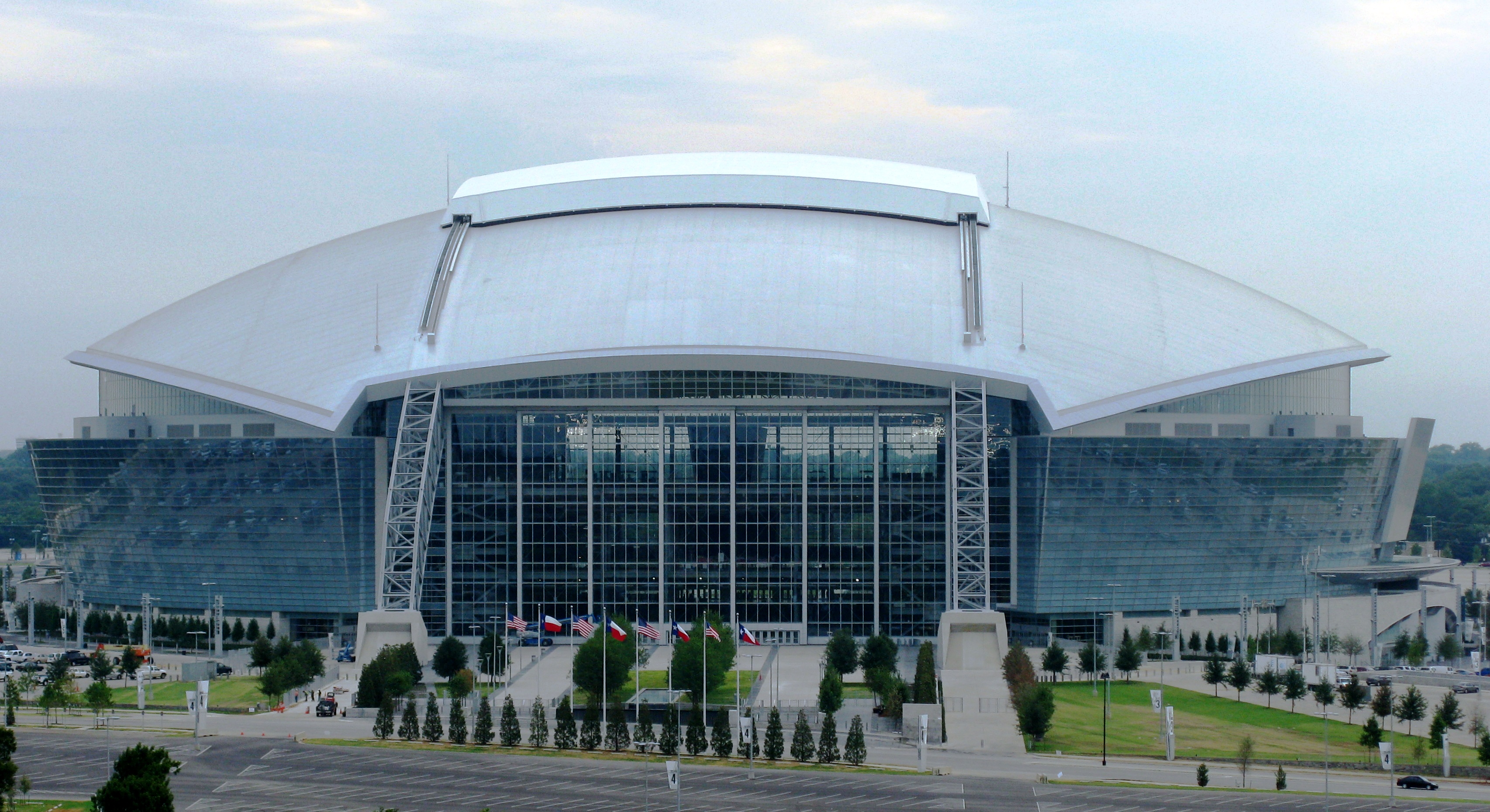
Club Sport Founded League Venue Dallas Cowboys Football 1960 NFL Cowboys Stadium Texas Rangers Baseball 1972^ MLB Rangers Ballpark in Arlington Dallas Mavericks Basketball 1980 NBA American Airlines Center Dallas Stars Hockey 1993^ NHL American Airlines Center FC Dallas Soccer 1996 Major League Soccer Pizza Hut Park ^- Indicates year team relocated to the area
Other professional teams
Club Sport Founded League Venue Allen Americans Hockey 2009 Central Hockey League Allen Event Center Dallas Vigilantes Arena Football 2010 Arena Football League American Airlines Center Frisco RoughRiders Baseball 2003^ Texas League Dr Pepper Ballpark Fort Worth Cats Baseball 2001 AAIPBL LaGrave Field Grand Prairie AirHogs Baseball 2007 AAIPBL QuikTrip Park Texas Legends Basketball 2011 NBA D-League Dr Pepper Arena Texas Brahmas Hockey 1997 Central Hockey League NYTEX Sports Centre Allen Wranglers Arena Football 2011^ Indoor Football League Allen Event Center ^- Indicates year team relocated to the area
Division I college athletics
School City Nickname Conference University of North Texas Denton Mean Green Sun Belt University of Texas at Arlington Arlington Mavericks Southland Southern Methodist University University Park Mustangs Conference USA Texas Christian University Fort Worth Horned Frogs Mountain West* (*) TCU is moving to the Big 12 Conference effective July 1, 2012.
Sports events hosted
See also
- Dallas/Fort Worth Area Tourism Council
- Greater Dallas Korean American Chamber of Commerce
- Geology of the Dallas-Fort Worth Metroplex
- Texaplex
- United States metropolitan area
References
- ^ "Table 1. Annual Estimates of the Population of Metropolitan and Micropolitan Statistical Areas: April 1, 2000 to July 1, 2009 (CBSA-EST2009-01)" (CSV). 2009 Population Estimates. United States Census Bureau, Population Division. 2010-03-23. http://www.census.gov/popest/metro/tables/2009/CBSA-EST2009-01.csv. Retrieved 2010-03-24.
- ^ American Community Survey Dallas-Fort Worth-Arlington Urbanized Area (2008 estimate)
- ^ http://www.omniglot.com/info-articles/dallas/index.html
- ^ http://www.chron.com/databases/Census2010Texas.html
- ^ "Estimates of the Components of Population Change for Metropolitan and Micropolitan Statistical Areas: July 1, 2008 to July 1, 2009 (CBSA-EST2009-09)" (CSV). 2009 Population Estimates. United States Census Bureau, Population Division. 2010-03-23. http://www.census.gov/popest/metro/tables/2009/CBSA-EST2009-09.csv. Retrieved 2010-03-24.
- ^ "Dallas-Fort Worth area topping the nation in population growth". Eric Aasen, The Dallas Morning News. 2010-03-23. http://www.dallasnews.com/sharedcontent/dws/news/localnews/stories/DN-census_24met.ART.State.Edition2.4c64642.html. Retrieved 2010-03-24.
- ^ "Cumulative Estimates of the Components of Population Change for Metropolitan and Micropolitan Statistical Areas: April 1, 2000 to July 1, 2009 (CBSA-EST2009-10)" (CSV). 2009 Population Estimates. United States Census Bureau, Population Division. 2010-03-23. http://www.census.gov/popest/metro/tables/2009/CBSA-EST2009-10.csv. Retrieved 2010-03-24.
- ^ http://www.bea.gov/newsreleases/regional/gdp_metro/gdp_metro_newsrelease.htm
- ^ North Texas Commission (1 January 2002). ""Dallas/Fort Worth Metroplex" brand serves region well". http://www.ntc-dfw.org/news/newsarchives/metroplex.html. Retrieved 27 June 2006.[dead link]
- ^ "2010 population estimates" (PDF). North Central Texas Council of Governments, Research and Services Division. 010-04-23. http://www.nctcog.org/ris/demographics/population/2010PopEstimates.pdf. Retrieved 2010-05-04.
- ^ "Update of Statistical Area Definitions and Guidance on Their Uses". Office of Management and Budget. 2010-05-04. http://www.whitehouse.gov/omb/assets/bulletins/b10-02.pdf.
- ^ a b "American FactFinder". United States Census Bureau. http://factfinder.census.gov. Retrieved 2008-01-31.
- ^ "Table 2. Annual Estimates of the Population of Combined Statistical Areas: April 1, 2000 to July 1, 2009 (CBSA-EST2009-02)" (CSV). 2009 Population Estimates. United States Census Bureau, Population Division. 2010-03-23. http://www.census.gov/popest/metro/tables/2009/CBSA-EST2009-02.csv. Retrieved 2010-03-24.
- ^ "Cross Timbers and Prairies Ecological Region". http://www.tpwd.state.tx.us/landwater/land/habitats/cross_timbers/ecoregions/cross_timbers.phtml.
- ^ http://www.airports.org/cda/aci_common/display/main/aci_content07_c.jsp?zn=aci&cp=1-5-54-55_666_2__
- ^ http://www.iata.org/ps/publications/Pages/wats-passenger-carried.aspx
- ^ Peterson, Matt (June 20, 2011). "A-train railway begins rolling, carrying commuters from Denton to Carrollton". The Dallas Morning News. http://thescoopblog.dallasnews.com/archives/2011/06/a-train-railway-begins-rolling.html. Retrieved June 20, 2011.
- ^ http://www.trinityrailwayexpress.org/traininfo.html
External links
Official sites
- North Texas Commission
- DFW International Airport
- Greater Dallas Chamber
- Visit Dallas Fort Worth
- Metroplex Business Directory
Additional information
- 77,000 Dallas Homes for Sale and Dallas Real Estate
- Fort Worth Star-Telegram - major Fort Worth newspaper
- The Dallas Morning News - major Dallas newspaper
- Metroplex Daily
- Dallas Fort Worth Travel Guide
- Downtown Fort Worth news and information
- Satirical DFW news and humor
- TourTexas.com: DFW travel and entertainment information guide
- Dallas-Fort Worth Metro photoblog
- DFW Town Guide
- DFW Amatuer Radio information
Transportation
- DART (Dallas Area Rapid Transit) - Dallas Area Bus and Rail Service
- The "T" (Fort Worth Transportation Authority) - Fort Worth Bus Service
- TRE (Trinity Railway Express) - Rail Service
- DCTA (Denton County Transportation Authority) - Denton/Highland Village/Lewisville Bus Service
Dallas–Fort Worth–Arlington Counties Major cities Cities and towns
100k-300kCarrollton • Denton • Frisco • Garland • Grand Prairie • Irving • McKinney • Mesquite • Plano • RichardsonCities and towns
25k-99kAllen • Bedford • Cedar Hill • Cleburne • The Colony • Coppell • DeSoto • Duncanville • Euless • Farmers Branch • Flower Mound • Grapevine • Haltom City • Highland Village • Hurst • Keller • Lancaster • Lewisville • Mansfield • North Richland Hills • Rockwall • Rowlett • WylieCities and towns
10k-25kAddison • Balch Springs • Benbrook • Burleson • Colleyville • Corinth • Ennis • Forest Hill • Greenville • Saginaw • Seagoville • Southlake • Terrell • University Park • Watauga • Waxahachie • Weatherford • White Settlement50 largest metropolitan statistical areas in the United States by population - New York
- Los Angeles
- Chicago
- Dallas–Fort Worth
- Philadelphia
- Houston
- Washington
- Miami
- Atlanta
- Boston
- San Francisco–Oakland
- Detroit
- Riverside–San Bernardino
- Phoenix
- Seattle
- Minneapolis–St. Paul
- San Diego
- St. Louis
- Tampa–St. Petersburg
- Baltimore
- Memphis
- Louisville
- Richmond
- Oklahoma City
- Hartford
- New Orleans
- Buffalo
- Raleigh
- Birmingham
- Salt Lake City
Categories:- Dallas – Fort Worth Metroplex
- Geography of Dallas County, Texas
- Geography of Tarrant County, Texas
- Geography of Collin County, Texas
- Geography of Denton County, Texas
- Geography of Johnson County, Texas
- Geography of Ellis County, Texas
- Geography of Kaufman County, Texas
- Geography of Parker County, Texas
- Geography of Rockwall County, Texas
- Geography of Hunt County, Texas
- Geography of Wise County, Texas
- Geography of Delta County, Texas


Wikimedia Foundation. 2010.