- Crockey Hill
-
Coordinates: 53°54′42″N 1°03′00″W / 53.911758°N 1.050091°W
Crockey Hill 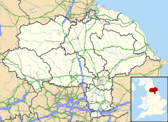
 Crockey Hill
Crockey Hill shown within North YorkshireOS grid reference SE624467 Unitary authority City of York Ceremonial county North Yorkshire Region Yorkshire and the Humber Country England Sovereign state United Kingdom Post town YORK Postcode district YO19 Police North Yorkshire Fire North Yorkshire Ambulance Yorkshire EU Parliament Yorkshire and the Humber UK Parliament York Outer List of places: UK • England • Yorkshire Crockey Hill is a small village in the unitary authority of City of York in North Yorkshire, England. It is situated on the A19 approximately 1.5 miles south of York.
The village is in the Wheldrake ward of the City of York.
Businesses located at Crockey Hill include a car dealership, a veterinary surgery, a transport cafe and a fruit and vegetable stall. The York Designer Outlet is also nearby, situated at the intersection of the A19 and the A64, approximately 1 mile north of the village.
The A19 at Crockey Hill was a notorious blackspot with many people becoming injured or losing their lives in road traffic accidents. This led to traffic lights being installed at the junction linking the A19 to Wheldrake Lane in 2007.[1]
References
- ^ Black spot works go-ahead York Press. Retrieved 2010-01-08
Categories:- Villages and areas in the City of York
- York geography stubs

Wikimedia Foundation. 2010.