- Cowabbie
-
Cowabbie
New South Wales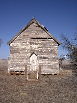
Cowabbie Presbyterian Church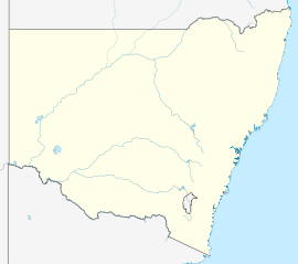
 Cowabbie
Postcode: 2663 Coordinates: 34°36′0″S 147°0′36″E / 34.6°S 147.01°ECoordinates: 34°36′0″S 147°0′36″E / 34.6°S 147.01°E Location: LGA: Coolamon Shire Council County: Bourke State District: Murrumbidgee Federal Division: Division of Riverina Cowabbie is a rural community in the central part of the Riverina region of New South Wales, Australia. It is situated by road about 29 kilometres (18 mi) south from Ardlethan and 32 kilometres (20 mi) north from Matong along the Wagga Wagga road.
The place name Cowabbie is derived from expression used by the local Aboriginals for cows when they were first seen in the area by these early inhabitants,[1] and Cowabbie Station is one of the functioning properties in the area.
Cowabbie has a rich Presbyterian history. The original church - dilapidated but memorialised by the small community surrounding it, was first built by the local Hannah family in 1865 and then transported to its current location by bullock-team in 1926.
Notes and references
Main Article: Local Government Areas of New South WalesCategories:- Towns in New South Wales
- Towns in the Riverina
- Australian Aboriginal placenames
- Riverina geography stubs


Wikimedia Foundation. 2010.