Wellesley County

Wellesley County
Wellesley
New South Wales
Wellesley NSW.PNG
Location in New South Wales
Lands administrative divisions around Wellesley
Wallace Beresford Auckland
Wallace Wellesley Auckland
Tambo (Vic) Croajingolong (Vic) Auckland

Wellesley County is one of the 141 Cadastral divisions of New South Wales. It is located along the border with Victoria, with the Snowy River part of the northern boundary. It includes Bombala.

Wellesley County was named in honour of Governor General of India Richard Colley Wellesley, Marquis Wellesley (1760-1842).[1]

Parishes within this county

A full list of parishes found within this county; their current LGA and mapping coordinates to the approximate centre of each location is as follows:

Parish LGA Coordinates
Alexander Bombala Shire 36°49′54″S 148°40′04″E / 36.83167°S 148.66778°E / -36.83167; 148.66778 (Alexander Parish)
Ashton Bombala Shire 36°56′54″S 149°06′04″E / 36.94833°S 149.10111°E / -36.94833; 149.10111 (Ashton Parish)
Biddi Bombala Shire 36°45′54″S 148°30′04″E / 36.765°S 148.50111°E / -36.765; 148.50111 (Biddi Parish)
Boco Cooma-Monaro Shire 36°30′54″S 149°12′04″E / 36.515°S 149.20111°E / -36.515; 149.20111 (Boco Parish)
Bombala Bombala Shire 36°54′14″S 149°14′25″E / 36.90389°S 149.24028°E / -36.90389; 149.24028 (Bombala Parish)
Bungarby Bombala Shire 36°40′54″S 149°01′04″E / 36.68167°S 149.01778°E / -36.68167; 149.01778 (Bungarby Parish)
Bungee Bombala Shire 36°36′54″S 149°06′04″E / 36.615°S 149.10111°E / -36.615; 149.10111 (Bungee Parish)
Burnima Bombala Shire 36°50′54″S 149°17′04″E / 36.84833°S 149.28444°E / -36.84833; 149.28444 (Burnima Parish)
Burrimbucco Bombala Shire 36°58′54″S 149°20′04″E / 36.98167°S 149.33444°E / -36.98167; 149.33444 (Burrimbucco Parish)
Byadbo Bombala Shire 36°50′54″S 148°30′04″E / 36.84833°S 148.50111°E / -36.84833; 148.50111 (Byadbo Parish)
Cambalong Bombala Shire 36°46′54″S 149°05′04″E / 36.78167°S 149.08444°E / -36.78167; 149.08444 (Cambalong Parish)
Cathcart Bombala Shire 36°49′54″S 149°24′04″E / 36.83167°S 149.40111°E / -36.83167; 149.40111 (Cathcart Parish)
Coolumbooka Bombala Shire 36°53′54″S 149°20′04″E / 36.89833°S 149.33444°E / -36.89833; 149.33444 (Coolumbooka Parish)
Cooper Bombala Shire 36°36′54″S 149°10′04″E / 36.615°S 149.16778°E / -36.615; 149.16778 (Cooper Parish)
Corrowong Bombala Shire 36°59′54″S 148°50′04″E / 36.99833°S 148.83444°E / -36.99833; 148.83444 (Corrowong Parish)
Creewah Bombala Shire 36°44′54″S 149°23′04″E / 36.74833°S 149.38444°E / -36.74833; 149.38444 (Creewah Parish)
Delegate Bombala Shire 35°59′54″S 149°00′04″E / 35.99833°S 149.00111°E / -35.99833; 149.00111 (Delegate Parish)
Gecar Bombala Shire 36°53′54″S 149°09′04″E / 36.89833°S 149.15111°E / -36.89833; 149.15111 (Gecar Parish)
Glenbog Cooma-Monaro Shire 36°33′54″S 149°17′04″E / 36.565°S 149.28444°E / -36.565; 149.28444 (Glenbog Parish)
Grenville Bombala Shire 36°50′54″S 148°46′04″E / 36.84833°S 148.76778°E / -36.84833; 148.76778 (Grenville Parish)
Gulgin Bombala Shire 37°02′54″S 149°16′04″E / 37.04833°S 149.26778°E / -37.04833; 149.26778 (Gulgin Parish)
Gunning Grach Bombala Shire 36°44′54″S 149°11′04″E / 36.74833°S 149.18444°E / -36.74833; 149.18444 (Gunning Grach Parish)
Hayen Bombala Shire 36°59′24″S 149°03′34″E / 36.99°S 149.05944°E / -36.99; 149.05944 (Hayen Parish)
Ironmungy Bombala Shire 36°35′54″S 149°01′04″E / 36.59833°S 149.01778°E / -36.59833; 149.01778 (Ironmungy Parish)
Jettiba Bombala Shire 36°36′54″S 149°15′04″E / 36.615°S 149.25111°E / -36.615; 149.25111 (Jettiba Parish)
Lawson Bombala Shire 37°07′54″S 149°07′04″E / 37.13167°S 149.11778°E / -37.13167; 149.11778 (Lawson Parish)
Maffra Snowy River Shire 36°31′54″S 149°00′04″E / 36.53167°S 149.00111°E / -36.53167; 149.00111 (Maffra Parish)
Maharatta Bombala Shire 36°58′04″S 149°12′34″E / 36.96778°S 149.20944°E / -36.96778; 149.20944 (Maharatta Parish)
Meringo Bombala Shire 36°52′54″S 149°05′04″E / 36.88167°S 149.08444°E / -36.88167; 149.08444 (Meringo Parish)
Merriangaah Bombala Shire 36°49′54″S 149°00′04″E / 36.83167°S 149.00111°E / -36.83167; 149.00111 (Merriangaah Parish)
Merrumbulo Bombala Shire 36°46′54″S 148°41′04″E / 36.78167°S 148.68444°E / -36.78167; 148.68444 (Merrumbulo Parish)
Mila Bombala Shire 36°59′04″S 149°06′54″E / 36.98444°S 149.115°E / -36.98444; 149.115 (Mila Parish)
Mount Trooper Bombala Shire 36°50′54″S 148°26′04″E / 36.84833°S 148.43444°E / -36.84833; 148.43444 (Mount Trooper Parish)
Nelson Cooma-Monaro Shire 36°33′54″S 149°06′04″E / 36.565°S 149.10111°E / -36.565; 149.10111 (Nelson Parish)
Nimmitabel Cooma-Monaro Shire 36°29′54″S 149°15′04″E / 36.49833°S 149.25111°E / -36.49833; 149.25111 (Nimmitabel Parish)
Peters Bombala Shire 36°44′54″S 149°00′04″E / 36.74833°S 149.00111°E / -36.74833; 149.00111 (Peters Parish)
Pickering Bombala Shire 36°45′54″S 149°15′04″E / 36.765°S 149.25111°E / -36.765; 149.25111 (Pickering Parish)
Quidong Bombala Shire 36°53′54″S 149°00′04″E / 36.89833°S 149.00111°E / -36.89833; 149.00111 (Quidong Parish)
Rodney Bombala Shire 36°51′54″S 148°54′04″E / 36.865°S 148.90111°E / -36.865; 148.90111 (Rodney Parish)
Tangaroo Bombala Shire 36°47′54″S 148°27′04″E / 36.79833°S 148.45111°E / -36.79833; 148.45111 (Tangaroo Parish)
Tarrabandra Bombala Shire 36°53′54″S 148°30′04″E / 36.89833°S 148.50111°E / -36.89833; 148.50111 (Tarrabandra Parish)
Thoko Bombala Shire 36°40′54″S 149°22′04″E / 36.68167°S 149.36778°E / -36.68167; 149.36778 (Thoko Parish)
Tingaringi Bombala Shire 36°54′54″S 148°39′04″E / 36.915°S 148.65111°E / -36.915; 148.65111 (Tingaringi Parish)
Tivy Bombala Shire 36°39′54″S 149°11′04″E / 36.665°S 149.18444°E / -36.665; 149.18444 (Tivy Parish)
Tombong Bombala Shire 36°55′54″S 148°53′04″E / 36.93167°S 148.88444°E / -36.93167; 148.88444 (Tombong Parish)
Wangellic Bombala Shire 36°42′54″S 149°07′04″E / 36.715°S 149.11778°E / -36.715; 149.11778 (Wangellic Parish)
Wellington Snowy River Shire 36°30′54″S 149°05′04″E / 36.515°S 149.08444°E / -36.515; 149.08444 (Wellington Parish)
Wellsmore Bombala Shire 36°43′54″S 149°15′04″E / 36.73167°S 149.25111°E / -36.73167; 149.25111 (Wellsmore Parish)
Wollondibby Bombala Shire 37°00′54″S 148°44′04″E / 37.015°S 148.73444°E / -37.015; 148.73444 (Wollondibby Parish)

References

  1. ^ Geographical Names Board of NSW

Wikimedia Foundation. 2010.

Игры ⚽ Нужен реферат?

Look at other dictionaries:

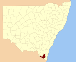
  • Wellesley County, New South Wales — Infobox Australian cadastral name = Wellesley state = New South Wales caption = Location in New South Wales near nw = Wallace near n = Beresford near ne = Auckland near e = Auckland near se = Auckland near s = Croajingolong (Vic) near sw = Tambo… …   Wikipedia

  • Wellesley, Ontario — Wellesley   Township   A bridge crossing the Conestogo River in Wellesley …   Wikipedia

  • Wellesley Island — in Jefferson County, New York, USA is partially in the Town of Orleans and partially in the Town of Alexandria. Geography The island is located coord|44|19|N|76|00|W| in the St. Lawrence River, which surrounds Wellesley Island on three sides. The …   Wikipedia

  • County Armagh — Contae Ard Mhacha Coontie Airmagh / Armagh Coat of arms …   Wikipedia

  • Wellesley Island State Park — is located on Wellesley Island in the St. Lawrence River in the Town of Orleans in Jefferson County, New York at 44° 19 North, 76° 00 West. The park is divided into sections that are on different parts of the island. It has the largest camping… …   Wikipedia

  • Wellesley [1] — Wellesley (spr. Uëll sli), Name der Familie Cowley od. Colley, welche im 16. Jahrh. aus England in Irland einwanderte u. aus welcher Richard Cowley 1728 mit den Gütern der ausgestorbenen Familie W. od. Wesley, welche er an sich brachte, auch… …   Pierer's Universal-Lexikon

  • Wellesley, Massachusetts — Infobox Settlement official name = Wellesley, Massachusetts nickname = motto = imagesize = image caption = image mapsize = 250px map caption = Location in Norfolk County in Massachusetts mapsize1 = map caption1 = subdivision type = Country… …   Wikipedia

  • Wellesley (of Norragh), Richard Colley Wellesley, Marquess — born June 20, 1760, Dangan, County Meath, Ire. died Sept. 26, 1842, London, Eng. British statesman. He inherited his father s Irish title as earl of Mornington and sat in the Irish House of Lords from 1781. He served in the British House of… …   Universalium

  • Wellesley Farms Railroad Station — Infobox Station name = Wellesley Farms Station type = Commuter Rail address = 90 Crotin St Wellesley, MA 02481 coordinates = coord|42|19|24.99|N|71|16|20.24|W|type:railwaystation line = rail color box|system=MBTA|line=Framingham platform =… …   Wikipedia

  • Wellesley Municipal Light Plant — Infobox Company company name = Wellesley Municipal Light Plant (WMLP) company type = Public company company slogan = Dedicated to Excellence foundation = 1892 location = key people = Richard F. Joyce, Director Debra J. Healy, Business Manager… …   Wikipedia

Share the article and excerpts

Direct link
Do a right-click on the link above
and select “Copy Link”