- Conchillas
-
Conchillas — Town — Location within Uruguay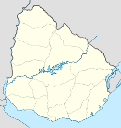
 Conchillas
Coordinates: 34°9′52″S 58°1′58″W / 34.16444°S 58.03278°W Country  Uruguay
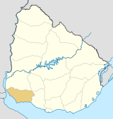
Department Colonia Department Population (2004) - Total 756 Time zone UTC -3 Postal code 70004 Area code(s) +598 4577 Conchillas (Spanish pronunciation: [kontʃi'ʒas]) is a small industrial town located within the Colonia Department, in southwestern Uruguay.
Contents
Geography
Conchillas is located in southwestern Colonia, near the Arroyo Conchillas. It has coasts over the Río de la Plata. Colonia del Sacramento, the capital city of the department and one of the oldest European settlements in present-day Uruguay, lies 50 km to the southeast. Carmelo, another important resort located near the Uruguay River, lies 40 km to the northwest.
History
The town is said to have been founded by the English at the turn of the 19th century. It soon became an important place for the exploitation of mineral resources. The English created a factory, founded two cemeteries, and established an Anglican Church. It is also believed that they kept their own currency for economic transactions, which was widely accepted in the rest of the country.[1]
However, with the outbreak of the Second World War, Conchillas was sold to two Uruguayan enterpreneurs who introduced a series of modifications. Today, the English influence and that resulted from the arrival of numerous European settlers, is mainly evident in the architecture of Conchillas rather than in the way of life of its inhabitants.[1]
Population
According to the 2004 census, Conchillas had a population of 756.[2]
Year Population 1963 825 1975 755 1985 727 1996 784 2004 756 Source: Instituto Nacional de Estadística de Uruguay[3]
See also
- Barker, Uruguay
References
- ^ a b History of Conchillas (Spanish)
- ^ "2004 Census of Colonia department" (XLS). INE. 2004. http://www.ine.gub.uy/fase1new/Colonia/Cuadro7_05.XLS. Retrieved 27 June 2011.
- ^ "1963–1996 Statistics / C" (DOC). Instituto Nacional de Estadística de Uruguay. 2004. http://www.ine.gub.uy/biblioteca/toponimico/TOPOletraC.doc. Retrieved 27 June 2011.
External links
 Colonia Department of Uruguay
Capital: Colonia del Sacramento Towns and
villagesArrivillaga • Barker • Carmelo • Colonia del Sacramento • Colonia Valdense • Conchillas • El Semillero • Florencio Sánchez • Fomento • Horqueta • Juan Lacaze • La Paz • Los Pinos • Miguelete • Nueva Helvecia • Nueva Palmira • Ombúes de Lavalle • Rosario • Tarariras • Zagarzazú
Sights Categories:- English diaspora
- Populated places in the Colonia Department


Wikimedia Foundation. 2010.