- Civil parishes in Cornwall
-
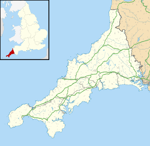
 A map of Cornwall (Cornish: Kernow); the Isles of Scilly (Cornish: Enesek Syllan) are in the extreme bottom left.
A civil parish is a subnational entity, forming the lowest unit of local government in England. There are 218 civil parishes in the ceremonial county of Cornwall (Cornish: Kernow), the county effectively being entirely parished; only the unpopulated Wolf Rock is unparished. At the 2001 census, there were 501,267 people living in the 218 parishes, accounting for 100.0 per cent of the county's population. The final unparished areas of mainland Cornwall, around St Austell, were parished on 1 April 2009, to coincide with the structural changes to local government in England.
Contents
History
Parishes arose from Church of England divisions, and were originally purely ecclesiastical divisions. Over time they acquired civil administration powers.[1]
The Highways Act 1555 made parishes responsible for the upkeep of roads. Every adult inhabitant of the parish was obliged to work four days a year on the roads, providing their own tools, carts and horses; the work was overseen by an unpaid local appointee, the Surveyor of Highways.[2]
The poor were looked after by the monasteries, until their dissolution. In 1572, magistrates were given power to 'survey the poor' and impose taxes for their relief. This system was made more formal by the Poor Law Act 1601, which made parishes responsible for administering the Poor Law; overseers were appointed to charge a rate to support the poor of the parish.[3] The 19th century saw an increase in the responsibility of parishes, although the Poor Law powers were transferred to Poor Law Unions.[4] The Public Health Act 1872 grouped parishes into Rural Sanitary Districts, based on the Poor Law Unions; these subsequently formed the basis for Rural Districts.[5]
Parishes were run by vestries, meeting annually to appoint officials, and were generally identical to ecclesiastical parishes,[6] although some townships in large parishes administered the Poor Law themselves; under the Divided Parishes and Poor Law Amendment Act 1882, all extra-parochial areas and townships that levied a separate rate became independent civil parishes.[7]
Civil parishes in their modern sense date from the Local Government Act 1894, which abolished vestries; established elected parish councils in all rural parishes with more than 300 electors; grouped rural parishes into Rural Districts; and aligned parish boundaries with county and borough boundaries.[7] Urban civil parishes continued to exist, and were generally coterminous with the Urban District, Municipal Borough or County Borough in which they were situated; many large towns contained a number of parishes, and these were usually merged into one. Parish councils were not formed in urban areas, and the only function of the parish was to elect guardians to Poor Law Unions; with the abolition of the Poor Law system in 1930 the parishes had only a nominal existence.[8]
The Local Government Act 1972 retained civil parishes in rural areas, and many former Urban Districts and Municipal Boroughs that were being abolished, were replaced by new successor parishes; urban areas that were considered too large to be single parishes became unparished areas.[9]
The current position
Recent governments have encouraged the formation of town and parish councils in unparished areas, and the Local Government and Rating Act 1997 gave local residents the right to demand the creation of a new civil parish.[10]
A parish council can become a town council unilaterally, simply by resolution;[9] and a civil parish can also gain city status, but only if that is granted by the Crown.[9] The chairman of a town or city council is called a mayor.[9] The Local Government and Public Involvement in Health Act 2007 introduced alternative names: a parish council can now choose to be called a community; village; or neighbourhood council.[11]
 Bude–StrattonSt BlaiseCivil parishes with town or city status
List of civil parishes and unparished areas
Image Name
Cornish nameStatus Population District Former local authority [12] Refs 
Advent
Sen AdhwynnCivil parish 153 Cornwall
KernowCamelford
Rural District[13]
[14]
Altarnun
AlternonnCivil parish 976 Cornwall
KernowAntony
TrevantaCivil parish 436 Cornwall
KernowBlisland Civil parish 565 Cornwall
KernowBoconnoc
BoskennekCivil parish 121 Cornwall
KernowBodmin
BosveneghTown 12,881 Cornwall
KernowBodmin
Municipal Borough[20]
[14]
Botusfleming
BosflumyesCivil parish 783 Cornwall
KernowBoyton
TrevoyaCivil parish 378 Cornwall
KernowBreage
EglosvregCivil parish 2,955 Cornwall
KernowBroadoak
BrodhekCivil parish 124 Cornwall
KernowBude–Stratton
Bud–StrasnedhTown 9,242 Cornwall
KernowBude–Stratton
Urban District[23]
[14]
Budock
BudhekCivil parish 1,399 Cornwall
KernowCallington
KelliwikTown 4,783 Cornwall
KernowCalstock
KalstokCivil parish 6,095 Cornwall
KernowCamborne
KammbronnTown 20,010 Cornwall
KernowCamborne–Redruth
Urban District[24]
[22]
Camelford
RyskammelTown 2,256 Cornwall
KernowCamelford
Rural District[13]
[14]
Cardinham
KardhinanCivil parish 588 Cornwall
KernowCarharrack
KarardhekCivil parish 1,324 Cornwall
KernowCamborne–Redruth
Urban District[24]
[22]
Carlyon Civil parish 1,333 Cornwall
KernowSt Austell with Fowey
Municipal Borough[25]
[26]
[27]
Carn Brea
Carn BreCivil parish 7,466 Cornwall
KernowCamborne–Redruth
Urban District[24]
[22]
Chacewater
Dowr an ChasCivil parish 1,517 Cornwall
KernowColan
KolanCivil parish 1,766 Cornwall
KernowConstantine
LanngostentinCivil parish 1,705 Cornwall
KernowCrantock
LanngorrowCivil parish 764 Cornwall
KernowNewquay
Urban District[32]
[31]
Crowan
EgloskrowennCivil parish 2,375 Cornwall
KernowCubert
LannowynnCivil parish 1,155 Cornwall
KernowCuby
Sen KubiCivil parish 146 Cornwall
KernowCury
EgloskuriCivil parish 388 Cornwall
KernowDavidstow
LanndhewiCivil parish 470 Cornwall
KernowCamelford
Rural District[13]
[14]
Deviock Civil parish 1,341 Cornwall
KernowDobwalls and Trewidland
Fos an Mogh ha TrewydhlannCivil parish 1,939 Cornwall
KernowDuloe
DewloghCivil parish 660 Cornwall
KernowEgloshayle
EglosheyleCivil parish 371 Cornwall
KernowEgloskerry
EgloskeriCivil parish 374 Cornwall
KernowFalmouth
AberfalTown 20,775 Cornwall
KernowFalmouth
Municipal Borough[33]
[29]
Feock
LannfiekCivil parish 3,505 Cornwall
KernowForrabury and Minster Civil parish 888 Cornwall
KernowCamelford
Rural District[13]
[14]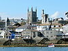
Fowey
FowydhTown 2,273 Cornwall
KernowSt Austell with Fowey
Municipal Borough[25]
[31]
Germoe
GermowCivil parish 508 Cornwall
KernowGerrans
GerensCivil parish 933 Cornwall
KernowGrade–Ruan Civil parish 1,070 Cornwall
KernowGrampound with Creed
Ponsmeur a'byth Sen KridaCivil parish 638 Cornwall
KernowGunwalloe
GwynnwalowCivil parish 221 Cornwall
KernowGweek
GwigCivil parish 581 Cornwall
KernowGwennap
LanwenepCivil parish 1,501 Cornwall
KernowGwinear–Gwithian
Sen Gwynnyer–
Sen GoedhyanCivil parish 3,032 Cornwall
KernowWest Penwith
Rural District[34]
[35]
Hayle
HeylTown 8,317 Cornwall
KernowWest Penwith
Rural District[34]
[35]
Helland
HellannCivil parish 205 Cornwall
KernowHelston
HellysTown 9,780 Cornwall
KernowHelston
Municipal Borough[36]
[22]
Illogan
EgloshalCivil parish 5,585 Cornwall
KernowCamborne–Redruth
Urban District[24]
[22]
Jacobstow
LannjagoCivil parish 421 Cornwall
KernowKea
Sen KeCivil parish 1,516 Cornwall
KernowKenwyn
KeynwynnCivil parish 4,944 Cornwall
KernowKilkhampton
TregylghCivil parish 1,193 Cornwall
KernowLadock
EgloslasekCivil parish 1,522 Cornwall
KernowLandewednack
LanndewynnekCivil parish 886 Cornwall
KernowLandrake with
St Erney
Lannergh a'byth
Sen ErneyCivil parish 1,001 Cornwall
KernowLandulph
LanndhelekCivil parish 485 Cornwall
KernowLaneast
LannastCivil parish 164 Cornwall
KernowLanhydrock
LannhydrekCivil parish 171 Cornwall
KernowLanivet
LannevesCivil parish 1,844 Cornwall
KernowLanlivery
LannlivriCivil parish 492 Cornwall
KernowLanner
LannerghCivil parish 2,493 Cornwall
KernowCamborne–Redruth
Urban District[24]
[22]
Lanreath
LannreydhowCivil parish 514 Cornwall
KernowLansallos
LannsalwysCivil parish 1,584 Cornwall
KernowLanteglos
NanseglosCivil parish 994 Cornwall
KernowLauncells
LannselesCivil parish 563 Cornwall
KernowLaunceston
LannstefanTown 7,135 Cornwall
KernowLaunceston
Municipal Borough[38]
[14]
Lawhitton Rural
NansgwydhennCivil parish 270 Cornwall
KernowLesnewth
LysnowydhCivil parish 68 Cornwall
KernowCamelford
Rural District[13]
[14]
Lewannick
LannwenekCivil parish 884 Cornwall
KernowLezant
LannsansCivil parish 751 Cornwall
KernowLinkinhorne
LanngynhornCivil parish 1,471 Cornwall
KernowLiskeard
LyskerrysTown 8,656 Cornwall
KernowLiskeard
Municipal Borough[39]
[17]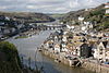
Looe
LoghTown 5,280 Cornwall
KernowLooe
Urban District[40]
[17]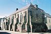
Lostwithiel
LostwydhyelTown 2,739 Cornwall
KernowLudgvan
LudewanCivil parish 3,184 Cornwall
KernowWest Penwith
Rural District[34]
[35]
Luxulyan
LansulienCivil parish 1,371 Cornwall
KernowMabe
LannvabCivil parish 1,276 Cornwall
KernowMadron
EglosvadernCivil parish 1,533 Cornwall
KernowWest Penwith
Rural District[34]
[35]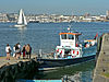
Maker with Rame
Magor a-berth
HordhCivil parish 1,071 Cornwall
KernowManaccan
ManaghanCivil parish 299 Cornwall
KernowMarazion
MarghasyowTown 1,466 Cornwall
KernowWest Penwith
Rural District[34]
[35]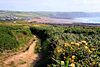
Marhamchurch
EglosvarwennCivil parish 754 Cornwall
KernowMawgan in Meneage
Sen MowganCivil parish 1,117 Cornwall
KernowMawgan in Pydar
LanherneCivil parish 1,176 Cornwall
KernowMawnan
Sen MownanCivil parish 1,454 Cornwall
KernowMenheniot
MahunyesCivil parish 1,605 Cornwall
KernowMevagissey
LannvorekCivil parish 2,221 Cornwall
KernowSt Austell with Fowey
Municipal Borough[25]
[31]
Michaelstow
LannvighalCivil parish 199 Cornwall
KernowCamelford
Rural District[13]
[14]
Millbrook
GovermelinCivil parish 2,033 Cornwall
KernowMorvah
MorvedhCivil parish 79 Cornwall
KernowWest Penwith
Rural District[34]
[35]
Morval
MorvalCivil parish 616 Cornwall
KernowMorwenstow
LannvorwennaCivil parish 768 Cornwall
KernowMullion
EglosvelyanCivil parish 1,986 Cornwall
KernowMylor
LannwydhekCivil parish 2,533 Cornwall
KernowNewquay
Tewyn PlustryTown 19,423 Cornwall
KernowNewquay
Urban District[32]
[31]
North Hill
Bre GledhCivil parish 917 Cornwall
KernowNorth Petherwin
Paderwynn GledhCivil parish 777 Cornwall
KernowNorth Tamerton
Tre war DamerCivil parish 288 Cornwall
KernowOtterham
PrasdowrgiCivil parish 228 Cornwall
KernowCamelford
Rural District[13]
[14]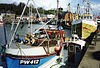
Padstow
LannwedhenekTown 3,162 Cornwall
KernowPaul
PawlCivil parish 234 Cornwall
KernowWest Penwith
Rural District[34]
[35]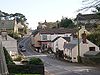
Pelynt
PlunennysCivil parish 1,124 Cornwall
KernowPenryn
PenrynnTown 6,227 Cornwall
KernowPenryn
Municipal Borough[41]
[29]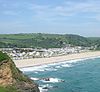
Pentewan Valley Civil parish 542 Cornwall
KernowSt Austell with Fowey
Municipal Borough[25]
[42]
[27]
Penzance
PensansTown 21,168 Cornwall
KernowPenzance
Municipal Borough[43]
[35]
Perranarworthal
Pyran ar WoethelCivil parish 1,558 Cornwall
KernowPerranuthnoe
PyranudhnoCivil parish 2,200 Cornwall
KernowWest Penwith
Rural District[34]
[35]
Perranzabuloe
Pyran yn TrethCivil parish 5,382 Cornwall
KernowPhilleigh
EglosrosCivil parish 159 Cornwall
KernowPillaton
TrebeulyowCivil parish 435 Cornwall
KernowPorthleven
PorthlevenTown 3,190 Cornwall
KernowHelston
Municipal Borough[36]
[22]
Portreath
PorthtrethCivil parish 1,377 Cornwall
KernowCamborne–Redruth
Urban District[24]
[22]
Poundstock
TregorlannCivil parish 805 Cornwall
KernowProbus
LannbroboesCivil parish 2,082 Cornwall
KernowQuethiock
GwydhekCivil parish 429 Cornwall
KernowRedruth
ResrudhTown 12,352 Cornwall
KernowCamborne–Redruth
Urban District[24]
[22]
Roche
An GarrekCivil parish 2,876 Cornwall
KernowRuanlanihorne
LannihornCivil parish 250 Cornwall
KernowSaltash
EssaTown 14,964 Cornwall
KernowSaltash
Municipal Borough[44]
[17]
Sancreed
EglossankresCivil parish 628 Cornwall
KernowWest Penwith
Rural District[34]
[35]
Sennen
Sen SenanCivil parish 829 Cornwall
KernowWest Penwith
Rural District[34]
[35]
Sheviock
SeviekCivil parish 683 Cornwall
KernowSithney
Sen SydhniCivil parish 767 Cornwall
KernowSouth Hill
Bre DheghowCivil parish 474 Cornwall
KernowSouth Petherwin
Paderwynn
DheghowCivil parish 932 Cornwall
KernowSt Agnes
BreanekCivil parish 7,257 Cornwall
KernowSt Allen
EglosallenCivil parish 435 Cornwall
KernowSt Anthony in Meneage
LannenteninCivil parish 171 Cornwall
KernowSt Austell
Sen OstellTown 18,378 Cornwall
KernowSt Austell with Fowey
Municipal Borough[25]
[45]
[27]
St Austell Bay Civil parish 857 Cornwall
KernowSt Austell with Fowey
Municipal Borough[25]
[46]
[27]
St Blaise
LanndrethTown 6,632 Cornwall
KernowSt Austell with Fowey
Municipal Borough[25]
[31]
St Breock
NanssansCivil parish 703 Cornwall
KernowSt Breward
Sen BranwaladerCivil parish 880 Cornwall
KernowCamelford
Rural District[13]
[14]
St Buryan
EglosveryanCivil parish 1,215 Cornwall
KernowWest Penwith
Rural District[34]
[35]
St Cleer
Sen KlerCivil parish 3,257 Cornwall
KernowSt Clement
Sen KlemensCivil parish 1,089 Cornwall
KernowSt Clether
Sen KlederCivil parish 149 Cornwall
KernowCamelford
Rural District[13]
[14]
St Columb Major
Sen Kolomm VeurTown 3,984 Cornwall
KernowSt Day
Sen DayCivil parish 1,621 Cornwall
KernowCamborne–Redruth
Urban District[24]
[22]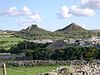
St Dennis
TredhinasCivil parish 2,696 Cornwall
KernowSt Dominick
Sen DomynekCivil parish 833 Cornwall
KernowSt Endellion
Sen EndelynCivil parish 1,143 Cornwall
KernowSt Enoder
EglosenoderCivil parish 3,819 Cornwall
KernowSt Erme
EglosermCivil parish 1,215 Cornwall
KernowSt Erth
LannudhnoCivil parish 1,384 Cornwall
KernowWest Penwith
Rural District[34]
[35]
St Ervan
Sen ErvenCivil parish 408 Cornwall
KernowSt Eval Civil parish 963 Cornwall
KernowSt Ewe
LannewaCivil parish 507 Cornwall
KernowSt Gennys
Sen GwynnysCivil parish 810 Cornwall
KernowSt Germans
LannalesCivil parish 1,427 Cornwall
KernowSt Gluvias Civil parish 1,271 Cornwall
KernowSt Goran Civil parish 1,271 Cornwall
KernowSt Hilary
BronnlowenaCivil parish 785 Cornwall
KernowWest Penwith
Rural District[34]
[35]
St Issey
EgloskrugCivil parish 881 Cornwall
KernowSt Ive
Sen IvCivil parish 2,121 Cornwall
KernowSt Ives
Porth IaTown 11,165 Cornwall
KernowSt Ives
Municipal Borough[47]
[35]
St John
Sen YowannCivil parish 375 Cornwall
KernowSt Juliot Civil parish 317 Cornwall
KernowCamelford
Rural District[13]
[14]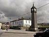
St Just
LannyustTown 4,690 Cornwall
KernowSt Just
Urban District[48]
[35]
St Just in Roseland
LannsiekCivil parish 1,197 Cornwall
KernowSt Keverne
LannaghevranCivil parish 2,107 Cornwall
KernowSt Kew
LanndoghoCivil parish 1,026 Cornwall
KernowSt Keyne
Sen KeynCivil parish 486 Cornwall
KernowSt Levan
Sen SelevanCivil parish 487 Cornwall
KernowWest Penwith
Rural District[34]
[35]
St Mabyn
Sen MabonCivil parish 560 Cornwall
KernowSt Martin by Looe
PenndrummCivil parish 321 Cornwall
KernowSt Martin in Meneage
Sen Martyn yn MenaghekCivil parish 343 Cornwall
KernowSt Mellion
Sen MelyanCivil parish 377 Cornwall
KernowSt Merryn Civil parish 1,608 Cornwall
KernowSt Mewan
Sen MewenCivil parish 3,071 Cornwall
KernowSt Michael Caerhays
LannvighalCivil parish 80 Cornwall
KernowSt Michael Penkevil
PennkevyllCivil parish 213 Cornwall
KernowSt Michael's Mount
Karrek Loos y'n KoosCivil parish 29 Cornwall
KernowWest Penwith
Rural District[34]
[35]
St Minver Highlands Civil parish 1,025 Cornwall
KernowSt Minver Lowlands Civil parish 1,449 Cornwall
KernowSt Neot Civil parish 867 Cornwall
KernowSt Newlyn East
EglosniwlinCivil parish 1,532 Cornwall
KernowSt Pinnock
Sen PynnekCivil parish 621 Cornwall
KernowSt Sampson Civil parish 223 Cornwall
KernowSt Stephen in Brannel
EglosstefanCivil parish 6,775 Cornwall
KernowSt Stephens by Launceston Rural
Lannstefan WarthaCivil parish 312 Cornwall
KernowSt Teath
EglostedhaCivil parish 2,343 Cornwall
KernowCamelford
Rural District[13]
[14]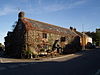
St Thomas the Apostle Rural
Sen Tommos LannstefanCivil parish 815 Cornwall
KernowSt Tudy
EglostudiCivil parish 637 Cornwall
KernowSt Veep
Sen VipCivil parish 299 Cornwall
KernowSt Wenn
Sen GwennaCivil parish 335 Cornwall
KernowSt Winnow
Sen GwynnowCivil parish 304 Cornwall
KernowStithians
Sen StedhyansCivil parish 2,004 Cornwall
KernowStokeclimsland
EglosklymCivil parish 1,670 Cornwall
KernowTintagel
DintagellCivil parish 1,822 Cornwall
KernowCamelford
Rural District[13]
[14]
Torpoint
PenntorrTown 8,457 Cornwall
KernowTorpoint
Urban District[49]
[17]
Towednack
TewynnekCivil parish 370 Cornwall
KernowWest Penwith
Rural District[34]
[35]
Tregoney
TrerigniCivil parish 809 Cornwall
KernowTremaine Civil parish 87 Cornwall
KernowTreneglos
TreneglosCivil parish 101 Cornwall
KernowTresmeer
TrewasmeurCivil parish 216 Cornwall
KernowTrevalga
TrevelgiCivil parish 83 Cornwall
KernowCamelford
Rural District[13]
[14]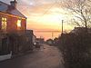
Treverbyn Civil parish 6,159 Cornwall
KernowSt Austell with Fowey
Municipal Borough[25]
[31]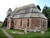
Trewen
TrewynnCivil parish 124 Cornwall
KernowTruro
TruruCity 17,431 Cornwall
KernowTruro
Municipal Borough[50]
[29]
Tywardreath and Par
Chi war Dreth ha PorthCivil parish 3,161 Cornwall
KernowSt Austell with Fowey
Municipal Borough[25]
[31]
Veryan
ElerghiCivil parish 982 Cornwall
KernowWadebridge
PonsrysTown 6,351 Cornwall
KernowWarbstow
LannwarburghCivil parish 439 Cornwall
KernowWarleggan
GorleganCivil parish 203 Cornwall
KernowWeek St Mary
Gwig Sen MariaCivil parish 550 Cornwall
KernowWendron
EgloswendronCivil parish 2,476 Cornwall
KernowWerrington
TrewolvrinCivil parish 453 Cornwall
KernowWhitstone
MengwynnCivil parish 582 Cornwall
KernowWithiel
GwydhyelCivil parish 351 Cornwall
KernowWolf Rock Unparished area 0 Cornwall
KernowWest Penwith
Rural District[34]
[35]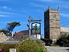
Zennor
Sen SenarCivil parish 217 Cornwall
KernowWest Penwith
Rural District[34]
[35]
Bryher
BryherCivil parish 92 Isles of Scilly
Enesek SyllanIsles of Scilly
Rural District[51]
[52]
St Agnes
AganasCivil parish 73 Isles of Scilly
Enesek SyllanIsles of Scilly
Rural District[51]
[52]
St Martin's
BrechiekCivil parish 142 Isles of Scilly
Enesek SyllanIsles of Scilly
Rural District[51]
[52]
St Mary's
EnnorCivil parish 1,666 Isles of Scilly
Enesek SyllanIsles of Scilly
Rural District[51]
[52]
Tresco
Ynys SkawCivil parish 180 Isles of Scilly
Enesek SyllanIsles of Scilly
Rural District[51]
[52]See also
References
- ^ Angus Winchester, 2000, Discovering Parish Boundaries. Shire Publications. Princes Risborough, 96 pages ISBN 978-0747804703
- ^ RAC Foundation : What Went Wrong? British Highway Development Before Motorways. Retrieved 22 August 2009.
- ^ The Victorian Web : The Poor Law : Introduction. Retrieved 22 August 2009.
- ^ Staffordshire University : Poor Law Unions and Registration Districts. Retrieved 22 August 2009.
- ^ A Vision of Britain Through Time : Status Details for Rural Sanitary District. Retrieved 22 August 2009.
- ^ Robert Tittler, The Reformation and the Towns in England, 1998, Oxford University Press, 395 pages, ISBN 9780198207184
- ^ a b Modern British Surnames : Selected Events in the History of Civil Registration and Boundary Changes 1801-1996. Retrieved 22 August 2009.
- ^ Alex MacMorran and T R Colquhoun Dill, The Local Government Act 1894 and the Subsequent Statutes Affecting Parish Councils, 1907, Butterworth and Co, London, 626 pages
- ^ a b c d Office of Public Sector Information : Local Government Act 1972. Retrieved 22 August 2009.
- ^ Office of Public Sector Information : Local Government and Rating Act 1997. Retrieved 22 August 2009.
- ^ Office of Public Sector Information : Local Government and Public Involvement in Health Act 2007. Retrieved 22 August 2009.
- ^ From 1974 to 2009, mainland Cornwall was divided into districts: Caradon (Cornish: Karadon), formed from Liskeard Municipal Borough, Liskeard Rural District, Looe Urban District, Saltash Municipal Borough, St Germans Rural District and Torpoint Urban District; Carrick (Cornish: Karrek), formed from Falmouth Municipal Borough, Penryn Municipal Borough, Truro Municipal Borough and Truro Rural District; Kerrier (Cornish: Keryer), formed from Camborne–Redruth Urban District, Helston Municipal Borough and Kerrier Rural District; North Cornwall (Cornish: Kernow Gledh), formed from Bodmin Municipal Borough, Bude–Stratton Urban District, Camelford Rural District, Launceston Municipal Borough, Launceston Rural District, Stratton Rural District and Wadebridge and Padstow Rural District; Penwith (Cornish: Pennwydh), formed from Penzance Municipal Borough, St Ives Municipal Borough, St Just Urban District and West Penwith Rural District; and Restormel (Cornish: Rostorrmoel), formed from Newquay Urban District, St Austell Rural District and St Austell with Fowey Municipal Borough
- ^ a b c d e f g h i j k l m A Vision of Britain Through Time : Camelford Rural District. Retrieved 22 September 2010.
- ^ a b c d e f g h i j k l m n o p q r s t u v w x y z aa ab ac ad ae af ag ah ai aj ak al am an ao ap aq ar as at au av aw ax ay az ba bb bc bd be bf bg bh bi bj bk bl bm Office for National Statistics : Census 2001 : Parish Headcounts : North Cornwall. Retrieved 22 September 2010.
- ^ a b c d e f g h i j k l m n o p q r s t A Vision of Britain Through Time : Launceston Rural District. Retrieved 22 September 2010.
- ^ a b c d e f g h i j k l m n o p A Vision of Britain Through Time : St Germans Rural District. Retrieved 22 September 2010.
- ^ a b c d e f g h i j k l m n o p q r s t u v w x y z aa ab ac ad ae af ag ah ai aj ak al am an ao Office for National Statistics : Census 2001 : Parish Headcounts : Caradon. Retrieved 22 September 2010.
- ^ a b c d e f g h i j k l m n o p q r s t A Vision of Britain Through Time : Wadebridge and Padstow Rural District. Retrieved 22 September 2010.
- ^ a b c d e f g h i j k l m n o p q r s t A Vision of Britain Through Time : Liskeard Rural District. Retrieved 22 September 2010.
- ^ A Vision of Britain Through Time : Bodmin Municipal Borough. Retrieved 22 September 2010.
- ^ a b c d e f g h i j k l m n o p q r s t u v A Vision of Britain Through Time : Kerrier Rural District. Retrieved 22 September 2010.
- ^ a b c d e f g h i j k l m n o p q r s t u v w x y z aa ab ac ad ae af Office for National Statistics : Census 2001 : Parish Headcounts : Kerrier. Retrieved 22 September 2010.
- ^ A Vision of Britain Through Time : Bude–Stratton Urban District. Retrieved 22 September 2010.
- ^ a b c d e f g h A Vision of Britain Through Time : Camborne–Redruth Urban District. Retrieved 20 September 2010.
- ^ a b c d e f g h i A Vision of Britain Through Time : St Austell with Fowey Municipal Borough. Retrieved 22 September 2010.
- ^ Office for National Statistics : Census 2001 : Usual Resident Population Crinnis (part) ward. Retrieved 22 September 2010.
- ^ a b c d Restormel Borough Council : New Parishes Plan. Retrieved 10 April 2009.
- ^ a b c d e f g h i j k l m n o p q r s t u v w x A Vision of Britain Through Time : Truro Rural District. Retrieved 22 September 2010.
- ^ a b c d e f g h i j k l m n o p q r s t u v w x y z aa Office for National Statistics : Census 2001 : Parish Headcounts : Carrick. Retrieved 22 September 2010.
- ^ a b c d e f g h i j k l m n o p q A Vision of Britain Through Time : St Austell Rural District. Retrieved 22 September 2010.
- ^ a b c d e f g h i j k l m n o p q r s t u v w x Office for National Statistics : Census 2001 : Parish Headcounts : Restormel. Retrieved 22 September 2010.
- ^ a b A Vision of Britain Through Time : Newquay Urban District. Retrieved 22 September 2010.
- ^ A Vision of Britain Through Time : Falmouth Municipal Borough. Retrieved 22 September 2010.
- ^ a b c d e f g h i j k l m n o p q r A Vision of Britain Through Time : West Penwith Rural District. Retrieved 22 September 2010.
- ^ a b c d e f g h i j k l m n o p q r s t u Office for National Statistics : Census 2001 : Parish Headcounts : Penwith. Retrieved 22 September 2010.
- ^ a b A Vision of Britain Through Time : Helston Municipal Borough. Retrieved 22 September 2010.
- ^ a b c d e f g h i j A Vision of Britain Through Time : Stratton Rural District. Retrieved 22 September 2010.
- ^ A Vision of Britain Through Time : Launceston Municipal Borough. Retrieved 22 September 2010.
- ^ A Vision of Britain Through Time : Liskeard Municipal Borough. Retrieved 22 September 2010.
- ^ A Vision of Britain Through Time : Looe Urban District. Retrieved 22 September 2010.
- ^ A Vision of Britain Through Time : Penryn Municipal Borough. Retrieved 22 September 2010.
- ^ Office for National Statistics : Census 2001 : Usual Resident Population Mevagissey (part); and St Ewe (part) wards. Retrieved 22 September 2010.
- ^ A Vision of Britain Through Time : Penzance Municipal Borough. Retrieved 22 September 2010.
- ^ A Vision of Britain Through Time : Saltash Municipal Borough. Retrieved 22 September 2010.
- ^ Office for National Statistics : Census 2001 : Usual Resident Population Bethel (part); Gover (part); Mount Charles; and Poltair (part) wards. Retrieved 22 September 2010.
- ^ Office for National Statistics : Census 2001 : Usual Resident Population Crinnis (part); and St Ewe (part) wards. Retrieved 22 September 2010.
- ^ A Vision of Britain Through Time : St Ives Municipal Borough. Retrieved 22 September 2010.
- ^ A Vision of Britain Through Time : St Just Urban District. Retrieved 22 September 2010.
- ^ A Vision of Britain Through Time : Torpoint Urban District. Retrieved 22 September 2010.
- ^ A Vision of Britain Through Time : Truro Municipal Borough. Retrieved 22 September 2010.
- ^ a b c d e A Vision of Britain Through Time : Isles of Scilly Rural District. Retrieved 22 September 2010.
- ^ a b c d e Office for National Statistics : Census 2001 : Parish Headcounts : Isle of Scilly. Retrieved 22 September 2010.
External links
- Office for National Statistics : Geographical Area Listings
- Cornwall Council: Names of Town and Parish Councils
Civil parishes in England Administration Legislation Lists by county Bedfordshire • Berkshire • Bristol • Buckinghamshire • Cambridgeshire • Cheshire • Cornwall • Cumbria • Derbyshire • Devon • Dorset • Durham • East Riding of Yorkshire • East Sussex • Essex • Gloucestershire • Greater Manchester • Hampshire • Herefordshire • Hertfordshire • Isle of Wight • Kent • Lancashire • Leicestershire • Lincolnshire • Merseyside • Norfolk • Northamptonshire • Northumberland • North Yorkshire • Nottinghamshire • Oxfordshire • Rutland • Shropshire • Somerset • South Yorkshire • Staffordshire • Suffolk • Surrey • Tyne and Wear • Warwickshire • West Midlands • West Sussex • West Yorkshire • Wiltshire • Worcestershire
Geography of Cornwall Cornwall Portal Unitary authorities Major settlements Bodmin • Bude • Callington • Camborne • Camelford • Falmouth • Fowey • Hayle • Helston • Launceston • Liskeard • Looe • Lostwithiel • Marazion • Newlyn • Newquay • Padstow • Par • Penryn • Penzance • Porthleven • Redruth • Saltash • St Austell • St Blazey • St Columb Major • St Ives • St Just-in-Penwith • St Mawes • Stratton • Torpoint • Truro • Wadebridge
See also: Civil parishes in CornwallRivers Topics History • Status debate • Flag • Culture • Places • People • The Duchy • Diocese • Politics • Hundreds/shires • Places of interest • full list...Categories:- Geography of Cornwall
- Lists of civil parishes in England
- Civil parishes in Cornwall
- Politics of Cornwall


Wikimedia Foundation. 2010.