- Odalar Mosque
-
Odalar mosque Odalar Câmîi 
The Mosque seen from East with Kariye Mosque in the background after the fire of 1919
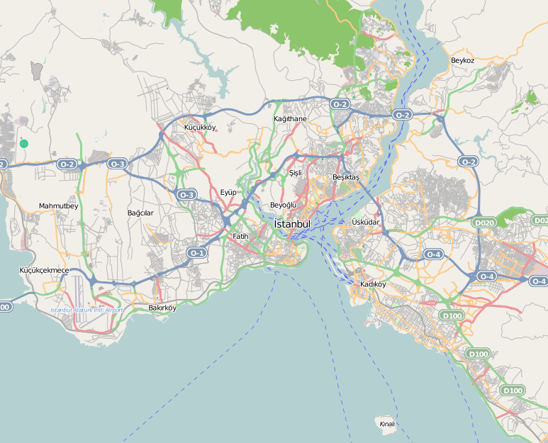
 Location within Istanbul
Former names Santa Maria di Costantinopoli General information Status Destroyed Type Church Architectural style Middle Byzantine - Comnenian Address Müftu Sokaĝi 20-22 Town or city Istanbul Country Turkey Destroyed July 2nd, 1919 Technical details Structural system Cross-in-square Coordinates: 41°01′45″N 28°56′23″E / 41.029071°N 28.939828°E The Odalar Mosque (Turkish: Odalar Câmîi, meaning "the mosque of the barracks", after the nearby accommodations of the married Jannisaries established in this quarter in the 18th century. Also: Kemankeş Mustafa Paşa Câmîi) was an Ottoman mosque in Istanbul. [1] The building was originally an Eastern Orthodox church of unknown dedication. [1] In 1475, after the Fall of Constantinople, it became a Roman Catholic church , dedicated to Saint Mary of Constantinople, until finally it was converted into a mosque by the Ottomans in 1640. [1] The mosque burned in 1919, and since then fell into ruin. [1] As of today (2011) only some walls remain, hidden among modern blocks.
Contents
Location
The building lied in Istanbul, in the district of Fatih, in the neighborhood of Salmatomruk, not far from Edirne Kapı (the ancient Gate of Charisius), more or less halfway between the museum of Chora and the mosque of Fethiye. [2] The few remains lie in a courtyard and can be accessed through modern blocks built on Müftu Sokaĝi 20-22. [2]
History
Byzantine Age
Between the ninth and the tenth century[3] a church with an underlying basement and acrypt was erected on the top of the sixth hill of Constantinople, on a plateau which is limited by the open air Cistern of Aetios (now a football field) and by the unidentified Byzantine edifice denominated in Ottoman time Boĝdan Saray. [2] The dedication of this building is uncertain, [1] but it was probably part of a complex which included also today's Kasim Aĝa Mescidi and the İpek cistern, and was almost certainly the Katholikon of a monastery. [2] The edifice has been identified for a long time as the Theotokos de Petra, but without conclusive evidence. [4] In this area lied during the Byzantine Age several monasteries, like that of Manuel, that devoted to St. John en te Petra, and the nunnery dedicated to the Theotokos Kecharitomene ("full of grace" or "favoured (by God)"). [2] The latter was founded at the begin of 12th century by Empress Eirene Doukaina, and is known above all because of its detailed Typikon. [5] Also the nearby church of the Theotokos tas Kellararias, used by the nuns of the Karithomene as burial place, and that of Hagios Nikolaos, both mentioned in the Typikon of the nunnery, are possible candidates for the identification. [6] Moreover, the Odalar mosque could also be identified with a nearby church of the Saints Sergius and Bacchus plesion tes Aetiou kinsternes (Greek "near the cistern of Aetios": not to be confounded with the homonymous church which lies near Hagia Sophia) because of the discovery in the vicinity of a monogrammed capital (unfortunately found not in situ) . [7] Between 1150 and 1175 a new church of the cross-in-square plan was built above the old one (possibly burned or menaced by a landslide). [8] [1]
Ottoman Age
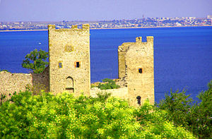 The Genoese Fortress of Kaffa. From here were deported the Italians which populated the Kefeli Mahalle in Istanbul
The documented history of the edifice begins in 1475, shortly after the Fall of Constantinople, when sultan Mehmet II conquered the Genoese colony of Caffa, in Crimea. About 4,000 Latin, Greek, Armenian and Jewish inhabitants who lived in Caffa ("Caffariotes" or, in Turkish, Kefeli) were then deported to Istanbul and relocated to this quarter, which was named after them Kefe Mahallesi. [1][9] The Latins, mainly Genoese, were authorized to use in their quarter as churches the building and, together with the Armenians, another edifice known later as Kefeli Mosque, which was dedicated to Saint Nicholas.[1] The edifice, dedicated then to Saint Mary of Constantinople (Italian:"Santa Maria di Costantinopoli"), was officiated by the Dominicans, which before the Ottoman conquest had also a monastery in the city on the Black Sea. [10] Here was brought from Kaffa a large Icon of the Hodegetria type, which now is kept in the Dominican monastery of SS. Pietro e Paolo in Galata. [9] The church became the center of this quarter predominantly inhabited by Italians, but the building fell soon in disrepair. [10] Under Sultan Murad IV (r. 1623 - 1640) the decision was taken to exclude from the walled city the Christian which were not Ottoman subjects and to resettle them in Galata and Pera. [11] As consequence of that, and after riots among Christian and Muslims, the church was closed in 1636, and in 1640 it was transformed into a mosque by Sadrazam (Great Vizier) Kemankeş Mustafa Paşa (d. 1644). [12][1] After the relocation of the married Janissaries in the quarter in 1782, the mosque got the appellation of Odalar (In Turkish "Oda" means "room" but also "barrack of the Janissaries"). Previously these were lodged at the Eski Odalar ("Old Barracks") near Şehzade Mosque, which were destroyed in the fire of 1782. [2] The building decayed steadily (in 19th century the dome was not anymore in place ), and it was heavily damaged by the fire of Salmatomruk on July 2nd, 1919. When the Quarter was rebuilt with modern criteria the edifice was not restored, and fell into ruins. [13]
Architecture
As mentioned above, several constructive phases can be recognized in the building during the byzantine period. The first church, erected in the middle byzantine age, had an almost square plan (about 11.65 m x 10 m ) with three apses, and was oriented toward East. [1] In 1935, only the tripartite Sanctuary and the Bema were still visible. [14] The church was built on a basement composed of 24 vaulted rooms and a vaulted crypt with an apse, which is supposed to have been a chapel containing Relics. [15] These rooms had at first a profane usage, later they were used as burial place[4] and finally as a cistern.[16] The second church, erected at the end of the twelfth century, used also 16 small rooms of the abandoned first church's basement as substructure. The brickwork was made of stone and bricks, and was erected with the technique of the hidden layer, [17] [9] [18] In this technique, alternate courses of bricks and stones are mounted on the line of the wall, and are plunged in a mortar's bed. Three or four rows of bricks alternate with single rows of stones. [18] The new church was of the cross-in-square type with an almost square naos about 10.5 m wide: it had four columns sustaining the dome through Pendentives, three apses - the central one having a polygonal shape - [1] and a narthex embracing the edifice on the West and North sides. [17] [13] The dome was about 4.4. m wide, lied on a Drum and was adorned with frescoes. [13] East of the naos lied a tripartite sanctuary composed of a Bema flanked by a prothesis and a diakonikon. [19] The floor of the new church was 3.3 m above that of the first church. [1] The edifice can be described as a middle sized byzantine church, similar to the near Church of Christ Pantepoptes. [20]
From a relation of Pietro Demarchis, bishop of Santorini, who visited Istanbul in 1622, we know that at that time the columns of the church had been taken away by the Turks and substituted with wooden pillars, and that the dome was covered with frescoes. [10] Moreover, part of the building was already menacing ruin. [10] Just after the conversion to mosque, to the building were added a Mihrab, a Minbar and a Minaret. After the fire of 1919, the building fell into ruin (the roof collapsed and the minaret crashed already in the twenties of last century), but luckily it was thoroughly studied and surveyed by the German Archeologist Paul Schatzmann in 1934/1935.[21] According to Paspates, in the East part of the basement of the Mosque lied a water source (Greek: Hagiásma, Turkish: Ayazma) dedicated to Saint John the Baptist, abandoned since long time.[9]
Paintings
During the excavation of 1934/1935 up to four mortar layers covered with frescoes on blue background were uncovered. [9] [4] A fresco representing a Madonna on Throne with angels was found in the crypt. [17] In the basement rooms were found fragments of paintings having as subject funerary themes. [22] In the inferior church were discovered two deesis, a fresco representing the soldier Saint Mercurius - of unparalleled technique among the known byzantine works of this age - and prophets. [17] These paintings were executed either in the tenth or in the middle of the eleventh century, belonging so to the first church. The diakonikon of the second church was adorned with frescoes showing saints and episodes of the Life of the Virgin. [17] [22] The best preserved frescoes (among them Saint Mercurius) were detached, restored and are on display at the Archaeological Museum of Istanbul. [9]
References
- ^ a b c d e f g h i j k l Müller-Wiener (1977), p. 188.
- ^ a b c d e f Westphalen (1998), p. 1.
- ^ Westphalen (1998) p.40
- ^ a b c Eyice (1955) p.72
- ^ Janin (1953), p. 196.
- ^ Westphalen (1998), p. 2.
- ^ Janin (1953), p. 559.
- ^ Westphalen (1998) p.43
- ^ a b c d e f Mamboury 1953) p. 308
- ^ a b c d Westphalen (1998), p. 48.
- ^ Westphalen (1998), p. 49.
- ^ Gülersoy (1976) p. 249.
- ^ a b c Westphalen (1998), p. 52.
- ^ Westphalen (1998) p. 37
- ^ Westphalen (1998) p. 24
- ^ Westphalen (1998) p. 47
- ^ a b c d e Janin (1953), p. 560.
- ^ a b Westphalen (1998) p. 53
- ^ Westphalen (1998) p. 60
- ^ Westphalen (1998) p. 67
- ^ Westphalen (1998), p. 5.
- ^ a b Westphalen (1998) p. 85
Sources
- Janin, Raymond (1953) (in French). La Géographie Ecclésiastique de l'Empire Byzantin. 1. Part: Le Siège de Constantinople et le Patriarcat Oecuménique. 3rd Vol. : Les Églises et les Monastères. Paris: Institut Français d'Etudes Byzantines.
- Mamboury, Ernest (1953). The Tourists' Istanbul. Istanbul: Çituri Biraderler Basımevi.
- Eyice, Semavi (1955) (in French). Istanbul. Petite Guide a travers les Monuments Byzantins et Turcs. Istanbul: Istanbul Matbaası.
- Gülersoy, Çelik (1976). A Guide to Istanbul. Istanbul: Istanbul Kitaplığı. OCLC 3849706.
- Müller-Wiener, Wolfgang (1977) (in German). Bildlexikon Zur Topographie Istanbuls: Byzantion, Konstantinupolis, Istanbul Bis Zum Beginn D. 17 Jh. Tübingen: Wasmuth. ISBN 9783803010223.
- Krautheimer, Richard (1986) (in Italian). Architettura paleocristiana e bizantina. Turin: Einaudi. ISBN 88-06-59261-0.
- Westphalen, Stephan (1998) (in German). Die Odalar Camii in Istanbul. Architektur und Malerei einer mittelbyzantinischen Kirche. Tübingen: Wasmuth. ISBN 3-803-01741-6.
External links
Categories:- Mosques converted from churches in Istanbul
- Byzantine sacred architecture
- Fatih, Istanbul


Wikimedia Foundation. 2010.