- Chulabhorn Dam
-
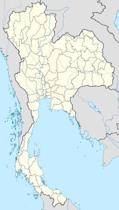
Chulabhorn Dam Location of Chulabhorn Dam Official name Chulabhorn Dam Location Chaiyaphum province, Thailand Coordinates 16°32′10.56″N 101°39′0.13″E / 16.5362667°N 101.6500361°ECoordinates: 16°32′10.56″N 101°39′0.13″E / 16.5362667°N 101.6500361°E Construction began 1970 Opening date 1972 Owner(s) Electricity Generating Authority of Thailand (EGAT) Dam and spillways Type of dam Earth core rockfill dam Height 70 m (230 ft) Length 700 m (2,300 ft) Impounds Nam Phrom River Reservoir Creates Chulabhorn Dam Reservoir Capacity 165,000,000 m3 (5.8×10⁹ cu ft) Catchment area 545 km2 (210 sq mi) Surface area 31 km2 (12 sq mi) Power station Owner(s) Electricity Generating Authority of Thailand (EGAT) Operator(s) Electricity Generating Authority of Thailand (EGAT) Installed capacity 40 MW Annual generation 59 GWh Chulabhorn Dam (เขื่อนจุฬาภรณ์) is a dam in Tambon Thung Lui Lai, Amphur Kon San, Chaiyaphum Province, Thailand. It impounds the Phrom River, a tributary of the Mekong. The dam has diverted the Nam Phrong River. As water leaves its turbines, it empties into the Choen River. The dam is named after Princess Chulabhorn Walailak, of Thailand.
Contents
Description
Typical to Thai dams, the Chulabhorn Dam is an earth core rockfill dam. Its function is to generate electricity and to irrigate riparian agriculture. The dam is 700 m (2,300 ft) long and 70 m (230 ft) high. Its reservoir covers 31 km2 (12 sq mi)[1].
Power House
The power house is located at the dam. The power house contains two turbines, each with a capacity of 20,000 KW. Total annual energy production is 59 Gwh.[1]
Controversies
Like the Pak Mun Dam downstream, the Chulabhorn has not been without its share of controversies. These have principally been over the way in which water is allocated for irrigation vis-a-vis power generation; and over the diversion of water from the Nam Phong to the Choen River, depriving downstream communities along the Choen.
Downstream of the Chulabhorn Dam, along the Choen River, lie three districts: Kaset Sombun, Ban Thaen and Phu Khieo. The reduced flows of the Choen has caused villagers to come together and try to persuade EGAT to increase the amount of water. This protest started in 1973, and has earned these villagers the title of the "water beggars of the Northeast".[2]
References
- ^ a b "Renovation of Small Hydropower Plants by Hydropower Construction Division in 2005". Electricity Generating Authority of Thailand. http://hpcd.egat.com/history_tech/history_renovation.html. Retrieved 2011-01-30.
- ^ . Bangkok Post. 2000-03-13. http://www.probeinternational.org/mekong-utility-watch/egat-dam-denying-people-water. Retrieved 2011-01-31.
External links
Categories:- Dams in Thailand
- Hydroelectric power stations in Thailand
Wikimedia Foundation. 2010.

