- Chatham, Kent
-
For the municipality in Ontario, see Chatham–Kent.
Coordinates: 51°21′40″N 0°32′10″E / 51.3610°N 0.5362°E
Chatham 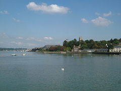
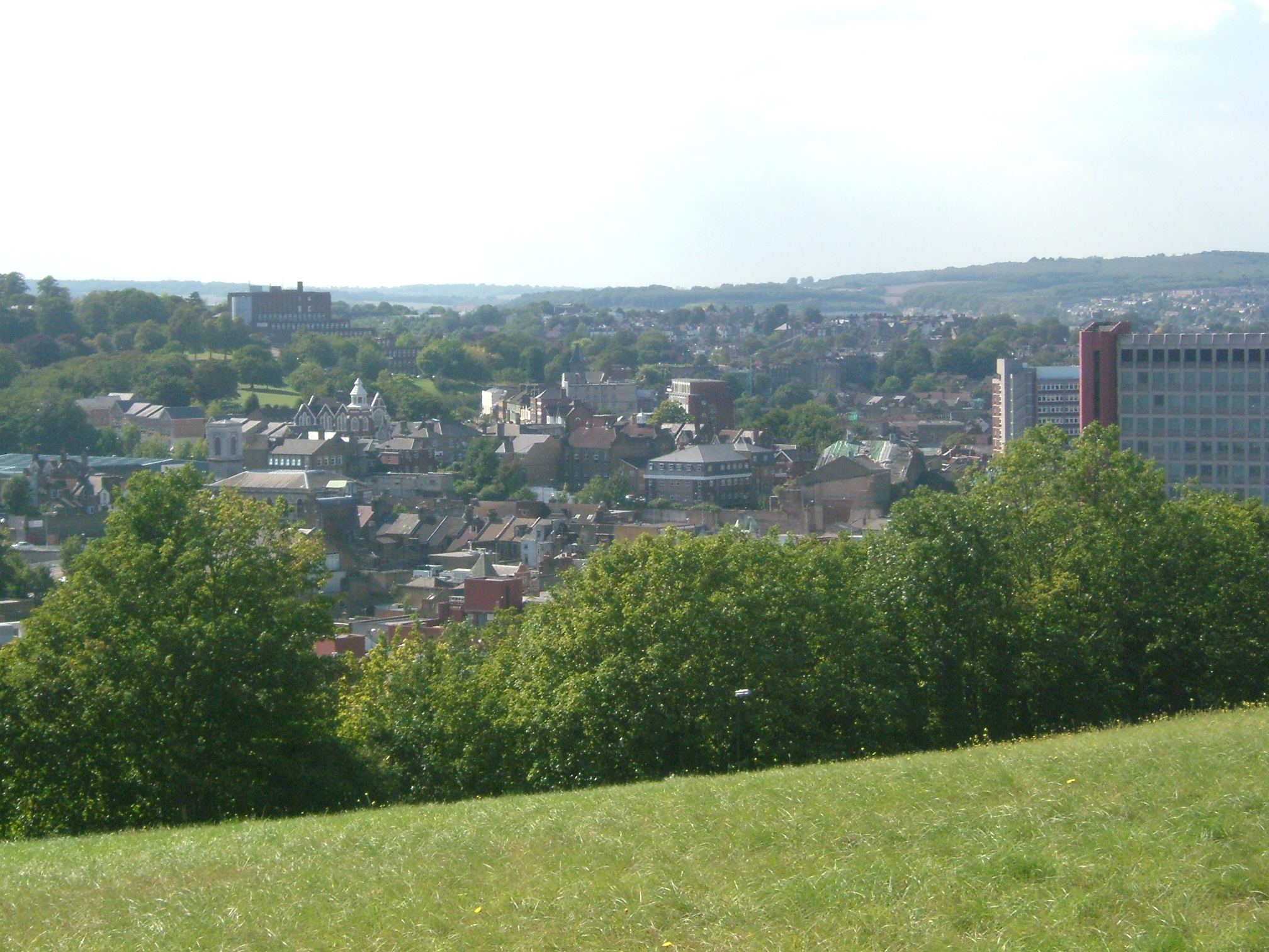
Chatham Riverside from Sun Pier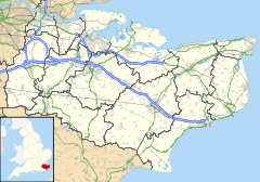
 Chatham
Chatham shown within KentPopulation 70,540 (2001 Census) OS grid reference TQ765659 - London 33mi Unitary authority Medway Ceremonial county Kent Region South East Country England Sovereign state United Kingdom Post town CHATHAM Postcode district ME4, ME5 Dialling code 01634 Police Kent Fire Kent Ambulance South East Coast EU Parliament South East England UK Parliament Chatham and Aylesford List of places: UK • England • Kent Chatham (
 /ˈtʃætəm/ chat-əm) is one of the Medway towns located within the Medway unitary authority, in North Kent, in South East England.
Although the dockyard has long been closed and is now being redeveloped into a business and residential community as well as a museum featuring the famous submarine, HMS Ocelot, major naval buildings remain as the focus for a flourishing tourist industry. Chatham also has military connections; several Army barracks were located here, together with 19th-century forts which provided a defensive shield for the dockyard. Brompton Barracks, located in the town, remains the headquarters of the Corps of Royal Engineers.
The town has important road links and the railway and bus stations are the main interchanges for the area. It is the administrative headquarters of Medway unitary authority, as well as its principal shopping centre.
Contents
History
The name Chatham was first recorded as Cetham in 880, its name coming from the British root ceto and the Old English ham thus meaning a forest settlement.[1][2] The Domesday Book records the place as Ceteham.
Chatham stands on the A2 road along the line of the ancient Celtic route, which was paved by the Romans, and named Watling Street by the Anglo-Saxons. Among finds have been the remains of a Roman cemetery. After the Norman invasion the manor of Chatham, originally Saxon, was given by William the Conqueror to Earl Godwinson.
It long remained a small village on the banks of the river, but by the 16th century was being used to harbour warships, because of its strategic location facing the Continent. It was established as a Royal Dockyard by Queen Elizabeth I in 1568. Initially a refitting base, it became a shipbuilding yard; from then until the late 19th century, further expansion of the yard took place. In its time, many thousands of men were employed at the dockyard, and many hundreds of vessels were launched there, including HMS Victory which was built there in the 1760s. After World War I many submarines were also built in Chatham Dockyard.
 Looking from the river at Sun Pier along the Great Barrier Ditch, to the Gun Platforms at Fort Amherst
In addition to the dockyard itself, defensive fortifications[3] were built to protect it from attack. Upnor Castle had been built in 1567, but had proved ineffectual; the Dutch Raid on the Medway in 1667 showed that more was required. The fortifications, which became more elaborate as the threat of invasion grew, were begun in 1756 as a complex across the neck of the peninsula formed by the bend in the River Medway, and included Fort Amherst. The threat of a land-based attack from the south during the 19th century led to the construction of even more forts.
The second phase of fort-building (1806–1819) included Fort Pitt (later used as a hospital and the site of the first Army Medical School). The 1859 Royal Commission on the Defence of the United Kingdom ordered, inter alia, a third outer ring of forts: these included Fort Luton,[4] Fort Bridgewood, and Fort Borstal.[5] These fortifications all required military personnel to man them and Army barracks to house those men. These included Kitchener Barracks (c 1750–1780), the Royal Marine Barracks (c 1780). Brompton Artillery Barracks (1806)[6] and Melville Barracks. H.M.S. Collingwood and H.M.S. Pembroke were both naval barracks.
In response to the huge manpower needs, the village of Chatham and other nearby villages and towns grew commensurately. Trams, and later buses, linked those places to bring in the workforce.[7] The area between the High Street and Luton village illustrates part of that growth, with its many streets of Victorian terraces.
The importance of Chatham dockyard gradually declined as Britain's naval resources were reduced or moved to other locations, and eventually, in 1984, it was closed completely. The dockyard buildings were preserved as the historic site Chatham Historic Dockyard (operated by Chatham Historic Dockyard Trust[8]), now under consideration as a World Heritage Site[9] the site is being used for other purposes. Part of the St Mary's Island section is now used as a marina, and the remainder is being developed for housing, commercial and other uses, branded as "Chatham Maritime".[10]
Governance
 Medway Council Building at Gun Wharf
Chatham lost its independence as a borough under the Local Government Act 1972, by which, on 1 April 1974, it became part of the Borough of Medway, a non-metropolitan district of the county of Kent; under subsequent renaming the Borough became the Borough of Rochester-upon-Medway (1979); and, from 1982, the City of Rochester-upon-Medway. Under the most recent change, in 1998, and with the addition of the Borough of Gillingham, the Borough of Medway became a unitary authority area, administratively separate from Kent.[11] It remains part of the county of Kent for ceremonial purposes.
Medway Council has recently relocated its main administration building to Gun Wharf, the site of the earliest part of the Dockyard. [12] A former Lloyds Office Building. [13]
Chatham is currently part of the parliamentary constituency of Chatham and Aylesford. Prior to 1997, Chatham had been included in the constituencies of Mid Kent, Rochester and Chatham & Chatham.
Like several other Kent constituencies, Chatham has proven to be a marginal seat, swinging backwards and forwards on the political tide and almost always following the national trend. Since 1945, the Members of Parliament for Chatham have been as follows:
Election Member Party 1945 Arthur Bottomley Labour 1959 Julian Critchley Conservative 1964 Anne Kerr Labour 1970 Peggy Fenner Conservative Oct 1974 Robert Bean Labour 1979 Peggy Fenner Conservative 1983 Andrew Rowe Conservative 1997 Jonathan Shaw Labour 2010 Tracey Crouch Conservative Geography
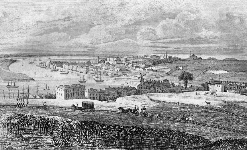
 (1) Chatham Dockyard, seen from Fort Pitt, ca. 1830.[14]
 (2) Chatham Town Centre from the Great Lines
 (3) Luton Valley, from Darland Banks
Chatham is situated where the lower part of the dip slope of the North Downs meets the River Medway which at this point is flowing in a south-north direction. This gives the right bank, where the town stands, considerable advantages from the point of view of river use. Compared with opposite bank, the river is fast-flowing and deep; the illustration (1), an early print of the settlement, is taken from the point where Fort Pitt now stands. The town lies below at river level, curving round to occupy a south-easterly trending valley (The Brook”), in which lies the High Street. Beyond the dockyard was marshy land, now called St Mary’s Island, and has several new developments of housing estates. The New Road crosses the scene below the vantage point of the illustration.
Illustration (2) is taken from the opposite side of the valley: the Pentagon Centre is to the right, with the building on the ridge left of centre, Fort Pitt and Rochester lies beyond that ridge; and Frindsbury is on the rising ground in the right distance.
The valley continues southeastwards as the Luton Valley, in which is the erstwhile village of that name; and Capstone Valley. The Darland Banks, the northern slopes of the valley above these valleys, are unimproved chalk grassland. The photograph (3), taken from the Banks and looking south, shows the village in the centre, with the rows of Victorian terraced housing, which unusually follow the contour lines. The opposite slopes are the ‘’Daisy Banks’’ and ‘’Coney Banks’’, along which some of the defensive forts were built (including Fort Luton, in the trees to the left)
Until the start of the 20th century, most of the south part of the borough was entirely rural, with a number of farms and large tracts of woodland. The beginning of what is now Walderslade was when a speculative builder began to build the core of the village in Walderslade Bottoms.[15]
Demography
Chatham became a market town in its own right in the 19th century, and a municipal borough in 1890. By 1831 its population had reached more than 16,000. By 1961 it had reached 48,800.[16]
Economy
The close of the Dockyard has had the effect of changing the employment statistics of the town[citation needed].
Landmarks
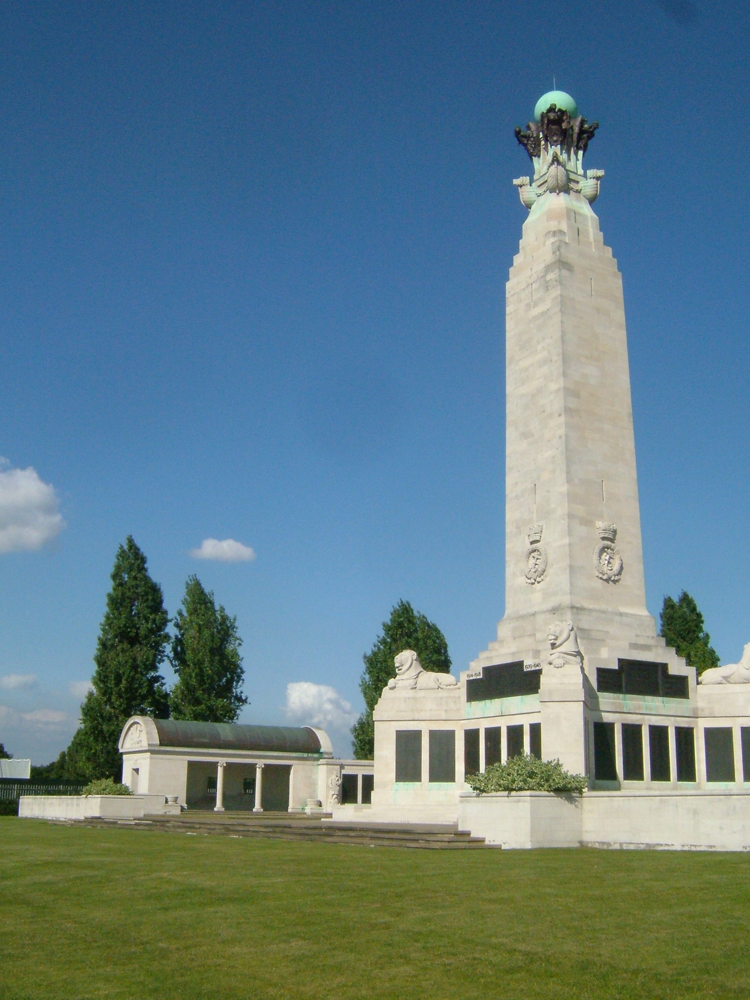
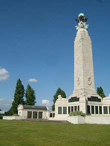 Chatham Naval Memorial
The Chatham Naval Memorial commemorates the 18,500 officers, ranks and ratings of the Royal Navy who were lost or buried at sea in the two World Wars. It stands on the Great Lines between Chatham and Gillingham. Chatham Town Hall was built in 1900; it stands in The Brook, and is of a unique architectural design[citation needed]. With the town being part of Medway conurbation, it took on a new role as an arts centre. In 1996, it became the Brook Theatre.[17] The Pentagon Centre which incorporates Chatham Bus Station, stands in the town centre.[18]
Transport
Main article: River MedwayThe Medway, apart from Chatham Dockyard, has always had an important role in communication: historically it provided a means for the transport of goods to and from the interior of Kent. Stone, timber and iron from the Weald for shipbuilding and agricultural produce were among the cargoes. Sun Pier in Chatham was one of many such along the river. By 1740, barges of forty tons could navigate as far upstream as Tonbridge.[16] Today its use is confined to tourist traffic; apart from the marina, there are many yacht moorings on the river itself.
 The A2 road at Luton Arches. The New Road runs underneath the Luton Arches Footbridge.
Chatham's position on the road network began with the building of the Roman road (Watling Street, which passed through the town. Turnpike trusts were established locally, so that the length from Chatham to Canterbury was turnpiked in 1730; and the Chatham to Maidstone road (now the A230) was also turnpiked before 1750. The High Street was bypassed in 1769, by the New Road (see illustration (1)) leading from the top of Star Hill Rochester, to the bottom of Chatham Hill at Luton Arches. This also became inadequate for the London cross-channel traffic and the Medway Towns Bypass, the M2 motorway, was constructed to divert through traffic south of the Medway Towns.
 Sir John Hawkins Flyover, which was demolished in 2009.
Chatham is the hub of the Medway Towns. This fact means that the existing road system has always proved inadequate for the amount of traffic it has to handle, and various schemes have been tried to alleviate the congestion. The High Street itself is traffic-free, so all traffic has to skirt around it. The basic west-east routes are The Brook to the north and New Road to the south, but the additional problems caused by the situation of the Pentagon Bus Station meant that conflicting traffic flows were the result. In the 1980s the Chatham town centre was remodelled and an inner ring road – a one-way system – was constructed. This was completed with the construction of the Sir John Hawkins Flyover opened in 1989 carrying the south to north traffic over the High Street.
In September 2006, the one-way system was abandoned and two-way traffic reintroduced on most of the ring-road system.[19] Further work on the road system commenced early in 2009, and as of early 2010, the demolition of the Sir John Hawkins Flyover has been completed. It is to be replaced by a street-level, buses only, road coupled with repositioning of the bus station.[20]
 Chatham Railway Station and Fort Pitt Tunnel
Chatham railway station, opened in 1858, serves both the North Kent and the Chatham Main Lines, and is the interchange between the two lines. It lies in the valley between the Fort Pitt and the Chatham Tunnels. There are four trains an hour to London Victoria, and two trains an hour to London Charing Cross. The former services run to Dover and Ramsgate; the latter terminate at Gillingham.
Part of the industrial railway in what is now Chatham Historic Dockyard is still in operation, run by the North Kent Industrial Locomotive Society.
Religion
In the 19th century the ecclesiastical parish of Chatham included Luton and Brompton and also Chatham Intra (land on the river that was administered by the City of Rochester).[21] Chatham's parish church, St Marys, which stood on Dock Road, was rebuilt in 1788. St John's was a Waterloo church built in 1821 by Robert Smirke, and restructured in 1869 by GM Hills;[22] it ceased being an active church in 1964, and is currently used as an art project.[23] St Paul's New Road was built in 1854; declared redundant in 1974, it has been demolished. St Peter's Troy Town was built in 1860. Christchurch Luton was built in 1843, replaced in 1884. The Royal Dockyard church (1806) was declared redundant in 1981.
St Michael's is a Roman Catholic church, that was built in 1863. There is a Unitarian Chapel built in 1861.
Chatham is reputed to be the home of the first Baptist chapel in north Kent, the Zion Baptist Chapel in Clover Street. The first known pastor was Edward Morecock who settled there in the 1660s. During Cromwell's time Morecock had been a sea-captain and had been injured in battle. His knowledge of the River Medway is reputed to have preserved him from persecution in the reign of King Charles II. There was a second Baptist chapel founded about 1700. The Ebenezer Chapel dates back to 1662.
Chatham Memorial Synagogue was built by Simon Magnus in 1867 on the Chatham end of Rochester High Street in Rochester.[24]
Education
Chatham is served by the following Primary Schools:
- All Saints CE Primary
- Balfour Junior
- Delce Infant
- Delce Junior
- Glencoe Junior
- Greenvale Infant
- Horsted Infant
- Horsted Junior
- Kingfisher Primary
- Lordswood Infant
- Lordswood Junior
- Luton Infant
- Luton Junior
- Maundene
- New Road Primary School & Nursery Unit
- Oaklands Infant
- Oaklands Junior
- Ridge Meadow Primary
- Silverbank Park
- Spinnens Acre Junior
- St Benedict's Catholic Primary
- St John's CE (VC) Infant
- St Mary's Island C of E (Aided) Primary
- St Michael's Catholic Primary
- St Thomas More Catholic Primary
- Swingate Infant
- Walderslade Primary
- Wayfield Community Primary & Nursery Unit
Secondary Education, outside the Catholic Sector, is selective. Many pupils attend schools in neighbouring towns.
- Bishop of Rochester Academy (formed by a merger between Chatham South School and Medway Community College [25])
- Bradfields School
- Chatham Grammar School for Boys
- Chatham Grammar School for Girls
- Fort Pitt Grammar School (girls)
- Greenacre School
- St John Fisher RC Comprehensive School
- Walderslade Girls' School[26]
Universities:
Chatham is also the home of Universities at Medway, a tri-partite collaboration on a single campus between:
- University of Greenwich
- University of Kent
- Canterbury Christchurch University[27]
Sports
The town's Association Football club, Chatham Town F.C., plays in the Isthmian League Division One South. Lordswood F.C. play in the Kent League. The defunct Chatham Excelsior F.C. were one of the early pioneers of football in Southern England. Football league side Gillingham F.C. are seen to represent Medway as a whole.
Kite Flying, especially power kiting has seen a resurgence in recent months, with the Great Lines becoming a popular area.
Skiing is possible near Capstone Farm Country Park.
Popular culture
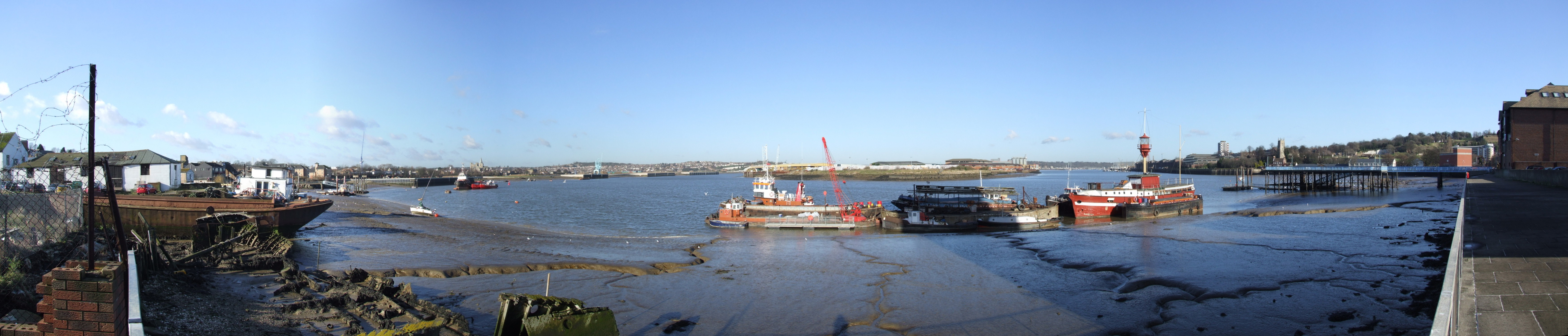
 Panorama of the River Medway
The term 'chav', research suggests, derives from the romany word for 'youngster'.[28][29] However, one of many popularly suggested 'origins' for the word 'Chav' is an abbreviation of 'Chatham Average', alluding to a public perception of a segment of Chatham residents as tracksuit-wearing, gold hoop-earringed common people with a penchant for hard drinking, recreational drug use, and aggressive and anti-social behaviour.
On a cultural level, Chatham also gave birth to several movements in literature, art and music. In the period from 1977 until 1982 the Medway Delta Sound emerged. The term was coined as a joke by Chatham born writer painter and musician Billy Childish after Russ Wilkins' Medway based record label, Empire Records, used the phrase "from the Medway Delta". Several Medway Delta bands gained international recognition, including The Milkshakes, The Prisoners (see also James Taylor Quartet), The Daggermen, The Dentists, Christopher Broderick and The Singing Loins. In the mid to late 1980s a scene of more contemporary indie bands emerged, centred around Churchill's pub, and organising themselves within the Medway Bands Co-operative.
There was a resurgence in the live music scene in the early 2000s, with an initial focus on the Tap 'n' Tin venue in Chatham. The spirit of the original Medway Delta was revived by music and poetry evenings promoted by Dave Wise's Urban Fox organisation, which also published several books by Medway poets and artists. In 2008 the independent arts organisation Medway Eyes was founded, specialising in music and photography. Medway Eyes has promoted several arts exhibitions and gigs at The Barge in Gillingham and The Nags Head in Rochester.
The Medway Poets were formed in 1977 and disbanded in 1982 having performed at major literary festivals and on TV and Radio. They became a major influence to writers in the Medway Towns. From the core of this group the anti conceptual/pro painting movements of Stuckism and Remodernism came into being.
Recent Medway artists of note include Kid Harpoon, Red Light, Underground Heroes.Pete Molinari, Lupen Crook, Stuart Turner and Theatre Royal.
Local media
Newspapers
Local newspapers for Chatham include Medway News and Medway Standard, both published by Kent Regional News and Media; and the Medway Messenger, published by the KM Group. The town also has free newspapers in the Medway Extra (KM Group) and yourmedway (KOS Media).
Radio
The local radio station for Chatham is KMFM Medway, owned by the KM Group. The area can also receive the county wide stations BBC Radio Kent, Heart and Gold, as well as many radio stations in Essex and Greater London.
Notable people
 Ordnance Terrace in October 2007
Charles Dickens lived in the town as a boy, both in 'The Brook, Chatham' and in Ordnance Terrace before Chatham railway station was built just opposite. He subsequently described it as the happiest period of his childhood, and eventually returned to the area in adulthood when he bought a house in nearby Gad's Hill. Medway features in his novels.
Others who were born or who lived or live in Chatham:
- Organist and post-romantic composer Percy Whitlock
- Victorian era painter and patricide Richard Dadd
- Artist, poet, and musician Billy Childish
- Poet, painter, storyteller and mythographer Bill Lewis
- Poet, screenwriter, film maker and writer Alan Denman , was a lecturer at the Kent Institute of Art & Design (KIAD) at Fort Pitt in Rochester.
- Artist Tracey Emin (one time girl friend of Billy Childish in 1980's) [30] Young British Artists
- Designer Zandra Rhodes, CBE, RDI
- Author and screenwriter Stel Pavlou attended the Chatham Grammar School for Boys
- Boyband-singer Lee Ryan also attended the Chatham Grammar School for Boys
- Ben Mills, singer and X Factor contestant
- Actor Tommy Knight
- Twice BDO World Darts Championship Finalist Dave Whitcombe
- Former captain of League of Ireland club, Bohemians, Kevin Hunt
- England international hockey player, Ashley Jackson
- Composer, pop musician and member of The Art of Noise, Anne Dudley
- The actor Kevin Eldon, stand up comedian and comedy actor, who starred in Big Train, I'm Alan Partridge and with Stewart Lee and Richard Herring in Fist of Fun and This Morning with Richard Not Judy
- Professional footballer Chris Smalling, who attended Chatham Grammar School for Boys and is currently playing for Manchester United
- Professional footballer Andrew Crofts currently playing for Norwich City FC
- Professional footballer Neil Shipperley, formerly of Crystal Palace FC and Wimbledon FC - now manager of non-league Walton Casuals FC
- Author and historian William Coles Finch lived at Luton, Chatham.
- Keith Donohue, Devon cricketer
- The biographer, novelist and poet Elizabeth Benger was brought up here between 1782 and 1797.[31]
- Professional footballer George Boyd of Peterborough United was born in Chatham and played briefly for Chatham Town FC
- Professional footballer Lee Minshull of AFC Wimbledon was born in Chatham.
Twin towns
References
- ^ A. D. Mills, A Dictionary of British Place-Names, 2003, Oxford University Press. ISBN 0198527586
- ^ Judith Glover, The Place Names of Kent, 1976, Batsford. ISBN 0905270 614
- ^ Map and dates of construction of the Chatham Defences
- ^ Now a heritage site
- ^ Chatham's Fortified Places
- ^ Although the postal address of Brompton Barracks (now the headquarters of the Royal Engineers) indicates Chatham as its location, Brompton village lies in Gillingham
- ^ Harley, Robert J. (1994). Maidstone and Chatham Tramways. Middleton Press. ISBN 1-873793-40-5.
- ^ Chatham Historic Dockyard Trust
- ^ "Chatham Naval Dockyard". Unesco. http://whc.unesco.org/en/tentativelists/1309/. Retrieved 2007-09-21.
- ^ "Chatham Maritime" article on SEEDA website. Retrieved 2010-08-25.
- ^ Rochester, The past 2000 years, Published Privately City of Rochester Society 1999.
- ^ http://www.medway.gov.uk/pdf/06_ca_5_gun_wharf_6_kitchener_barracks1.pdf
- ^ http://medway.gov.uk/pdf/med_matters_issue15.pdf
- ^ From W. H. Ireland's History of Kent
- ^ Walderslade Online: A Short History of Walderslade Village
- ^ a b Jessup, Frank W. (1966). Kent History Illustrated. Kent County Council.
- ^ The Brook Theatre
- ^ Pentagon Shopping Centre
- ^ "Chatham two way". British Broadcasting Corporation. 2006. http://www.bbc.co.uk/kent/content/articles/2006/09/13/chatham_two_way_feature.shtml. Retrieved 2009-01-28.
- ^ "Town flyover demolition next month". Medway Messenger. 2009. http://www.medwaymessenger.co.uk/paper/default.asp?article_id=41215&newspage=9. Retrieved 2009-01-28.
- ^ John Marius Wilson, Imperial Gazetteer of England and Wales (1870–72)
- ^ http://www.westgallerychurches.com/Kent/Chatham/Chatham_John.html
- ^ "Church transformed into vineyard". BBC News. 2004-10-25. http://news.bbc.co.uk/2/hi/uk_news/england/kent/3950333.stm. Retrieved 2010-04-01.
- ^ Rochester, The past 2000 years, (City of Rochester Society) 1999.
- ^ http://blog.traceycrouch.org/2010/08/good-news-for-bishop-of-rochester.html
- ^ Chatham "Medway Council List of Schools". http://www.medway.gov.uk/schools-index.asp?I_action=3&town=Chatham&I_nice=Chatham&I_key=town Chatham. Retrieved 2007-09-21.
- ^ "Universities at Medway". http://www.medway.ac.uk/. Retrieved 2007-09-21.
- ^ "Savvy Chavvy: social entrepreneurs engage gypsies". London: The Telegraph. 2008-07-24. http://blogs.telegraph.co.uk/richard_tyler/blog/2008/07/24/savvy_chavvy_social_entrepreneurs_engage_gypsies. Retrieved 2008-12-24.
- ^ Quinion, Michael. "Chav". http://www.worldwidewords.org/topicalwords/tw-cha2.htm. Retrieved 2009-02-23.
- ^ http://www.guardian.co.uk/theobserver/2004/jun/27/features.magazine17of
- ^ ODNB entry: Retrieved 10 March 2011. Subscription required.
Bibliography
- David Hughes, Chatham Naval Dockyard and Barracks, The History Press Ltd (2004), ISBN 0752432486
External links
Towns and villages in the Unitary authority of Medway in Kent, England Allhallows · Borstal · Brompton · Chatham · Chattenden · Cliffe · Cliffe Woods · Cooling · Cuxton · Frindsbury · Frindsbury Extra · Gillingham · Halling · Hempstead · High Halstow · Hoo St Werburgh · Isle of Grain · Lordswood · Rochester · Rainham · Rainham Mark · St Mary Hoo · St Mary's Island · Stoke · Strood · Twydall · Upnor · Wainscott · Walderslade · WigmoreList of places in Kent Ceremonial county of Kent Kent Portal Unitary authorities Boroughs or districts Major settlements Ashford, Broadstairs, Canterbury, Chatham, Cranbrook, Dartford, Deal, Dover, Edenbridge, Faversham, Folkestone, Fordwich, Gillingham, Gravesend, Greenhithe, Herne Bay, Hythe, Lydd, Maidstone, Margate, Minster, New Romney, Northfleet, Paddock Wood, Queenborough, Rainham, Ramsgate, Rochester, Royal Tunbridge Wells, Sandwich, Sevenoaks, Sheerness, Sittingbourne, Snodland, Southborough, Strood, Swanley, Swanscombe, Tenterden, Tonbridge, Walmer, West Malling, Westerham, Westgate-on-Sea, Whitstable
See also: List of civil parishes in KentRivers See: Rivers of KentTopics Categories:- Medway
- Ports and harbours of Kent
- Towns in Kent


Wikimedia Foundation. 2010.