- Chandrapur district
-
This article is about the district. For its eponymous headquarters, see Chandrapur.
Chandrapur district
चंद्रपूर जिल्हा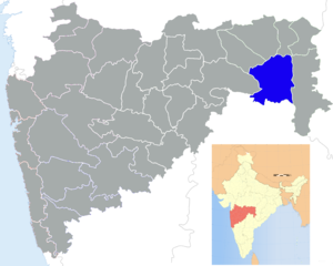
Location of Chandrapur district in MaharashtraState Maharashtra,  India
IndiaAdministrative division Nagpur Division Headquarters Chandrapur Area 10,690 km2 (4,130 sq mi) Population 2,071,101 (2001) Population density 155 /km2 (400 /sq mi) Urban population 32.11% Literacy 59.41% Tehsils 1. Chandrapur, 2. Bhadravati, 3. Warora, 4. Chimur, 5. Nagbhid, 6. Bramhapuri, 7. Sindewahi, 8. Mul, 9. Saoli, 10. Gondpimpri, 11. Rajura, 12. Korpana, 13. Pomburna, 14. Ballarpur, 15. Gadchandur Lok Sabha Constituencies 1. Chandrapur (shared with Yavatmal district), 2. Gadchiroli-Chimur (shared with Gadchiroli district) Assembly Seats 6 Average annual precipitation 1398 mm Official website Chandrapur District (Marathi: चंद्रपूर जिल्हा) is a district in Nagpur Division of the Indian state of Maharashtra.It is located at the boundary of Andhrapradesh. The district was formerly known as Chanda District. In 1964, it was renamed as Chandrapur. It was the largest district in India until it was split into the separate district of Gadchiroli. It had a population of 2,071,101 of which 32.11% were urban as of 2001.[1]
It is famous for its superthermal power plant, one of the biggest in Asia, and its vast reserves of coal. Chandrapur also has large reservoirs of limestone. The abundance of lime and coal supplies many cement factories like L&T (now UltraTech Cement), Gujarat Ambuja (Maratha Cement Works), Manikgarh, Murli Cement and ACC Cement in the district.
Tadoba National Park near Chandrapur is one of India's 28 Project tiger reserves.
The city of Chandrapur, the administrative headquarters, has ancient temples of Anchleshwar (Lord Shiva) and Mahakali (Goddess Mahakali).
Contents
History
In ancient times Chandrapur included Vairagad, Kosala, Bhadravati and Markanda. Hindu and Buddhist kings are said to have ruled the area for a long time, Later on Gonds overtook Mana Naga Chiefs who ruled Chanda around 9th century and Gond Kings ruled the area till 1751 after which Maratha period started.
In the 18th century, the district became part of the dominions of the Bhonsle Maratha Maharajas of Nagpur. At the conclusion of the Third Anglo-Maratha War, the Bhonsle state of Nagpur became a princely state of British India. In 1853, when the Bhonsle Maharaja died without a direct male heir, the British annexed the kingdom, which became the Nagpur Province of British India. Nagpur Province was merged into the newly-constituted Central Provinces in 1861. Chandrapur District was known as Chanda District.
In 1854, Chandrapur was an independent district and in 1874, it comprised the three tehsils: namely, Warora and Bramhpuri. In 1874, however, the upper Godavai district of Madras was abolished and four tehsils were added to Chandrapur to form one tehsil with Sironcha as its headquarters. In 1895, the headquarters of one tehsil transferred to Mul to Chandrapur. A new tehsil with headquarter at Gadchoroli was created in 1905 by transfer of zamindari estates from Bramhpuri and Chandrapur tehsil. An small zamindari tract from Chandrapur district was transferred to newly formed districts in 1907. In the same year an area of about 1560 square kilometers comprising three divisions of the lower Sironcha tehsil (namely Cherla, Albak and Nugir) were transferred to Madras State.
After India's independence in 1947, the former Central Provinces became the new Indian state of Madhya Pradesh. No major changes occurred in the boundaries of the district or its tehsils between 1911-1955.
The Indian states were reorganized along linguistic lines in 1956, and the largely Marathi-speaking Chandrapur District was transferred from Madhya Pradesh to became part of Bombay State.
In the same year, Rajura tehsil, a part of Adilabad district of Hydrabad state, was transferred to Nanded district subsequently it was transferred to Chandrapur district in 1959. The district became part of the Maharashtra since its creation in May 1960. For administrative convenience and industrial and agricultural development the district was again divided into Chandrapur and Gadchiroli districts after 1981 census.
The famous jatpura gate located at the center of chandrapur.
The district is currently a part of the Red Corridor.[2]
Economy
In 2006 the Ministry of Panchayati Raj named Chandrapur one of the country's 250 most backward districts (out of a total of 640).[3] It is one of the twelve districts in Maharashtra currently receiving funds from the Backward Regions Grant Fund Programme (BRGF).[3]
Divisions
Chandrapur district comprises 15 talukas, namely Chandrapur, Ballarpur, Rajura, Bhadravati, Warora, Chimur, Nagbhid(which is a railway junction too), Bramhapuri, Sindewahi, Mul, Sawali, Gondpipri, Korpana, Pombhurna and Jiwati.
The district has six Vidhan Sabha (legislative assembly) constituencies: Rajura (Vidhan Sabha constituency)Rajura, Chandrapur, Ballarpur, Warora, Brahmapuri and Chimur. Rajura, Chandrapur, Ballarpur and Warora are part of [[Chandrapur (Lok Sabha constituency)|Chandrapur Lok Sabha constituency.Brahmapuri and Chimur are part of Gadchiroli-Chimur Lok Sabha constituency.[4]
Demography
According to the 2011 census Chandrapur district has a population of 2,194,262,[5] roughly equal to the nation of Latvia[6] or the US state of New Mexico.[7] This gives it a ranking of 207th in India (out of a total of 640).[5] The district has a population density of 192 inhabitants per square kilometre (500 /sq mi) .[5] Its population growth rate over the decade 2001-2011 was 5.95 %.[5] Chandrapur has a sex ratio of 959 females for every 1000 males,[5] and a literacy rate of 81.35 %.[5]
Geography
Chandrapur district is located in the eastern edge of Maharashtra in Nagpur division and forms the eastern part of 'Vidharbha' region. It is located between 19.30’ N and 20.45’ N latitude and 78.46’E longitude. It is the easternmost district of the state of Maharashtra. The district is bounded by Nagpur, Bhandara and Wardha on the northern side, Yavatmal on the western side, Gadchiroli on the eastern side and Adilibad district of the Andhra Pradesh on the southern side. Physiographically, the district is situated in the Wainganga and Wardha river basin. The eastern and western boundaries of the district are well defined by the rivers Wainganga and Wardha, the tributaries of Godavari. Chandrapur district occupies an area of 11,443 km² which constitutes 3.72 percent of the total area of the state. Geographically Maharashtra is located 16.40 N to 22.10 N latitude and 72.60 E to 80.9 E longitude.
Owing to the geographical location and physical features, the climate of the district can be classified as a tropical hot climate with a high range of temperature throughout the year. Primarily there are two prominent seasons in the district - the very hot summer and moderate winter. The summer months are very hot and prolonged while winter is short and mild. The monsoon season starts immediately after summer and lasts until late September. The southwest monsoons bring a lot of rainfall during rainy season and there is no drought-prone area in the district.
Climate
The temperature starts decreasing from the month of October. December is the coldest month. The mean maximum temperature during December is 28.2°C and mean minimum is 11.6°C. The southern part is comparatively warmer than the north, which ranges between 29.6°C and 14.6°C. The lowest recorded temperature in the north is 3°C and 8°C in the south. The daily mean temperature starts rising from the month of February, and May is the peak summer month when mean maximum temperature goes up to 43°C and minimum temperature is 28°C to 29°C. According to the temperature records of 2009, the temperature of chandrapur has crossed 49°C in the month of may. In severe heat conditions, the temperature is among the highest temperatures in the South Asian region. However, temperature starts reducing after May due to the onset of the monsoon, which lasts from June to September when it is hot and humid.
The average annual rainfall is about 1420 mm. The eastern part receives more rainfall than the west. The average number of rainy days is 60 to 65 throughout the district. The relative humidity is very high during monsoon season, which exceeds 70%, but after monsoon season it goes down rapidly and in summer it is only 20%.
The prominent wind direction is from south to north. In summer the wind direction is from east to south and, during the monsoon, from south to east. During winter, the wind direction changes from north to east. Frequently it is characterized by the blowing of wild and violent winds, heralding the approach of the hot season which lasts till the middle of June.
River Systems and Dams
The entire area of the district falls in the Godavari basin. The area is drained by major tributaries of the Godavari River. The major Tributaries are the Wardha, the Wainganga and the Penganga rivers. The Penganga, flowing along part of the Western boundary, meets the Wardha river at Wadha near Ghugus to form the Wardha river. It further flows in NW-SE direction finally merging into the Wainganga river at the south eastern corner of the district. After this confluence the river at the south eastern corner of the district. After this confluence the river along with their sub tributaries rising in the uplands within the district drain whole area of the district. Rising in the uplands within the district drain whole area of the district.
The Wainganga river which flows along the border of Chandrapur and Gadchiroli district is the main river of the district. The Wardha is the only perennial river in the district having the longest river course as compared to the other two major rivers. The main tributaries of the Wardha river are the Erai rises in the northern part of Warora tahsil and flows along due south over a length of 80 km. until it meets the Wardha just south of Chandrapur. The Penganga flowing along western border takes east west course and then joins the wardha river at Wadha near Ghugus. The area occupied by Gadchiroli tahsil and part of Rajura tahsil is drained by the Penganga and its tributaries.
References
- ^ [1]
- ^ "83 districts under the Security Related Expenditure Scheme". IntelliBriefs. 2009-12-11. http://intellibriefs.blogspot.com/2009/12/naxal-menace-83-districts-under.html. Retrieved 2011-09-17.
- ^ a b Ministry of Panchayati Raj (September 8, 2009). "A Note on the Backward Regions Grant Fund Programme". National Institute of Rural Development. http://www.nird.org.in/brgf/doc/brgf_BackgroundNote.pdf. Retrieved September 27, 2011.
- ^ "District wise List of Assembly and Parliamentary Constituencies". Chief Electoral Officer, Maharashtra website. http://ceo.maharashtra.gov.in/acs.php. Retrieved 5 September 2010.
- ^ a b c d e f "District Census 2011". Census2011.co.in. 2011. http://www.census2011.co.in/district.php. Retrieved 2011-09-30.
- ^ US Directorate of Intelligence. "Country Comparison:Population". https://www.cia.gov/library/publications/the-world-factbook/rankorder/2119rank.html. Retrieved 2011-10-01. "Latvia 2,204,708 July 2011 est."
- ^ "2010 Resident Population Data". U. S. Census Bureau. http://2010.census.gov/2010census/data/apportionment-pop-text.php. Retrieved 2011-09-30. "New Mexico - 2,059,179"
External links

Wardha district Nagpur district Bhandara district Yavatmal district 
Gadchiroli district  Chandrapur district

Adilabad district, Andhra Pradesh Divisions and Districts of Maharashtra Amravati Division Konkan Division Aurangabad Division Nagpur Division Nashik Division Pune Division  State of Maharashtra
Capital : Mumbai Topics Regions Desh · Khandesh · Konkan · Mumbai Metropolitan Region · Marathwada · Vidarbha
Districts Ahmednagar · Akola · Amravati · Aurangabad · Beed · Bhandara · Buldhana · Chandrapur · Dhule · Gadchiroli · Gondia · Hingoli · Jalgaon · Jalna · Kolhapur · Latur · Mumbai (City) · Mumbai (Suburban) · Nagpur · Nanded · Nandurbar · Nashik · Osmanabad · Parbhani · Pune · Raigad · Ratnagiri · Sangli · Satara · Sindhudurg · Solapur · Thane · Wardha · Washim · Yavatmal
Million-plus Cities
in MaharashtraMumbai · Pune · Nagpur · Thane · Pimpri-Chinchwad · Nashik · Kalyan-Dombivali · Navi Mumbai · Aurangabad
Other Cities with
Municipal CorporationsAhmednagar · Akola · Amravati · Bhiwandi · Chandrapur · Dhule · Jalgaon · Kolhapur · Latur · Malegaon · Mira-Bhayandar · Nanded · Parbhani · Sangli · Solapur · Ulhasnagar · Vasai-Virar ·
Portal : Maharashtra

Wikimedia Foundation. 2010.