Chale Bay

Chale Bay
Chale Bay is located in Isle of Wight
{{{alt}}}
Chale Bay
Chale Bay on the Isle of Wight
Chale Bay looking to the north west
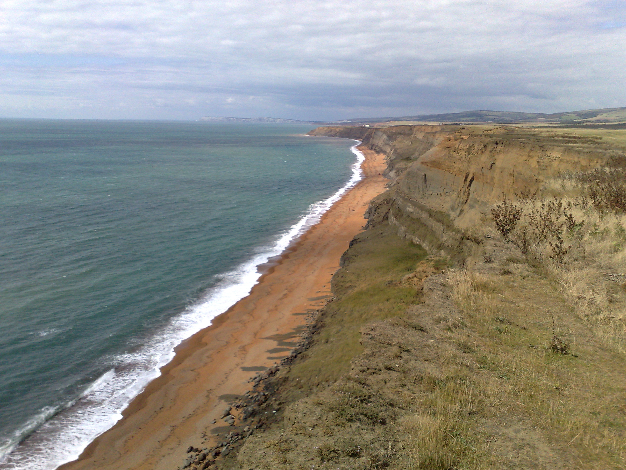
Chale Bay looking to the south east

Chale Bay is a bay on the south west coast of the Isle of Wight, England. It lies to the west of the village of Chale from which it takes its name. It faces south west towards the English Channel, its shoreline is 5km in length and is gently curving. It stretches from Artherfield Point in the north west to Rocken End in the south east.

The seabed is a mixture of mud, sand and shells. The beach is predominantly shingle

The bay is best viewed from the car park on the A3055 above Blackgang Chine or anywhere along the Isle of Wight Coastal Path which follows the whole coastline along the cliff top.

External links

Coordinates: 50°35′42″N 1°19′56″W / 50.5949°N 1.3323°W / 50.5949; -1.3323


Wikimedia Foundation. 2010.

Игры ⚽ Нужен реферат?

Look at other dictionaries:

  • Chale — Coordinates: 50°35′47″N 1°18′59″W / 50.59652°N 1.31625°W / 50.59652; 1.31625 …   Wikipedia

  • Chale, Isle of Wight — Infobox UK place | country = England official name= Chale civil parish= Chale latitude = 50.59652 longitude = 1.31625 population= unitary england= Isle of Wight map type = Isle of Wight lieutenancy england= Isle of Wight region = South East… …   Wikipedia

  • Chale Green — Stores located opposite the village green. Chale Green is a hamlet on the B3399 road about a mile inland from the village of Chale on the Isle of Wight. Officially it is part of Chale. Contents 1 …   Wikipedia

  • New Chine — …   Wikipedia

  • St. Catherine's Oratory — is a medieval Isle of Wight lighthouse on St. Catherine s Hill near the southern coast of the Isle of Wight. It was built by Lord of Chale Walter de Godeton (sometimes spelled Goditon ) as an act of penance for plundering wine from the wreck of… …   Wikipedia

  • List of bays of the British Isles — This is a list of bays of the British Isles, geographically by island. They are listed by island, in clockwise order, from the stated starting point.BritainClockwise from the River Tweed:England from the River Tweed to the Bristol Channel*Budle… …   Wikipedia

  • Walpen Chine — Location map Isle of Wight label=Walpen Chine lat dir=N | lat deg=50.60 lon dir=W | lon deg=1.325 position=above width=250 float=right caption=Walpen Chine on the Isle of WightWalpen Chine is a geological feature on the south west coast of the… …   Wikipedia

  • Ladder Chine — Location map Isle of Wight label=Ladder Chine lat dir=N | lat deg=50.60 lon dir=W | lon deg=1.326 position=above width=250 float=right caption=Ladder Chine on the Isle of WightLadder Chine is a geological feature on the south west coast of the… …   Wikipedia

  • St. Catherine's Down — Infobox Mountain Name = St Catherine s Down Photo = Caption = Elevation = convert|237|m|ft|0|lk=on Location = Isle of Wight, England Range = Prominence = Coordinates = Topographic OS Landranger 196 Grid ref UK = SZ493773 Listing = (none) St.… …   Wikipedia

  • Whale Chine — Location map Isle of Wight label=Whale Chine lat dir=N | lat deg=50.603031 lon dir=W | lon deg=1.338614 position=above width=250 float=right caption=Whale Chine on the Isle of WightWhale Chine is a geological feature near Chale on the south west… …   Wikipedia

Share the article and excerpts

Direct link
Do a right-click on the link above
and select “Copy Link”