- Neighborhoods in Detroit
-
This article provides brief highlights of some of the city's many notable neighborhoods along with areas designated as historic districts in Detroit, Michigan by geographic area.[1] There is a comprehensive index of neighborhoods by geographic area near the end of the article.[2]
Contents
Downtown
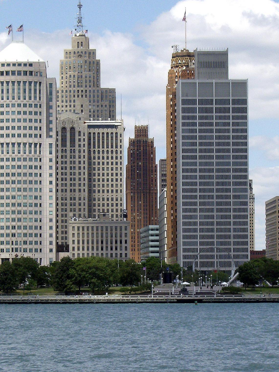
Main article: Downtown DetroitDowntown Detroit is the city's central business district and a residential area, bordered by the Lodge Freeway to the west, the Fisher Freeway to the north, Interstate 375 (Chrysler Freeway) to the east, and the Detroit River to the south. The area contains most of the prominent skyscrapers in Detroit, including the Renaissance Center, the Penobscot Building, and the Guardian Building. The downtown area features high-rise residential living along with a number of parks including those linked by a promenade along the Detroit International Riverfront.[2] In 2007, downtown Detroit was named among the best big city neighborhoods in which to retire by CNN Money Magazine editors.[3]
Campus Martius Park and Grand Circus Park Historic District are central gathering places for downtown containing parks, fountains, monuments, and a large traffic circles surrounded by commercial and residential high-rises connected by Woodward Avenue.
 The Elwood Bar and Grill is listed on the National Register of Historic Places and is within the Grand Circus Park Historic District.
Foxtown is a name used in Detroit for the Grand Circus Park Historic District, with Kales Building, Grand Park Centre, The Fillmore Detroit, Comerica Park, and Ford Field located in it. It is named after the Fox Theatre, a National Historic Landmark. Interstate 75, Grand River Avenue, Woodward Avenue, Interstate 375, Michigan Avenue/US 12, and Gratiot Avenue all pass through or close to Foxtown.[4] The Detroit People Mover has a station in Foxtown on the south end of Grand Circus Park.[2]
The Detroit Opera House is located at Broadway and Grand Circus. The east necklace of downtown links Grand Circus and the stadium area to Greektown along Broadway. The east neckace contains a sub-district sometimes called the Harmonie Park District, which has taken on the renowned legacy of Detroit's music from 1930s through the 1950s to the present.[5] Near the Opera House, and emanating from Grand Circus along the east necklace are other venues including the Music Hall Center for the Performing Arts and the Gem Theatre and Century Club. The historic Harmonie Club and Harmonie Centre are located along Broadway. The Harmonie Park area ends near Gratiot and Randolph. The Detroit Athletic Club stands in view of center field at Comerica Park. Part of the east necklace, the area contains architecturally notable buildings planned for renovation as high-rise residential condominiums such as the Gothic Revival Metropolitan Building at 33 John R St. The Hilton Garden Inn is also in the Harmonie Park area. The east necklace area is serviced by the People Mover at Cadillac station and Broadway station.
Greektown is located less than half a mile (800 m) from the Renaissance Center in the downtown area. The neighborhood is a popular restaurant and entertainment district, having many restaurants that serve Greek cuisine, as well as one of the city's three casinos, Greektown Casino. Certain buildings on Monroe Street are themed to resemble the Parthenon, Pegasus, and other forms of Greek architecture. Greek music is also played on Monroe Street throughout the day. Well-known restaurants include The Laikon Cafe, Cyprus Taverna, Pegasus Taverna, and Pizza Papalis. St. Mary Roman Catholic Church, founded by German immigrants, is located in the heart of the district. The Second Baptist Church once served as "station" for the Underground Railroad. The Detroit People Mover has a station at the Greektown Casino on Beaubien Street between Monroe Street and Lafayette Boulevard.[2]
Name Image Location Summary Bricktown Historic District 
Separates the Renaissance Center from Greektown. Bricktown separates the Renaissance Center from Greektown.[2] Bricktown is home to St. Peter and Paul's Catholic Church, the oldest standing church in Detroit, and the Italian Renaissance style Wayne County Building (which was saved from demolition in the early 1980s). The Wayne County Courthouse, once located in the Wayne County Building, was the place where Mae West was once a defendant on a charge of public indecency. Bricktown is notable for its live music venues. Jacoby's German Biergarten (1904), the city's oldest surviving pub, provides a small performance space for up & coming acts. St. Andrew's Hall is a venue for nationally touring acts, as is the Shelter in the basement of St. Andrew's. Broadway Avenue Historic District 
Broadway between Gratiot and Grand River Boulevard
42°20′6″N 83°2′46″W / 42.335°N 83.04611°WThe Broadway Avenue Historic District is located along a single block of Broadway Avenue, and contains eleven commercial buildings built between 1896 and 1926. The area was developed in the late 1800s as a commercial area catering to the women's trade, and included businesses such as hairdressers, florists, corset makers, and fashionable clothiers. Three buildings in the district — the Cary Building, Harmonie Centre, and the Merchants Building — are individually listed on the NHRP. Campus Martius Park 
42°19′53″N 83°2′48″W / 42.33139°N 83.04667°W Woodward Ave. Campus Martius is a historic district and central gathering place which contains parks, Woodward Fountain, the Michigan Soldiers' and Sailors' Monument, and a large traffic circle surrounded by commercial and residential high-rises including 1001 Woodward Avenue. Since the traffic circles restoration and expansion, it has emerged as a central gathering spot downtown with a mainstage. Capitol Park Historic District 
Roughly bounded by Grand River Ave., Woodward Ave., Michigan Ave., and Washington Boulevard
42°19′58″N 83°2′58″W / 42.33278°N 83.04944°WCapitol Park itself is a triangular plot of land (now a public park) bounded by Shelby Street, Griswold Street, and State Street. A courthouse was built in Capitol Park in 1823-28; when Michigan became a state in 1837, the building served as the state capitol. The Historic District includes the park and seventeen surrounding buildings for a block in each direction, including the Farwell Building, the Griswold Building, the David Stott Building, and the Industrial-Stevens Apartments. Detroit Financial District 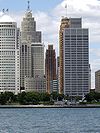
Bounded by Woodward and Jefferson and Lafayette and Washington Boulevard
42°19′46.36″N 83°2′50.43″W / 42.3295444°N 83.0473417°WThis is the historic financial district of Detroit which dates to the 1850s and contains prominent skyscrapers. Ornate skyscrapers in Detroit (including the Guardian Building, the Penobscot Building, and One Woodward Avenue), reflecting two waves of large-scale redevelopment: the first in 1900–1930 and the second in the 1950s and early 1960s. Grand Circus Park Historic District 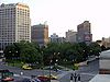
Roughly bounded by Clifford, John R. and Adams Sts.; also 25 W. Elizabeth
42°20′10″N 83°3′2″W / 42.33611°N 83.05056°WGrand Circus Park Historic District contains the 5-acre (2.0 ha) Grand Circus Park, bisected by Woodward Avenue. Notable buildings encircling the park include the David Broderick Tower and David Whitney Building on the south, the Kales Building, and the First Methodist Church on the north. Comerica Park and the Detroit Opera House on the East. 25 W. Elizabeth was a boundary increase added in 2000. Greektown Historic District 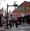
Monroe Ave., between Brush and St. Antoine Sts.
42°20′6″N 83°2′32″W / 42.335°N 83.04222°WGreektown is a primarily commercial district that extends two city blocks. It includes St. Mary Roman Catholic Church, Second Baptist Church, separately listed on the Register, Greektown Casino, and the Athenium Suite Hotel. The district contains numerous restaurants and Greek-themed shops. West Jefferson Avenue 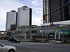
West Jefferson Avenue runs parallel to downtown along the International Riverfront which contains the Renaissance Center, Cobo Center, a cruise ship terminal and dock, residential high rises, and a prominade of parks and marinas extending to Belle Isle. The towering Riverfront Condominiums are among the high-rise residential areas along the riverfront. The University of Detroit Mercy College of Law is across from the Renaissance Center along Jefferson Avenue. The People Mover serves the Renaissance Center and the Cobo Center along the riverfront. Lower Woodward Avenue Historic District 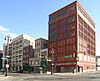
1202–1449 and 1400–1456 Woodward Ave.
42°20′3″N 83°2′56″W / 42.33417°N 83.04889°WThe Lower Woodward Avenue Historic District contains thirty-four commercial buildings built at the end of the nineteenth century and the beginning of the twentieth, many by noted architects. Monroe Avenue Commercial Buildings 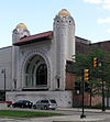
16-118 Monroe Ave.
42°19′58″N 83°2′45″W / 42.33278°N 83.04583°WThe National Theatre (1911) at 118 Monroe Ave., the oldest surviving theatre in Detroit, is a part of the city's original theatre district from the late 1800s. Albert Kahn designed the theatre. Park Avenue Historic District 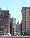
Park Ave., between W. Adams Ave. and W. Fisher Freeway
42°20′12″N 83°3′49″W / 42.33667°N 83.06361°WIn the 1920s, Detroit's prestigious Grand Circus Park was crowded with buildings and development began to spill north from Grand Circus Park up Park Avenue. In 1923, the Park Avenue Association was formed. They planned the street to concentrate high-grade commercial and office space at the south end, and prestigious residential development at the north end, much like New York City's Fifth Avenue. The district includes the Women's City Club, the Royal Palms Hotel, and the Kales Building. Randolph Street Commercial Buildings Historic District 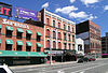
1208–1244 Randolph St.
42°20′4″N 83°2′42″W / 42.33444°N 83.045°WBuildings along this section of Randolph Street have been used for retail since the area was first built up in the 1840s; the building at 1244 Randolph was built during the period of original construction. As the city grew, larger commercial buildings were required and the other structures on Randolph were constructed. Washington Boulevard Historic District 
Washington Boulevard, between State and Clifford Sts.
42°19′59″N 83°3′4″W / 42.33306°N 83.05111°WThis district includes the Book-Cadillac Hotel, the Book Tower, the Industrial-Stevens Apartments, and Washington Square (Trolley Plaza) among other architecturally significant buildings. The Detroit Statler Hotel was located on the boulevard until it was demolished in 2005. The street was broadened and ornamented in the early part of the twentieth century to resemble New York's Fifth Avenue and European boulevards. Midtown
Main article: Midtown Detroit Old Main at WSU
Midtown Detroit is an area covering roughly two square miles between Downtown Detroit to the south and New Center to the north. Its boundaries are the Ford, Chrysler, Fisher, and Lodge Freeways. It includes the Art Center and the Medical Center in the northeast quadrant, Wayne State University's campus, the Detroit Public Library, and the Detroit Historical Museum in the northwest, and the Cultural Center including various restaurants, galleries, newly constructed lofts/condos and nightlife venues along Woodward in the center, among other things.[6][7]
Detroit's Cultural Center is located in the Midtown neighborhood, about two miles (3 km) north of downtown, centered on the Cultural Center Historic District, which is listed in the National Register of Historic Places. The Cultural Center is roughly bounded by Cass Avenue to the west, Interstate 75 to the east, Interstate 94 to the north and Warren Avenue to the south. It also includes the East Ferry Avenue Historic District.[2] Attractions include the Detroit Institute of Arts, the Charles H. Wright Museum of African American History, the Scarab Club, the Detroit Historical Museum, the Museum of Contemporary Art Detroit, the main library of the Detroit Public Library system and the Detroit Science Center. The College for Creative Studies is located adjacent the Scarab Club and opposite the East face of the Detroit Institute of Arts. The main campus of Wayne State University is located adjacent to the area, on the opposite side of Woodward.[2]
 Restored Victorian homes on East Ferry Avenue.
 Brush Park Historic District.
 Hunter House in Woodbridge.
 Homes on Avery in Woodbridge.
 Orchestra Hall on Woodward Ave.
 David Whitney House on Woodward Ave.
 Cathedral Church of St. Paul on Woodward Ave.
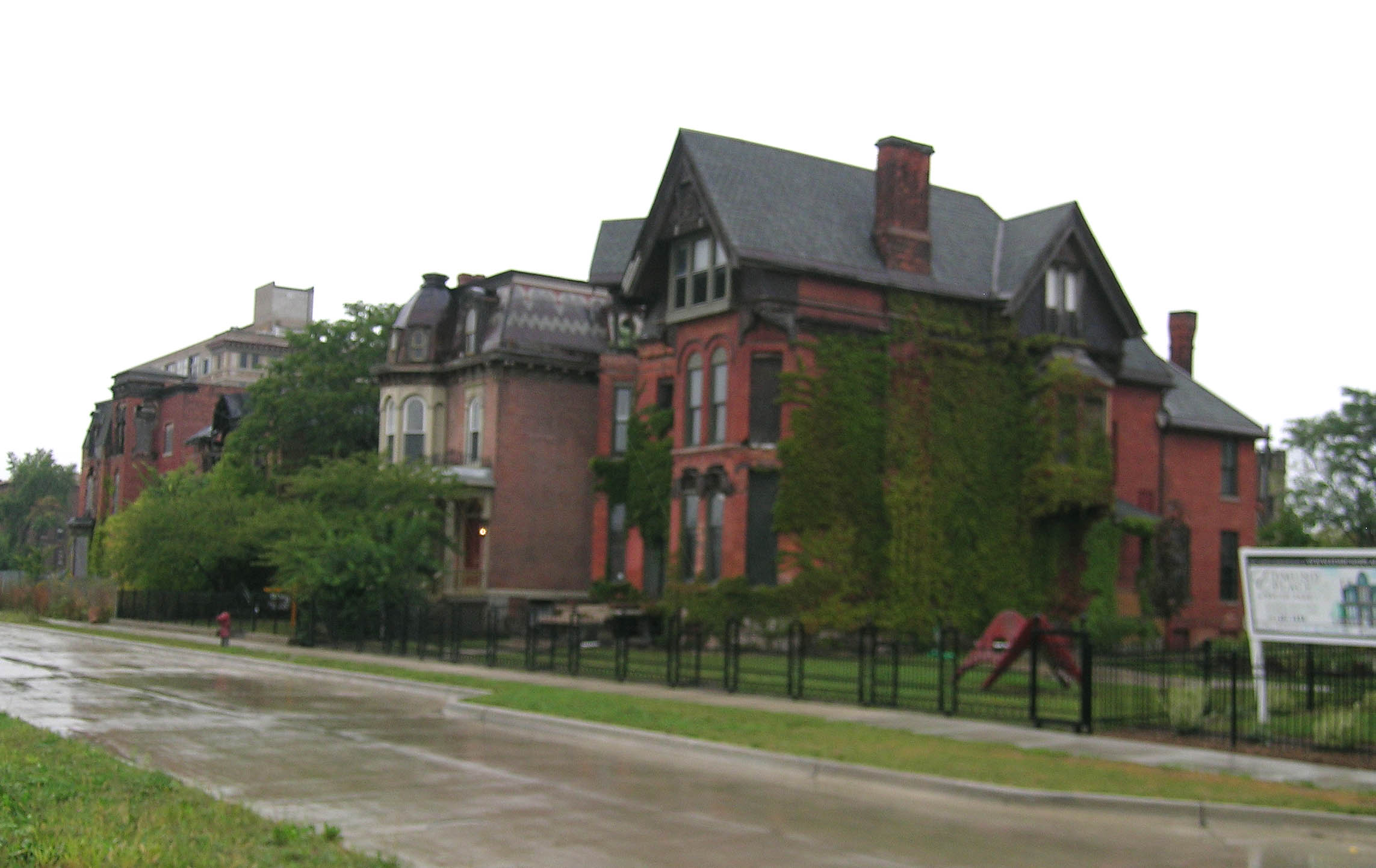
Name Image Location Summary Brush Park Historic District / Woodward East 
Bounded by Alfred, Edmund, Watson, Brush and John R. Sts.
42°20′43″N 83°3′9″W / 42.34528°N 83.0525°WBrush Park is the 24 block area bounded by Mack on the north, Woodward on the west, Beaubien on the east, and the Fisher Freeway on the south.[2] This neighborhood is within the larger area known as Midtown.[2] The Woodward East Historic District, located within the locally-designated Brush Park Historic District, is particularly known for the High Victorian style residences constructed for Detroit's wealthiest citizens. Although many of the once-grand houses have been demolished in recent years, those remaining exhibit a variety of Victorian style subtypes and architectural details. Cass Corridor 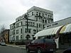
The Cass Corridor is bounded by Woodward Ave. to the East, West Grand Blvd. to the North, the John C. Lodge Freeway to the West, and the Fisher Freeway serves as its southern terminus in Downtown Detroit.[2] Originally home to some of Detroit's wealthiest residents from the late 19th to mid 20th century, it developed as the hub of urban arts and culture in Detroit. Wayne State University expanded in the area to encompass much of the original Cass Corridor. Cass Park Historic District 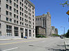
Temple, Ledyard, and 2nd at Cass Park
42°20′28″N 83°3′35″W / 42.34111°N 83.05972°WThis historic district surrounds Cass Park itself, and contains over 20 buildings including apartments, a hotel, the Detroit Masonic Temple, the S. S. Kresge World Headquarters, and Cass Technical High School. Cass-Davenport Historic District 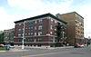
Roughly bounded Cass Ave., Davenport, and Martin Luther King Jr. Boulevard
42°20′46″N 83°3′40″W / 42.34611°N 83.06111°WThe Cass-Davenport Historic District includes four apartment buildings near the corner of Cass Avenue and Martin Luther King Boulevard. Two are typical of the small scale, luxurious apartment buildings built in Detroit near the turn of the century and two are typical of the large scale, high density apartment buildings constructed between 1915 and 1930. Cultural Center Historic District 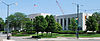
5200, 5201 Woodward Ave., and 100 Farnsworth Ave.
42°21′31″N 83°3′57″W / 42.35861°N 83.06583°WWoodward Avenue passes through the Cultural Center Historic District which includes: the Detroit Public Library, the Detroit Institute of Arts, and the Horace H. Rackham Education Memorial Building. East Ferry Avenue Historic District 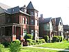
E. Ferry Ave.
42°21′42″N 83°3′56″W / 42.36167°N 83.06556°WIn the mid-1880s, D. M. Ferry platted his seed farm near Woodward into residential lots. East Ferry Avenue was quickly settled by prosperous middle and upper middle class Detroit residents. Although Woodward Avenue has since been redeveloped into primarily commercial property, the mansions and upscale housing on East Ferry survives. The district includes the separately-designated Col. Frank J. Hecker House and the Charles Lang Freer House. Midtown Woodward Historic District 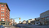
2951-3424 Woodward Ave., 14 Charlotte St., 10 and 25 PeterboroSt.
42°20′43.5″N 83°3′23.5″W / 42.345417°N 83.056528°WThe Midtown Woodward Historic District spans two blocks along Woodward Avenue, and contains three Alber Kahn-designed structures—the Addison Hotel, Kahn Print Shop, and the Temple Beth-El -- in addition to the C. Howard Crane-designed Fine Arts Theatre. Sugar Hill Historic District 
East Forest, Garfield, and East Canfield, between Woodward Avenue on the west and John R. on the east. An art gallery is located on Forest Ave. On Canfield, one historic properties was recently refurbished into luxury loft condos and office space. University-Cultural Center 
Bounded by the Chrysler Freeway (I-75) on the east, the Lodge Freeway (M-10) on the west, the Grand Trunk Railroad tracks on the north, and Selden Street, Parsons Street, East Willis Street, and East Warren Avenue on the south.[8]42°21′35″N 83°4′9″W / 42.35972°N 83.06917°W Structures in this Multiple Resource Area are located within Midtown. The section of the University-Cultural Center just beyond Midtown contains the New Amsterdam Historic District and the Piquette Avenue Industrial Historic District.
Warren-Prentis Historic District 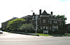
Bounded by Woodward, Warren, 3rd, and the alley south of Prentis
42°21′15″N 83°4′4″W / 42.35417°N 83.06778°WThis district contains a mix of building styles. Upper-class Detroit citizens built single-family homes in the area in 1880–1895. During the same time, apartment living became more popular, and duplexes and small apartment buildings were constructed in the 1890s through the first part of the 20th century. Commercial development was added to the mix in the years after World War I. Wayne State University 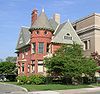
4735-4841 Cass Ave.
42°21′16″N 83°4′2″W / 42.35444°N 83.06722°WWayne State is a large university in the heart of Midtown. The Detroit Medical Center and many notable buildings are in the area including the Queen Anne style style Mackenzie House, the Hilberry Theater, and Old Main. West Canfield Historic District 
Canfield Ave. between 2nd and 3rd Sts.; also 3rd Ave. between Canfield and Calumet
42°21′3″N 83°4′4″W / 42.35083°N 83.06778°WThe West Canfield Historic district is located on a primarily residential block of Canfield. Homes in the district are examples of Queen Anne architecture that have remained nearly unchanged since the late 19th century. A boundary increase (added 1997-09-22) added buildings on Third Avenue between Canfield and Calumet to the district. Willis-Selden Historic District 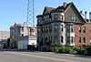
Bounded by the alley north of W. Willis, Woodward, the alley south of Selden, and 3rd Ave.
42°20′57″N 83°3′52″W / 42.34917°N 83.06444°WThe Willis-Selden Historic District includes a large number of commercial buildings and high-density apartment buildings built in the early 1900s to service Detroit's booming auto economy. Woodbridge Historic District 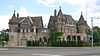
Bounded by Trumbull, Calumet, Gibson, Grand River, 12th W. Warren and Wabash Sts., railroad tracks, and Edsel Ford Expressway; also 4304-14 Trumbull Ave. and 3800 Grand River; also the southeastern corner of Trumbull and Warren
42°20′50″N 83°4′42″W / 42.34722°N 83.07833°WThe Woodbridge neighborhood was originally developed between 1870 and 1920 with residences built in Queen Anne, Colonial Revival, Georgian Revival, and 'cottage' style architecture. The original commercial districts in the neighborhood were located along Grand River, Trumbull, Twelfth and Fourteenth. The boundaries of the District were increased twice: first on 1997-12-01, and 2008-03-20; these are distinguished in the boundary listings with "also" descriptions. Woodbridge is one of Detroit's rapidly developing neighborhoods as nearby Wayne State University continues to grow.[2] New Center area
Main article: New Center, DetroitThe New Center area is a mixed use commercial and residential district adjacent to Midtown and located approximately three miles (5 km) north of the city's downtown, and one mile (1.6 km) north of the Cultural Center Historic District, around the intersection of Woodward Avenue and Grand Boulevard (which is sometimes referred to as The Boulevard).[2] Developed in the 1920s, it was designed to create a business hub that would offer convenient access to both downtown resources and outlying areas. Some historians believe that the New Center may be the original edge city - a sub-center remote from but related to an urban core. From 1923 to 1996, General Motors maintained its world headquarters in the New Center (in what is now Cadillac Place) before relocating downtown to the Renaissance Center. Cadillac Place, a National Historic Landmark is now occupied by State of Michigan government offices. The Detroit St. Regis Hotel is across from Cadillac Place. The descriptor "New Center" derived its name from the New Center News, an automotive-focused free newspaper begun in 1933 that continues to operate under the name Detroit Auto Scene. The CityFest, a five-day street festival held around Independence Day, takes place on the streets of New Center. The Fisher Building, a National Historic Landmark, is considered an Art Deco masterpiece, sits in the New Center.[2]
Name Image Location Summary Arden Park-East Boston Historic District 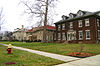
Arden Park and E. Boston Aves. between Woodward and Oakland Aves.
42°23′19″N 83°4′49″W / 42.38861°N 83.08028°WThe Arden Park-East Boston Historic District was platted in the 1890s east of Woodward in what was then the far northern reaches of Detroit. The neighborhood was platted with large lots which feature richly planted trees and flowers, and attracts wealthier residents; some of the neighborhood's first residents included Frederick Fisher, John Dodge, and J.L. Hudson. The neighborhood, along with nearby Boston-Edison (also on the register) remained a premier address for residential living in Detroit with about 92 large homes and mansions.[9][10] Atkinson Avenue Historic District 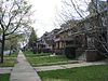
Atkinson Avenue between the Lodge Freeway and Linwood Avenue South of Boston-Edison, it contains approximately 225 homes built from 1915 to 1925.[2] Boston-Edison Historic District 
Roughly bounded by Edison St., Woodward and Linwood Aves. and Glynn Ct.
42°22′54″N 83°5′50″W / 42.38167°N 83.09722°WThe Boston-Edison Historic District is a historic neighborhood consisting of over 900 homes, primarily built from 1905 to 1925 which makes it the largest residential historic district in the nation.[2] Historically significant residents include Henry Ford, James Couzens, Horace Rackham, Charles T. Fisher, Peter E. Martin, C. Harold Wills, Clarence W. Avery, Sebastian S. Kresge, and Clarence Burton. It is one of the largest residential historic district in the nation. New Amsterdam Historic District 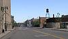
435, 450 Amsterdam;440, 41-47 Burroughs; 5911-5919, 6050-6160 Cass; 6100-6200 Second; 425 York
42°21′56″N 83°4′21″W / 42.36556°N 83.0725°WThe New Amsterdam Historic District contains a mix of industrial, commercial, and government/utility buildings constructed primarily near the turn of the century. Industry in the district was enabled by the construction of major railroad infrastructure, known as the Milwaukee Junction, in the 1890s. The district includes the original Cadillac assembly plant. New Center 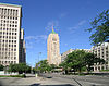
7430 2nd Ave. and 3011 W. Grand Boulevard
42°22′11″N 83°4′39″W / 42.36972°N 83.0775°WThe Cadillac Place and the Fisher Building are National Historic Landmarks in the New Center area. The significant complex demonstrates some of the finest craftsmanship and artistry in Art Deco style buildings. Both were funded by the Fisher brothers (of Fisher Body) and designed by Albert Kahn. New Center is a vibrant residential community. Piquette Avenue Industrial Historic District 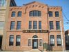
Roughly bounded by Woodward, Harper, Hastings and the Grand Trunk Western Railroad Line
42°22′5″N 83°3′57″W / 42.36806°N 83.06583°WThe area along Piquette was an important center for automobile production in the early 20th century. Ford Motor Company, Studebaker, Cadillac, Dodge, and Regal Motor Car had plants in the area, as well as suppliers such as Fisher Body. In 1911, the two largest automobile producers in the world, Studebaker and Ford, were located next door to each other on Piquette. The district in cludes the National Historic Landmark Ford Piquette Avenue Plant. Virginia Park Historic District 
Both sides of Virginia Park From Woodward Ave. to John Lodge Service Dr.
42°22′29″N 83°4′54″W / 42.37472°N 83.08167°WIn 1893, Virginia Park was platted with 92 relatively small lots. Requirements ensured that only well-to-do businessmen and professionals could afford to erect a home in the neighborhood. Most of the homes were built between 1893 and 1915, in Tudor, Neo-Georgian, Bungalow and Arts and Crafts architectural styles. North
 Bishop Gallagher residence in Palmer Woods.
The area includes the Detroit Golf Club and neighborhoods which surround the main campus of the University of Detroit Mercy.[1] Pilgrim Village, developed in the 1920s, is nearby and bounded by Livernois, Idaho, Puritan and Fenkell. It is the birthplace of the Honey Baked Ham Company, which started on Fenkell in 1957.[2]
Palmer Park Apartment Building Historic District, along with the nearby Palmer Woods Historic District, was largely constructed before World War II. Adjacent to the neighborhood is a 140 acre (0.6 km²) park named Palmer Park. The neighborhood and the park were the property of Thomas Witherell Palmer. The neighborhood consists of stately apartment buildings as well as some single-family detached homes. Palmer Park, along with the nearby cities of Ferndale and Royal Oak, are among the gay populated areas with several gay-oriented businesses. The 1990s saw an increase in African-American residents to the area. The 2000s have brought increased investment to the neighborhood with older homes and apartment buildings being restored.[2]
Palmer Woods Historic District is known for its elm-lined streets, large brick homes, and Tudor style architecture. Palmer Woods is located on the west side of Detroit. It is bordered by 7 Mile Road, 8 Mile Road, Woodward Avenue, and the Sherwood Forest neighborhood. The area was developed from farmland in the 1920s as an exclusive enclave for the business class. Lots are large, with ample room for trees, play equipment, and a good expanse of grass. It is still the home of physicians, politicians, business owners, artists, executives and their families.[2]
Name Image Location Summary Chaldean Town Along 7 Mile Rd. from Woodward Ave. east to John R. Rd. Designated in 1999 as an economic district featuring Chaldean-owned businesses, it has a history of residential settlement primarily by Chaldean Christian immigrants dating from the 1960s. Chaldean Town is often seen as a "staging area" for new immigrants to settle before moving on to other ethnic enclaves in the northern suburbs of Detroit, though many retain the ownership of businesses in the area after moving to the suburbs.[2] Grixdale Farms East of Palmer Park Golf Course. South of 7 Mile. East of Woodward Ave. West of John R. North of Highland Park. A little known gem of a neighborhood with uniquely designed houses in an enclave of historic homes. Some of its stately homes sit on double-sized tree-lined lots built in the 1920s and 1930s. Once farmland owned by the Grix family in then Greenfield Township. Platted in 1913 by Frank Grix as the Grixdale Home Park Subdivision. The stretch of Woodward Ave.(between 6 Mile and 7 Mile Roads) along Grixdale Farms is recognized as the first full mile of concrete paved road in the United States.[11] Highland Park 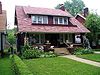
42°24′13″N 83°6′6″W / 42.40361°N 83.10167°W A separate city within the boundaries of Detroit. Palmer Park Apartment Building Historic District 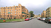
Roughly bounded by Pontchartrain Boulevard, McNichols Rd. and Covington Dr.
42°25′11″N 83°6′37″W / 42.41972°N 83.11028°WThe land that this historic district sits on was once the estate of Thomas Palmer. In 1925, Walter Briggs hired Albert Kahn to design an apartment building in the area (this building, at 1001 Covington, was converted to condos in 2005). Forty buildings total were constructed in the district by multiple architects, including Weidmaier and Gay, Robert West, and William Kapp. Most of the buildings were constructed in the 1920s and 1930s, but development continued until 1965. Palmer Woods Historic District 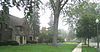
Roughly bounded by Seven Mile Rd., Woodward Ave., and Strathcona Dr.
42°26′5″N 83°7′28″W / 42.43472°N 83.12444°WPalmer Woods Historic District is named after Thomas W. Palmer, a prominent citizen of nineteenth-century Detroit and a United States Senator; the district sits on land originally owned by Palmer. The neighborhood was platted in the mid-1910s. It contains many large homes and mansions constructed primarily between from 1917 to 1929. The developer hired landscape architect Ossian Cole Simonds to design the layout. Sherwood Forest Historic District University District 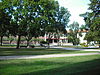
North central, one mile (1.6 km) west of Woodward Ave. Known for its tree-lined streets, architectural variety, central location in the metropolitan area, and strong sense of community, the neighborood is named for the University of Detroit Mercy (UDM).Th e neighborhood is bounded on the north by residential Seven Mile Road, on the south by McNichols Road and the UDM campus, and on the east by the Detroit Golf Club and Golf Club Estates. The western boundary is Livernois Avenue.[2]
University of Detroit Mercy 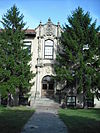
UDM was ranked in the top tier of Midwestern master's universities in U.S.News & World Report "America's Best Colleges" 2009 edition. The University sponsors 19 NCAA Division I level varsity sports for men and women, and is a member of the Horizon League. It is the largest Roman Catholic university in Michigan. The University offers more than a hundred academic degrees and programs of study, including clinical psychology, business, dentistry, law, engineering, architecture, nursing and allied health. East
Upper
Name Image Location Summary Chandler Park Detroit Public Library operates the Chandler Park Branch Library at 12800 Harper. The branch opened at its current location on March 23, 1957.[12] The third floor collection has an emphasis on African-American authors.[13] East English Village [2] The tree-lined streets of East English Village feature a variety of homes ranging from small bungalows to large, luxurious older homes. The housing stock also includes a large number of two-family homes. Grosse Pointe borders it on the South.[2] Hamtramck 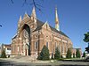
Hamtramck is an incorporated city almost entirely surrounded by Detroit's boundaries.42°23′52″N 83°3′26″W / 42.39778°N 83.05722°W German farmers established the area, but Polish immigrants flooded into the area when the Dodge Brothers plant opened in 1914.[14] As of the 2000 census, over 22% of Hamtramck's population is of Polish origin; in 1970, it was 90% Polish.[15] A large number of immigrants from the Middle East, and South Asia (especially Bangladesh) have moved to the area. Highland Heights-Stevens' Subdivision Historic District / North End 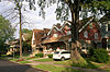
John R. and California St. within the North End area bounded by Woodward Avenue to the west.42°23′49″N 83°5′13″W / 42.39694°N 83.08694°W There are 422 single-family homes, two apartment buildings, five commercial buildings, and the McGregor Library located within the historic district. Of these, 392 single-family houses, both two apartment buildings, and the library are classified as contributing to the district's historic character. The surrounding North End neighborhood area is a focus neighborhood for the NEXT Detroit Neighborhood Initiative.,[16] with specific goals to beautify the neighborhood and strengthen civic leadership. Some in the city have accused the administration of using the NEXT Detroit Neighborhood Initiative to give tax breaks to speculators. Many musicians, such as Aretha Franklin, Smokey Robinson and Diana Ross, are from the North End. Krainz Woods 7 Mile Road and Ryan Road to E Nevada Street and Mound Road The Sojourner Truth Homes housing project is located there. The neighborhood was named after Captain John Krainz, a World War II hero from Detroit.[2] Many Motown-ers singing groups such as The Dramatics & The Floaters, were from the Sojourner Truth housing projects. In 2009, Mayor Bing lead ribbon-cutting dedication of Krainz Park - photo via: [3] Milwaukee Junction E. Grand Boulevard to the South, St. Aubien st./Hamtramck Drive to the east, the Chrysler Freeway and its service drive, the Chrysler Freeway on the west, and Clay St. to the north. An area with significant history related to the automobile industry east of the New Center area, it is near the railroad junction of the Detroit and Milwaukee Railroad, and the Grand Trunk Western Railroad lines, MorningSide 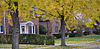
Harper Avenue and I-94 to the north, Mack Avenue to the south, E. Outer Drive and Whittier to the west and Alter Road and E. Outer Drive to the east. MorningSide is an upper east side neighborhood in Detroit encompassing 2.875 square miles (7.45 km2). It is characterized by red brick tudors with wide streets. Van Steuban / Osborne In May 2007, Osborn which is had about 37,000 residents, mostly middle income. In a period before May 2007 Osborne's population grew by 11%, a rarity in Detroit neighborhoods. During that period, the number of children grew by 35.8%; therefore most of the overall growth in Osborne was of an increase in children. In May 2007, per capita, Osborn had more children than any other neighborhood in Michigan. The neighborhood includes brick homes.[17] Central
Name Image Location Summary Eastern Market Historic District 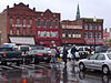
Bounded by Gratiot Ave., Riopelle, Rivard, and Division Sts.; also roughly bounded by Gratiot Ave., Riopelle St., Wilkins St., the Grand Trunk Railroad line, and Division St.
42°20′44″N 83°2′22″W / 42.34556°N 83.03944°WEastern market, established in the 1850s, is the largest historic public market district in the United States. The district houses food wholesaling and processing businesses as well as public market sheds. St. Joseph Roman Catholic Church is near the Eastern Market. Poletown East Poletown East is neighborhood area bordering Hamtramck; the high proportion of Polish immigrants gave the neighborhood its name. A portion of the neighborhood known as Poletown became the General Motors Hamtramck assembly plant following the decision of a historic Michigan Supreme Court case.[2] Lower
Name Image Location Summary Belle Isle 
Detroit River
42°20′32″N 82°58′46″W / 42.34222°N 82.97944°W Jefferson 07200s
Over bridge to south.Belle Isle is a 982-acre (397 ha) island park in the Detroit River, home to the Anna Scripps Whitcomb Conservatory, the Detroit Yacht Club, the Detroit Boat Club, the Dossin Great Lakes Museum, a Coast Guard post, and a municipal golf course. It is the largest island park in the United States. St. Charles Borromeo Roman Catholic Parish Complex 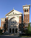
Baldwin Ave. at St. Paul Ave.
42°21′18″N 83°0′7″W / 42.355°N 83.00194°WIn 1886, a parish dedicated to St. Charles Borromeo was established to minister to the eastside area where in influx of Belgians had settled. As Detroit grew, the parish grew along with it, with French, German, Irish, Scotch, and English congregants in addition to the original Belgians. By 1920, the congregation numbered over 3000. Eastside Historic Cemetery District 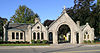
Bounded by Elmwood and Mt. Elliot Aves., Lafayette and Waterloo Sts.
42°20′59″N 83°1′5″W / 42.34972°N 83.01806°WThe Eastside Historic Cemetery District consists of three separate cemeteries: Mount Elliott Cemetery (Catholic, established 1841), Elmwood Cemetery (Protestant, established 1846), and the Lafayette Street Cemetery (Jewish, established 1850), spreading over 150 acres (61 ha) in total. The cemeteries are notable for the monuments, landscaping, and notable individuals interred there. East Grand Boulevard Historic District 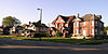
E. Grand Boulevard, between E. Jefferson Ave. and Mack Ave.
42°21′12″N 83°0′22″W / 42.35333°N 83.00611°WThe East Grand Boulevard Historic District includes a few moderate-sized apartment buildings and numerous large homes constructed primarily between 1900 and 1925. The apartment buildings in the district include the El Tovar Apartments, Saint Paul Manor Apartments, and the Kingston Arms Apartments. East Jefferson Avenue Residential District 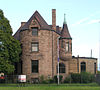
E. Jefferson Avenue.
42°20′28″N 83°1′0″W / 42.34111°N 83.016667°WContains many prominent residences including the Alden Park Towers. Indian Village Historic District 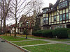
Bounded by Mack, Burns, Jefferson, and Seminole Aves.
42°21′40″N 82°59′48″W / 42.36111°N 82.99667°WIndian Village has a number of architecturally-significant homes built in the early 20th century. Many of the homes were built by prominent architects such as Albert Kahn, Louis Kamper and William Stratton for some of the area's most prominent citizens such as Edsel Ford. Island View Bounded by Baldwin St. on the east. Immediately west of West Village, Island View is bound by Jefferson to the south, Mack to the north, Baldwin to the east, and Mt. Elliott to the west. The eastern boundary of the neighborhood, Baldwin Street, was the Detroit city limit until 1891. The eastern portion features many large turn-of-the-century single and multi-family homes, apartment buildings and brick row houses. The western portion is home to several notable non profits including the Capuchin Soup Kitchen, the Earthworks Urban Farming Project, and Gleaners Food Bank. Large portions of the neighborhood, (especially the southeastern portion close to West Village) are undergoing a rebirth with several new housing developments by community-based Messiah Housing Corp. and Islandview Development Corp. English Village, a luxury condominium, townhouse and loft development is being constructed along Townsend, Sheridan and Field streets just south of Kercheval. Islandview is named for its close proximity to Detroit's island park, Belle Isle.[2] Jefferson-Chalmers Historic Business District 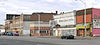
Between Eastlawn and Alter.
42°22′26″N 82°56′34″W / 42.37389°N 82.94278°WThe district has recently seen a resurgence, with a Michigan Cool Cities grant,[18] five million dollars worth of streetscape improvements, and rehabilitation of a number of anchor buildings in the district, such as the Platte Warehouse at Jefferson and Ashland and the Chalmers Building at Jefferson and Chalmers.[19] Lafayette Park / Mies van der Rohe Residential District 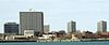
Roughly bounded by Lafayette Ave., Rivard, Antietam, and Orleans Sts.
42°20′31″N 83°2′8″W / 42.34194°N 83.03556°WMies van der Rohe, Ludwig Hilberseimer and Alfred Caldwell planed this 78-acre (32 ha) urban renewal project constructed on the site of the former Black Bottom area. Lafayette Park includes a landscaped, 19-acre (7.7 ha) park with no through traffic, in which these and other low-rise apartment buildings are sited. The apartment buildingsare classic examples of Mies' International Style, with their simplicity, clean proportions, and cladding of tinted glass and aluminum. Rivertown 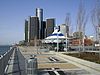
East Jefferson Avenue Rivertown includes Detroit's upscale high rise Harbortown condominiums and marina near the MacArthur Bridge leading to Belle Isle Park. West Village Historic District 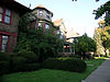
Roughly bounded by Jefferson, Kercheval, Parker and Seyburn Aves.
42°21′16″N 82°59′53″W / 42.35444°N 82.99806°WThe West Village Historic District is a neighborhood just west of Indian Village Historic District. It is a primarily residential neighborhoods containing 275 single and two-family houses, thirty apartment buildings, and about twenty commercial structures of a wide range of architectural styles spread over 20 square blocks. It has many Victorian homes and four squares with apartment buildings and row houses interspersed in between. A walkable urban neighborhood, it is an advantageous location just 2 miles (3.2 km) east of downtown Detroit and minutes from Belle Isle Park and the new Detroit Riverwalk make it a popular neighborhood. Many historic homes and apartment buildings have recently been restored. Its commercial areas include a short stretch along Agnes Street in the center of the neighborhood and along Kercheval and busy Jefferson Avenue.[2] West
Upper
Name Image Location Summary Bagley West of the Palmer Woods/Sherwood Forest/University District. The Bagley community is an area in Northwest Detroit whose boundaries are West Outer Drive to the north, Livernois Avenue to the east, West McNichols (Six Mile Road) to the south, and Wyoming Avenue to the west. The community's name is likely derived from Bagley Elementary School, which is the lone public school within the community. .[2] Old Redford Grand River Avenue and Lahser Road. Stretches from Five Points east to Greenfield Road and from 8 Mile Road to Schoolcraft Road, Old Redford encompasses approximately 8 to 10 square miles (21 to 26 km²) of land. It was originally part of Redford Township outside of the city limits, but was annexed in 1926. Much of the housing stock near the center of the area is a mixture of early 1900s to 1940s homes.[2] The Redford Theatre is within the area. Rosedale Park Historic District 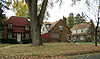
Roughly bounded by Fenkell, Outer Dr. W. Grand River Ave., the Southfield Freeway, Glastonbury, Lyndon, Westwood Dr.
42°24′1″N 83°13′37″W / 42.40028°N 83.22694°WConstruction in Rosedale Park was accomplished primarily in the 1920s and the late 1930s/early 1940s. houses were built in a multitude of styles, including English Tudor revival, Arts and Crafts, Bungalow, Colonial Revival, Dutch Colonial, American Foursquare, Prairie, but an English country esthetic seems to have been encouraged , and many homes have Engish Tudor details. In North Rosedale Park, there is a civic association (NRPCA), club house and park. The Rosedale Park Community House is home to the Jim Dandy Ski Club.[20] Central
Name Image Location Summary Parkland 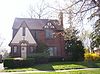
Roughly bounded by West Warren, Ann Arbor Trail, West Parkway, and Parkland. Parkland is a neighborhood in far western Detroit, bordering Warrendale.[2] Warrendale Warren Ave. Warrendale is one of Detroit's largest neighborhoods. Its approximate borders are Joy Road to the north, Ford Road to the south, Greenfield road to the east and the Rouge River to the west. Warrendale borders the communities of Dearborn and Dearborn Heights and is composed of bungalows dating from the 1930s to the 1950s.[21] A large influx of Arab immigrants throughout the twentieth century have also contributed to the character of the neighborhood and the types of businesses found along its main street Warren Avenue. Rouge Park runs through part of Warrendale. Located on each side of the Rouge River, the park has a large picnic area, a playground and swimming pool. Southwest / Near West
Detroit Public Library operates the Bowen Branch Library at 3648 West Vernor Highway. On December 28, 1912 the branch opened in its current location.[22] The area includes the historic Michigan Central Station and the Ambassador Bridge.
Name Image Location Summary Corktown Historic District 
Roughly bounded by Lodge Freeway, Porter, Trumbull, Bagley, Rosa Parks Boulevard, and Michigan Ave.
42°19′46″N 83°4′27″W / 42.32944°N 83.07417°WCorktown is the oldest surviving neighborhood in Detroit, dating to the 1850s. The name comes from the Irish immigrants who settled there; they were predominantly from County Cork. The neighborhood is primarily residential, but the district does include some commercial buildings, mostly along Michigan Avenue. Delray 
Boundaried by Fort Street to the west with Clark Street and the Detroit River to its east. Delray is a residential area in the industrial south side of the city. It is isolated from other residential communities by industrial warehouses and other commercial properties. Delray is bordered by the cities of Dearborn, Melvindale, and River Rouge to its south, Nearby is the Ford River Rouge Complex (constructed as the largest industrial complex in the world at the time). Hubbard Farms Historic District Bounded by Dix Hwy. to the north, West Grand Boulevard to the east, Lafayette Ave. to the south, and Clark St. to the west. Hubbard Farms is a residential neighborhood named after Bela Hubbard (1814–1896) who owned much of the area during his lifetime and whose Italianate mansion Vinewood rested on the property from 1856 to 1933. Originally a number of French ribbon farms, followed by farms and wooded estates, the area was annexed into the City of Detroit in 1885 which lead to the development of residential housing throughout. Significant architecture spans the years from approximately 1870 though 1930, representing a variety of styles including Victorian Eclectic, Italianate, Romanesque, Tudor Revival, Beaux Arts, and American Four Square.[23][24] Clark Park, named for John Pearson Clark who donated the land to the city for use as a public park, is located in Hubbard Farms[25] North Corktown 
North Corktown came into existence after the construction of I-75. Before this period North Corktown was part of the Corktown neighborhood. Mexicantown 
Roughly, from Clark St. along W. Vernor Hwy. to Ste. Ann St., one block north of the Ambassador Bridge, Porter and Bagley, excluding the area within known as Hubbard farms.[2] With a 6.9 percent population rise to 96,000 from 1990 to 2000, the city's revitalized Mexicantown has improved the local economy. About half the residents are Hispanic, 25% are African American, 20% are European American and 5% are Arab American, according to the Southwest Detroit Business Association.[26] It is known for Mexican cuisine at restaurants such as Mexican Village, Evie's Tamales, El Zocalo and Xochimilco. Restaurants, bakeries, and shops are located on Vernor Highway. Mexicantown has had a thriving economy in the 2000s, as evidenced by new housing and increased business openings.[26] Clark Park, named for John Pearson Clark who donated much of the land to the city, borders the neighborhood.[25] Ste. Anne de Detroit Catholic Church is north of the Ambassador Bridge. Springwells Village Boundaried by Dix Hwy. to the north, Waterman St. to east, Fort St. to the south, and Woodmere St. to the west. Springwells Village is largely residential. It includes the West Vernor-Springwells and West Vernor-Lawndale Historic Districts Historic, which are commercial districts located along West Vernor Highway. West Vernor-Junction Historic District 
W. Vernor Highway between Lansing and Cavalry
42°19′2″N 83°6′7″W / 42.31722°N 83.10194°WThe West Vernor-Junction Historic District is a mixed use district located along West Vernor Highway. The district encompasses 160 acres (65 ha) and 44 buildings, including the Most Holy Redeemer Church, which was once estimated as the largest Catholic parish in North America. The West Vernor–Junction Historic District, which is listed in the National Register of Historic Places, is adjacent to Mexicantown and contains a large vibrant Latino community and resurgent neighborhoods.[2][27] West Vernor-Lawndale Historic District 
W. Vernor Highway between Cabot and Ferris
42°18′33″N 83°7′57″W / 42.30917°N 83.1325°WThe West Vernor-Lawndale Historic District is a commercial district located along West Vernor Highway between. The district encompasses 30 acres (12 ha) and 10 buildings. Patton Park named for U.S. General George S. Patton of World War II is within the district. West Vernor-Springwells Historic District 
W. Vernor Highway between Honorah and Norman
42°18′44″N 83°7′35″W / 42.31222°N 83.12639°WThe West Vernor-Springwells Historic District is a commercial district located along West Vernor Highway. The district encompasses 80 acres (32 ha) and 28 buildings. Index[2]

City of Detroit neighborhoods by area Downtown Bricktown • Broadway Ave. • Campus Martius • Capital Park • Downtown • Financial District • Greektown • Grand Circus • Griswold Street • West Jefferson Avenue • Lower Woodward Avenue • Monroe Avenue • Park Avenue • Randolph Street Commercial • Riverfront Condominiums • Washington Blvd. • Woodward Avenue
Midtown Art Center • Brush Park • Cass Corridor • Cass-Davenport • Cass Park • Cultural Center • Medical Center • East Ferry Avenue • Jeffries • Midtown • Midtown Woodward Avenue • Sugar Hill • University-Cultural Center • Wayne State University • Warren-Prentis • West Canfield • Willis-Selden • Woodbridge • Woodward East • Woodward Avenue
New Center Alden Park • Arden Park-East Boston • Atkinson Ave. • Boston-Edison • Henry Ford Hospital • New Amsterdam • New Center • Piquette Ave. • Virginia Park • Woodward Avenue
North Chaldean Town • Detroit Golf Club • State Fairgrounds • Green Acres • Highland Park • Martin Park • Palmer Park • Palmer Woods • Sherwood Forest • University District • University of Detroit Mercy
East UpperChandler Park • Conant Gardens • East English Village • Fox Creek • Greenbriar • Grixdale • Hamtramck • Highland Heights-Stevens' Sub. • Krainz Woods • Milwaukee Junction • La Salle College Park • Mohican Regent • Morningside • North End • Pulaski • Ravendale • Regent Park • Van Steuban
CentralEastern Market • Forest Park • Poletown East
LowerBarry Sub. • Belle Isle Park • Conner Creek • East Jefferson Ave. • East Village • Eastside Cemetary • Elmwood Park • English Village • Gold Coast • Indian Village • Islandview • Jefferson-Chalmers • Lafayette Park • McDougall-Hunt • Marina Park • Rivertown • St. John Hospital • Victoria Park • West Village
West UpperBagley • Belmont • Berg-Lahser • Brightmoor • Blackstone Park • Castle Rouge • Eight Mile Wyoming • Eliza Howell • The Eye • Fitzgerald • Five Points • Grandmont # 1 • Grandmont - Rosedale • LaSalle Gardens • Minock Park • NW Goldberg • Oakman Boulevard • Old Redford • Petosky-Otsego • Riverdale • Russell Woods • Rosedale Park • Westwood Park
CentralAviation • Barton-McFarland • Briggs • Core City • Fiskhorn • Franklin Park • Grandale • Herman Gardens • Littlefield • Parkland • Hubbard-Richard • Warrendale • Weatherby
Southwest /
Near WestBoynton • Carbon Works • Corktown • Delray • Hubbard Richard • North Corktown • Mexicantown • Michigan-Martin • Millennium Village • Oakwood Heights West Vernor-Junction • West Vernor-Lawndale • West Vernor-Springwells • Westside Industrial
Historic Districts ResidentialArden Park-East Boston • Atkinson Avenue • Boston-Edison • Brush Park • Corktown • East Ferry • Grand Boulevard • East Jefferson Avenue • Highland Heights-Stevens' Sub. • Indian Village • Layafette Park • Palmer Park Apartments • Palmer Woods • Park Avenue • Rosedale Park • Sherwood Forest • Virginia Park • Warren-Prentis • West Canfield • West Village • Willis-Seldon • Woodbridge • Woodward East
Mixed-useBroadway Ave. • Capitol Park • Cass Park • Cass-Davenport • Cultural Center • Eastern Market • Eastside Cemetery • Financial District • Grand Circus • Greektown • Jefferson Chalmers • Lower Woodward • Midtown Woodward • Monroe Avenue • New Amsterdam • New Center • Piquette Ave • Randolph Street • Sugar Hill • University-Cultural Center • Washington Boulevard • Wayne State University • West Vernor-Junction • West Vernor-Lawndale • West Vernor-Springwells
See also: Historic homes in metropolitan Detroit Notes
- ^ a b Hill, Eric J. and John Gallagher (2002). AIA Detroit: The American Institute of Architects Guide to Detroit Architecture. Wayne State University Press. ISBN 0-8143-3120-3.
- ^ a b c d e f g h i j k l m n o p q r s t u v w x y z aa ab ac ad ae Cityscape Detroit - see neighborhoods
- ^ Bigda, Carolyn, Erin Chambers, Lawrence Lanahan, Joe Light, Sarah Max, and Jennifer Merritt.Detroit Best place to retire: Downtown. CNN Money Magazine. Retrieved on October 22, 2007.
- ^ Fox Town Map
- ^ Harmonie Park District.Retrieved on August 23, 2009.
- ^ [1]
- ^ Midtown. Model D media. Retrieved on July 8, 2009.
- ^ Midtown location from the University Cultural Center Association website (retrieved 6/9/09)
- ^ The Detroit Historic District Commission
- ^ Arden Park East Boston from Boston-Edison
- ^ www.grixdalefarms.org
- ^ "Chandler Park Branch Library." Detroit Public Library. Retrieved on April 19, 2009.
- ^ DetroitBlogger John. "Dewey-eyed." Metro Times. January 7, 2009. Retrieved on November 21, 2009.
- ^ City of Hamtramck official website, history.
- ^ Stanley S. (1976). In Quest of a Cultural Identity: An Inquiry for the Polish Community. New York, New York: IUME, Teachers College, Columbia University. ISBN ERIC ED167674.
- ^ NEXT Detroit Neighborhood Initiative
- ^ Osborn Work Plan. City of Detroit. May 2007. Retrieved on October 21, 2009.
- ^ Michigan Cool Cities Pilot Program Executive Summary--Jefferson East Business Association
- ^ Santiago Esparza, "Far east side revels in its revitalization," The Detroit News, June 23, 2007
- ^ Jim Dandy Ski Club
- ^ http://www.modeldmedia.com/features/warrendale44.aspx
- ^ "Bowen Branch Library." Detroit Public Library. Retrieved on April 19, 2009.
- ^ https://www.ci.detroit.mi.us/historic/districts/hubbard_farms.pdf
- ^ http://www.cityscapedetroit.org/historic_districts.php
- ^ a b Burton, Clarence Monroe (1922) The City of Detroit, Michigan, 1701–1922. S.J. Clarke Pub. Co. http://books.google.com/books?id=ZxxKyM6PLbcC&oe=UTF-8
- ^ a b Williams, Corey (February 28, 2008).New Latino Wave Helps Revitalize Detroit. USA Today. Retrieved on March 17, 2008.
- ^ Most Holy Redeemer Parish History
Further reading
- Fisher, Dale (1994). Detroit: Visions of the Eagle. Grass Lake, Michigan: Eyry of the Eagle Publishing. ISBN 0-9615623-3-1.
- Fogelman, Randall (2004). Detroit's New Center. Arcadia. ISBN 0738532711.
- Greenberg, Michael R. (1999). Restoring America's Neighborhoods: How local people make a difference. Rutgers University Press. ISBN 0813527120.
- Hill, Eric J. and John Gallagher (2002). AIA Detroit: The American Institute of Architects Guide to Detroit Architecture. Wayne State University Press. ISBN 0-8143-3120-3.
- Johnson, Lois and Margaret Thomas (2005). Detroit's Eastern Market. Wayne State University Press. ISBN 0-8143-3274-9.
- Meyer, Katherine Mattingly and Martin C.P. McElroy with Introduction by W. Hawkins Ferry, Hon A.I.A. (1980). Detroit Architecture A.I.A. Guide Revised Edition. Wayne State University Press. ISBN 0-8143-1651-4.
- Sugrue, Thomas (1996). The Origins of the Urban Crisis: Race and Inequality in Postwar Detroit. Princeton University Press. ISBN 0-691-12186-9.
- Woodford, Arthur M. (2001). This is Detroit 1701–2001. Wayne State University Press. ISBN 0-8143-2914-4.
External links
- Detroit1701
- The Detroit Historic District Commission
- City Living Detroit
- Cityscape Detroit - See neighborhoods of Detroit
- DetroitMidtown.com
- Downtown Detroit Partnership
- Greater Corktown Development Corporation (GCDC)
- Historic Boston-Edison Association
- Model D Media
- New Center Council
- Sherwood Forest Historic District
- Experience Detroit
- Barton-McFarlane Neighborhood Assoc
- University District
U.S. National Register of Historic Places Topics Lists by states Alabama • Alaska • Arizona • Arkansas • California • Colorado • Connecticut • Delaware • Florida • Georgia • Hawaii • Idaho • Illinois • Indiana • Iowa • Kansas • Kentucky • Louisiana • Maine • Maryland • Massachusetts • Michigan • Minnesota • Mississippi • Missouri • Montana • Nebraska • Nevada • New Hampshire • New Jersey • New Mexico • New York • North Carolina • North Dakota • Ohio • Oklahoma • Oregon • Pennsylvania • Rhode Island • South Carolina • South Dakota • Tennessee • Texas • Utah • Vermont • Virginia • Washington • West Virginia • Wisconsin • WyomingLists by territories Lists by associated states Other City of Detroit Architecture · Culture · Detroit River · Economy · Freeways · Government · History · Historic places · International Riverfront · Media · Music · Neighborhoods · Parks and beaches · People · Skyscrapers · Sports · Theatre · Tourism · Transportation

Neighborhoods in Detroit Downtown Bricktown • Broadway Ave. • Campus Martius • Capital Park • Downtown • Financial District • Greektown • Grand Circus • Griswold Street • West Jefferson Avenue · Monroe Avenue • Park Avenue • Randolph Street • Riverfront Condominiums • Washington Blvd. • Lower Woodward Avenue • Woodward Avenue
Wayne State University
MidtownArt Center • Brush Park • Cass Corridor • Cass-Davenport • Cass Park • Cultural Center • Medical Center • East Ferry Avenue • Jeffries • Midtown • Midtown Woodward Avenue • Sugar Hill • University-Cultural Center • Wayne State University • Warren-Prentis • West Canfield • Willis-Selden • Woodbridge • Woodward East • Woodward Avenue
New Center Alden Park • Arden Park-East Boston • Atkinson Ave. • Boston-Edison • Henry Ford Hospital • New Amsterdam • New Center • Piquette Ave. • Virginia Park • Woodward Avenue
University of Detroit Mercy
NorthChaldean Town • Detroit Golf Club • State Fairgrounds • Green Acres • Highland Park • Martin Park • Palmer Park • Palmer Woods • Sherwood Forest • University District • University of Detroit Mercy
East UpperChandler Park • Conant Gardens • East English Village • Fox Creek • Greenbriar • Grixdale • Hamtramck • Highland Heights-Stevens' Sub. • Krainz Woods • Milwaukee Junction • La Salle College Park • Mohican Regent • MorningSide • North End • Pulaski • Ravendale • Regent Park • Van Steuban
CentralEastern Market • Forest Park • Poletown East
LowerBarry Sub. • Belle Isle Park • Conner Creek • East Grand Boulevard • East Jefferson Ave. • East Village • Eastside Cemetary • Elmwood Park • English Village • Gold Coast • Indian Village • Islandview • Jefferson-Chalmers • Lafayette Park • McDougall-Hunt • Marina Park • Rivertown • St. John Hospital • Victoria Park • West Village
West UpperBagley • Belmont • Berg-Lahser • Brightmoor • Blackstone Park • Castle Rouge • Eight Mile Wyoming • Eliza Howell • The Eye • Fitzgerald • Five Points • Grandmont # 1 • Grandmont - Rosedale • LaSalle Gardens • Minock Park • NW Goldberg • Oakman Boulevard • Old Redford • Petosky-Otsego • Riverdale • Russell Woods • Rosedale Park • Westwood Park
CentralAviation • Barton-McFarland • Briggs • Castle Rouge • Core City • Fiskhorn • Franklin Park • Grandale • Herman Gardens • Littlefield • Parkland • Hubbard-Richard • Warrendale • Weatherby
Southwest Boynton • Carbon Works • Delray • Corktown • Hubbard Richard • North Corktown • Mexicantown • Michigan-Martin • Millennium Village • Oakwood Heights West Vernor-Junction • West Vernor-Lawndale • West Vernor-Springwells • Westside Industrial
Historic Districts See also: Historic homes in metropolitan DetroitHistoric homes in metropolitan Detroit City John N. Bagley House • Beaubien House • George L. Beecher House • James Burgess Book Jr. House • William C. Boydell House • Joseph Campau House • Alexander Chapoton House • Alexander Chene House • Croul-Palms House • Charles Lang Freer House • Charles T. Fisher House • Bishop Gallagher House • Bernard Ginsburg House • Berry Gordy House • John Harvey House • Col. Frank J. Hecker House • Hudson-Evans House • Northwood-Hunter House • Mulford T. Hunter House • Albert Kahn House • S.S. Kresge House • George W. Loomer House • David Mackenzie House • Manoogian Mansion • Perry McAdow House • Moross House • Philetus W. Norris House • Arthur M. Parker House • Thomas A. Parker House • Sibley House • Samuel L. Smith House • Marvin M. Stanton House • Frederick K. Stearns House • Herman Strasburg House • Elisha Taylor House • Thompson Home • Charles Trowbridge House • Franklin H. Walker House • Warren Home (Dunbar Hospital) • William H. Wells House • David Whitney House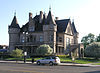
Suburban Henry W. Baker House • Cranbrook House and Gardens • Paul Harvey Deming House • Edsel and Eleanor Ford House • Edward Loranger House • Governor Robert McClelland House • Henry Ford's Fair Lane Estate • Greenfield Village • Greenmead Farms • Grosse Pointe landmarks • Koebel House • John and Rosetta Lee House • Meadow Brook Hall (Dodge-Wilson estate) • Orson Everitt House • Rudolph Nims House • Russell A. Alger Jr., House • Sawyer House • Carl E. and Alice Candler Schmidt House • William B. and Mary Chase Stratton House • John T. Woodhouse HouseCanton Township MPS Thomas and Maria Blackman Bartlett House • David and Elizabeth Bell Boldman House • Benjamin and Mary Ann Bradford House • Thomas and Isabella Moore Clyde House • Phillip and Maria Hasselbach Dingledey House • John and Edna Truesdell Fischer Farmstead • Orrin and Roxanne Fairman Kinyon House • John and Eliza Barr Patterson House • Sheldon Inn • George and Mary Pine Smith House • Ephraim and Emma Woodworth Truesdell HouseNeighborhood
Historic DistrictsSee also: Architecture of metropolitan DetroitCategories:- Neighborhoods in Detroit, Michigan
- Culture of Detroit, Michigan
- Lists of neighborhoods in U.S. cities
- Historic districts in Michigan


![[3]](http://img.timeinc.net/time/photoessays/2009/dave_bing/dave_bing_04.jpg)
Wikimedia Foundation. 2010.