- Saxthorpe
-
Coordinates: 52°49′49″N 1°08′23″E / 52.83025°N 1.1397°E
Saxthorpe 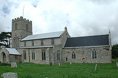
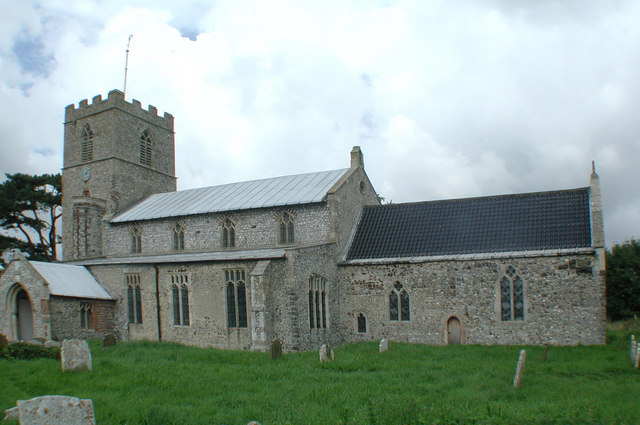
St Andrew parish church, Saxthorpe, Norfolk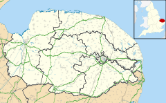
 Saxthorpe
Saxthorpe shown within NorfolkOS grid reference TG116315 - London 131 miles (211 km) Parish Corpusty CP District North Norfolk Shire county Norfolk Region East Country England Sovereign state United Kingdom Post town NORWICH Postcode district NR11 Dialling code 01263 Police Norfolk Fire Norfolk Ambulance East of England EU Parliament East of England List of places: UK • England • Norfolk Saxthorpe is a village within the civil parish of Corpusty in the English county of Norfolk.[1] The village is 12 miles (19 km) west south west of Cromer, 16.3 miles (26.2 km) north north west of Norwich and 131 miles (211 km) north east of London. The village lies 6.2 miles (10.0 km) south west of the town of Holt. The village is passed to the north and east by the B1149 between Holt and Norwich. The nearest railway station is at Sheringham for the Bittern Line which runs between Sheringham, Cromer and Norwich. The nearest airport is Norwich International Airport.
Contents
History
Saxthorpe has an entry in the Domesday Book of 1085.[2] In the great book Saxthorpe is recorded by the name ‘’Sastorp’’, “Saxiorp” and “Saxthorp” it is said to be in the ownership of the King and in the custardy of Godric, Count Alan and Ribralt from him. The survey also notes that there are 50 goats, 20 cattle and 4 cobs.
For more details about Saxthorpe and its sister village of Corpusty (divided by the River Bure) read the late Janet Wilson's A History of Corpusty & Saxthorpe. Janet was a Corpusty native and spent most of her life living in the village; she was also schoolteacher at Corpusty for many years.
Village Amenities
- Crossroad Garage:- Motor Vehicle Repairs And Mechanics
The Parish Church of St Andrew
The Parish Church of Saint Andrew is constructed in 1482[3] by the lord of the manor although chancel and tower are thought to be older. The church has a 15th century screen with tracery above panels which are decorated with flowers and foliage.[4] The beams of the north aisle roof have a boss with a grinning lion carving. The altar rail is carved with pillars and balusters and date from the 17th century. The church is a Grade I listed building[5]
References
- ^ OS Explorer Map 24 - Norfolk Coast Central. ISBN 0 319 21726 4.
- ^ The Domesday Book, Englands Heritage, Then and Now, Editor: Thomas Hinde,Norfolk page 194 ISBN 1858334403
- ^ Pevsner, Nikolaus; Wilson, Bill. "Bale". Norfolk 1: Norwich and North-East. ISBN 0-300-09607-0.
- ^ Mee, Arthur (1972). The King’s England series, NORFOLK. Hodder and Stoughton. p. 270 Saxthorpe. ISBN 0 340 15061 0.
- ^ "Images of England". English Heritage. http://www.imagesofengland.org.uk/details/default.aspx?id=224039.
External links
 Media related to Saxthorpe at Wikimedia CommonsCategories:
- Villages in Norfolk

Wikimedia Foundation. 2010.