- Mississauga
-
This article is about the City of Mississauga. For the First Nation tribe, see Mississaugas.
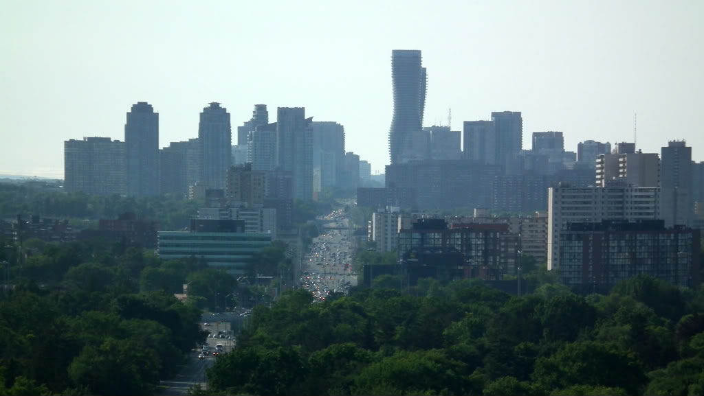
Mississauga — City — City of Mississauga Part of Mississauga's skyline as seen from Hurontario Street.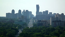

Flag
Coat of arms
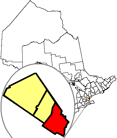
LogoNickname(s): Sauga, Land of Hurricane Hazel Motto: Pride in our past, Faith in our future. Be strong. Be Proud. Location of Mississauga in the Regional Municipality of Peel in the province of Ontario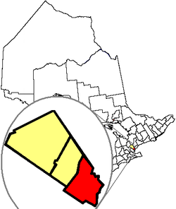
Coordinates: 43°36′N 79°39′W / 43.6°N 79.65°WCoordinates: 43°36′N 79°39′W / 43.6°N 79.65°W Country  Canada
Province  Ontario
Region Peel Established 1968, as a town Incorporated 1974, as a city Government - City Mayor Hazel McCallion - Local government Mississauga City Council
(11 wards)- MPs Eve Adams, Stella Ambler, Brad Butt, Bob Dechert, Bal Gosal, Wladyslaw Lizon - MPPs Dipika Damerla, Bob Delaney, Amrit Mangat, Jagmeet Singh, Charles Sousa, Harinder Takhar Area - Total 288.42 km2 (111.4 sq mi) Elevation 173 m (568 ft) Population (2006) - Total 668,549
(6th largest in Canada)- Density 2,544.89/km2 (6,591.2/sq mi) Time zone EST (UTC−5) - Summer (DST) EDT (UTC−4) Postal code span L4T to L5W Area code(s) 905 and 289 Twin Cities - Sister city  Kariya, Japan
Demonym Mississaugan Website www.mississauga.ca Mississauga
 i/ˌmɪsɨˈsɑːɡə/ is a city in Southern Ontario located in the Regional Municipality of Peel, and in the western part of the Greater Toronto Area. With an estimated population of 734,000,[1] it is Canada's sixth-most populous municipality,[2] and has almost doubled in population in each of the last two decades. Mississauga's growth reached a peak between the census years of 1986-1991, with the largest population growth in Canada (89,500). Sustained population growth has continued since, but at a somewhat slower pace. Mississauga is now the third most populous city on the Great Lakes, surpassing the cities proper of Detroit, Milwaukee and Cleveland over the last two decades.[3]
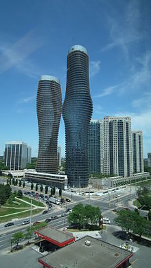
Developed as a suburb of Toronto, Mississauga's growth is attributed to its proximity to that city.[4] However, Mississauga's extensive corporate and industrial employment opportunities differentiate it from suburban bedroom communities. The city has also been trying to create a distinctive image for itself over the past few years. It held an international architectural design competition in 2006 for a 56-storey condominium tower, to be called Absolute World, that is intended to be a landmark for the city. The city is debt-free and has not borrowed money since 1978. Mississauga has been the beneficiary of federal infrastructure funding but may have to borrow money to build new capital projects in 2012.[5]
With five major freeways passing through the city, Mississauga offers quick access to major markets in Canada, in addition to large markets in the Northeastern and Midwestern United States. Toronto Pearson International Airport, Canada's busiest, is located in the city. Mississauga has one of the largest corporate/financial districts in Canada with major international companies having their Canadian headquarters located in the region including Hewlett-Packard, Microsoft, PepsiCo, General Electric, Siemens, Fujitsu, Walmart Canada , World Vision Canada and Intuit Canada among many other Fortune 500 companies. Square One Shopping Centre, the second-largest shopping mall of Greater Toronto Area, is also situated in Mississauga. Residents of the city are called Mississaugans.
Contents
History
At the time of the arrival of the Europeans in the 1600s, both Iroquoian and Algonquian-speaking peoples already lived in the Credit River Valley area. One of the First Nations groups the French traders found around the Credit River area were the Algonquian Mississaugas, a tribe originally from the Georgian Bay area. By 1700 the Mississaugas had driven away the Iroquois.
Toronto Township, consisting of most of present-day Mississauga, was formed on August 2, 1805 when officials from York (what is now Toronto) purchased 84,000 acres (340 km²) of land from the Mississaugas. In January 2010, the Mississaugas and the federal government settled a land claim, in which the band received $145,000,000, as more just compensation for their land and lost income.[6]
The original villages (and some later towns) settled included: Lakeview, Clarkson, Cooksville, Dixie, Erindale (called Springfield until 1890), Lorne Park, Port Credit, Sheridan, and Summerville. This region would become known as Toronto Township. Part of northeast Mississauga, including the Airport lands and Malton were part of Gore Township.[7]
After the land was surveyed, the Crown gave much of it in the form of land grants to United Empire Loyalists who emigrated from the Thirteen Colonies during and after the American Revolution, as well as loyalists from New Brunswick. A group of settlers from New York City arrived in the 1830s. The government wanted to compensate the Loyalists for property lost in the colonies and encourage development of what was considered frontier. In 1820, the government purchased additional land from the Mississaugas. Additional settlements were established, including: Barbertown, Britannia, Burnhamthorpe, Derry West, Elmbank, Malton, Meadowvale Village, Mount Charles, and Streetsville. European-Canadian growth led to the eventual displacement of the Mississaugas. In 1847, the government relocated them to a reserve in the Grand River Valley near present-day Hagersville.
In 1873, in light of the continued growth seen in this area much as a result of the many railway lines passing through the township which spurred on industry, the Toronto Township Council was formed to oversee the affairs of the various villages that were unincorporated at that time. The Council's responsibilities included road maintenance, the establishment of a police force, and mail delivery service. Except for small villages, some gristmills and brickworks served by railway lines, most of present-day Mississauga was agricultural land, including fruit orchards, through much of the 19th and first half of the 20th century.
Cottages were constructed along Lake Ontario in the 1920s as weekend getaway houses for city dwellers.
Malton Airport opened in 1937, which would become Canada's busiest, Toronto Pearson International Airport.
The Queen Elizabeth Way (QEW) highway, one of the first controlled access highways in the world opened from Highway 27 to Highway 10, Port Credit, in 1935 and later to Hamilton and Niagara in 1939. The first prototypical suburban developments occurred around the same time, in the area south of the Dixie Road/QEW interchange. Development in general moved north and west from there over time and around established towns. Large-scale developments, such as in Meadowvale and Erin Mills, sprang up in the 1960s and 70s.
With the exception of Port Credit and Streetsville, the township settlements of Lakeview, Cooksville, Lorne Park, Clarkson, Erindale, Sheridan, Dixie, Meadowvale Village, and Malton were amalgamated by a somewhat unpopular provincial decree in 1968 to form the Town of Mississauga. The town name was chosen by plebiscite over "Sheridan". Political will, as well as a belief that a larger city would be a hegemony in Peel County, kept Port Credit and Streetsville as independent island towns encircled by the Town of Mississauga. In 1974, both were annexed by Mississauga when it reincorporated as a city. That year, the sprawling Square One Shopping Centre opened, which has since expanded many times.
On November 10, 1979, a 106-car freight train derailed on the CP rail line while carrying explosive and poisonous chemicals just north of the intersection of Mavis Road and Dundas Street in Mississauga. One of the tank cars carrying propane exploded, and since other tank cars were carrying chlorine, the decision was made to evacuate nearby residents. With the possibility of a deadly cloud of chlorine gas spreading through suburban Mississauga, 218,000 people were evacuated.[8] Within a few days Mississauga was practically a ghost town.
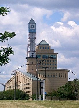 Mississauga Civic Centre seen from the south-east. This design was supposed to reflect the influence of farmsteads which once occupied much of Mississauga,[9] the architecture is based on a "futuristic farm" (the clock tower is the windmill, the main building on the top-right corner is the farmhouse, the cylindrical council chamber is the silo, and the building on the bottom left represents a barn)
Later when the mess had been cleared and the danger neutralized residents were allowed to return to their homes. At the time, it was the largest peacetime evacuation in North American history. Due to the speed and efficiency in which it was conducted, many cities later studied and modeled their own emergency plans after Mississauga's. For many years afterwards, the name "Mississauga" was to Canadians associated with a major rail disaster.
North American telephone customers placing calls to Mississauga (and other post 1970 Ontario cities) may not recognize the charge details on their billings, as Bell Canada continues to use the former community names, rather than "Mississauga", to identify exchanges in the city: Clarkson, Cooksville, Malton, Port Credit, Streetsville.
On January 1, 2010, Mississauga bought land from the Town of Milton and expanded its border by 400 acres (1.6 km2) to Hwy. 407 affecting 25 residents.[10]
Politics
Main article: Mississauga City CouncilMississauga has had only three mayors in its history. Dr. Martin Dobkin was the city's first mayor in 1974. He was then followed by Ron A. Searle. Searle was defeated by then-city councillor and former mayor of Streetsville, Hazel McCallion. McCallion is regarded as a force in provincial politics and often referred to as Hurricane Hazel, comparing her political force to the devastating 1954 storm that struck the Toronto area. McCallion has won or been acclaimed in every mayoral election since 1978, and in recent years has not even campaigned. In October 2010, McCallion won her twelfth term in office with over 76% of the votes. McCallion is the nation's longest serving mayor and was runner-up in World Mayor 2005.[11]
The mayor is currently part of the judicial inquiry into a land deal that her son, Peter McCallion, was involved with. The deal centred around Peter McCallion's development firm, World Class Developments purchasing lands from Ontario Municipal Employees Retirement System with the intention of building a high end hotel-condominium-office complex near City Hall. The deal eventually fell through but revelations that possible influence peddling by the mayor on behalf of her son, non-disclosure by the mayor to city council about the deal and the proposed exemption of development fees for World Class are being looked into, amongst other alleged improprieties. [1] [2]
See also: Mississauga Ward 5 by-election, 2011Geography
Main article: Geography of Mississauga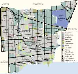 Overview map of Mississauga, including neighbourhoods, land use patterns, and transport corridors.
Mississauga covers 288.42 square kilometres (111.36 sq mi) of land,[12] fronting 13 kilometres (8.1 mi) of shoreline on Lake Ontario.
Mississauga is bounded by Oakville and Milton to the west/southwest, Brampton to the north, Toronto to the east, and Lake Ontario to the south/south-east. Halton Hills borders Mississauga's north-west corner. With the exception of the southeast border with Toronto (Etobicoke Creek), Mississauga shares a land border with all previous mentioned municipalities.
Two major river valleys feed into the lake. The Credit River is by far the longest with the heaviest flow, it divides the western side of Mississauga from the central/eastern portions and enters the lake at the Port Credit harbour. The indented, mostly forested valley was inhabited by first nation peoples long before European exploration of the area. The valley is protected and maintained by the Credit Valley Conservation Authority (CVCA).
Etobicoke Creek forms part of the eastern border of Mississauga with the city of Toronto. North of there it passes through the western limits of Pearson Airport. There have been two aviation accidents, in 1978 and 2005 where aircraft overshot the runaway and slid into the Etobicoke creek banks. In 1954, heavy flooding resulted in some homes along the riverbank being swept into the lake after heavy rains from Hurricane Hazel. Since that storm, houses are no longer constructed along this floodplain. This creek and its tributaries are administered by the Toronto and Region Conservation Authority (TRCA).
Most land in Mississauga drains to either of the two main river systems, with the exception of the smaller Mary Fix and Cooksville Creeks which run roughly through the center of Mississauga entering the lake near Port Credit. Some small streams and reservoirs are part of the Sixteen Mile Creek system in the far north-west corner of the city, but these drain toward the lake in neighbouring Milton and Oakville.
The shoreline of former Glacial Lake Iroquois roughly follows the Dundas Street alignment, although it is not noticeable in some places but is more prominent in others, such as the site of the former brickyard (Shoreline Dr. in Cooksville), the ancient shoreline drops below affording a clear view of downtown Toronto and Lake Ontario on clear days from the ridge. The land in Mississauga in general slopes gradually downward from almost 190 metres (623 ft) ASL in some northern spots to Lake Ontario(76 m/249 ft ASL), a 110 metre (361 ft) difference over an averaged 15 kilometres (9 mi) distance.
Apart from the Credit River valley and Iroquois shoreline, the only noticeable hills in Mississauga are actually part of the former Britannia Landfill near Streetsville and Centennial Park Ski Hill which is on the Toronto side of Etobicoke Creek.
Climate
The climate of Mississauga is officially represented by Pearson International Airport but conditions can differ depending on location: fog tends to be more common along the lakeshore and in the Credit River Valley at certain times of year, particularly during the spring and autumn.
During snowfalls when temperatures hover close to freezing, northern parts of the city, such as around Derry Road away from warmer Lake Ontario, tend to get more snow than the southern parts because of colder temperatures. The reverse occurs when a strong storm approaches from the south kicking up lake effect snow, bringing higher snowfall totals to south Mississauga.The city usually experiences 8 months of snow free weather however there is the odd occurence where snow does fall either in november or april.
Summer thunderstorms are common, most are not severe but can occasionally bring violent winds. The last known tornado to cause significant damage touched down on July 7, 1985, when an F1 rated tornado struck an industrial park in the Meadowvale area, heavily damaging some buildings and some parked tractor trailers. A relatively strong tornado tore a path across Mississauga (then part of Toronto Township) on June 24, 1923, cutting a swath from present-day Meadowvale to near Cooksville, killing 4 people and causing massive property damage in a time when most of Mississauga was still rural farmland dotted with fruit orchards.[13][dead link]
Attractions
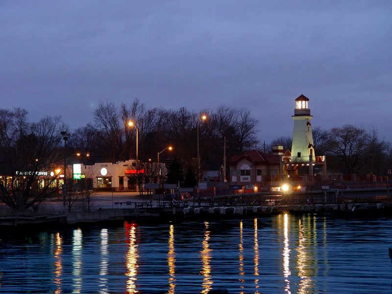
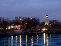 Port Credit Light house
In 2006, with the help of Project for Public Spaces,[14] the city started hosting "My Mississauga" summer festivities at its civic square.[15] Mississauga planned over 60 free events to bring more people to the city square. The square was transformed and included a movable stage, a snack bar, extra seating, and sports and gaming facilities (basketball nets, hockey arena, chess and checker boards) including a skate park. Some of the events included Senior's day on Tuesday, Family day on Wednesday, Vintage car Thursdays, with the main events being the Canada Day celebration, Rotary Ribfest, and Beachfest. The civic square is currently being reconstructed using federal stimulus money and will feature a permanent stage, a larger ice rink, media screens, and a permanent restaurant. Mississauga also boasts one of the largest shopping malls in Canada called Square One Shopping Centre, which is surrounded by many[weasel words] bars and restaurants, as well as City Hall, the Central Library, and Playdium. Mississauga also hosts a cultural festival named Carassauga each year to celebrate the diverse population. Mississauga is the home to Mosaic, the largest South Asian multi-disciplinary arts festival in North America. Now in its sixth year Mosaic is a completely free festival that attracts 50,000 people in three days.
Historical attractions
- Adamson Estate
- Benares Historic House
- Bradley Museum
- Cawthra Estate
- Old Meadowvale Village
- Leslie Log Cabin
Sports and recreation
Mississauga has been the home of the Mississauga St. Michael's Majors of the Ontario Hockey League since 2007, when the team moved from Toronto. It was previously home to the Mississauga Icedogs from 1999–2007, before they moved to St. Catharines and became the Niagara IceDogs. The Hershey Centre, the city's main sports venue, was opened in 1999 for the arrival of the Icedogs, and is where the St. Michael's Majors currently play. Other hockey teams include the Mississauga Chiefs of the Canadian Women's Hockey League (who play at Iceland Mississauga), the Mississauga Chargers of the Ontario Provincial Junior A Hockey League (who play at Port Credit Arena), and the many teams in the Greater Toronto Hockey League, Mississauga Hockey League, and Mississauga Girls Hockey League that play in the city's 13 arenas. In addition, there is a roller hockey team, the Mississauga Rattlers of the Great Lakes Inline Junior "A" Roller Hockey League.
The city also has teams for box lacrosse (Mississauga Tomahawks of the OLA Junior A Lacrosse League), cricket (Mississauga Ramblers of the Toronto and District Cricket League, Mississauga Titans of the Etobicoke District Cricket League), and Canadian football. The Mississauga Football League (MFL) is a youth football program that is for players aged 7–17, founded in 1971. The city also has other amateur football teams in Ontario leagues: the Mississauga Warriors of the Ontario Varsity Football League and the Mississauga Demons of the Ontario Australian Football League. Mississauga's rugby players are now served by the Mississauga Blues at the youth level though many still play for the more established clubs in neighbouring cities.
Recreational clubs include the Mississauga Figure Skating Club, Mississauga Synchronized Swimming Association,[16] North Mississauga Soccer Club, Mississauga Falcons Soccer Club,[17] Mississauga Canoe Club, Mississauga Scrabble Club, Don Rowing Club at Port Credit, and the Mississauga Aquatic Club. There are over 481 parks and woodlands areas in Mississauga. Mississauga is home to many of the finest indoor playgrounds in Ontario including Playdium,Kids Time Family Fun Center, KidSports indoor playground, and Laser Quest Center. There are over 26 major indoor playgrounds in the city of Mississauga.[18]
Media
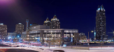
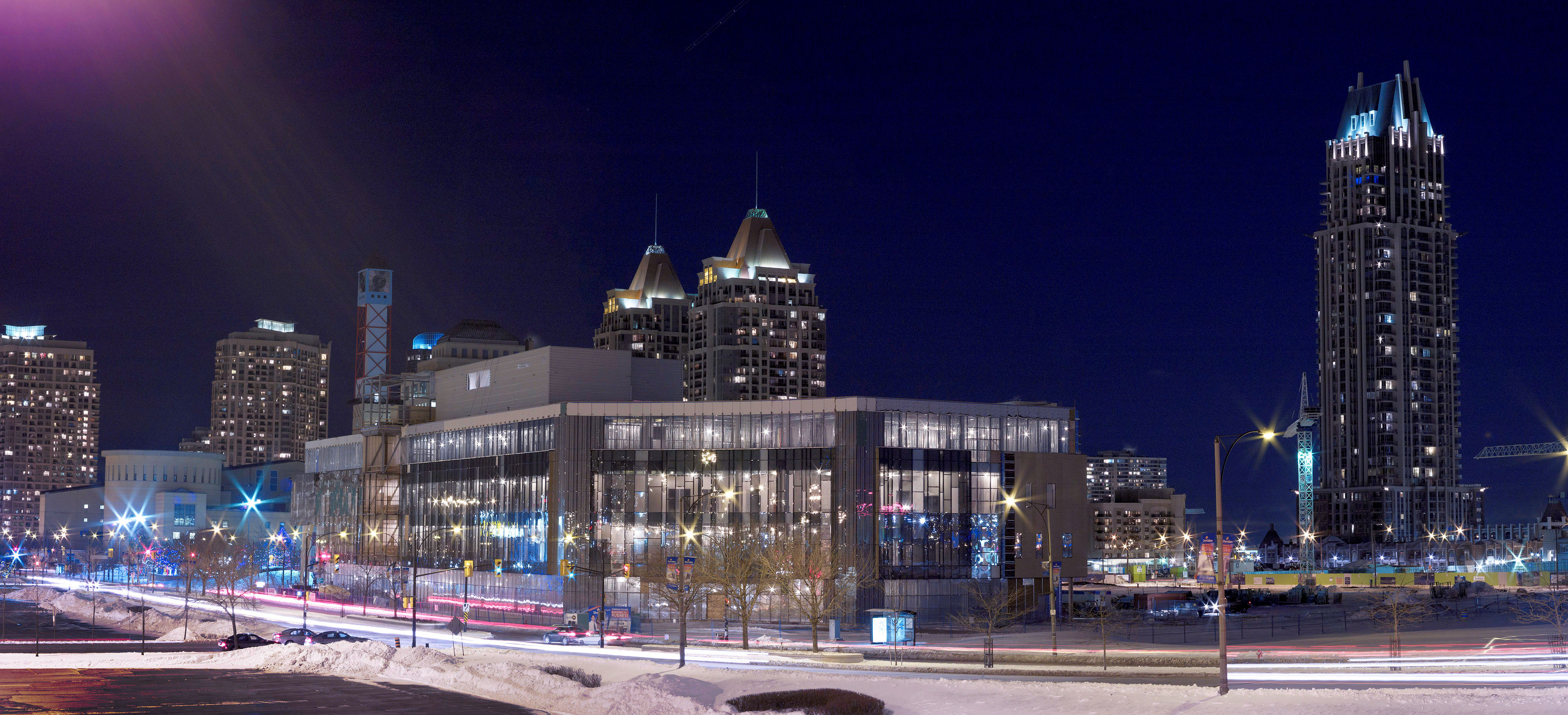
 Absolute World in Mississauga, Ontario.
Mississauga is primarily served by media based in Toronto, with markets in the Greater Toronto Area (GTA) that cover most of the news in the GTA. Examples of this being the majority of radio stations transmitting from the nearby CN Tower in Toronto. However, Mississauga also has The Mississauga News, a regional newspaper that is published three days a week in print and daily online, and the Sunday Times, a community newspaper for the South Asian community that is published weekly in print and also available online, as well as MississaugaLife Magazine, a monthly general interest magazine. The city also has one specialty radio station: FM 91.9 CFRE, the campus radio station of the University of Toronto Mississauga broadcasting at very low power.
The following national cable television stations also broadcast from Mississauga. For more area stations, see Toronto television stations.
- Rogers Television, community channel
- The Shopping Channel, broadcasts nationally from Mississauga
- The Weather Network, broadcast nationally from Mississauga 1998-2005
- Bite TV, Canada's first interactive television station.
- RawalTV, Canada's first 24/7 Canadian/South Asian television channel.
Main article: Media in PeelEconomy
Over 60 of the Fortune 500 base their Global or Canadian Head Offices in Mississauga. Some of the strongest industries are pharmaceuticals, banking and finance, electronics and computers, transportation parts and equipment industries.[citation needed]
Citibank Canada, has 2 corporate IT development centres in Mississauga. TD Bank Financial, also has 3 Corporate IT development centres in Mississauga along with Royal Bank of Canada. Microsoft Canada is also located in Mississauga, and Menu Foods, a cat and dog food manufacturer, is headquartered in the Streetsville area of Mississauga.[19] Hewlett Packard's main Canada offices are in Mississauga.[20] Air Georgian, a regional airline, is headquartered in Mississauga.[21] Air Canada Jazz operates a regional office in Mississauga.[22] Kam Air has its North American office in Mississauga.[23]
Demographics
 Ethnicities as of the 2006 Census.
Mississauga is a fast-growing and multicultural city. Statistics Canada estimates that Mississauga now has 734,000 people,[1] an increase of 150,000 from the previous decade and the population has roughly doubled in past twenty-five years. The city has one of the largest cluster of ethnic groups in Ontario and Canada. According to the 2006 census, the racial makeup of the city is as follows:[24]
Group Population Percentage White 337,230 49.8 South Asian 136,750 21.6 Chinese 46,120 6.9 Black 41,365 6.2 Filipino 30,705 4.6 Arab 16,785 2.5 Southeast Asian 14,160 2.1 Latin American 12,410 1.9 Multiple Visible Minority 9,100 1.4 Korean 6,865 1.0 West Asian 6,015 0.9 Other Visible Minority 5,715 0.9 Aboriginal 2,475 0.4 Japanese 2,425 0.4 Census Population 1971 156,070 1981 315,056 1991 463,388 2001 612,925 2006 668,549 Est. 2010 729,000 Slightly less than 45% of the population speaks a language other than English, reflecting a large immigrant population. 46.61% of the population was not born in Canada. 40.20% of the population are members of a visible minority (non-white or non-aboriginal). 21.29% of the population is under 14 years of age, compared to those of retirement age; 8.51%. The median (middle) age in Mississauga is 35.0.[citation needed]
Christianity is the majority faith of the city. The 2001 census indicated that 69.78% of the population adhere to Christianity, with Catholics constituting 42.00%, while the remaining 27.78% adhere to various Protestant, and Orthodox Christian groups. Other practiced faiths were Islam (6.83%), Hinduism (4.73%) Sikhism (3.82%), Buddhism, and Judaism.
Languages
Mississauga is one of the most linguistically diverse cities in Canada. The 2006 census found that English was spoken as mother tongue by 49.3% of the population. The next most common languages were the Chinese languages (5.5%), Urdu (4.6%), Polish (4.4%), Punjabi (3.6%), Portuguese (2.8%), Tagalog (2.7%), Arabic (2.6%), Italian (2.5%) and Spanish (2.1%).[25]
Mother tongue Population Percentage English 328,295 49.32% French 7,835 1.18% English and French 1,020 0.15% English and a non-official language 15,210 2.28% French and a non-official language 880 0.13% English, French and a non-official language 320 0.05% Chinese 36,445 5.48% Urdu 30,725 4.62% Polish 29,020 4.36% Punjabi 24,145 3.63% Portuguese 18,745 2.82% Tagalog 17,890 2.69% Arabic 17,290 2.60% Italian 16,580 2.49% Spanish 14,145 2.12% Vietnamese 10,380 1.56% Tamil 10,025 1.51% Hindi 8,425 1.27% Gujarati 7,620 1.14% Croatian 6,310 0.95% Mother tongue Population Percentage Ukrainian 5,785 0.87% Korean 5,775 0.87% Persian 4,640 0.70% German 4,485 0.67% Russian 3,540 0.53% Serbian 3,280 0.49% Bengali 3,150 0.47% Greek 2,815 0.42% Romanian 2,320 0.35% Malayalam 1,700 0.26% Hungarian 1,630 0.24% Bosnian 1,365 0.21% Slovene 1,255 0.19% Telugu 1,160 0.17% Macedonian 1,145 0.17% Japanese 1,095 0.16% Akan (Twi) 1,085 0.16% Malay 1,075 0.16% Maltese 1,070 0.16% Dutch 1,060 0.16% Law and government
Mississauga City Council consists of the mayor and eleven city councillors, each representing one of the city's eleven wards. Peel Regional Police provide policing within the city of Mississauga. In addition, the Ontario Provincial Police have a Port Credit detachment in the city. Mississauga Fire and Emergency Services provide fire fighting services and Peel Regional Paramedic Services provides emergency medical services.
The Mississauga Library System is a municipally owned network of 18 libraries.
Electoral districts
- Bramalea—Gore—Malton
- Mississauga—Erindale
- Mississauga—Brampton South
- Mississauga East—Cooksville
- Mississauga South
- Mississauga—Streetsville
Education
 Sheridan College Business education facility in downtown Mississauga
Mississauga is the home to the University of Toronto Mississauga (UTM/Erindale College), one of three intercity campuses of the University of Toronto. UTM has an enrollment of approximately 10,000 students. It is growing at a rate of about 1,000 students per year since 2002, following a major expansion.
Sheridan College has announced the construction of a new $46 million dollar facility that will open in Mississauga in 2011. The school will have two main concentrations: business education and programs to accelerate the movement of new Canadians into the workforce. The 150,000 sq ft (14,000 m2). campus will be located on an 8.5-acre (34,000 m2) parcel of land in City Centre just north of the Living Arts Centre. The campus is expected to accommodate 1,700 students upon completion of phase one of construction in Fall 2011. Phase two of construction after 2011 is expected to increase capacity by 3,740 students to a combined total of 5,000; it will also include construction of a 10-level municipal parking garage.[26][27][28][29]
Mississauga is served by the Peel District School Board and the Dufferin-Peel Catholic District School Board. Together there are more than 150 schools in this city to fulfill the needs of its large youth population.
Mississauga also has many prominent programs which push students to show their full potential including:
- French immersion schools in multiple locations across the city such as Applewood Heights Secondary School and Clarkson Secondary school.
- Extended French Program at St. Thomas More School, Green Glade Senior Public School, Philip Pocock Catholic Secondary School and St. Aloysius Gonzaga Secondary School
- Regional Arts Program at Queen Elizabeth Senior Public School and Cawthra Park Secondary School and Iona Catholic Secondary School
- International Business and Technology Program at Allan A. Martin Senior Public School and Gordon Graydon Memorial Secondary School
- International Baccalaureate Program at St. Francis Xavier Secondary School and Glenforest Secondary School.
- Sci Tech Program at Tomken Road Middle School and Port Credit Secondary School.
- Regional Enhanced Program at The Woodlands School , Glenforest Secondary School, and Lorne Park Secondary School.
Health
The city's two main hospitals are Credit Valley Hospital and Trillium Health Centre (formerly Mississauga Hospital). The health system and the administration for students in Mississauga was the property of the Peel District School Board Health Centre[citation needed] and the health support for citizens in Mississauga was the property of Peel Health Centre.[citation needed] The eastern part of Mississauga was the property of Pearson Health (Greater Toronto Area Health Department).[citation needed]
Transportation
Highways
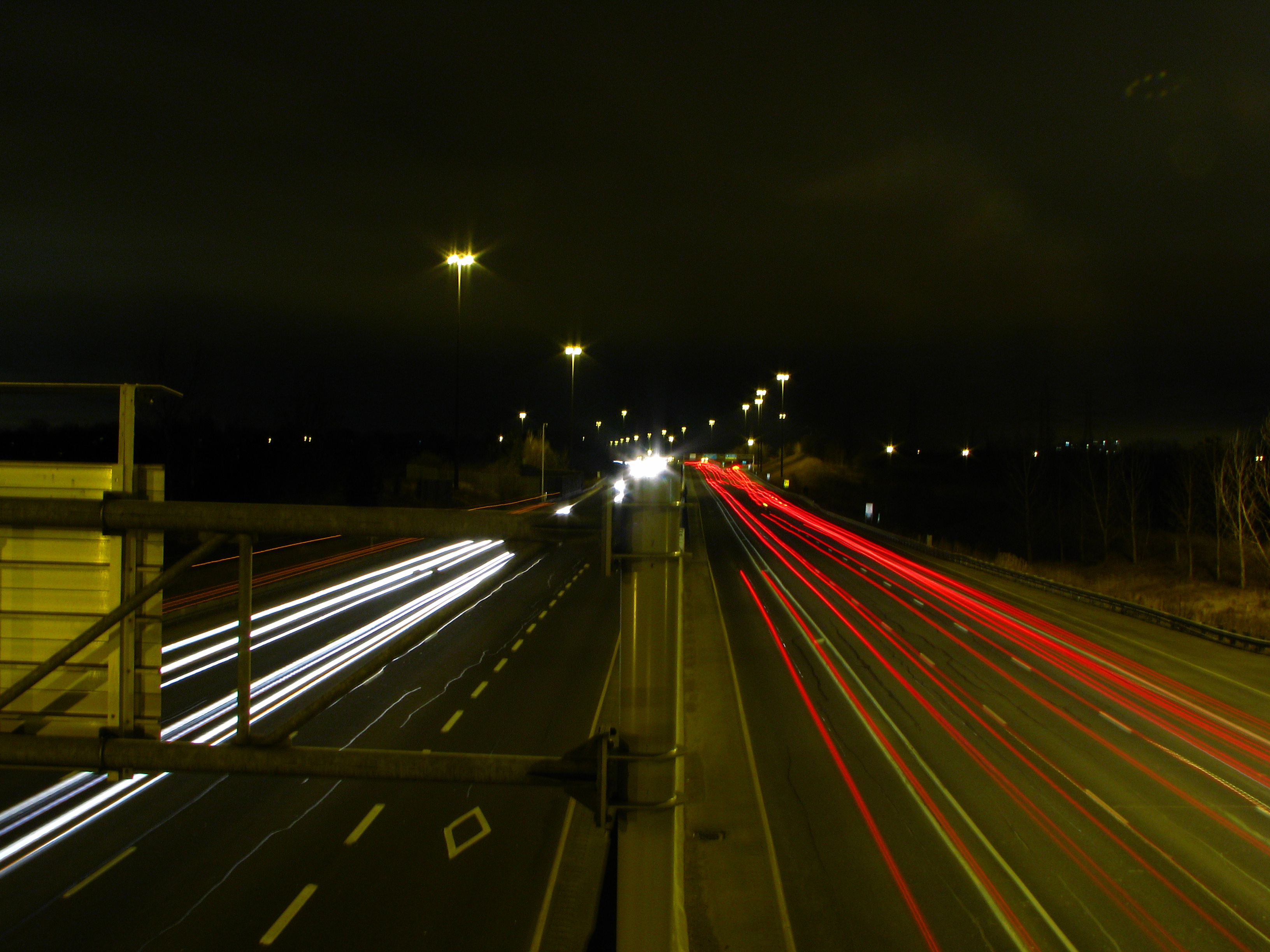
 Highway 403 in Mississauga, showing HOV lanes adjacent to the median.
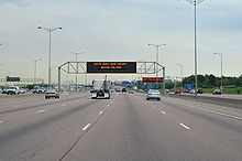 At 18 lanes wide, Highway 401 in Mississauga near Pearson International Airport is one of the widest and busiest freeways in the world.
Highway 401 (the Macdonald-Cartier Freeway, connecting Windsor to Quebec) passes through the city's north end. The eastern part uses the collector/express lane system and feeds into Highway 403, the main freeway in the city, which runs through the City Centre and Erin Mills areas. The Queen Elizabeth Way, the city's first freeway, runs through the southern half of the city. These three freeways each run east-west, with the exception of the 403 from the 401 to Cawthra Road, and from the 407 to QEW. North of the 401, the collector lanes of the 403 become Highway 410, which goes to Brampton. Part of Highway 409 is within the city of Mississauga, and it provides access to Pearson Airport. Two other freeways run along or close to Mississauga's municipal borders. Highway 407 runs metres from the northern city limits in a power transmission corridor and forms the city's boundary with Milton between highways 401 and 403. Highway 427 forms the Toronto-Mississauga boundary in the northeast, and is always within 2 kilometres of the boundary further south, with the exception of the area around Centennial Park.
Rail
See also: Hurontario-Main Street LRTMississauga is on three major railway lines (one each owned by the Canadian National Railway, the Canadian Pacific Railway, and Metrolinx). Although Via Rail trains on the Quebec City-Windsor Corridor pass through Mississauga, the city lacks a station; the nearest stations are located in the neighbouring cities of Brampton, Oakville, and Toronto. The only passenger rail service is provided by GO Transit, on the Lakeshore West, Georgetown, and Milton lines. However these lines mainly serve commuters going to and from Toronto's Union Station, and only operate during rush hours on workdays.
There are plans for the construction of an LRT line along Hurontario Street stretching from Port Credit to the south to Downtown Brampton to the north.[30] The project is currently undergoing environmental assessment and design phases. Light rail transit could possibly be built on some other main thoroughfares, namely Dundas Street and Lakeshore Road, but no definite dates have been set.
Bus
Main article: MiWaySee also: Mississauga TransitwayThe city's public transit service, MiWay (formerly Mississauga Transit), provides bus service across the city, and connects to the Toronto subway and RT, GO Transit, Oakville Transit, and Brampton Transit. MiWay offers two services: MiLocal for local travel, and MiExpress for express travel, stopping only at the terminals and the major stops.
A 12-station busway similar to Ottawa's transitway is being built along Highway 403 from Winston Churchill Boulevard to Renforth Drive via the City Centre.[31] This will provide faster service for passengers by cutting commuting times by as much as half. The first phase of the bus rapid transit project is expected to be completed by early 2013.
Air
Toronto Pearson International Airport (YYZ) in northeastern Mississauga (Malton) is a hub for Air Canada and WestJet and provides flights to regional, national, and international destinations. It is Canada's busiest airport with over 30 million passenger movements annually.
Bicycle
In 2010, the City of Mississauga approved a Cycling Master Plan outlining a strategy to develop over 900 kilometres of on and off-road cycling routes in the city over the next 20 years. Over 1,000 Mississauga citizens and stakeholders contributed their thoughts and ideas to help develop this plan. The plan focuses on fostering cycling as a way of life in the city, building an integrated network of cycling routes and aims to adopt a safety first approach to cycling.[32]
Sister cities
See also
- List of people from Mississauga
- The Mississauga Blob
- Absolute World
References
- ^ a b "Mississauga". City of Mississauga. http://www.mississauga.ca/portal/residents/mississaugadata. Retrieved 2010-11-08.
- ^ "Population and Dwelling Counts, for Canada and Census Subdivisions (Municipalities), 2006 and 2001 Censuses - 100% Data". Statistics Canada, 2006 Census of Population. 2007-03-13. http://www12.statcan.ca/english/census06/data/popdwell/Table.cfm?T=301&S=3&O=D. Retrieved 2007-03-14.
- ^ "Population and Dwelling Counts, for Canada and Census Subdivisions (Municipalities), 2001 and 1996 Censuses - 100% Data". Statistics Canada. http://www12.statcan.ca/english/census01/products/standard/popdwell/Table-CSD-N.cfm?T=1&SR=1&S=3&O=D. Retrieved 2007-03-14.
- ^ "Three large urban areas: the Montreal and Vancouver CMAs and the Greater Golden Horseshoe". Statistics Canada, 2006 Census of Population. 2007-03-13. http://www12.statcan.ca/english/census06/analysis/popdwell/Subprov4.cfm. Retrieved 2007-03-22. "Mississauga (668,549), a suburb of Toronto..."
- ^ Gombu, Phinjo (2010-01-14). "Mississauga's cash reserves set to run out within two years". Toronto Star. http://www.thestar.com/news/gta/article/750585--mississauga-s-cash-reserves-set-to-run-out-within-two-years. Retrieved 2010-02-21.
- ^ "Feds offer to settle land claims". Mississauga Article. 2010-01-27. http://www.mississauga.com/news/article/544075--feds-offer-to-settle-land-claims. Retrieved 2010-07-27.
- ^ "Mississauga Heritage". City of Mississauga. http://www.mississauga.ca/portal/discover/historyandheritage. Retrieved 2006-04-24.
- ^ "Missisauga Train Derailment". http://www.mississauga.ca/portal/residents/derailmentgallery. Retrieved 14 September 2011.
- ^ "Mississauga: Present Day". The Canadian Encyclopedia. http://www.thecanadianencyclopedia.com/index.cfm?PgNm=TCE&Params=A1SEC824482. Retrieved 2011-03-02.
- ^ "Home - Welcome to the City of Mississauga". Mississauga.ca. http://www.mississauga.ca/portal/home;jsessionid=CYUSNA2ITWIKNTRPH3XD4FWOF25W4PW0?paf_gear_id=9700020&itemId=106100975n&returnUrl=%2Fportal%2Fhome%3Bjsessionid%3DCYUSNA2ITWIKNTRPH3XD4FWOF25W4PW0. Retrieved 2010-07-27.
- ^ "World Mayor 2005 Finalists". Worldmayor.com. http://www.worldmayor.com/results05/worldmayor_finalists05.html. Retrieved 2011-03-02.
- ^ "Community Profile, City of Mississauga". Statistics Canada, 2006 Census of Population. 2007-03-13. http://www12.statcan.ca/english/census06/data/profiles/community/Details/Page.cfm?Lang=E&Geo1=CSD&Code1=3521005&Geo2=PR&Code2=35&Data=Count&SearchText=Mississauga&SearchType=Begins&SearchPR=01&B1=All&Custom=. Retrieved 2007-03-14.
- ^ http://i13.tinypic.com/71rbfbd.jpg
- ^ "PBS". Pps.org. http://www.pps.org/. Retrieved 2011-03-02.
- ^ "Discover Mississauga - My Mississauga". Mississauga.ca. http://www.mississauga.ca/portal/discover/mymississauga. Retrieved 2011-03-02.
- ^ "Welcome to the Mississauga Synchro Swim Association". Mssa.ca. http://www.mssa.ca. Retrieved 2011-03-02.
- ^ "Mississauga Falcons 1996 Home Page". Htosports.com. http://www.htosports.com/MISSISSAUGAFALCONS1996. Retrieved 2010-07-27.
- ^ "List of Indoor Playgrounds in Mississauga, Ontario". http://kidsindoorplaygrounds.com/directory/indoor-playgrounds/mississauga-ontario. Retrieved 2011-08-03.
- ^ "Contact Us." Menu Foods. Cott is headquartered in Mississauga. Retrieved on May 20, 2009.
- ^ "Office Locations." Hewlett Packard. Retrieved on July 22, 2009.
- ^ "Contact Us." Air Georgian. Retrieved on May 21, 2009.
- ^ "Contact Us." Air Canada Jazz. Retrieved on May 19, 2009.
- ^ "Our Offices." Kam Air North America. Retrieved on May 18, 2010.
- ^ "2006 Community Profiles - Census Subdivision". 2.statcan.ca. 2010-12-07. http://www12.statcan.ca/english/census06/data/profiles/community/Details/Page.cfm?Lang=E&Geo1=CSD&Code1=3521005&Geo2=PR&Code2=35&Data=Count&SearchText=Mississauga&SearchType=Begins&SearchPR=01&B1=All&GeoLevel=&GeoCode=3521005. Retrieved 2011-03-02.
- ^ "Mississauga, CY". Detailed Mother Tongue (103), Knowledge of Official Languages (5), Age Groups (17A) and Sex (3) for the Population of Canada, Provinces, Territories, Census Divisions and Census Subdivisions, 2006 Census - 20% Sample Data. Statistics Canada. 2007-11-20. http://www12.statcan.ca/english/census06/data/topics/RetrieveProductTable.cfm?ALEVEL=3&APATH=3&CATNO=&DETAIL=0&DIM=&DS=99&FL=0&FREE=0&GAL=0&GC=99&GK=NA&GRP=1&IPS=&METH=0&ORDER=1&PID=89202&PTYPE=88971&RL=0&S=1&ShowAll=No&StartRow=1&SUB=701&Temporal=2006&Theme=70&VID=0&VNAMEE=&VNAMEF=&GID=773674. Retrieved 2008-02-06.
- ^ "College contract awarded". Mississauga Article. 2009-12-24. http://www.mississauga.com/news/local/article/247251--college-contract-awarded. Retrieved 2010-07-27.
- ^ "Ground broken for college campus". Mississauga Article. 2009-12-15. http://www.mississauga.com/news/local/article/244665--ground-broken-for-college-campus. Retrieved 2010-07-27.
- ^ "City approves Sheridan lease". Mississauga Article. 2009-10-29. http://www.mississauga.com/news/article/159280--city-approves-sheridan-lease. Retrieved 2010-07-27.
- ^ "City to get Sheridan College campus". Mississauga Article. 2009-05-25. http://www.mississauga.com/news/article/28496--city-to-get-sheridan-college-campus. Retrieved 2010-07-27.
- ^ "Hurontario Main Street". Hurontario-main.ca. http://www.hurontario-main.ca/. Retrieved 2010-07-27.
- ^ "Residents - Bus Rapid Transit (BRT) Project". Mississauga.ca. http://www.mississauga.ca/portal/residents/brt. Retrieved 2010-07-27.
- ^ "Mississauga Cycling Master Plan". mississaugacycling.ca. http://www.mississaugacycling.ca/tag/cycling-master-plan. Retrieved 2010-01-23.
External links

Halton Hills Brampton Vaughan Milton 
Toronto  Mississauga

Oakville Lake Ontario Lake Ontario Mississauga Geography Clarkson · Cooksville · Dixie · Erin Mills · Erindale · Lakeview · Lorne Park · Malton · Meadowvale · Port Credit · StreestvilleBuildings and structures Health Events Sports Media Education Transportation City Centre Transit Terminal · Hurontario-Main Street LRT · MiWay · Mississauga Transitway · Square One Bus Terminal · Toronto Pearson International AirportMunicipalities of Peel Region, Ontario City of Brampton • Town of Caledon • City of MississaugaGreater Toronto Area Largest city: Toronto Regions 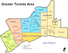
Cities Towns Ajax • Aurora • Caledon • East Gwillimbury • Georgina • Halton Hills • Markham • Milton • Newmarket • Oakville • Richmond Hill • WhitbyTownships and municipalities  The Toronto portalCategories:
- Mississauga
- Populated places established in 1805


Wikimedia Foundation. 2010.