- Niumi National Park
-
Niumi National Park IUCN Category II (National Park)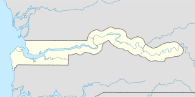

Location  Gambia
Coordinates 13°34′N 16°30′W / 13.567°N 16.5°WCoordinates: 13°34′N 16°30′W / 13.567°N 16.5°W Area 4940 hectares Established 1987 Niumi National Park is a national park in The Gambia.
Contents
General information
The Niumi National Park occupies the coastal strip of The Gambia north of the river. The park is approximately 4,940 ha (49.4 square km) in extent. Apart from being an important fish breeding ground, it constitutes one of the last untouched mangrove stands on the West African Coast north of the equator. The more terrestrial parts of the park contain an interesting cross section of threatened regional fauna and a wide diversity of habitat types. The international character of the Delta complex as one ecological entity with vital and incalculable environmental value to the region and its people, prompted The Gambia and Senegal to recognise the need to protect this area. The Gambia declared its portion of the Delta as a national park in 1986, comprising the southern part of the coastal wetlands and mangroves of the Saloum Delta. The park is contiguous with Senegal’s Delta du Saloum National Park and Biosphere Reserve.
Areas of Interest
Niumi National Park encompasses the island of Jinack which is separated from the mainland by the narrow Niji Bolon. The island is mainly low-lying with extensive areas of coastal dune woodlands, salt water marsh dominated by Tamarisk and mangrove fringing the bolon. The mainland section of the park incorporates dry woodland and grassland savannah which is on a raised laterite plateau. This plateau is dissected by the Masarinko Bolon which is mangrove lined and backed by salt-pan to the escarpment edge. West African Manatee’s occur within the bolon and were previously hunted for meat. The African Clawless Otter (Aonyx Capensis) is also found in the Masarinko Bolon but as with the manatee it is shy and difficult to observe.
Habitat Type - Mangroves
Mangroves can be defined as a tropical swamp forest growing in salt or brackish water. Mangroves are usually found in the tidal zone in sheltered places such as estuaries and coastal lagoons. In the Gambia mangroves border the river all the way up to Kaur - 150 km up river - which is about as far as the river is influenced by salt sea water. In the coastal area the mangroves are comparatively low, but upriver they usually consist of trees 15–20 km high.
Those species that make up the mangrove forests need special adaptations to be able to grown on an unstable soil that the tide threatens to wash away and to be able to survive the constant changes in water level and salinity. Common adaptations are seeds that germinate while the fruit is still attached to the mother plant (vivipary), leathery leaves to minimise evaporation, stilt or prop roots to give a better foothold and breathing roots and air channels to provide the underground parts with oxygen. Mangroves are extremely important in preventing erosion. They also have been utilised by certain nationally rare eg. sitatunga, African Clawless Otter and West African Manatee.
Avi-Fauna
Niumi National Park is home to a large diversity of resident bird species and also is an important site for European Migrants. A bird ringing programme has been in operation on Jinack Island since 1994 and has added numerous new species to the parks bird list. A large variety of warblers (17 species) have been found to use the island as a stop-over and feeding site both on the journey south and on their return north. The warblers are difficult to distinguish in the field due to their subtle plumage characteristics and generally skulking behaviour. The shallow offshore waters provide excellent feeding conditions for terns, gulls and other piscivorous species. which roost in large numbers off Buniadu Point. The mangrove and tidal flats are rich in waders, many of which are seasonal migrants but some, such as the white-fronted plover, nest on the dune fringe. Harriers are frequently encountered quartering the area during the European winter months.
Fauna
Leopard, Spotted Hyena and a variety of smaller carnivores are found on the island which feed on oribi, bohor, reedbuck, primates and carrion. Hyenas often forage the shoreline looking for dead fish. Crocodiles occur in the seasonally flooded lagoons and swamps, retreating to semi-permanent waterholes as the dry season progresses and excavating burrows several metres long when these are also dry. Green turtles nest along the coastal strip, coming ashore on moonless nights to lay their eggs. In addition to supporting a complex of fauna and avifauna of great scientific interest, the area possesses one of the world’s rarer mammalian species - the West African Manatee and also an endangered member of the otter family - the African Clawless Otter. Humpbacked Dolphin, Nile Crocodile, Bush Duiker and Kob also occur in the area.
National parks and forest parks in The Gambia National Parks Nature reserves Forest Parks Bamakuno · Bankuba · Belel · Beri Kolon · Bijilo · Brikama · Dobo · Faba · Finto Manereg · Furnya · Gambissara · Gassang · Hamdulai · Hela Kunda · Jabisa · Jalabiro · Jamara · Jambangkunda · Jeloki · Jollifin · Jumba Yaka · Jundala · Kabafita · Kahi Badi · Kaiaf · Kaolang · Kasaywa · Katilenge · Kenowore · Kiberi · Kumadi · Kunkilling · Kusum · Lohen · Madina Demba · Mamato Konko · Marike · Mutaro Kunda · Ngeyen · Ngongonding · Nianimaru · Njama · Nyassang · Njau · Nymbai · Nyanaberi · Pakala · Pilabi · Sabi · Sakaru Dalla · Salagi · Sambo Tumang · Sao Frest · Se-Ulumbang · Sibi Kuroto · Si-Kunda · Sutukung Bani · Tabaning Sita · Tambajang · TanuCategories:- IUCN Category II
- National parks of the Gambia
- Protected areas established in 1987

Wikimedia Foundation. 2010.