- Hadrian's Wall
-
This article is about the fortification in Northern England. For the Broad Wall of Jerusalem, see Broad Wall (Jerusalem).
Coordinates: 55°01′27″N 2°17′33″W / 55.02417°N 2.2925°W

This article is part of the series on:
Military of ancient Rome (portal)
753 BC – AD 476Structural history Roman army (unit types and ranks, legions, auxiliaries, generals) Roman navy (fleets, admirals) Campaign history Lists of wars and battles Decorations and punishments Technological history Military engineering (castra, siege engines, arches, roads) Political history Strategy and tactics Infantry tactics Frontiers and fortifications (limes, Hadrian's Wall)  Location of Hadrian's Wall
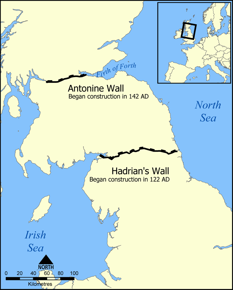
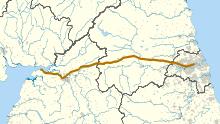 Route of Hadrian's Wall
 Sections of Hadrian's Wall remain along the route, though much has been dismantled over the years to use the stones for various nearby construction projects.
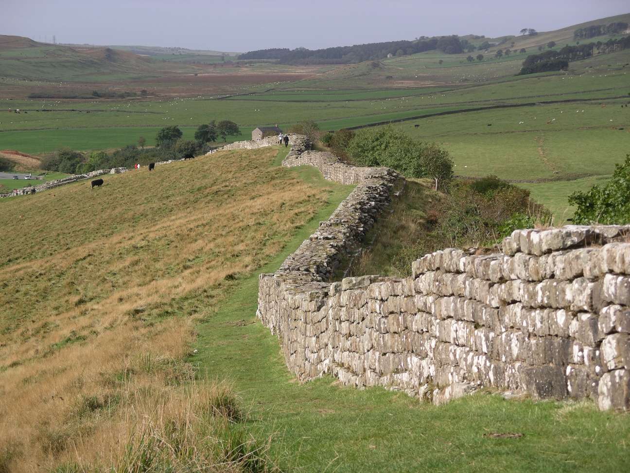
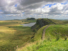 Hadrian's Wall facing East towards Crag Lough
Hadrian's Wall (Latin: Vallum Aelium, "Aelian Wall" – the Latin name is inferred from text on the Staffordshire Moorlands Patera) was a defensive fortification in Roman Britain. Begun in AD 122, during the rule of emperor Hadrian, it was the first of two fortifications built across Great Britain, the second being the Antonine Wall, lesser known of the two because its physical remains are less evident today.
The wall was the most heavily fortified border in the Empire. In addition to its role as a military fortification, it is thought that many of the gates through the wall would have served as customs posts to allow trade and levy taxation.
A significant portion of the wall still exists, particularly the mid-section, and for much of its length the wall can be followed on foot by Hadrian's Wall Path or by cycle on National Cycle Route 72. It is the most popular tourist attraction in Northern England. It was made a UNESCO World Heritage Site in 1987. English Heritage, a government organisation in charge of managing the historic environment of England, describes it as "the most important monument built by the Romans in Britain".[1]
Contents
Dimensions
Hadrian's Wall was 80 Roman miles (73 statute miles or 120 km) long,[2] its width and height dependent on the construction materials which were available nearby. East of River Irthing the wall was made from squared stone and measured 3 metres (9.7 ft) wide and five to six metres (16–20 ft) high, while west of the river the wall was made from turf and measured 6 metres (20 ft) wide and 3.5 metres (11.5 ft) high. This does not include the wall's ditches, berms and forts. The central section measured eight Roman feet wide (7.8 ft or 2.4 m) on a 10-foot (3.0 m) base. Some parts of this section of the wall survive to a height of 10 feet (3.0 m).
Route
Hadrian's Wall extended west from Segedunum at Wallsend on the River Tyne to the shore of the Solway Firth, ending a short but unknown distance west of the village of Bowness-on-Solway.[3]
Although the curtain wall ends near Bowness-on-Solway, this does not mark the end of the line of defensive structures. The system of Milecastles and Turrets is known to have continued along the Cumbria coast as far as Maryport. For classification purposes, the Milecastles west of Bowness-on-Solway are referred to as Milefortlets.
The A69 and B6318 roads follow the course of the wall as it starts in Newcastle upon Tyne to Carlisle, then along the northern coast of Cumbria (south shore of the Solway Firth). It is a common misconception that Hadrian's wall marks the boundary between England and Scotland. This is not the case; Hadrian's wall lies entirely within England, and south of the border with Scotland by less than one kilometre in the west at Bowness-on-Solway, and 110 kilometres (68 mi) in the east.[4]
Purpose of construction
Hadrian's Wall was likely planned before Roman Emperor Hadrian's visit to Britain in AD 122. According to restored sandstone fragments found in Jarrow that date from 118 or 119, it was Hadrian's wish to keep "intact the empire," which had been imposed upon him by "divine instruction."[5] The fragments then announce the building of the wall. It is entirely possible that, on his arrival in Britain in 122, one of the stops on his itinerary was the northern frontier and an inspection of the progress of the wall as it was being built.
Reasons for the construction of the wall vary, and the exact explanation has never been recorded. However, a number of theories have been presented by historians, primarily centering around an expression of Roman power and Hadrian's policy of defense before expansion. For example, on his accession to the throne in 117, Hadrian had been experiencing rebellion in Roman Britain and from the peoples of various conquered lands across the Empire, including Egypt, Judea, Libya, Mauretania.[5] These troubles may have had a hand in Hadrian's plan to construct the wall, and his construction of limes in other areas of the Empire, but to what extent is unknown.
Scholars also disagree over how much of an actual threat the sparsely populated land of northern Britannia (Scotland) actually presented, and whether there was any more economic advantage in defending and garrisoning a fixed line of defenses like the Wall over simply conquering and annexing the Scottish Lowlands and manning the territory with a loose arrangement of forts.[5] The limes of Rome were never expected to stop whole tribes from migrating or entire armies from invading, and while a frontier protected by a palisade or stone wall would surely help curb cattle-raiders and the incursions of other small groups,[6] the economic viability of constructing and constantly manning a 72-mile (116 km) long boundary along a sparsely populated border to stop small-scale raiding is dubious.[5]
Another possible explanation for the erection of the great wall is the degree of control it would have provided over immigration, smuggling, and customs.[5] Limes did not strictly mark the boundaries of Rome, with Roman power and influence often extending beyond its walls.[5] People inside and beyond the limes traveled through it each day when conducting business, and organized check-points like those offered by Hadrian's Wall provided good opportunities for taxation. With watch towers only a short distance from gateways in the limes, patrolling legionaries would have been able to keep track of entering and exiting natives and Roman citizens alike, charging customs dues, and checking for smuggling activity.
Another theory is of the simpler variety—Hadrian's Wall was, if not wholly, at least partially, constructed to reflect the power of Rome, and was used as a political point by Hadrian. Once its construction was finished, it is thought to have been covered in plaster and then white-washed, its shining surface able to reflect the sunlight and be visible for miles around.[5]
Construction
Construction probably started sometime in AD 122[7] and was largely completed within six years.[8] Construction started in the east, between milecastles four and seven, and proceeded westwards, with soldiers from all three of the occupying Roman legions participating in the work. The route chosen largely paralleled the nearby Stanegate road from Luguvalium (Carlisle) to Coria (Corbridge), upon which were situated a series of forts, including Vindolanda. The wall in the east follows a hard, resistant igneous diabase rock escarpment, known as the Whin Sill.

The initial plan called for a ditch and wall with 80 small gated milecastle fortlets, one placed every Roman mile, holding a few dozen troops each, and pairs of evenly spaced intermediate turrets used for observation and signalling. However, very few milecastles are actually situated at exact Roman mile divisions; they can be up to 200 yards east or west because of landscape features or to improve signalling to the Stanegate forts to the south.[9] Local limestone was used in the construction, except for the section to the west of Irthing where turf was used instead, since there were no useful outcrops nearby. Milecastles in this area were also built from timber and earth rather than stone, but turrets were always made from stone. The Broad Wall was initially built with a clay-bonded rubble core and mortared dressed rubble facing stones, but this seems to have made it vulnerable to collapse, and repair with a mortared core was sometimes necessary.
The milecastles and turrets were of three different designs, depending on which Roman legion built them — inscriptions of the Second, Sixth, and Twentieth Legions, show that all were involved in the construction. All were about 493 metres (539 yards) apart and measured 4.27 square metres (46.0 square feet) internally.
Construction was divided into lengths of about 5 miles (8.0 km). One group of each legion would excavate the foundations and build the milecastles and turrets and then other cohorts would follow with the wall construction. It was finished in 128 AD.
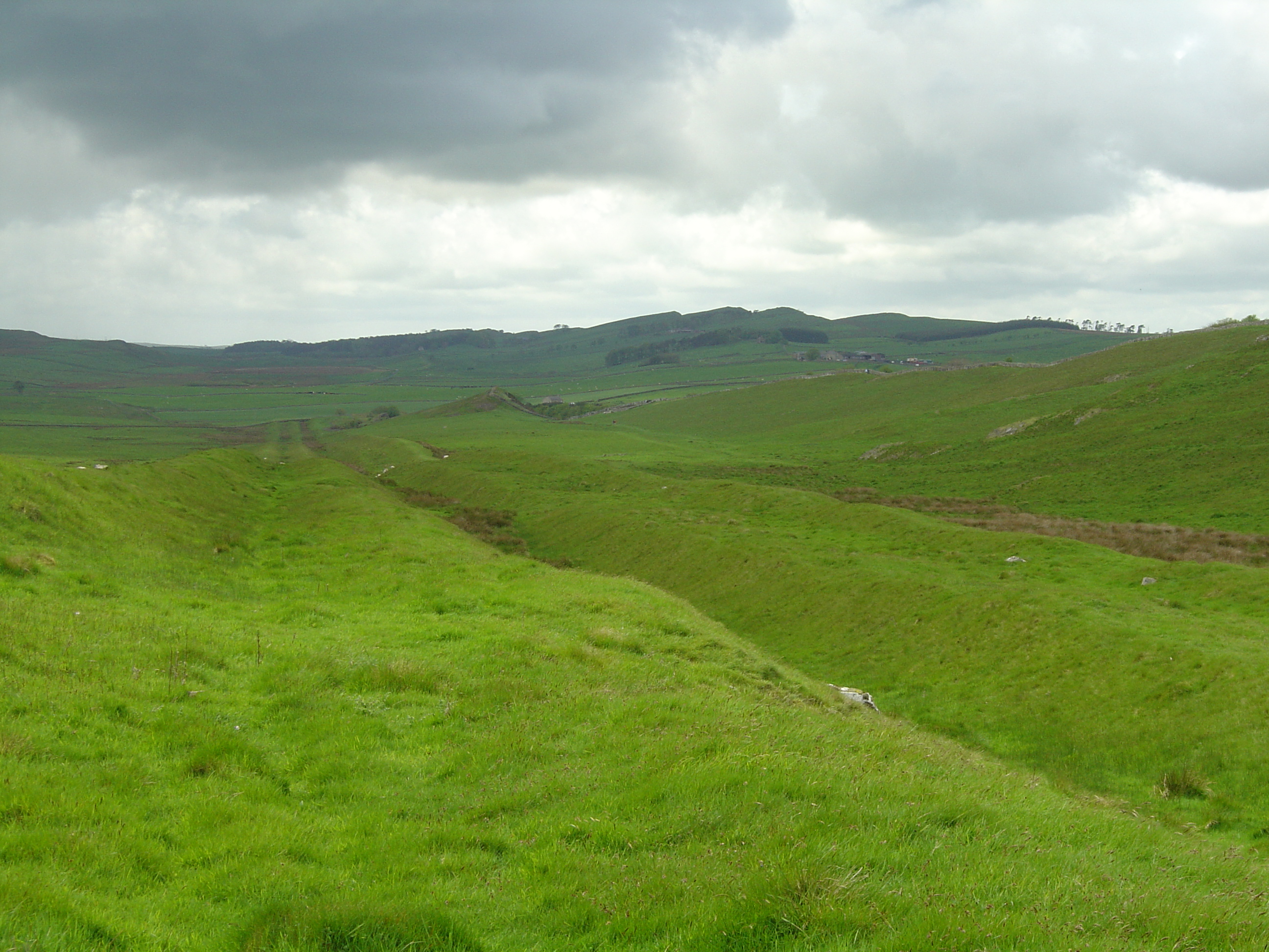
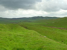 Vallum at Hadrian's Wall near Milecastle 42 (Cawfields)
Early in its construction, just after reaching the North Tyne, the width of the wall was narrowed to 2.5 metres (8.2 ft) or even less (sometimes 1.8 metres) (the "Narrow Wall"). However, Broad Wall foundations had already been laid as far as the River Irthing, where the Turf Wall began, demonstrating that construction worked from east to west. Many turrets and milecastles were optimistically provided with stub 'wing walls' in preparation for joining to the Broad Wall, offering a handy reference for archaeologists trying to piece together the construction chronology.
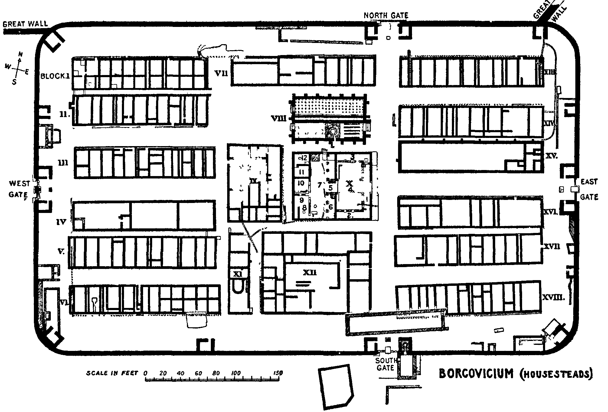
Within a few years it was decided to add a total of 14 to 17 (sources disagree) full-sized forts along the length of the wall, including Vercovicium (Housesteads) and Banna (Birdoswald), each holding between 500 and 1,000 auxiliary troops (no legions were posted to the wall). The eastern end of the wall was extended further east from Pons Aelius (Newcastle) to Segedunum (Wallsend) on the Tyne estuary. Some of the larger forts along the wall, such as Cilurnum (Chesters) and Vercovicium (Housesteads), were built on top of the footings of milecastles or turrets, showing the change of plan. An inscription mentioning early governor Aulus Platorius Nepos indicates that the change of plans took place early on. Also some time still during Hadrian's reign (before AD 138) the wall west of the Irthing was rebuilt in sandstone to basically the same dimensions as the limestone section to the east.
After most of the forts had been added, the Vallum was built on the southern side. The wall was thus part of a defensive system which, from north to south included:
- A row of forts built 5 to 10 miles (16 km) north of the wall, used for scouting and intelligence (e.g. Bewcastle Roman Fort)
- a glacis and a deep ditch
- a berm with rows of pits holding entanglements
- the curtain wall
- a later military road (the Military Way)
- The Vallum.
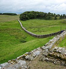 Part of Hadrian's Wall from Housesteads showing the Knag Burn Gateway in the valley
Standards
Above the curtain wall's foundations, one or more footing courses were laid. Offsets were introduced above these footing courses (on both the north and south faces), which reduced the wall's width. Where the width of the curtain wall is stated, it is in reference to the width above the offset. Two standards of offset have been identified. Standard A, where the offset occurs above the first footing course, and Standard B where the offset occurs after the third (or sometimes fourth) footing course.[10]
Garrison
The wall was garrisoned by auxiliary (non-legionary) units of the army (non-citizens). Their numbers fluctuated throughout the occupation but may have been around 9,000 strong in general, including infantry and cavalry. The new forts could hold garrisons of 500 men, while cavalry units of 1,000 troops were stationed at either end. The total number of soldiers manning the early wall was probably greater than 10,000.
They suffered serious attacks in 180, and especially between 190 and 197 when the garrison had been seriously weakened, following which major reconstruction had to be carried out under Septimius Severus. The region near the wall remained peaceful for most of the rest of the 3rd century. It is thought that some in the garrison may have married and integrated into the local community throughout the years.
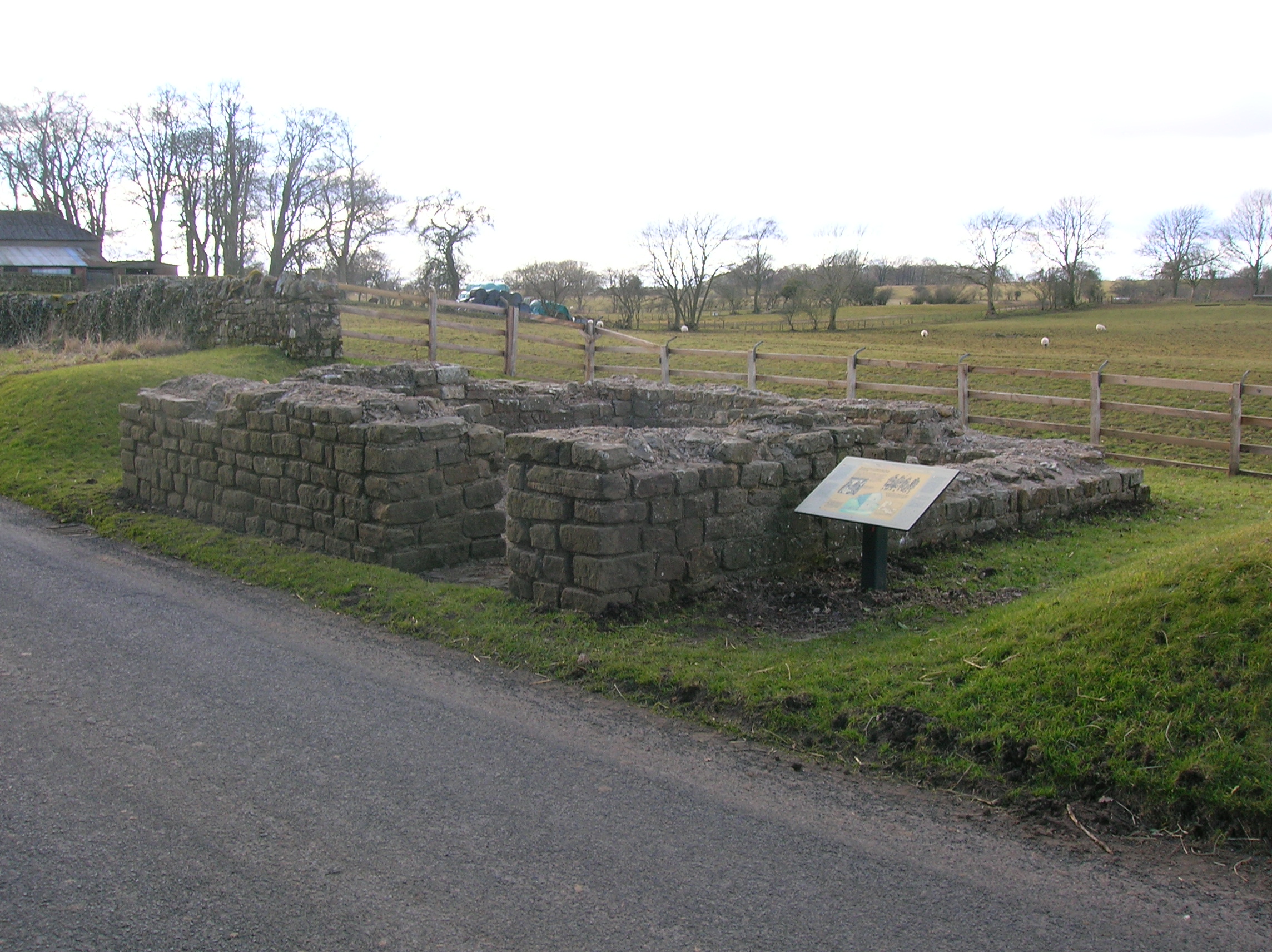
 Leahill 51B is a typical example of the many turrets built into the wall between the mile castles.
After Hadrian
In the years after Hadrian's death in AD 138, the new emperor, Antoninus Pius essentially abandoned the wall, leaving it occupied in a support role, and began building a new wall called the Antonine Wall, about 160 kilometres (99 mi) north, in what later became known as the Scottish Lowlands through the short strip running West South West to East North East from coast to coast sometimes referred to as the Central Belt or Central Lowlands. This turf wall ran 40 Roman miles (about 37.8 mi (60.8 km)) and had significantly more forts than Hadrian's Wall. Antoninus was unable to conquer the northern tribes, so when Marcus Aurelius became emperor he abandoned the Antonine Wall and reoccupied Hadrian's Wall as the main defensive barrier in AD 164. The wall remained occupied by Roman troops until their withdrawal from Britain.
In the late 4th century, barbarian invasions, economic decline, and military coups loosened the Empire's hold on Britain. By 410, the Roman administration and its legions were gone, and Britain was left to look to its own defences and government. The garrisons, by now probably made up mostly of local Britons who had nowhere else to go,[citation needed] probably lingered on in some form for generations.[citation needed] Archaeology is beginning to reveal that some parts of the wall remained occupied well into the 5th century. Enough also survived in the 8th century for spolia from it to find its way into the construction of Jarrow Priory, and for Bede to see and describe the wall thus in Historia Ecclesiastica 1.5, although he misidentified it as being built by Septimius Severus:
After many great and dangerous battles, he thought fit to divide that part of the island, which he had recovered from the other unconquered nations, not with a wall, as some imagine, but with a rampart. For a wall is made of stones, but a rampart, with which camps are fortified to repel the assaults of enemies, is made of sods, cut out of the earth, and raised above the ground all round like a wall, having in front of it the ditch whence the sods were taken, and strong stakes of wood fixed upon its top.
But in time the wall was abandoned and fell into ruin. Over the centuries the stone was reused in other local buildings.
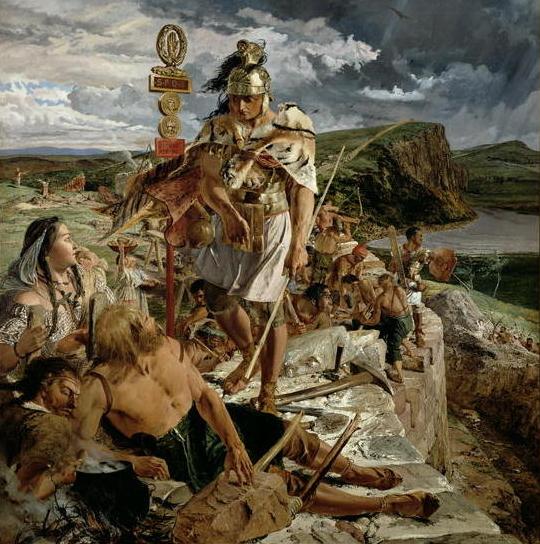
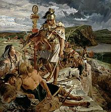 Painting by William Bell Scott
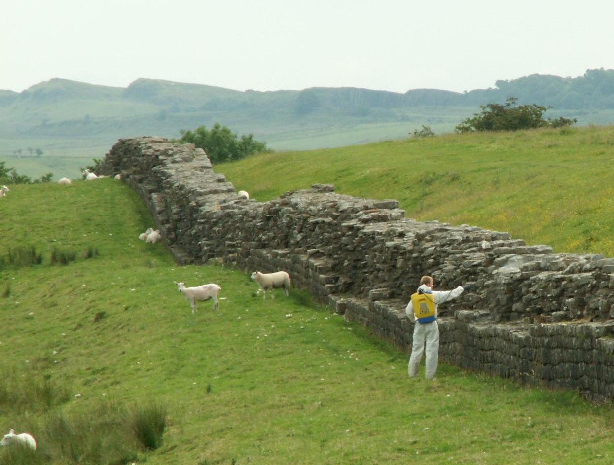
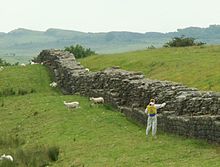 Hadrian's Wall near Birdoswald Fort, with a man spraying weed-killer to reduce biological weathering to the stones
The wall fascinated John Speed, who published a set of maps of England and Wales by county at the turn of the 17th century. He described it as 'the Picts Wall' (or 'Pictes'; he uses both spellings). A map of Newecastle (sic), drawn in 1610 by William Matthew, described it as 'Severus' Wall', thus giving it the name ascribed by Bede. The maps for Cumberland and Northumberland not only show the wall as a major feature, but are ornamented with drawings of Roman finds, together with, in the case of the Cumberland map, a cartouche in which he sets out a description of the wall itself.
Preservation by John Clayton
Much of the wall has disappeared. Long sections of it were used for roadbuilding in the 18th century,[11] especially by General Wade in construction of a military road (most of which lies beneath the present day B6318 "Military Road") for the purpose of moving troops to crush the Jacobite insurrection.[12] The preservation of much of what remains can be credited to John Clayton. He trained as a lawyer and became town clerk of Newcastle in the 1830s. He became enthusiastic about preserving the wall after a visit to Chesters. To prevent farmers taking stones from the wall, he began buying some of the land on which the wall stood. In 1834 he started purchasing property around Steel Rigg. Eventually he had control of land from Brunton to Cawfields. This stretch included the sites of Chesters, Carrawburgh, Housesteads and Vindolanda. Clayton carried out excavation work at the fort at Cilurnum and at Housesteads, and he excavated some milecastles.
Clayton managed the farms he had acquired and succeeded in improving both the land and the livestock. His successful management produced a cash flow which could be invested in future restoration work.
Workmen were employed to restore sections of the wall, generally up to a height of seven courses. The best example of the Clayton Wall is at Housesteads. After Clayton’s death, the estate passed to relatives and was soon lost at gambling. Eventually the National Trust began the process of acquiring the land on which the wall stands.
At Wallington Hall, near Morpeth, there is a painting by William Bell Scott, which shows a centurion supervising the building of the wall. The centurion has been given the face of John Clayton.
World Heritage Site
Hadrian's Wall was declared a World Heritage Site in 1987, and in 2005 it became part of the transnational "Frontiers of the Roman Empire" World Heritage Site which also includes sites in Germany.[13]
Tourism to the Wall
Although Hadrian's Wall was declared a World Heritage Site in 1987, it remains unguarded, allowing those interested in the site full advantage of going up to, and standing upon, the wall (although this is not encouraged, as it could damage the historic structure).
On 13 March 2010 a public event Illuminating Hadrian's Wall took place, which saw the route of the wall lit with 500 beacons.
Hadrian's Wall Path
Main article: Hadrian's Wall PathIn 2003, a National Trail footpath was opened which follows the line of the wall from Wallsend to Bowness-on-Solway.[14] Because of the fragile landscape, walkers are asked to follow the path only in summer months.[15]
In popular culture
English Nobel Prize-winning author Rudyard Kipling contributed to popular image of the "Great Pict Wall" in his short stories about Parnesius, a Roman legionary who defended the Wall against the Picts and Vikings. These stories are part of the Puck of Pook's Hill cycle.
Hal Foster (1892-1982), a Canadian-American illustrator, used the wall in his comic strip Prince Valiant and so did Hans G. Kresse (1921-1992), a Dutch illustrator, in Eric de Noorman.
American author George R. R. Martin has acknowledged that Hadrian's Wall was the inspiration for the wall in his A Song of Ice and Fire series. [16]
Australian poet Peter Skrzynecki refers to Hadrian's Wall in his poem "Feliks Skrzynecki" in his book Immigrants Chronicle.
The wall has also been featured in recent films such as King Arthur and The Eagle. In the former, the wall was a central plot device as the film occurs during the fifth century when Rome was beginning to recall it's forces from the northern territories, including the British Isles while the Saxons invaded in the north. Arthur and his knights are stationed at a fort near the wall, initially they exit Roman territory through the wall to rescue a Roman family, and later in the film a large battle takes place just inside the wall between Arthur's forces (including British natives) and the Saxons. In the latter film, the main characters discuss the wall briefly and are subsequently seen passing through it to the ungoverned territory on the other side on their quest to recover a precious Roman artifact and the truth of the fabled Ninth Legion.
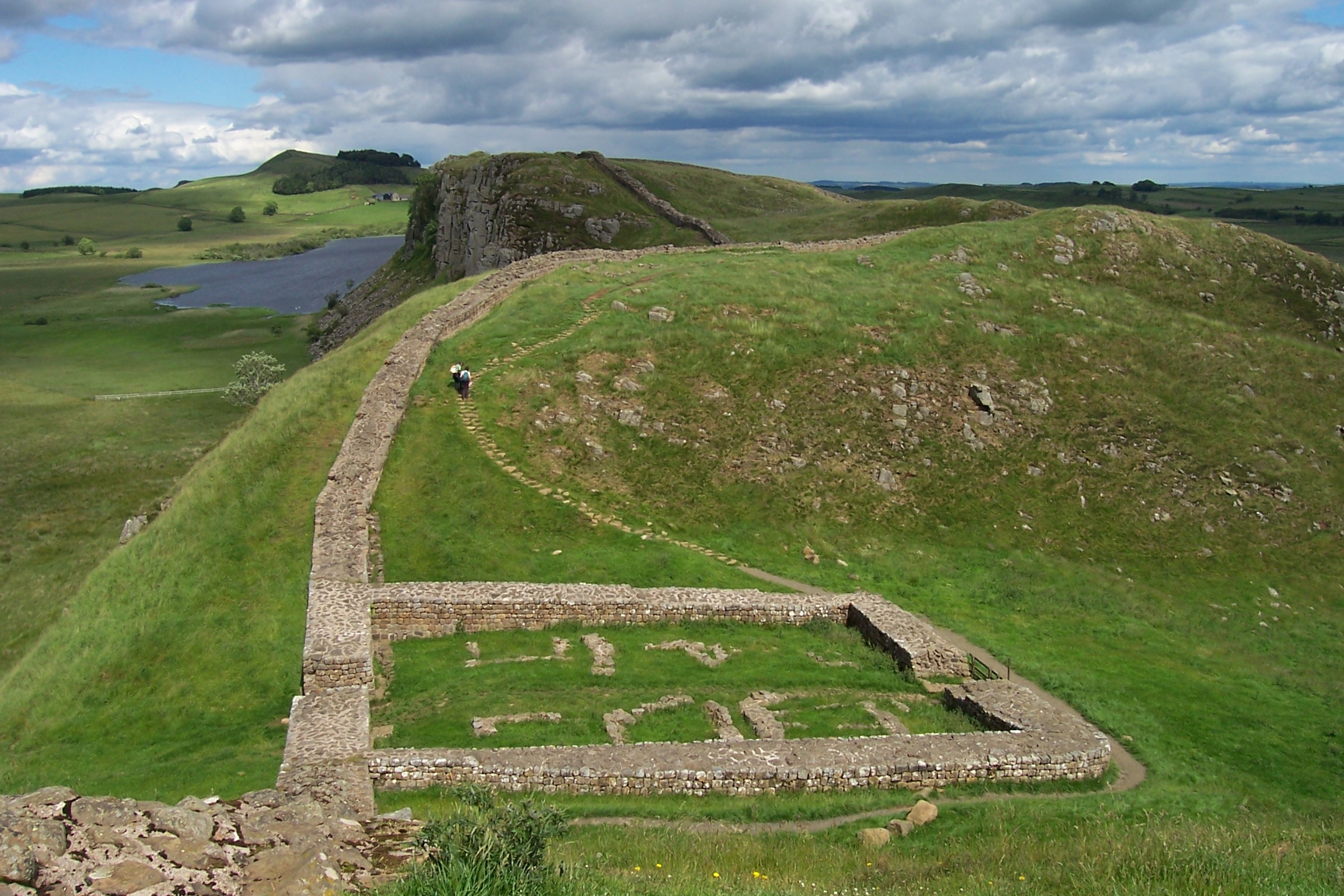
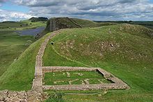 The remains of Castle Nick, Milecastle 39, near Steel Rigg, between Housesteads and the Once Brewed Visitor Centre for the Northumberland National Park
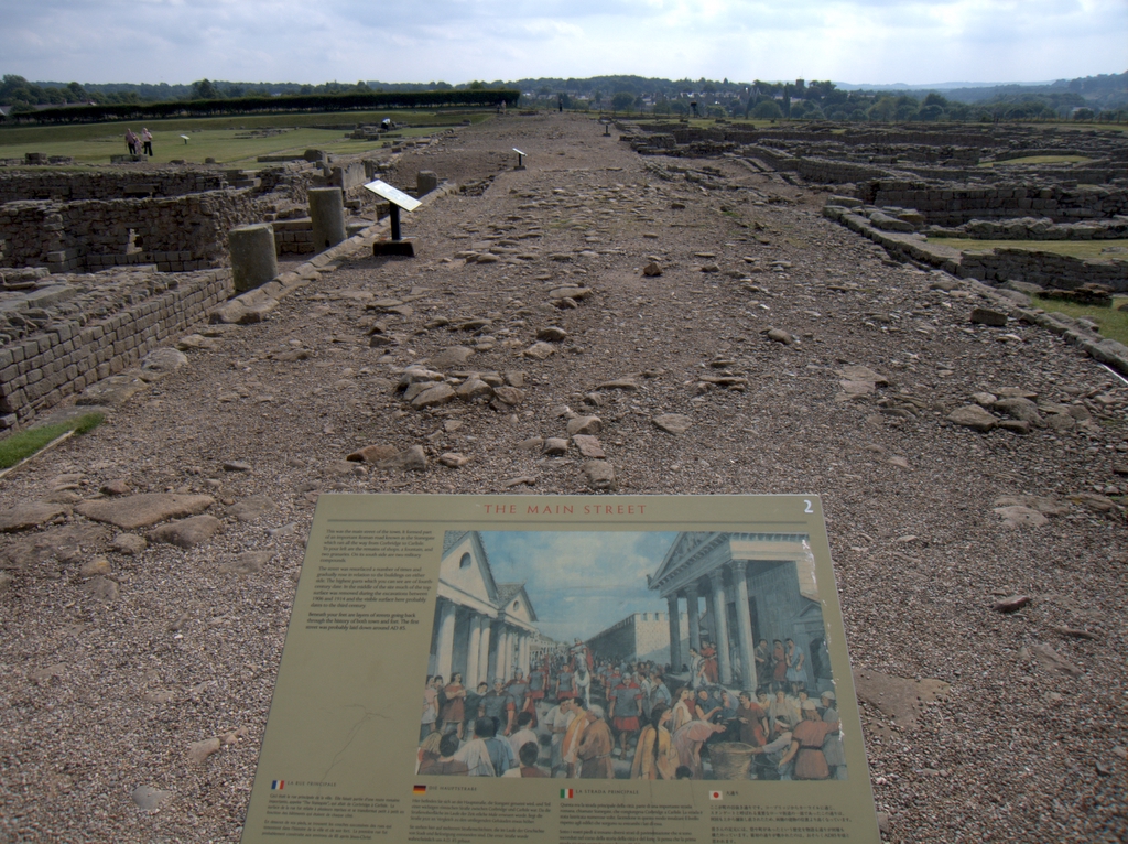
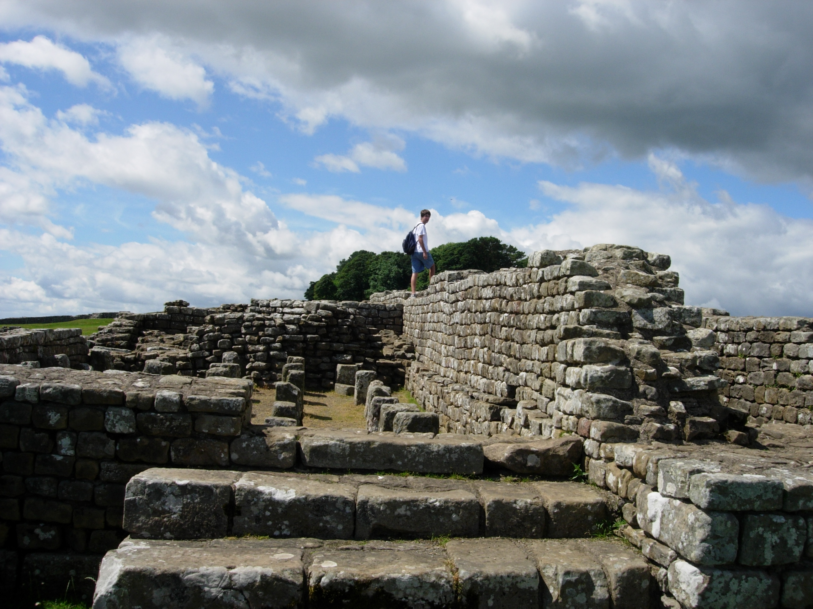
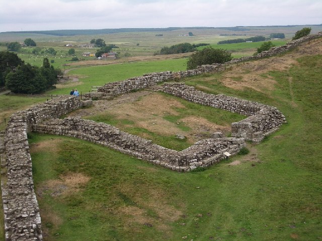
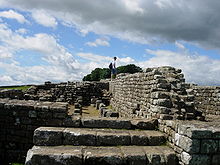 The remains of the fort at Housesteads
 The Staffordshire Moorlands cup, which may provide the ancient name of Hadrian's Wall
 Poltross Burn, Milecastle 48
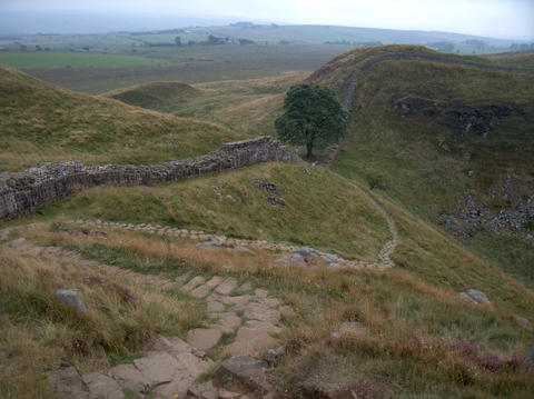
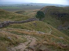 Sycamore Gap (the "Robin Hood Tree")[17]
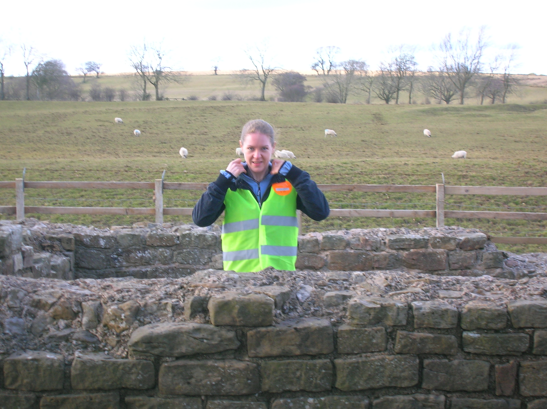
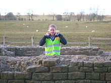 A volunteer stationed at Leahill Turret 51B, one of Cell 27 of the event volunteer 'legions'
Roman-period names
The only ancient source for its provenance is the Augustan History. No sources survive to confirm what the wall was called in antiquity, and no historical literary source gives it a name. However, the discovery of a small enamelled bronze Roman cup in Staffordshire in 2003 has provided a clue. The cup is inscribed with a series of names of Roman forts along the western sector of the wall, together with a personal name and the phrase MAIS COGGABATA VXELODVNVM CAMBOGLANNA RIGORE VALI AELI DRACONIS.
Bowness (MAIS) is followed by Drumburgh-by-Sands (COGGABATA) until now known only as CONGAVATA from the late Roman document, the Notitia Dignitatum. Next comes Stanwix (VXELODVNVM), then Castlesteads (CAMBOGLANNA).
RIGORE is the ablative form of the Latin word rigor. This can mean several things, but one of its less-known meanings is ‘straight line’, ‘course’ or ‘direction’. This sense was used by Roman surveyors and appears on several inscriptions to indicate a line between places. So the meaning could be 'according to the course'.
There is no known word as vali, but vallum was the Latin word for an earthen wall, rampart, or fortification;[18] today vallum is applied to the ditch and berm dug by the Roman army just south of the wall. The genitive form of vallum is valli, so one of the most likely meanings is VAL[L]I, ‘of the vallum’. Omitting one of a pair of double consonants is common on Roman inscriptions; moreover, an error in the transcription of a written note could be the reason: another similar bronze vessel, known as the Rudge Cup (found in Wiltshire in the 18th century) has VN missing from the name VXELODVNVM, for example, although the letters appear on the Staffordshire Moorlands cup. The Rudge Cup only bears fort names.
The name AELI was Hadrian's nomen, his main family name, the gens Aelia. The Roman bridge at Newcastle-upon-Tyne was called Pons Aelius.
DRACONIS can be translated as ‘[by the hand – or property] of Draco’. It was normal for Roman manufacturers to give their names in the genitive (‘of’), and ‘by the hand’ would be understood. The form is common, for example, on Samian ware.
The translation, therefore, could be:
"Mais, Coggabata, Uxelodunum, Camboglanna, according to the line of the Aelian wall. [By the hand or The property] of Draco." Another possibility is that the individual's name was Aelius Draco, which would only leave us with an unspecified vallum, 'wall'.
Forts
The Latin and Romano-Celtic names of some of the Hadrian's Wall forts are known, from the Notitia Dignitatum and other evidence:
- Segedunum (Wallsend)
- Pons Aelius (Newcastle upon Tyne)
- Condercum (Benwell Hill)
- Vindobala (Rudchester)[19]
- Hunnum (Halton Chesters)[19]
- Cilurnum (Chesters aka Walwick Chesters)[19]
- Procolita (Carrowburgh)
- Vercovicium (Housesteads)
- Aesica (Great Chesters)[19]
- Magnis (Carvoran)
- Banna (Birdoswald)
- Camboglanna (Castlesteads)
- Uxelodunum (Stanwix. Also known as Petriana)
- Aballava (Burgh-by-Sands)
- Coggabata (Drumburgh)
- Mais (Bowness-on-Solway)
Turrets on the wall include:
- Leahill Turret
Outpost forts beyond the wall include:
- Habitancum (Risingham)
- Bremenium (Rochester)[19]
- Fanum Cocidi (Bewcastle) (north of Birdoswald)
- Ad Fines (Chew Green)[20]
Supply forts behind the wall include:
- Alauna (Maryport)
- Arbeia (South Shields)
- Coria (Corbridge)
- Vindolanda (Little Chesters or Chesterholm)[19]
- Vindomora (Ebchester)[19]
See also
- Rudge Cup
- Scots' Dike
- Separation barrier
- Silesia Walls
- Via Hadriana
References
- ^ English Heritage
- ^ BBC – History – Hadrian's Wall Gallery
- ^ Breeze, David J (1934), Handbook to the Roman Wall (14th Revised edition – November 2006), Society of Antiquaries of Newcastle upon Tyne, ISBN 0901082651
- ^ "hadrianswall-northumberland.com". http://www.hadrianswall-northumberland.com/hadrianswall/roman-wall. Retrieved 16 March 2011.
- ^ a b c d e f g Anthony Everitt (2009) Hadrian and the Triumph of Rome, Random House, Inc, 448 pages, ISBN 0-8129-7814-5
- ^ Stephen Johnson (2004) Hadrian's Wall, Sterling Publishing Company, Inc, 128 pages, ISBN 0-7134-8840-9
- ^ Breeze, D.J., and Dobson, B., 2000, Hadrian's Wall (fourth edition), London: Penguin Books, pp86
- ^ Wilson, 271.
- ^ Woolliscroft, D., 1989, "Signalling and the design of Hadrian's Wall", Archaeologia Aeliana 5th Series, Vol. XVII, pp5-20
- ^ Breeze, David J (1934), Handbook to the Roman Wall (14th Revised edition – Nov 2006), Society of Antiquaries of Newcastle upon Tyne, pp. 53, ISBN 0901082651
- ^ Hadrian's Wall, English Lakes website
- ^ [1] Hadrian's Wall
- ^ UNESCO World Heritage Centre. "Frontiers of the Roman Empire". http://whc.unesco.org/en/list/430/. Retrieved 2007-11-26.
- ^ National Trails. "Hadrian's Wall Path". http://www.nationaltrail.co.uk/HadriansWall/. Retrieved 2007-11-26.
- ^ Hadrians Wall Path National Trail. "Every Footstep Counts – The Trail's Country Code". http://www.nationaltrail.co.uk/HadriansWall/text.asp?PageId=27. Retrieved 2007-11-26.
- ^ Martin, George R.R. "A Conversation With George R.R. Martin". The SF Site. http://www.sfsite.com/01a/gm95.htm. Retrieved 10 September 2011.
- ^ Sycamore Gap, a section of the wall between two crests just east of Milecastle 39, is locally known as the "Robin Hood Tree" for its use in the 1991 film Robin Hood: Prince of Thieves (1991).
- ^ Lewis and Short, A Latin Dictionary
- ^ a b c d e f g Note the suffix "chester", reflecting the presence of a Roman castra.
- ^ [2]
Further reading
- Burton, Anthony Hadrian's Wall Path. 2004 Aurum Press Ltd. ISBN 1-85410-893-X.
- de la Bédoyère, Guy. Hadrian's Wall. A History and Guide. Stroud: Tempus, 1998. ISBN 0-7524-1407-0.
- England's Roman Frontier. Discovering Carlisle and Hadrian's Wall Country. Hadrian's Wall Heritage Ltd and Carlisle Tourism Partnership. 2010.
- Forde-Johnston, James L. Hadrian's Wall. London: Michael Joseph, 1978. ISBN 0-7181-1652-6.
- Hadrian's Wall Path (map). Harvey, 12–22 Main Street, Doune, Perthshire FK16 6BJ. harveymaps.co.uk
- Ritman, Lex, Eric de Noorman en Erwin de Noorman (2003)
- Speed Maps – A set of Speed's maps were issued bound in a single volume in 1988 in association with the British Library and with an introduction by Nigel Nicolson as 'The Counties of Britain A Tudor Atlas by John Speed'.
- Moffat, Alistair, The Wall. 2008 Birlinn Limited Press. ISBN 1 84158 675 7.
- Tomlin, R.S.O., 'Inscriptions' in Britannia (2004), vol. xxxv, pp. 344–5 (the Staffordshire Moorlands cup naming the Wall).
- Wilson, Roger J.A., A Guide to the Roman Remains in Britain. London: Constable & Company, 1980. ISBN 0-09-463260-X.
External links
- Hadrian's Wall Discussion Forum
- UNESCO Frontiers of the Roman Empire
- News on the Wall path
- English Lakes article
- iRomans website with interactive map of cumbrian section of Hadrian Wall
Milecastles of Hadrian's Wall Milecastles 0 • 1 • 2 • 3 • 4 • 5 • 6 • 7 • 8 • 9 • 10 • 11 • 12 • 13 • 14 • 15 • 16 • 17 • 18 • 19 • 20 • 21 • 22 • 23 • 24 • 25 • 26 • 27 • 28 • 29 • 30 • 31 • 32 • 33 • 34 • 35 • 36 • 37 • 38 • 39 • 40 • 41 • 42 • 43 • 44 • 45 • 46 • 47 • 48 • 49 • 50 • 50TW • 51 • 52 • 53 • 54 • 55 • 56 • 57 • 58 • 59 • 60 • 61 • 62 • 63 • 64 • 65 • 66 • 67 • 68 • 69 • 70 • 71 • 72 • 73 • 74 • 75 • 76 • 77 • 78 • 79 • 80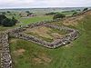
Milefortlets MF 1 • MF 2 • MF 3 • MF 4 • MF 5 • MF 6 • MF 7 • MF 8 • MF 9 • MF 10 • MF 11 • MF 12 • MF 13 • MF 14 • MF 15 • MF 16 • MF 17 • MF 18 • MF 19 • MF 20 • MF 21 • MF 22 • MF 23 • MF 24 • MF 25 • MF 26Other structures on Hadrian's Wall Portgate • Chesters Bridge • Knag Burn Gateway • Peel Gap Tower • Willowford Bridge • Pike Hill Signal TowerWall Forts (East to West) Segedunum • Pons Aelius • Condercum • Vindobala • Onnum • Cilurnum • Procolita • Vercovicium • Aesica • Magnis • Banna • Camboglanna • Uxelodunum • Aballava • Coggabata • Maia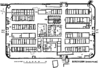
Outpost Forts Stanegate Forts Corstopitum • Newbrough • Vindolanda • Haltwhistle Burn • Magnis • Throp • Nether Denton • Castle Hill Boothby • Brampton Old Church • LuguvaliumSupply Forts World Heritage Sites in the United Kingdom England Bath · Blenheim Palace · Canterbury Cathedral, St. Augustine's Abbey and St. Martin's Church · Cornwall and West Devon Mining Landscape · Derwent Valley Mills · Durham Castle and Cathedral · Frontiers of the Roman Empire (Hadrian's Wall) · Ironbridge Gorge · Jurassic Coast · Kew Gardens · Liverpool Maritime Mercantile City · Maritime Greenwich · Saltaire · Stonehenge, Avebury and Associated Sites · Studley Royal Park and Fountains Abbey · Tower of London · Westminster Palace, Westminster Abbey and St. Margaret's Church
Scotland Wales Northern Ireland British Overseas Territories Dating from Neolithic/ Bronze Age Dating from Roman Britain Ambleside Roman Fort · Hadrian's Wall (including Banks East Turret, Birdoswald Roman Fort, Hare Hill, Harrows Scar Milecastle and Wall, King's Stables (Milecastle 48), Leahill Turret and Piper Sike Turret, Pike Hill Signal Tower, Willowford Wall Turrets and Bridge) · Hardknott Roman Fort · Ravenglass Roman Bath HouseDating from the Middle Ages Dating from the 17th Century onwards Categories:- Ancient Roman architecture
- Hadrian's Wall
- 2nd-century architecture
- Buildings and structures in Cumbria
- Buildings and structures in Northumberland
- Buildings and structures in Tyne and Wear
- English Heritage sites in Cumbria
- English Heritage sites in Northumberland
- English Heritage sites in Tyne and Wear
- Archaeological sites in Cumbria
- Archaeological sites in Northumberland
- Archaeological sites in Tyne and Wear
- Fortification
- History of Cumbria
- History of Northumberland
- History of Tyne and Wear
- Military history of Cumbria
- Military history of Northumberland
- Military history of Tyne and Wear
- Nerva-Antonine Dynasty
- Roman frontiers
- Roman military architecture
- Roman sites in Northumberland
- Ruins in Cumbria
- Ruins in Northumberland
- Separation barriers
- Visitor attractions in Cumbria
- Visitor attractions in Northumberland
- Visitor attractions in Tyne and Wear
- Walls
- Walls in England
- World Heritage Sites in England


Wikimedia Foundation. 2010.