- St Mary's Church, Pyrton
-
St Mary's Church, Pyrton 
St Mary's Church, Pyrton, from the southeastLocation in Oxfordshire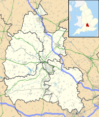
 St Mary's Church, Pyrton
Coordinates: 51°39′21″N 1°00′22″W / 51.6559°N 1.0060°W OS grid reference SU 687 957 Location Pyrton, Oxfordshire Country England Denomination Anglican Website St Mary's, Pyrton History Consecrated 1856 Architecture Status Parish church Functional status Active Heritage designation Grade II* Designated 18 June 1963 Architect(s) J. C. Buckler Architectural type Church Style Norman, Gothic Revival Completed 1856 Specifications Materials Flint with limestone dressings
tile roofAdministration Parish Pyrton and Shirburn Deanery Aston and Cuddesdon Archdeaconry Oxford Diocese Oxford Province Canterbury Clergy Rector Rev Christopher Evans Assistant priest Rev Angie Paterson,
Canon Tony WilliamsonMinister(s) Rev Adam Clayton Laity Churchwarden(s) Jenny Lockwood,
Ken Hugh-JonesSt Mary's Church, Pyrton, is the Anglican parish church of Pyrton, Oxfordshire, England. Its parish is part of the benefice of Icknield, in the deanery of Aston and Cuddesdon, the archdeaconry of Oxford and the diocese of Oxford.[1] The church has been designated by English Heritage as a Grade II* listed building.[2]
Contents
History
A church was on the site in 987 and around 1115 it was granted to an Augustinian foundation of canons at Runcorn, Cheshire, by William fitz Nigel, who was Lord of Pyrton and also the second Baron of Halton.[3][4] In 1134 the community of canons was moved to the nearby village of Norton and the church remained in the possession of Norton Priory until the dissolution of the monasteries in 1536. The rectory and advowson were then granted to Christ Church, Oxford. In 1943 the parish was united with that of Shirburn.[3] The united parish is now part of the benefice of Icknield.[5]
The present church building dates from the 12th century with a porch added in the 15th century.[2] The nave and chancel were largely rebuilt in 1854 by J. C. Buckler, who preserved the basic lines of the former church and retained some of the original features.[6] The nave was lengthened by 6 feet (2 m) at the west end to provide seating for an additional 120 people. In 1929 additional heating was installed and in 1939 electric lighting was added and the organ replaced a harmonium in 1953.[3]
Architecture
Exterior
The church is built in knapped and coursed flint with ashlar limestone dressings and a gabled tile roof. Its plan consists of a chancel with vestry, a three-bay nave with a south porch and a bell-cote at the west end.[2] The remaining Norman features are the south doorway, the chancel arch and the internal part of window in the north wall of the nave. A similar window in the south wall of the nave is a Victorian copy.[6] The east window has three lights, the chancel has 12th-century lancet windows and in the vestry are round-arched 19th-century windows. At the west end is a two-light window flanked with buttresses. The bell-cote has trefoil-headed lancet windows above two cinquefoil-headed bell openings.[2]
Interior
The pews, lectern and stained glass date from the 19th century; the glass in one of the nave windows erected in 1893 was made by Clayton and Bell. In the south porch are medieval tiles of six different designs. The oak pulpit is dated 1636. The wooden parish chest was acquired in 1638.[3] The font dates from the 12th century and has a mid-19th century cover.[2] The church contains a number of memorials, the oldest of which is a slab of Purbeck marble in front of the altar in memory of a priest. It dates from around 1340 and formerly had an inscription in brass letters. The monuments in the nave are mostly to members of the Hamersley family; one of these is a brass tablet dated 1929 which was designed by Eric Gill. The ring consists of three bells; two of these are dated 1605 and 1606, the other was given in 1953 to replace a bell dated 1593. The parish registers date from 1568 and there are churchwardens' accounts from between 1548 and 1882.[3]
External features
Two chest tombs in the churchyard dating from the 18th century are listed Grade II.[7][8]
References
- ^ "Pyrton: St Mary, Pyrton". Church of England. http://www.achurchnearyou.com/pyrton-st-mary/. Retrieved 11 September 2009.
- ^ a b c d e "Church of St Mary, Pyrton", The National Heritage List for England (English Heritage), 2011, http://list.english-heritage.org.uk/resultsingle.aspx?uid=1059730, retrieved 20 May 2011
- ^ a b c d e Lobel, Mary, ed. (1964), "Parishes: Pyrton", A History of the County of Oxford, Victoria County History (University of London & History of Parliament Trust) 8: pp. 138–178, http://www.british-history.ac.uk/report.aspx?compid=63823#s7, retrieved 20 May 2011
- ^ Greene, J. Patrick (1989), Norton Priory: The archaeology of a medieval religious house, pp. 1–4, ISBN 0-521-33054-8
- ^ The Benefice of Icknield, The Benefice of Icknield, http://www.icknield.info/default.aspx, retrieved 19 July 2008
- ^ a b "St Mary, Pyrton, Oxfordshire". Corpus of Romanesque Sculpture of Great Britain and Ireland. http://www.crsbi.ac.uk/ed/ox/pyrto/index.htm/index.htm. Retrieved 19 July 2008.
- ^ "Chest tomb approximately 16 metres east of chancel of Church of St Mary, Pyrton", The National Heritage List for England (English Heritage), 2011, http://list.english-heritage.org.uk/resultsingle.aspx?uid=1284473, retrieved 20 May 2011
- ^ "Chest tomb approximately 25 metres southeast of south porch of Church of St Mary, Pyrton", The National Heritage List for England (English Heritage), 2011, http://list.english-heritage.org.uk/resultsingle.aspx?uid=1368848, retrieved 20 May 2011
Further reading
- Sherwood, Jennifer; Pevsner, Nikolaus (1974), Oxfordshire, The Buildings of England, Harmondsworth: Penguin Books, pp. 732–733, ISBN 0-14-071045-0
Categories:- Church of England churches in Oxfordshire
- Grade II* listed churches
- Grade II* listed buildings in Oxfordshire
- Norman architecture
- English Gothic architecture
- Religious buildings completed in 1856
- Gothic Revival architecture in England
- Diocese of Oxford


Wikimedia Foundation. 2010.