- Nur Shams, Tulkarm
-
Nur Shams Other transcription(s) – Arabic مخيّم نور شمس Location of Nur Shams within the Palestinian territories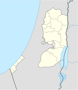
 Nur Shams
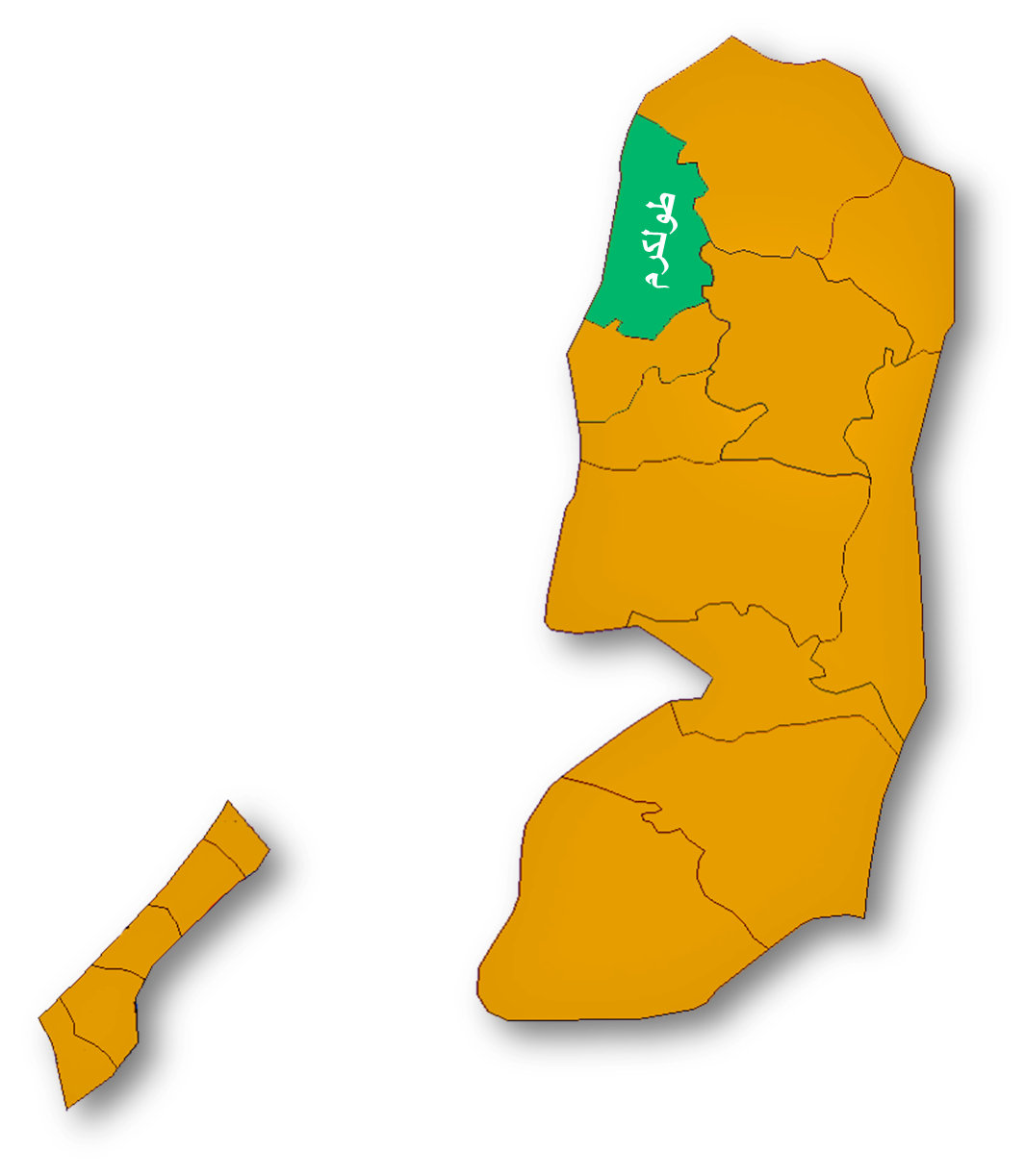
Coordinates: 32°19′07.36″N 35°03′31.63″E / 32.3187111°N 35.0587861°ECoordinates: 32°19′07.36″N 35°03′31.63″E / 32.3187111°N 35.0587861°E Governorate Tulkarm Government – Type Refugee Camp Area – Jurisdiction 226 dunams (0.2 km2 / 0.1 sq mi) Population (2006) – Jurisdiction 7,889 Nur Shams (Arabic: مخيّم نور شمس) is a Palestinian refugee camp in the Tulkarm Governorate in the North Western West Bank, located 3 kilometers East of Tulkarm. According to the Palestinian Central Bureau of Statistics, Nur Shams had a population of approximately 7,889 inhabitants in mid-year 2006.[1] 95.1% of the population of Nur Shams were refugees in 1997.[2] The UNRWA-run healthcare facility for Nur Shams camp was re-built in 1996 with contributions from the Government of Germany. [3]
During the Mandate period, a British detention camp was situated at Nur Shams.[4]
Nur Shams camp was established in 1952 on 226 dunums. The camp was transferred to Palestinian Authority control in November 1998, after the signing of the Wye River Memorandum and the first phase of further Israeli redeployment.
The two schools in the camp are in poor condition and are listed on UNRWA's priority list for replacement pending securing of funds to carry out the project. A four story Boy’s school was constructed in 2004 and has 1035 pupils, the girl’s school was constructed in 2001 and has 975 pupils.[5]
See also
Footnotes
- ^ Projected Mid -Year Population for Tulkarm Governorate by Locality 2004- 2006 Palestinian Central Bureau of Statistics.
- ^ Palestinian Population by Locality and Refugee Status Palestinian Central Bureau of Statistics
- ^ Health care Facilities Tulkarm Governorate
- ^ Ian Black; Benny Morris (1991). Israel's secret wars: a history of Israel's intelligence services. Grove Weidenfeld. p. 1. ISBN 9780802132864. http://books.google.com/books?id=TBCSmOpyrTEC. Retrieved 15 June 2011.
- ^ UNRWA Nur Shams camp profile
Cities 

Municipalities Anabta · Attil · Bal'a · Baqa ash-Sharqiyya · Beit Lid · Deir al-Ghusun · Dhinnaba · 'Illar · Kafr al-Labad · Qaffin · ZeitaVillages Far'un · Iktaba · Izbat Shufa · Al Jarushiya · Kafr Abbush · Kafr Jammal · Kafr Rumman · Kafr Sur · Kafr Zibad · Khureish · Kur · an-Nazla al-Gharbiya · an-Nazla ash-Sharqiya · an-Nazla al-Wusta · Nazlat Abu Nar · Nazlat 'Isa · Raml Zeita · Ramin · al-Ras · Saffarin · Seida · ShufaRefugee camps Nur Shams · Tulkarm campPalestinian refugee camps1 locations and populations as of 2005  Gaza Strip
986,034 refugees Jordan
2,127,877 refugees Lebanon
404,170 refugees Syria
Syria
432,048 refugees West Bank
699,817 refugeesAl-Shati (Beach) 76,109 Bureij 30,059 Deir al-Balah 20,188 Jabalya 175,646 Khan Yunis 60,662 Maghazi 22,536 Nuseirat 64,233 Rafah 90,638 Canada Camp disbanded Beddawi 15,695 Burj el-Barajneh 19,526 Burj el-Shemali 18,134 Dbayeh 4,223 Dikwaneh destroyed Ein el-Hilweh 44,133 El-Buss 9,840 Jisr el-Basha destroyed Mar Elias 1,406 Mieh Mieh 5,078 Nabatieh destroyed Nahr el-Bared 28,358 Rashidieh 24,679 Sabra Shatila 11,998 Tel al-Zaatar destroyed Wavel 7,357 Abu Dis Aida 3,260 Am'ari 8,083 Aqabat Jabr 5,197 al-'Arrub 9,180 Askar 31,894 'Azza 1,828 Balata 41,681 Deir Ammar 2,189 Dheisheh 10,923 Ein Beit al-Ma' 6,221 Ein as-Sultan 1,888 Far'a 12,836 Fawwar 7,072 Jalazone 9,284 Jenin 35,050 Kalandia 9,188 Nur Shams 8,179 Shuafat (Shu'fat) 9,567 Tulkarm 17,259 1 The UNRWA definition of a "Palestinian refugee" is a person "whose normal place of residence was Palestine between June 1946 and May 1948, who lost both their homes and means of livelihood as a result of the 1948 Arab-Israeli conflict ... UNRWA's definition of a refugee also covers the descendants of persons who became refugees in 1948." [1]Categories:- Tulkarm Governorate
- Populated places established in 1952
- Palestinian refugee camps in the West Bank
- Palestine geography stubs

Wikimedia Foundation. 2010.