- Hobardz
-
Hobardzi
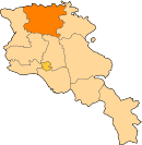
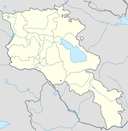
ՀոբարձիPanorama of Hobardzi from the main road into the village Coordinates: 40°57′37″N 44°29′39″E / 40.96028°N 44.49417°ECoordinates: 40°57′37″N 44°29′39″E / 40.96028°N 44.49417°E Country Armenia Marz (Province) Lori Province Elevation 1,345 m (4,413 ft) Population (2001) – Total 814 Time zone (UTC+4) – Summer (DST) (UTC+5) Hobardz (Armenian: Հոբարձ; also romanized as Oparts; also, Opartsi, Opartsy, and Hobardzi) is a rural community in the Lori Province of Armenia.
It is about 11 km south-east of Stepanavan (about 20 minutes by car) and is close to the small towns of Vardablur and Gyulagarak. The Stepanavan Dendropark is located about 3 km south-west of Hobardzi (about a 1-hour walk).
Contents
See also
Nearby towns
Nearby villages
References
- Hobardz at GEOnet Names Server (as Opartsi)
- Report of the results of the 2001 Armenian Census, National Statistical Service of the Republic of Armenia
Capital: VanadzorAlaverdi 
Vanadzor Spitak Arevashogh · Geghasar · Ghursal · Gogaran · Hartagyugh · Jrashen · Karadzor · Katnajur · Khnkoyan · Lernantsk · Lernavan · Lusaghbyur · Mets Parni · Nor Khachakap · Sarahart · Saralanj · Saramej · Shenavan · Shirakamut · Spitak · TsaghkaberStepanavan Agarak · Amrakits · Bovadzor · Gargar · Gyulagarak · Hobardz · Hovnanadzor · Katnaghbyur · Koghes · Kurtan · Lejan · Lori Berd · Privolnoye · Pushkino · Saratovka · Stepanavan · Sverdlov · Urasar · Urut · Vardablur · YaghdanTashir Apaven · Artsni · Blagodarnoye · Dashtadem · Dzoramut · Dzyunashogh · Katnarat · Lernahovit · Medovka · Meghvahovit · Metsavan · Mikhayelovka · Norashen · Novoseltsovo · Paghaghbyur · Petrovka · Sarchapet · TashirCategories:- Populated places in Lori
- Lori geography stubs
Wikimedia Foundation. 2010.


