- 2008–09 South Pacific cyclone season
-
2008–09 South Pacific cyclone season 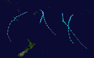
Season summary mapFirst storm formed: December 1, 2008 (01F) Last storm dissipated: April 10, 2009 (15F) Strongest storm: Lin – 975 hPa (mbar), 110 km/h (70 mph) (10-minute sustained) Total disturbances: 15 Total depressions: 12 Tropical cyclones: 6 Severe tropical cyclones: 0 (Record low) Total fatalities: 11 Total damage: $65 million (2009 USD) South Pacific cyclone seasons
2006–07, 2007–08, 2008–09, 2009–10, 2010–11Related articles: - Timeline of the 2008–09 South Pacific cyclone season
- 2008–09 Australian region cyclone season
- 2008–09 South-West Indian Ocean cyclone season
The 2008–09 South Pacific cyclone season began on December 1, 2008 with the formation of Tropical Disturbance 01F. This was 30 days after the season had officially begun on November 1, 2008.[1] The season officially ended on April 30, 2009. Tropical cyclones that were between 160°E and 120°W and north of 25°S were monitored by the Fiji Meteorological Service. Those that moved south of 25°S were monitored by the Tropical Cyclone Warning Centre (TCWC) in Wellington, New Zealand.[1]
During the season, there were 15 Tropical Disturbances with 12 of them intensifying into Tropical Depressions, which were monitored by the Regional Specialized Meteorological Centre in Nadi, Fiji, which is a part of the Fiji Meteorological Service. Only five of the Tropical Depressions intensified into Tropical Cyclones which were named Hettie, Innis, Joni, Ken, and Lin. Both Cyclone Innis and Cyclone Hettie had peak wind speeds of 75 km/h (45 mph) which made them Category One cyclones on the Australian Tropical Cyclone Intensity Scale, whilst Cyclone Ken had wind speeds of 95 km/h (60 mph). Cyclones Joni and Lin had peak wind speeds of 100 km/h (65 mph) and 110 km/h, (70 mph) respectively which made them Category 2 cyclones. Cyclone Jasper also moved into the region from the Australian basin at its peak wind speeds of 100 km/h (65 mph) which made it a Category Two cyclone. For the first time since the 1994-95 tropical cyclone season there were no tropical cyclones that developed into a Severe Tropical Cyclone, which have winds of at least 120 km/h (75 mph).
Seasonal forecasts
Predictions of tropical cyclone activity during 2008–09 Source Date TC STC Average (1970–71 – 2007–08) 9 4.5[2][3] Record high activity 17 7[4][5] Record low activity 3 0[4][5] –––––––––––––––––––––––––––––––––––––––––– NIWA September 26, 2008 8–10 N/A[6] FMS October 23, 2008 9 4.5[2][3] NIWA January 9, 2009 6–7 N/A[7] –––––––––––––––––––––––––––––––––––––––––– Actual activity 7 0 On September 26, the New Zealand National Institute of Water and Atmospheric Research (NIWA) issued a seasonal forecast for the whole of the southern Pacific Ocean to the east of 135°E. They predicted that the 2008–09 South Pacific cyclone season would see an average risk of cyclones forming, which they said would mean that 8–10 tropical cyclones with wind speeds greater than 35 knots would form east of 150°E.[6] Niwa then issued a revised forecast on January 9 as a weak La Nina had formed, predicting that there would be six to seven cyclones forming in the whole of the Southern Pacific. They also predicted that there would be a higher risk of Tropical cyclones forming to the west of the International dateline.[7]
In October 2008, the Regional Specialized Meteorological Center in Nadi, Fiji, released their 2008–09 Seasonal Outlook. Within their seasonal outlook the RSMC stated that the 2008–09 season would start under Neutral conditions meaning that there is no La Niña or El Niño Conditions.[2] They also stated that this was expected to last for the majority of the cyclone season.[2] RSMC Nadi also predicted that there would be nine cyclones forming in the 2008–09 season which was an average amount of Cyclones with half of them becoming Severe Tropical Cyclones. During January 2009, as there had been no Tropical cyclones in the South Pacific within the first two months of the season and a weak La Nina had formed during December, RSMC Nadi suggested that there was a slight possibility that there would be less activity than previously predicted.[8] The Fiji Meteorological service then reported in their March 2009 Climate Outlook for the Fiji Islands that Tropical cyclone activity was now expected to be below average within the whole of the South Pacific however, this proved inaccurate as an average number of storms formed within the whole of the southern Pacific.[9]
Season summary

During the 2008–09 season, fifteen Tropical disturbances passed through RSMC Nadi's area of responsibility. Of these fifteen disturbances only eleven developed into Tropical Depressions, with a further five becoming Tropical cyclones within RSMC Nadi's area of responsibility with a further three cyclones forming within the Coral sea. No Tropical Cyclone intensified into a Severe Tropical cyclones this season to the east of 160E, with only Cyclone Hamish intensifying into one to the west of 160E.
Notable Tropical depressions include Tropical Depression 04F, which caused Fiji's second worst natural disasters. Tropical Depression 08F, which intensified into Cyclone Hettie becoming the first tropical cyclone to form this season. Tropical Depression 10F brought heavy rains to Vanuatu and before making landfall on New Caledonia intensified into Category One Tropical Cyclone Innis. After it made landfall Innis became the first Tropical Depression to move into TCWC Brisbane's Area of responsibility since Cyclone Larry. Cyclones Joni and Ken both threatened the Southern Cook Islands however the only impact they had was minimal. Cyclone Jasper then moved into the region early on March 24 at peak intensity, having developed inside TCWC Brisbane's area of responsibility two days earlier. The final Tropical Depression this year to develop was Tropical Cyclone Lin near to the Lau Group of Fiji and Tonga.
Storms
Tropical Disturbance 01F
Tropical disturbance (Australian scale) 
Duration December 1 – December 2 Intensity Winds unknown, 1006 mbar (hPa) Ealry on December 1, RSMC Nadi reported that Tropical Disturbance 01F had formed about 750 km, (465 mi) to the north-east of Apia, American Samoa.[10] Convection around the disturbance had been present for 24 hours, and had helped to develop a well-defined low level circulation center.[10] The disturbance lied within an area of moderate vertical wind shear as well as a trough of low pressure.[10] Over the next couple of days, the disturbance moved slowly towards the west before it was downgraded to an area of low pressure early on December 3.[11]
Tropical Depression 02F
Tropical depression (Australian scale) 

Duration December 3 – December 6 Intensity 45 km/h (30 mph) (10-min), 1004 mbar (hPa) Early on December 3, RSMC Nadi reported that a Tropical Disturbance had formed near the Southern Cook Islands and was located in a moderately sheared environment and was moving towards the southeast.[11][12] Deep Convection had been present around a well-defined cyclonic circulation for the previous 24 hours.[12] Over the next day the disturbance gradually developed with RSMC Nadi upgrading it to a Tropical Depression later that day whilst it was moving between Niue and the Southern Cook Islands.[13] Over the next couple of days the depression gradually weakened with convection which was located in the southern and eastern quadrants became sheared and the low level circulation centre became exposed as it moved into an area of cooler sea surface temperatures.[14] Late on December 6 RSMC Nadi issued their final advisory on the depression as it moved into TCWC Wellingtons area of responsibility and was expected to become a mid latituted low pressure system within 12 hours.[15]
Tropical Disturbance 03F
Tropical disturbance (Australian scale) 
Duration December 10 – December 11 Intensity 35 km/h (25 mph) (10-min), 1001 mbar (hPa) Late on December 10, RSMC Nadi reported that a Tropical disturbance had formed near to the western edge of their area of responsibility.[16] The disturbance had no definite low level circulation center with convection confined to the north quadrant of the disturbance.[16] The disturbance lied to the west of an upperlevel anticyclone and was located in an area of moderately sheared environment.[16] Early the next day, RSMC Nadi issued their final advisory on the disturbance as it was difficult to locate the low level circulation center as there seemed to be a more dominant cyclonic circulation to the northwest of 03F which they reported might have engulfed the system.[17]
Tropical Depression 04F
Main article: Tropical Depression 04F (2009)Tropical depression (Australian scale) 

Duration January 4 – January 12 Intensity 65 km/h (40 mph) (10-min), 994 mbar (hPa) Tropical Depression 04F formed late on January 4, as a weak tropical disturbance near to the eastern edge of RSMC Nadi's responsibility.[18] The disturbance then rapidly organised itself sufficiently to be classified as Tropical Depression 04F early the next morning.[19] Over the next couple of days the depression moved towards the southeast, before on January 8 as it started to bring heavy rainfall to Fiji.[20] RSMC Nadi then issued their final advisory on it later that day, as it was now an extratropical depression. However late the next day RSMC Nadi started to reissue advisories on the depression and immediately passed primary warning responsibility for it to the Tropical Cyclone Warning Center in Wellington, who issued warnings on the depression until early on January 12 when they issued their last advisory.
Floods and mudslides caused by the depression killed at least eleven people in Fiji. Several towns and rural areas on Viti Levu were flooded.[21]
Tropical Depression 05F
Tropical depression (Australian scale) 

Duration January 11 – January 14 Intensity 55 km/h (35 mph) (10-min), 999 mbar (hPa) On January 11, RSMC Nadi reported that a tropical depression had formed to the south of the Solomon Islands and was just inside TCWC Brisbane's area of responsibility, and started issuing Tropical Disturbance Summaries on it. As the depression moved into RSMC Nadi’s area of responsibility it was designated as 05F. Nadi reported at this time that whilst the depression had a low to moderate chance of forming into a tropical cyclone within 48 hours, there was an upper trough of low pressure that could provide an opportunity for the depression to either rapidly or explosively develop. Despite fair conditions, it dissipated without ever becoming a cyclone.
Tropical Depression 06F
Tropical depression (Australian scale) 

Duration January 19 – January 23 Intensity 55 km/h (35 mph) (10-min), 1005 mbar (hPa) Late on January 19, RSMC Nadi reported that a tropical disturbance had formed in a monsoonal trough of low pressure about 940 km to the north west of Papeete, in French Polynesia. Convection was confined to the northeast of the low level circulation and was disorganised.[22][23][24] Late the next day whilst the disturbance was moving to the east and into an area of higher vertical wind shear, RSMC Nadi upgraded the disturbance to a tropical depression despite its low level circulation centre being exposed and lying to the west of the deep convection.[24] During the next morning as it interacted with another disturbance to the northwest the depression reached its peak wind speeds of 55 km/h, (35 mph)[25][26] Over the next couple of days th depression moved towards the south before late on January 23 RSMC Nadi issued their final advisory on the depression as it was expected to become a hybird system within 24 hours.[27]
Tropical Depression 07F
Tropical depression (Australian scale) 

Duration January 23 – January 25 Intensity 65 km/h (40 mph) (10-min), 1006 mbar (hPa) On January 23, RSMC Nadi reported that a Tropical Depression had formed, to the southwest of American Samoa. Later that day as the Depression moved towards the east they downgraded the Depression to a Tropical Disturbance as the Low Level Circulation Center was exposed and located in an environment of moderate to strong vertical wind shear.[28] During the morning of January 24 the Tropical Disturbance was reupgraded to a Tropical Depression and assigned the Tropical Depression the designation of 07F.[29] Later that day the tropical depression reached its peak wind speeds of 65 km/h (40 mph).[30] Early the next day RSMC Nadi released their final Tropical Disturbance Summary as the Tropical Depression had lost all tropical characteristics.[31]
Tropical Cyclone Hettie
Category 1 tropical cyclone (Australian scale) Tropical storm (SSHS) 

Duration January 24 – January 31 Intensity 65 km/h (40 mph) (10-min), 993 mbar (hPa) Main article: Cyclone Hettie (2009)Late on January 24, RSMC Nadi reported that a weak low pressure area had formed within a monsoon trough to the north of the Fijian dependency of Rotuma.[30] The next day after the disturbance had made landfall on Rotuma, it was designated as Tropical Depression 08F.[32] Early on January 27, a Tropical Cyclone Formation Alert was released by the JTWC, as the depression had a well-defined, but wide low level circulation center.[33] The Depression was upgraded to a Tropical Cyclone the next day when it was named as Hettie by RSMC Nadi whilst the JTWC designated Hettie as Tropical Cyclone 11P.[34] At this time, Hettie was moving towards the southeast in between Fiji and Tonga and did not intensify any further and was downgraded to a Depression the next day.[35] Over the next couple of days, it moved slowly towards the southeast and weakened before being downgraded to an area of low pressure late on January 31.[36] There was very minimal damage from Cyclone Hettie on Rotuma and in Tonga with 55.8MM of rainfall falling on Rotuma during January 24 and January 25.[37][38] There were no deaths reported within Fiji or Tonga.[37]
Tropical Depression 09F
Tropical depression (Australian scale) 

Duration February 1 – February 7 Intensity 55 km/h (35 mph) (10-min), 998 mbar (hPa) Late on February 1, a Tropical disturbance formed about 645 km (401 mi) to the west of Vanuatu and was embedded in a monsoonal trough. It quickly organized itself and thus later that day, it was upgraded to Tropical Depression 09F. At this time the Low Level Circulation Center was exposed as strong vertical wind shear and deep convection was displaced to the north of Low Level Circulation Center. The next morning the JTWC reported that deep convection, was located over the western boundary, of the depression's low level circulation center. Strong shear also still existed over the system, with deep convection still being displaced to the north of the system. The next morning RSMC Nadi reported that the Low Level Circulation Center was obscured with indications of good inflow bands flowing into the depression from the north and west. The depression was not in a favorable environment and it later dissipated on the 7th.
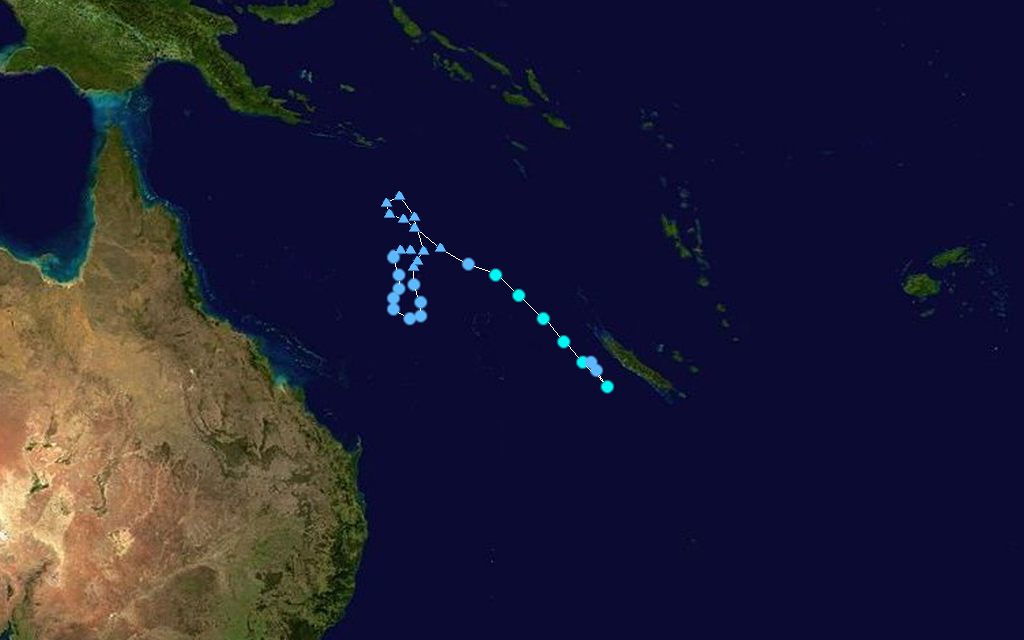
Tropical Cyclone Innis
Category 1 tropical cyclone (Australian scale) Tropical storm (SSHS) 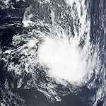
Duration February 13 – February 18 Intensity 75 km/h (45 mph) (10-min), 990 mbar (hPa) Main article: Cyclone Innis (2009)Cyclone Innis formed as Tropical Disturbance 10F to the east of Fiji on February 13, as it moved towards the southeast, the disturbance was designated as a tropical depression late the next day by RSMC Nadi.[39][40] A tropical cyclone formation alert was then issued on February 15 by the JTWC, as the depression moved towards Vanuatu and continued to organise itself.[41] Vanautu then suffered a direct hit from the depression early the next day before it was upgraded to a cyclone and named Innis, early on February 17 as it moved across New Caledonia.[42][43] Innis then quickly reached its peak intensity with winds of 75 km/h (45 mph), which made it a category one cyclone.[44][45] This came as RSMC Nadi transferred primary warning responsibility of Cyclone Innis, to the TCWC Wellington, who within their first advisory downgraded it to an extratropical low.[46][47][48] The extra tropical remnants of Innis briefly moved into the Australian region and were designated as a Tropical Low by TCWC Brisbane.[49] Cyclone Innis was then absorbed by a trough of low pressure which brought heavy rain to New Zealand during February 20.[50] There were no deaths reported by Cyclone Innis and little impact was reported from the storm in Vanautu or New Caledonia.[50][51]
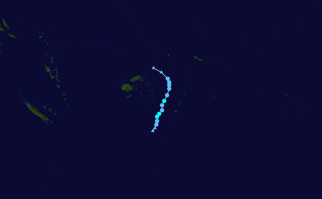
Tropical Cyclone Joni
Category 2 tropical cyclone (Australian scale) Tropical storm (SSHS) 

Duration March 10 – March 14 Intensity 100 km/h (65 mph) (10-min), 980 mbar (hPa) A weak tropical disturbance formed late on March 9, about 770 km (480 mi) west of Tahiti.[45] A Tropical Cyclone Formation Alert was then issued by the JTWC, the following day as the disturbance had a well-defined low level circulation center however RSMC Nadi, did not start to issue advisories on the Tropical disturbance until later that day designating it as Tropical Depression 11F.[52] On March 11 the Tropical Depression continued to intensify and was upgraded to a Tropical Cyclone by RSMC Nadi and the JTWC with RSMC Nadi assigning the name Joni to the storm.[53][54] The next day both RSMC Nadi and the JTWC reported that Joni had reached its peak windspeeds of 100 km/h (65 mph), which made it a Category Two Cyclone.[45][55] As Cyclone Joni reached its peak windspeeds RSMC Nadi passed primary warning responsibility of Cyclone Joni to TCWC Wellington who downgraded it to an extratropical low early on March 14.[55][56] The final warning on Cyclone Joni was then issued by TCWC Wellington early the next day.[57] There was only minimal impact reported in the southern Cook Islands with reports of heavy rainfall on Mangaia Island.[58]
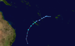
Tropical Cyclone Ken
Category 2 tropical cyclone (Australian scale) Tropical storm (SSHS) 

Duration March 16 – March 19 Intensity 95 km/h (60 mph) (10-min), 985 mbar (hPa) Early on March 16, a tropical disturbance formed to the south of a convergence zone which was located to the east of Palmerston Island, in the Cook Islands.[59] Early that afternoon the JTWC reported that the disturbances low level circulation centre had rapidly consolidated and issued a Tropical Cyclone Formation Alert on the developing system.[60] Later that day, RSMC Nadi reported that the disturbance had organised enough to be classified as Tropical Depression 12F.[61] Early the next morning, as the depression was moving towards the southeast, RSMC Nadi reported that outflow was good to the south of the depression and upgraded it to a Category 1 Cyclone, assigning the name Ken to the cyclone.[62] Later that day, the JTWC started to issue advisories on the storm and designated it as Tropical Cyclone 21P.[63]
Late on March 18, RSMC Nadi reported that Ken had reached its peak intensity with winds of 95 km/h, (60 mph), which made it a Category 2 Cyclone.[64] RSMC Nadi then passed primary warning responsibility of Cyclone Ken to TCWC Wellington who, downgraded Ken to a Category 1 Cyclone early the next day.[64][65] Ken then re-intensified into a Category 2 Cyclone later that day;[66] however it was quickly downgraded to a Category 1 Cyclone within their next advisory[67] and then was declared extratropical by both TCWC Wellington[68] and the JTWC early on March 20.[69] As an extratropical cyclone, Ken reached 1-minute windspeeds of 110 km/h (70 mph).[70] TCWC Wellington then issued their final advisory early on March 22, as it moved out of their eastern area of responsibility and was tracked by the Bureau of Meteorology for three more days as it crossed the Antarctic Peninsula into the Weddell Sea.[71][72]
Tropical Cyclone Jasper
Category 2 tropical cyclone (Australian scale) Tropical storm (SSHS) 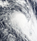

Duration March 24 – March 30 Intensity 100 km/h (65 mph) (10-min), 980 mbar (hPa) Early on March 24, Cyclone Jasper moved into the South Pacific, from the Australian region, as a Category 2 Cyclone with windspeeds of 95 km/h (60 mph), it weakened unexpectedly and rapidly after it moved into the area, while it was nearing New Caledonia, it moved northwest and degenerated to a remnant low. The remnant low of Jasper later returned the South Pacific as a very weak low.
Flooding, triggered by heavy rains in northern New Caledonia, forced the evacuation of 25 families.[73] Rough seas produced by the storm caused beach erosion along the coastlines of New Caledonia. High winds caused localized structural damage and knocked down a few power lines, leaving some residents without power.[74]
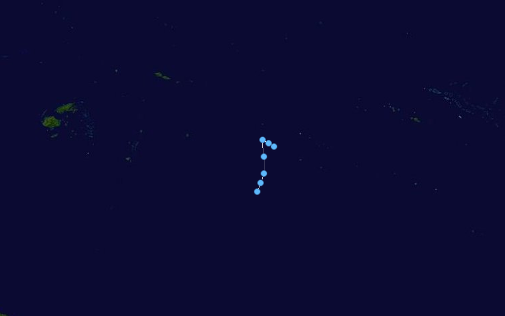
Tropical Cyclone Lin
Category 2 tropical cyclone (Australian scale) Tropical storm (SSHS) 

Duration March 31 – April 6 Intensity 110 km/h (70 mph) (10-min), 975 mbar (hPa) Main article: Cyclone Lin (2009)Cyclone Lin formed as a tropical depression within a monsoonal trough to the northwest of Fiji.[75] Over the next few days, the depression moved towards the southeast through the Fijian archipelago until late on April 3, when RSMC Nadi reported that the depression had intensified into a category one cyclone, and named it as Cyclone Lin.[76] The JTWC did not start issuing warnings on Lin until the next day when they designated it as Cyclone 25P while it was approaching its 10-minute peak windspeeds of 110 km/h (65 mph) and 1-minute peak windspeeds of 95 km/h (60 mph).[77][78] Cyclone Lin then reached its peak windspeeds early on April 5 as it passed directly over Tonga and then later that day as it approached the edge of RSMC Nadi's area of responsibility Lin started to go through an extratropical transition with the JTWC issuing their last advisory on it.[79] As it crossed into TCWC Wellington's area of responsibility the Cyclone was declared extratropical, however TCWC Wellington kept issuing warnings on Lin until late on April 8.[80][81]
In Tonga initial reports suggested that only vegetation had been impacted. However, it was later reported that power lines had been knocked down by high winds and the heavy rains triggered minor flooding in Nuku'alofa. Power stations in Tongatapu were also forced to close to protect the system. No one was injured by the storm but there were reports of significant crop losses. The Tongan Meteorological Service also reported that about $2000 TOP 2009, ($1000 USD 2009) worth of damage had been done to property owned by the service.
Tropical Disturbance 15F
Tropical disturbance (Australian scale) 
Duration April 7 – April 11 Out of area Intensity 35 km/h (25 mph) (10-min), 1004 mbar (hPa) Late on April 7, both the JTWC and RSMC Nadi reported that a tropical disturbance had developed in a monsoon trough about 510 km (320 mi), to the north-east of Honiara in the Solomon Islands.[82][83] Deep convection was flaring over an elongated low level circulation centre which was in an area of low vertical wind shear.[82] Early the next morning, RSMC Nadi designated it as 15F despite the disturbance remaining poorly defined.[84] Despite a tropical wave moving through the system on April 9, the disturbance remained poorly defined with the JTWC reporting that it had dissipated early the next day before RSMC Nadi issued their last advisory early on April 11 as the disturbance moved into TCWC Brisbane's area of responsibility and was re-designated as Tropical Low 22U.[85][86][87] Over the next couple of days the disturbance remained weak as it moved towards the southern tip of Papua New Guinea.[88][89]
Season effects
This table lists all the storms that developed in the South Pacific to the east of longitude 160°E during the 2008–2009 season. It includes their intensity on the Australian Tropical cyclone intensity scale, duration, name, landfalls, deaths, and damages. All data is taken from RSMC Nadi and or TCWC Wellington. The Damage figures are all 2009 USD.
Storm
NameDates active Storm category
at peak intensityPeak 10-min
sustained windsPressure Areas affected Damage
(USD)Deaths Refs 01F None December 1 – 2 Tropical Depression Unknown 1006 hPa (29.71 inHg) None None None 02F None December 3 – 7 Tropical Depression Unknown 1004 hPa (29.65 inHg) None None None 03F None December 10 – 11 Tropical Depression Unknown 1001 hPa (29.56 inHg) None None None 04F None January 4 – 14 Tropical Depression Unknown 1001 hPa (29.56 inHg) Fiji 05F None January 11 – 14 Tropical Depression Unknown 999 hPa (29.50 inHg) 06F None January 19 – 23 Tropical Depression Unknown 1005 hPa (29.68 inHg) None None None 07F None January 23 – 25 Tropical Depression Unknown 1006 hPa (29.71 inHg) None None None 08F/ Hettie January 24 – 31 Category 1 Tropical Cyclone Unknown 993 hPa (29.33 inHg) None None None See also
- List of Southern Hemisphere tropical cyclone seasons
- Atlantic hurricane seasons: 2008, 2009
- Pacific hurricane seasons: 2008, 2009
- Pacific typhoon seasons: 2008, 2009
- North Indian Ocean cyclone seasons: 2008, 2009
- 2009 Tonga undersea volcanic eruption
- 2009 Tonga earthquake
References
- ^ a b "Tropical Cyclone Operational plan for the South Pacific & Southeast Indian Ocean". World Meteorological Organization. 2008. http://www.webcitation.org/query?id=1242952602408859. Retrieved 2009-03-01.
- ^ a b c d "RSMC Nadi 2008/2009 South Pacific Tropical Cyclone Season Outlook" (PDF). RSMC Nadi. 2008-10-23. http://www.webcitation.org/5bom00daT. Retrieved 2008-10-24.
- ^ a b "Fiji Islands Climate Outlook October 2008" (PDF). Fiji Meteorological Service. 2008-10-13. http://www.webcitation.org/5fVPO0gJW. Retrieved 2009-03-24.
- ^ a b "4.7 Storm Longevity". Tropical cyclones: climatology and impacts in the South Pacific. Springer. 2007. pp. 49. ISBN 0387715428, 9780387715421. http://books.google.co.uk/books?id=syqPSpliRCwC&printsec=frontcover&client=firefox-a&source=gbs_navlinks_s. Retrieved 2009-07-23.
- ^ a b "Tropical Cyclone Information for the Southern Hemisphere". Australian Bureau of Meteorology. 2009. http://www.bom.gov.au/cgi-bin/silo/cyclones_sh.cgi. Retrieved 2009-07-13.
- ^ a b "Average risk of tropical cyclones across the South Pacific". National Institute of Water & Atmospheric Research. 2008-09-26. http://www.webcitation.org/5bj2QO214. Retrieved 2008-10-21.
- ^ a b "Average risk of tropical cyclones across the South Pacific". National Institute of Water & Atmospheric Research. 2009-01-09. http://www.webcitation.org/5fSDIbBy7. Retrieved 2009-03-15.
- ^ "Fiji Islands Climate Summary" (PDF). Fiji Meteorological Service. 2009-01-07. http://www.met.gov.fj/documents/FICS_December_20081231301543.pdf. Retrieved 2009-01-14.
- ^ "Fiji Islands Climate Outlook" (PDF). Fiji Meteorological Service. 2009-03-11. http://www.webcitation.org/5fSC5wvYE. Retrieved 2009-03-22.
- ^ a b c "Tropcial Disturbance Summary 2008-12-01 09z". Fiji Meteorological Service. 2008-12-01. http://www.webcitation.org/5cjxtG8il. Retrieved 2009-06-09.
- ^ a b "Marine Weather Bulletin 2008-12-03 06z". Fiji Meteorological Service. 2008-12-03. http://www.webcitation.org/5cmrniXTl. Retrieved 2009-06-09.
- ^ a b "Tropical Disturbance Summary 03-12-08 03z". Fiji Meteorological Service. 2008-12-03. http://www.webcitation.org/5cmsysM82. Retrieved 2009-06-11.
- ^ "Tropical Disturbance Summary 04-12-08 21z". Fiji Meteorological Service. 2008-12-04. http://www.webcitation.org/5cpKlGvRt. Retrieved 2008-12-05.
- ^ "Tropical Disturbance Summuary 04-12-08 21z". Fiji Meteorological Service. 2008-12-04. http://www.webcitation.org/5cpKlGvRt. Retrieved 2009-06-12.
- ^ "Tropical Disturbance Summuary 06-12-08 21z". Fiji Meteorological Service. 2008-12-06. http://www.webcitation.org/5cpKlGvRt. Retrieved 2009-06-12.
- ^ a b c "Tropical Disturbance Summuary 10-12-2008 21z". Fiji Meteorological Service. 2008-12-10. http://www.webcitation.org/5cyVzEA3A. Retrieved 2009-06-12.
- ^ "Tropical Disturbance Summary 11-12-08 09z". Fiji Meteorological Service. 2008-12-11. http://www.webcitation.org/5cz676TZk. Retrieved 2008-12-11.
- ^ "Tropical Disturbance Summary 04-01-2009 21z". Fiji Meteorological Service. 2009-01-04. http://www.webcitation.org/5daUv7wOF. Retrieved 2009-06-12.
- ^ "Tropical Disturbance Summary 05-01-09 02z". Fiji Meteorological Service. 2009-01-05. http://www.webcitation.org/5db5kQ67v. Retrieved 2009-06-12.
- ^ Gary Padgett (2009-04-06). "Gary Padgetts Monthly Tropical Cyclone Newsletter January 2009". Australian Severe Weather. http://australiasevereweather.com/cyclones/2009/summ0901.htm. Retrieved 2009-06-12.
- ^ "Floods in Fiji kill 8; thousands seek shelter". Associated Press. 2008-01-12. Archived from the original on 2009-01-12. http://www.webcitation.org/5dm1wUtpn. Retrieved 2008-01-12.
- ^ "Tropical Disturbance Summary 2009-01-19 21z". Fiji Meteorological Service. 2009-01-19. http://www.webcitation.org/5dxKts1It. Retrieved 2009-01-24.
- ^ "Tropical Disturbance Summary 2009-01-20 09z". Fiji Meteorological Service. 2009-01-20. http://www.webcitation.org/5dywJwD1u. Retrieved 2009-01-24.
- ^ a b "Tropical Disturbance Summary 2009-01-20 21z". Fiji Meteorological Service. 2009-01-20. http://www.webcitation.org/5dywJwD1u. Retrieved 2009-01-24.
- ^ "Marine Weather Bulletin 21-01-09 06z". Fiji Meteorological Service. 2009-01-21. http://www.webcitation.org/5dzPGrBoA. Retrieved 2009-01-24.
- ^ "Tropical Disturbance Summary 2009-01-21 21z". Fiji Meteorological Service. 2009-01-21. http://www.webcitation.org/5dzRQ2zhm. Retrieved 2009-01-24.
- ^ "Tropical Disturbance Summary 2009-01-23 21z". Fiji Meteorological Service. 2009-01-23. http://www.webcitation.org/5e3QWEP1p. Retrieved 2009-01-24.
- ^ "Tropical Disturbance Summary 23-01-09 21z". Fiji Meteorological Service. 2009-01-23. http://www.webcitation.org/5e3QWEP1p. Retrieved 2009-01-24.
- ^ "Tropical Disturbance Summary 24-01-09 09z". Fiji Meteorological Service. 2009-01-24. http://www.webcitation.org/5e3zyhIxc. Retrieved 2009-01-24.
- ^ a b "Tropical Disturbance Summary 24-01-09 21z". Fiji Meteorological Service. 2009-01-24. http://www.webcitation.org/5e4uRBsIY. Retrieved 2009-01-24.
- ^ "Tropical Disturbance Summary 25-01-09 09z". Fiji Meteorological Service. 2009-01-25. http://www.webcitation.org/5e5a4mlrV. Retrieved 2009-01-25.
- ^ "Tropical Disturbance Summary 25-01-09 21z". Fiji Meteorological Service. 2009-01-25. http://www.webcitation.org/5e6X02Z07. Retrieved 2009-01-27.
- ^ "Tropical Cyclone Formation Alert". Joint Typhoon Warning Center. 2009-01-27. http://www.webcitation.org/5e89LVk6z. Retrieved 2009-01-27.
- ^ "Tropical Disturbance Advisory 28-01-2009 09z". Fiji Meteorological Service. 2009-01-28. http://www.webcitation.org/5eAC7aBkK. Retrieved 2009-01-31.
- ^ "Tropical Cyclone 11P, Warning one". Joint Typhoon Warning Center. 2009-01-28. http://www.webcitation.org/5eAMxtRT5. Retrieved 2009-01-31.
- ^ "Tropical Disturbance Summary 31-01-09 21z". Fiji Meteorological Service. 2009-01-31. http://www.webcitation.org/5eFYZp89s. Retrieved 2009-01-31.
- ^ a b "Little damage in Tonga after high winds". Radio New Zealand. 2009-01-29. http://www.rnzi.com/pages/news.php?op=read&id=44469. Retrieved 2009-01-31.
- ^ "Preliminary Rainfall Data for January, 2009". Fiji Meteorological Service. 2009-01-30. http://www.met.gov.fj/documents/qcrain1233288018.pdf. Retrieved 2009-01-31.
- ^ "Tropical Disturbance Summary 13-02-2009 21z". Fiji Meteorological Service. 13-02-2009. http://www.webcitation.org/5eZVPFFrT. Retrieved 2009-02-18.
- ^ "Tropical Disturbance Summary 14-02-2009 21z". Fiji Meteorological Service. 14-02-2009. http://www.webcitation.org/5eau4Aqc2. Retrieved 2009-02-18.
- ^ "Tropical Cyclone Formation Alert 15-02-2009". Joint Typhoon Warning Center. 15-02-2009. http://www.webcitation.org/5ecIJDnXq. Retrieved 2009-02-18.
- ^ "Tropical Cyclone Innis Track Map". Fiji Meteorological Service. 17-02-2009. http://www.webcitation.org/5eeyeSXpV. Retrieved 2009-02-18.
- ^ "Tropical Disturbance Advisory 17-02-2009 03z". Fiji Meteorological Service. 17-02-2009. http://www.webcitation.org/5ehUgB2mi. Retrieved 2009-02-19.
- ^ "Tropical Disturbance Advisory 17-02-2009 12z". Fiji Meteorological Service. 17-02-2009. http://www.webcitation.org/5ehaZx7Jn. Retrieved 2009-02-19.
- ^ a b c "Tropical Cyclone Innis". Joint Typhoon Warning Center. 17-02-2009. http://199.9.2.143/tcdat/tc09/SHEM/15P.INNIS/trackfile.txt. Retrieved 2009-02-19.
- ^ "Tropical Disturbance Advisory 17-02-2009 18z". Fiji Meteorological Service. 18-02-2009. http://www.webcitation.org/5efGuFSuV. Retrieved 2009-02-22.
- ^ "Gale Warning 18-02-2009 00z". Meteorological Service of New Zealand Limited. 19-02-2009. http://www.webcitation.org/5efXL1kHO. Retrieved 2009-02-22.
- ^ Rajenda Prasad (19-02-2009). "Cyclone loses momentum: weatherman". Fiji Live. http://www.webcitation.org/5emi4yjeE. Retrieved 2009-02-22.
- ^ "Tropical Cyclone Outlooks". Bureau of Meteorology (Australia). 01-03-2009. http://www.webcitation.org/5ewVEAJWq. Retrieved 2009-03-24.
- ^ a b Bob Mcdavitt (19-02-2009). "Brace for some rain from the Tropics". Meteorological Service of New Zealand Limited. http://www.webcitation.org/5f8792pnO. Retrieved 2009-02-22.
- ^ Margaret De Silva (2009-02-19). "Rain to stay for around 4 days". Grafton Daily Examiner. http://www.dailyexaminer.com.au/story/2009/02/19/rain-to-stay-for-around-4-days/. Retrieved 2008-02-23.
- ^ "Tropical Disturbance Advisory 10-03-2009 21z". Fiji Meteorological Service. 10-03-2009. http://www.webcitation.org/5fBSUaF1W. Retrieved 2009-03-14.
- ^ "Tropical Cyclone 20P Advisory One". Joint Typhoon Warning Center. 10-03-2009. http://www.webcitation.org/5fBwlfSyE. Retrieved 2009-03-14.
- ^ Rajenda Prasad (12-03-2009). "Tropical Cyclone Joni". Fiji Meteorological Service. http://www.webcitation.org/5fG9kO0qv. Retrieved 2009-03-14.
- ^ a b Meteorological Service of New Zealand Limited (12-03-2009). "Tropical Disturbance Advisory 12-03-2009 18z". Fiji Meteorological Service. http://www.webcitation.org/5fECrvD9H. Retrieved 2009-03-17.
- ^ "Gale Warning 236". Meteorological Service of New Zealand Limited. 14-03-2009. http://www.webcitation.org/5fGJ1JZEo. Retrieved 2009-03-17.
- ^ "Gale Warning 258". Meteorological Service of New Zealand Limited. 15-03-2009. http://www.webcitation.org/5fHYQsiSn. Retrieved 2009-03-17.
- ^ "Cook Islands buffeted by strong winds". Radio New Zealand. 11-03-2009. Archived from the original on 2009-06-06. http://www.rnzi.com/pages/news.php?op=read&id=45279http://www.rnzi.com/pages/news.php?op=read&id=45279. Retrieved 2009-03-17.
- ^ "Tropical Disturbance Summary 16-03-2009 09z". Fiji Meteorological Service. 16-03-2009. http://www.webcitation.org/5fJzsuidU. Retrieved 2009-03-27.
- ^ "Tropical Cyclone Formation Alert 16-03-2009". Joint Typhoon Warning Center. 2009-03-16. http://www.webcitation.org/5fJzDz0yK. Retrieved 2009-03-27.
- ^ "Tropical Disturbance Summary 16-03-2009 21z". Fiji Meteorological Service. 16-03-2009. http://www.webcitation.org/5fKUpLqbq. Retrieved 2009-03-27.
- ^ "Tropical Disturbance Advisory 17-03-2009 06z". Fiji Meteorological Service. 17-03-2009. http://www.webcitation.org/5fL5LA7ua. Retrieved 2009-03-27.
- ^ "Tropical Cyclone 21P Advisory One". Joint Typhoon Warning Center. 2009-03-17. http://www.webcitation.org/5fLhFZQpT. Retrieved 2009-03-27.
- ^ a b Meteorological Service of New Zealand Limited (18-03-2009). "Tropical Disturbance Advisory 18-03-2009 18z". Fiji Meteorological Service. http://www.webcitation.org/5fNG6faZD. Retrieved 2009-03-27.
- ^ "Gale Warning 359". Meteorological Service of New Zealand Limited. 19-03-2009. http://www.webcitation.org/5fNb2DCOY. Retrieved 2009-03-27.
- ^ "Gale Warning 370". Meteorological Service of New Zealand Limited. 19-03-2009. http://www.webcitation.org/5fOQ3b7YO. Retrieved 2009-03-27.
- ^ "Gale Warning 375". Meteorological Service of New Zealand Limited. 19-03-2009. http://www.webcitation.org/5fOpWmOQS. Retrieved 2009-03-27.
- ^ "Gale Warning 380". Meteorological Service of New Zealand Limited. 2009-03-20. http://www.webcitation.org/5fP97pAnl. Retrieved 2009-03-27.
- ^ "Tropical Cyclone 21P Advisory One". Joint Typhoon Warning Center. 2009-03-19. http://www.webcitation.org/5fO0CkWJB. Retrieved 2009-03-27.
- ^ Joint Typhoon Warning Center (2009-03-). "Tropical Cyclone 21P Best Track". United States Naval Research Laboratory. http://199.9.2.143/tcdat/tc09/SHEM/21P.KEN/trackfile.txt. Retrieved 2009-03-27.
- ^ "Gale Warning 427". Meteorological Service of New Zealand Limited. 2009-03-22. http://www.webcitation.org/5fS9W8QZG. Retrieved 2009-03-27.
- ^ Gary Padgett. "Monthly Global Tropical Cyclone Tracks". Australian Severe Weather. http://www.australiasevereweather.com/cyclones/2009/trak0903.htm. Retrieved 2009-04-27.
- ^ Staff Writer (March 27, 2009). "Cyclone Jasper Douses New Caledonia". Earth Environment Service. http://www.earthweek.com/2009/ew090327/ew090327e.html. Retrieved April 5, 2009.
- ^ Kevin Vang (March 25, 2009). "Cyclone Jasper Continues to Weaken off New Caledonia (Nouvelle Caledonie); Moving away from the Territory.". Asia-Pacific Disaster Alerts. http://www.afap.org/apcedi/2009/03/apcedi-alert-spnc-jasper-4-2009-cyclone.html. Retrieved April 5, 2009.
- ^ "Tropical Disturbance Summary 2009-03-31 21z". Fiji Meteorological Service. 2009-03-31. http://www.webcitation.org/5fhUoXtJY. Retrieved 2009-04-05.
- ^ "Tropical Disturbance Advisory 03-04-2009 18z CCA". Fiji Meteorological Service. 2009-04-03. http://www.webcitation.org/5flhAskR5. Retrieved 2009-06-08.
- ^ "JTWC Tropical Cyclone Advisory 04-04-2009 00z". Joint Typhoon Warning Center. 2009-04-04. http://www.webcitation.org/5fmKzrXMy. Retrieved 2009-06-08.
- ^ "Tropical Disturbance Summary 05-04-09 00z". Fiji Meteorological Service. 2009-04-05. http://www.webcitation.org/5fnYziIP6. Retrieved 2009-06-08.
- ^ "JTWC Advisory 05-04-09 15z". Joint Typhoon Warning Center. 2009-04-05. http://www.webcitation.org/5foWPbdB4. Retrieved 2009-06-08.
- ^ "Gale Warning 147 06-04-09 00z". Meteorological Service of New Zealand Limited. 2009-04-06. http://www.webcitation.org/5foychVrn. Retrieved 2009-06-08.
- ^ "Gale warning 194 08-04-09 00z". Meteorological Service of New Zealand Limited. 2009-04-08. http://www.webcitation.org/5fs1YrNlw. Retrieved 2009-06-08.
- ^ a b "Significant Tropical Weather Advisory for the Western and Southern Pacific Ocean 2009-04-07 16z". Joint Typhoon Warning Center. 2009-04-07. http://www.webcitation.org/5frcZmhxV. Retrieved 2009-10-14.
- ^ "Tropical Disturbance Summary 2009-04-07 21z". Fiji Meteorological Service. 2009-04-07. http://www.webcitation.org/5frvD3KSM. Retrieved 2009-10-14.
- ^ "Tropical Disturbance Summary 2009-04-08 09z". Fiji Meteorological Service. 2009-04-08. http://www.webcitation.org/5fsSjGdz6. Retrieved 2009-10-14.
- ^ "Significant Tropical Weather Advisory for the Western and Southern Pacific Ocean 2009-04-10 02z". Joint Typhoon Warning Center. 2009-04-10. http://www.webcitation.org/5fv82ApNc. Retrieved 2009-10-14.
- ^ "Tropical Disturbance Summuary 2009-04-10 02z". Fiji Meteorological Service. 2009-04-10. http://www.webcitation.org/5fwWlELIB. Retrieved 2009-10-14.
- ^ "TCWC Brisbane Tropical Cyclone Outlook: 2009-04-11". Bureau of Meteorology. 2009-04-11. http://www.webcitation.org/5fx3gDymo. Retrieved 2010-01-02.
- ^ "TCWC Brisbane Tropical Cyclone Outlook: 2009-04-12". Bureau of Meteorology. 2009-04-12. http://www.webcitation.org/5fyNqsyq7. Retrieved 2010-01-02.
- ^ "TCWC Brisbane Tropical Cyclone Outlook: 2009-04-13". Bureau of Meteorology. 2009-04-13. http://www.webcitation.org/5fzrzGgjD. Retrieved 2010-01-02.
External links
- World Meteorological Organization
- Fiji Meteorological Service
- Meteorological Service of New Zealand
- Joint Typhoon Warning Center
2000–09 South Pacific cyclone seasons Categories:- 2008–09 South Pacific cyclone season
- 2009 in Tonga


Wikimedia Foundation. 2010.