- Marmarik
-
Coordinates: 40°34′58″N 44°40′06″E / 40.58278°N 44.66833°E
Marmarik
Մարմարիկ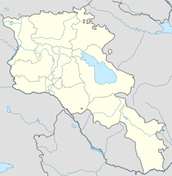
 Marmarik
Coordinates: 40°34′58″N 44°40′06″E / 40.58278°N 44.66833°E Country Armenia Marz (Province) Kotayk Population (2001) – Total 786 Time zone (UTC+4) – Summer (DST) (UTC+5) Marmarik (Armenian: Մարմարիկ; formerly, Pashkend and Pashakend) is a town in the Kotayk Province of Armenia.
References
- Marmarik at GEOnet Names Server
- Report of the results of the 2001 Armenian Census, National Statistical Service of the Republic of Armenia
Capital: HrazdanHrazdan Aghavnadzor · Artavaz · Hankavan · Hrazdan · Jrarat · Kaghsi · Lernanist · Marmarik · Meghradzor · Solak · Tsaghkadzor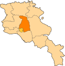
Abovyan Abovyan · Akunk · Aramus · Arinj · Arzni · Balahovit · Byureghavan · Dzoraghbyur · Garni · Geghadir · Geghard · Geghashen · Goght · Hatis · Hatsavan · Jraber · Jrvezh · Kamaris · Kaputan · Katnaghbyur · Kotayk · Mayakovski · Nor Gyugh · Nurnus · Ptghni · Radiokayanin kits · Sevaberd · Verin Ptghni · Voghjaberd · Zar · Zovashen · ZovkYeghvard Charentsavan Categories:- Populated places in Kotayk
- Kotayk geography stubs


Wikimedia Foundation. 2010.