- Crystal Springs, Alberta
-
Crystal Springs — Summer village — Summer Village of Crystal Springs Location of Crystal Springs in Alberta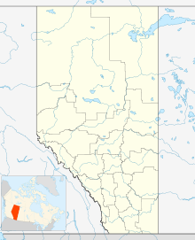

Coordinates: 52°58′52″N 114°02′47″W / 52.98110°N 114.04628°WCoordinates: 52°58′52″N 114°02′47″W / 52.98110°N 114.04628°W Country  Canada
Province  Alberta
Census division No. 11 Government[1] - Type Municipal incorporation - Mayor Walter Schlese - Governing body Crystal Springs Summer Village Council Area[2] - Total 0.58 km2 (0.2 sq mi) Population (2006)[2] - Total 112 - Density 193.1/km2 (500.1/sq mi) - Dwellings 124 Time zone MST (UTC-7) Crystal Springs is a summer village in Alberta, Canada. It is located on the South East shores of Pigeon Lake, north of Highway 13. The community borders the Village at Pigeon Lake to the South.
Demographics
In 2006, Crystal Springs had a population of 112 living in 124 dwellings, a 55.6% increase from 2001. The summer village has a land area of 0.58 km2 (0.22 sq mi) and a population density of 194.1 /km2 (503 /sq mi).[2]
See also
- List of communities in Alberta
- List of summer villages in Alberta
References
- ^ "Municipal Officials Search". Alberta Municipal Affairs. November 11, 2011. http://www.municipalaffairs.alberta.ca/mc_municipal_officials_search.cfm. Retrieved November 11, 2011.
- ^ a b c Statistics Canada (Census 2006). "Crystal Springs - Community Profile". http://www12.statcan.ca/english/census06/data/profiles/community/Details/Page.cfm?Lang=E&Geo1=CSD&Code1=4811006&Geo2=PR&Code2=48&Data=Count&SearchText=Crystal%20Springs&SearchType=Begins&SearchPR=01&B1=All&GeoLevel=&GeoCode=4811006. Retrieved 2008-06-23.
 Subdivisions of Alberta
Subdivisions Regions · Census divisions · Municipal districts (counties) · Specialized municipalities · School districts · Regional health authoritiesCommunities Cities · Towns · Villages · Summer villages · Hamlets · Indian reserves · Métis settlements · Ghost towns · Designated placesCities and Urban
Service AreasAirdrie · Brooks · Calgary · Camrose · Cold Lake · Edmonton (capital) · Fort McMurray · Fort Saskatchewan · Grande Prairie · Lacombe · Leduc · Lethbridge · Lloydminster · Medicine Hat · Red Deer · Sherwood Park · Spruce Grove · St. Albert · Wetaskiwin Category ·
  Portal ·
  WikiProjectCategories:
- Summer villages in Alberta
- Alberta geography stubs

Wikimedia Foundation. 2010.