- Espanola, New Mexico
Infobox Settlement
official_name = City of Española
settlement_type =City
motto = Serving The Community With Pride
Sources: [cite web |url=http://www.cityofespanola.org/ |title=City of Española Home Page |accessdate=2008-07-18 |publisher=City of Española] [cite web |url=http://www.newmexico.org/explore/regions/northcentral/espanola.php |title=New Mexico Tourism - Regions |accessdate=2008-07-18 |publisher=New Mexico Tourism Department] [cite news |first= |last= |title=First Capitol City in America |url=http://www.cityofespanola.org/ |work=COE |date=2008-09-30 |accessdate= ] [cite book
last = Penland
first = Paige R.
authorlink = Paige R. Penland
title = Lowrider
coauthors = Adán V. Baca
date = 2003
publisher = MotorBooks/MBI Publishing Company
isbn = 076031599X]
nickname = The Jewel of Northern New Mexico
First Capitol City in America
The Lowrider Capital of the World
Sundevil Country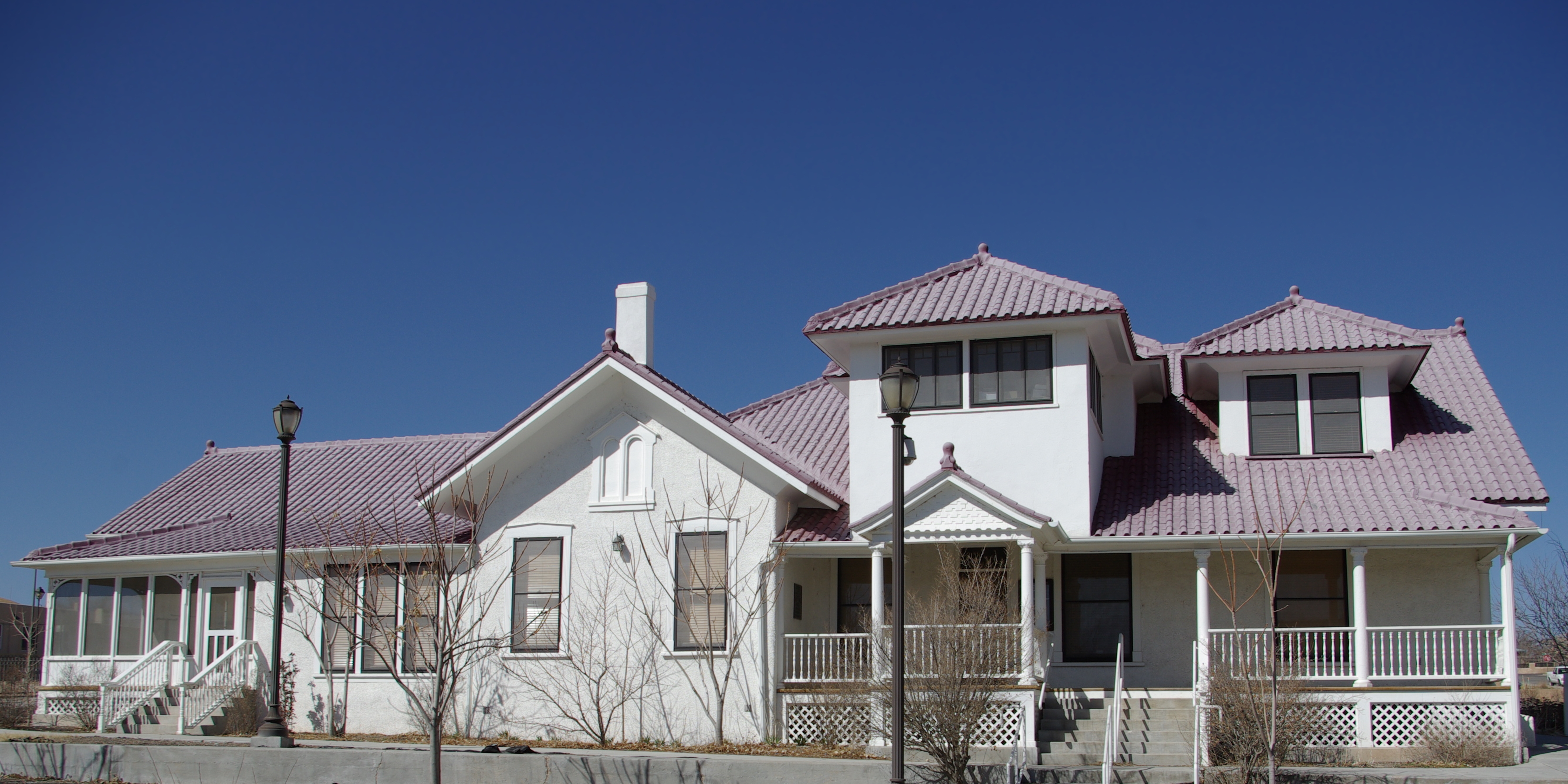
imagesize = 250px
image_caption = The Bond House Museum, Old City Hall Building.
image_
seal_size = 111px
subdivision_type = Country
subdivision_type1 = State
subdivision_type2 = County
subdivision_name =United States
subdivision_name1 =New Mexico
subdivision_name2 = Rio Arriba, Santa Fe
government_type =Mayor-council government
leader_title =Mayor
leader_name = Joseph Joe Maestas 1st Term (D)
established_title = Founded
established_title2 = Incorporated
established_date2 = 1925
established_date = 1598 [cite web
title = About Española, New Mexico
url = http://espanolaonline.com/aboutespanola.htm
accessdate = 2007-10-11]
mapsize = 250px
map_caption = Location of Espanola, New Mexico
mapsize1 =
map_caption1 =
unit_pref = Imperial
area_footnotes =
area_magnitude =
area_total_km2 = 21.9
area_land_km2 = 21.7
area_water_km2 = 0.2
area_total_sq_mi =
area_land_sq_mi =
area_water_sq_mi =
population_as_of = 2007
population_footnotes = cite web
url= http://www.census.gov/popest/cities/tables/SUB-EST2007-04-35.csv
title= Table 4: Annual Estimates of the Population for Incorporated Places in New Mexico, Listed Alphabetically: April 1, 2000 to July 1, 2007 (SUB-EST2007-04-35)
accessdate= 2008-07-15
date= 2008-07-10
publisher= US Census Bureau, Population Division] [cite web | url = http://www.census.gov/popest/metro/tables/2007/CBSA-EST2007-02.csv | title = Table 2. Annual Estimates of the Population of Combined Statistical Areas: April 1, 2000 to July 1, 2007 (CBSA-EST2007-02) | format = CSV | work = 2007 Population Estimates | publisher =United States Census Bureau , Population Division | date =2008-03-27 | accessdate = 2008-03-30]
population_metro = 183,782 (Santa Fe-Espanola CSA )
population_total = 9549
population_density_km2 = 440.0
population_density_sq_mi =
postal_code_type =ZIP code s
postal_code = 87532, 87533
area_code = 505
blank_name = FIPS code
blank_info = 35-25170
blank1_name = GNIS feature ID
blank1_info = 928729
website = [http://www.cityofespanola.org/ City of Española]
footnotes =
named_for = See Early historyEspañola is a city primarily in Rio Arriba County,
New Mexico . A portion of the southern section of the city is in Santa Fe County. Espanola, incorporated in 1925, is situated in an area thatJuan de Oñate declared a capital for Spain in 1598. The location is considered to be the first Capitol City in America [cite news |first= |last= |title=First Capitol City in America |url=http://www.cityofespanola.org/ |work=COE |date=2008-09-30 |accessdate= ] . At the 2000 census the city had a total population of 9,629cite web
url= http://www.census.gov/popest/cities/tables/SUB-EST2007-04-35.csv
title= Table 4: Annual Estimates of the Population for Incorporated Places in New Mexico, Listed Alphabetically: April 1, 2000 to July 1, 2007 (SUB-EST2007-04-35)
accessdate= 2008-07-15
date= 2008-07-10
publisher= US Census Bureau, Population Division] . Española is within theSanta Fe-Espanola Combined Statistical Area .History
Early history
The area now known as Espanola was the first European-founded capital of the "New World" (see below). In 1880, when the
Denver and Rio Grande Railroad (the "Chile Line") was being constructed in the area, Amado Lucero and his wife Josefita opened a restaurant to accommodate the railroad workers. The daughter of the famous Don Rafael Lopez of Santa Fe, Josefita could easily trace her roots to the earliest Spanish settlers of the region. Consequently, the railroad workers referred to the restaurant as "Espanola's", that is, the Spanish lady's restaurant. Soon the railroad started calling the area "Espanola" and the name stuck [Rio Grande Sun, Historical Issue on City of Espanola, 1961-62] . Amado, Josefita and their daughter Eliza Lucero Hill are buried at the foot of the altar inside the Church of the Holy Cross in nearby Santa Cruz. Descendants of theirs continue to reside in the Espanola Valley.Espanola has grown to include many of the adjacent rural communities. This includes the area in which Don
Juan de Oñate declared a capital forSpain in 1598. Oñate arrived in the Espanola Valley onJuly 11 1598 at the confluence of the Chama River and the Rio Grande, where he established a camp at a place then called Yunque-Yunque. He created a Spanish settlement in an area already inhabited by the indigenous descendants of theAnasazi . The treatment of the natives was typical of theConquistador es at that time, with enslavement and brutality being a mainstay, despite the initially warm welcome.Recent history
In 1998, Espanola celebrated the 400th Anniversary of the colonization by the Spanish and the founding of the first permeant European colony in North America. Though the event was celebratory for some and controversial for others, someone cut the foot off of a sculpture of
Juan de Oñate in the Oñate Monument Visitors Center to protest the recently erected monument.Fact|date=October 2008 This action is believed to be prompted Oñate's having the foot ofAcoma Pueblo warriors cut off in retaliation for the killing of his nephew.Fact|date=October 2008Heroin use in the area increased rapidly beginning in the 1970s. In the period 2001–2005, Rio Arriba County had the highest per capita rate of drug fatalities in the country, with 42.5 deaths per 100,000 population compared to 7.3 nationally. [cite news |first=Erik |last=Eckholm |title=A Grim Tradition, and a Long Struggle to End It |url=http://www.nytimes.com/2008/04/02/us/02overdose.html?pagewanted=print |work=New York Times |date=2008-04-02 |accessdate=2008-09-30 ]
Obama Visit
On September 18, 2008 Barack Obama, Democratic nominee for President of the United States, visited Espanola for a rally at the city's New Plaza in the Main Street district. Nearly 10,000 people packed the Plaza from around the Espanola Valley. [cite news
url = http://www.koat.com/politics/17479462/detail.html?rss=alb&psp=news
last =
first =
authorlink =
title = Obama Visits Espanola
coauthors =
date = September 18, 2008
publisher = KOAT 7 News] [cite news
url = http://www.santafenewmexican.com/Local%20News/Espa-amp-ntilde-ola-Town-braces-for-Obama-rally
last =
first =
authorlink =
title = Obama Rally In Espanola
coauthors =
date = September 18, 2008
publisher = Santa Fe New Mexican] Espanola has a large number of Hispanics and a large majority are Democrats.Fact|date=September 2008Geography
Espanola is located at coor dms|36|0|7|N|106|3|53|W| (36.001884, -106.064587).GR|1
According to the
United States Census Bureau , the city has a total area of 21.9square kilometer s (8.5 square miles). 21.7 square kilometers (8.4 square miles) of it is land and 0.2 square kilometers (0.1 square miles) of it is water. The total area covered by water is 0.83%.Espanola is over a mile high at an elevation of around convert|5595|ft|m with much variance. It is in a valley nestled between the Jemez and Sangre de Cristo mountain ranges, and the meeting point of three rivers, the
Rio Grande , theRio Chama , and the Rio Santa Cruz.Because of Espanola's geographical location, it serves as the economic hub for north central New Mexico.Fact|date=September 2008 The communities of Chimayo, Alcalde, Velarde, Hernandez,Truchas, Cordova, Dixon, Chama, Tierra Amarilla, La Puebla, Arroyo Seco are all in close proximity and are economically dependent on the City of Espanola and utilize stores, banks and restaurants.Fact|date=September 2008 The greater Espanola Valley has a population of 35,500 people.
Climate
July is the warmest month in Espanola, the Average is 91°F. The highest recorded temperature was 107°F in 2003. The average coolest month is January at 45°F. The lowest recorded temperature was -38°F in 1971. The maximum average precipitation occurs in August with an average of 1.90 inches.
Infobox Weather
single_line=Yes
location = Espanola, New Mexico
Jan_Hi_°F =45 |Jan_REC_Hi_°F =67
Feb_Hi_°F =52 |Feb_REC_Hi_°F =75
Mar_Hi_°F =60 |Mar_REC_Hi_°F =84
Apr_Hi_°F =69 |Apr_REC_Hi_°F =88
May_Hi_°F =78 |May_REC_Hi_°F =98
Jun_Hi_°F =88 |Jun_REC_Hi_°F =105
Jul_Hi_°F =91 |Jul_REC_Hi_°F =107
Aug_Hi_°F =87 |Aug_REC_Hi_°F =103
Sep_Hi_°F =81 |Sep_REC_Hi_°F =99
Oct_Hi_°F =72 |Oct_REC_Hi_°F =89
Nov_Hi_°F =58 |Nov_REC_Hi_°F =84
Dec_Hi_°F =47 |Dec_REC_Hi_°F =72
Jan_Lo_°F =14 |Jan_REC_Lo_°F =-38
Feb_Lo_°F =20 |Feb_REC_Lo_°F =-11
Mar_Lo_°F =26 |Mar_REC_Lo_°F =0
Apr_Lo_°F =33 |Apr_REC_Lo_°F =14
May_Lo_°F =41 |May_REC_Lo_°F =17
Jun_Lo_°F =50 |Jun_REC_Lo_°F =28
Jul_Lo_°F =57 |Jul_REC_Lo_°F =35
Aug_Lo_°F =55 |Aug_REC_Lo_°F =37
Sep_Lo_°F =47 |Sep_REC_Lo_°F =25
Oct_Lo_°F =34 |Oct_REC_Lo_°F =10
Nov_Lo_°F =24 |Nov_REC_Lo_°F =-21
Dec_Lo_°F =15 |Dec_REC_Lo_°F =-16
Jan_Precip_inch =0.40
Feb_Precip_inch =0.40
Mar_Precip_inch =0.60
Apr_Precip_inch =0.60
May_Precip_inch =0.70
Jun_Precip_inch =0.70
Jul_Precip_inch =1.60
Aug_Precip_inch =1.90
Sep_Precip_inch =1.20
Oct_Precip_inch =0.90
Nov_Precip_inch =0.60
Dec_Precip_inch =0.50
source =weather.com cite web
url =http://www.weather.com/outlook/travel/businesstraveler/wxclimatology/monthly/graph/87532?from=dayDetails_bottomnav_business | title =Monthly Averages for Esapnola, NM| accessmonthday =Aug 20 | accessyear =2008
publisher = | language = ]
accessdate =Demographics
At the
census GR|2 of 2000, there were 9,688 people, 5,751 households, and 4,569 families residing in the city. Thepopulation density was 1,155.4 people per square mile (446.4/km²). There were 5,107 housing units at an average density of 189.2/square kilometer (489.8/square mile). The racial makeup of the city was 67.55% White, 0.58% African American, 2.86% Native American, 0.14% Asian, 0.06% Pacific Islander, 25.56% from other races, and 3.25% from two or more races. 84.38% of the population were Hispanic or Latino of any race.There were 5,751 households, of which 35.6% had children under the age of eighteen living with them, 42.5% were married couples living together, 18.5% had a female householder with no husband present, and 31.5% were non-families. 26.2% of all households were made up of single individuals, and 9.7% had someone living alone who was sixty-five years of age or older. The average household size was 2.56 and the average family size was 3.08.
In the city the population was spread out, with 27.8% under the age of 18, 9.7% from 18 to 24, 28.1% from 25 to 44, 22.1% from 45 to 64, and 12.3% who were 65 years of age or older. The median age was thirty-four years. For every 100 females there were 95.3 males. For every 100 females aged eighteen and over, there were 94.6 males.
The median income for a household in the city was $27,144, and the median income for a family was $32,255. Males had a median income of $25,558 versus $23,177 for females. The
per capita income for the city was $14,303. 21.6% of the population and 16.5% of families were below thepoverty line . Out of the total population, 28.4% of those under the age of eighteen and 15.1% of those sixty-five and older were living below the poverty line.Economy
An Arizona-based arts and crafts company will likely build a store in town soon; a major health food grocer is also expressing interest in building an Espanola store. Computer and communications firms are moving in, some planning new buildings, others starting-up in home offices. A Wal-Mart opened in 1999 creating 400+ jobs, Lowe's Home Inprovement opened in 2006 adding another 300+ Jobs. Many of the residents are employed at near-by
Los Alamos National Laboratory as well.At Espanola Industrial Park, Nambe Mills (relocated from Santa Fe in what will be a multi-phase move of their entire silver working operation) is in the forefront of an industrial expansion that may soon see a host of businesses taking advantage of the city's relatively low-cost industrial land.
Agriculture
The "acequias", or irrigation ditches, set up by the Spanish helped them to prosper as an agrarian society. These life-giving lines are, in some ways, the only things that remain unchanged in Espanola today. While there is a tangible feeling of pride for culture and family amongst Hispanics and natives, there is an ever-increasing influence and presence of people that do not belong to either of these groups.
The prosperous agrarian society of the natives and the Spanish was replaced by a money-based system with the introduction of the railroad. As is typical throughout history, this disadvantaged many locals. They were forced to adopt a system for which they lacked the education. Many continued to farm, and their families still do today; however, they were taught to farm to sell rather than to sustain, and so were also disadvantaged. With poverty and gentrification came fewer resources for the community.
Largest employers
* Los Alamos National Labs
* Espanola Valley Transit-Mix
* San Juan Mining & Mineral Plant
* Espanola Valley Hospital
* Wal-Mart
* City Government
* Lowe's Home-ImprovementArts and Culture
Immigrant culture
There has been a steady influx of documented immigration to the Valley for the last decade, which has significantly increased their visibility and influence in the area. Espanola (especially the neighboring community of Sombrillo) is also home to the largest community of ethnically diverse
Sikh s in the world. While most Sikhs descend from the Punjab region of India and Pakistan, the Sikhs in Espanola come from all over the world,Fact|date=March 2008 and continue to attract people from these locations, which adds to the cultural mix that is Espanola.Lowriders
Some time after lowriding had appeared in Espanola in the early 1950s, the city had dubbed itself "Lowrider Capital of the World". It was only by 1993 that
MTV had broadcast that title to the rest of the world. [cite book
last = Penland
first = Paige R.
authorlink = Paige R. Penland
title = Lowrider
coauthors = Adán V. Baca
date = 2003
publisher = MotorBooks/MBI Publishing Company
isbn = 076031599X]Activities
Espanola's restaurants and convenience stores are popular with travelers between Santa Fe and northern communities, as well as with local people. The local fiestas are held in the fall and include live New Mexican-style Spanish or country music, vendors, and many locals. Every Friday and Saturday night the streets fill with cruisers.
There are many locations near Espanola to do almost any outdoor activity such as hiking, biking, and river sports like rafting and kayaking. Nearby winter sports include skiing (downhill and cross-country) and snowboarding.
Parks and Recreation
Community Aquatic centers
* Penny Roybal Garcia Aquatic Center
* Richard R. Lucero Aquatic CenterCommunity Parks
* Mainstreet Park & Plaza
* Ranchitos Park
* Valdez Memorial Park
* Senior Veteran Memorial ParkGovernment
The city of Española is served by an elected four-year term
mayor and a eight-membercity council . The Española City Council is the legislative authority of the city, and has the power to adopt all ordinances, resolutions, or other legislation. The council members are elected from the eight council districts on four-year terms, with four districted Councilors elected every two years. One of the council members is elected by the members of the council to be the mayor tempore. The mayor can approve orveto any decision made by the council. However, the council can override the mayor's veto with a five out of eight member vote. [cite web |url=http://www.cityofespanola.org/city-government.html |title=Espanola Government |accessdate=2008-10-30 |publisher=COE]Education
Elementary schools
*
James H. Rodriguez Elementary
*Eutimo Tim Salazar (Fairview) Elementary
*Tony E. Quintana (Sombrillo) ElementaryMiddle schools
*Carlos F. Vigil Middle School
*Espanola Middle School EastHigh schools
*
Española Valley High School
*McCurdy High School
*Española Military Academy , founded in September 2004, is acollege preparatory charter school with a military structure. The academic program includes four years of ArmyJunior ROTC . [cite web |url=http://ema.k12.nm.us/admissions1.html |title=EMA Admissions |accessdate=2008-09-16 |publisher=Española Military Academy ] [cite web |url=http://www.lanl.gov/news/index.php/fuseaction/nb.story/story_id/%205956 |title=KSL donates laptops to Española Military Academy |accessdate=2008-09-16 |publisher=Los Alamos National Laboratory |date=2004-12-08 ]Colleges
*
Northern New Mexico College Public Community Libraries
*
Richard Lucero Center References
External links
* [http://www.cityofespanola.org/index.html City website]
* [http://www.espanolaonline.com Community website]
* [http://www.espanolanmchamber.com Chamber of Commerce]
* [http://www.mccurdy.org McCurdy School]
* [http://www.riograndesun.com Rio Grande Sun - Local Newspaper]

Wikimedia Foundation. 2010.