- North Mankato, Minnesota
-
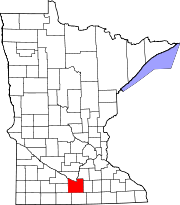
North Mankato — City — Location of North Mankato in Minnesota
Coordinates: 44°10′12.04″N 94°00′49.61″W / 44.1700111°N 94.0137806°WCoordinates: 44°10′12.04″N 94°00′49.61″W / 44.1700111°N 94.0137806°W Country United States State Minnesota Counties Nicollet, Blue Earth Government – Type Mayor – Council – Mayor Mark Dehen Area – Total 4.8 sq mi (12.4 km2) – Land 4.7 sq mi (12.2 km2) – Water 0.1 sq mi (0.2 km2) Elevation 781 ft (238 m) Population (2010)[1] – Total 13,394 – Density 2,502.5/sq mi (967.1/km2) Time zone CST (UTC-6) – Summer (DST) CDT (UTC-5) ZIP code 56003 Area code(s) 507 FIPS code 27-47068[2] GNIS feature ID 0648669[3] Website northmankato.com North Mankato is a city in Nicollet and Blue Earth counties in the U.S. state of Minnesota. The population was 13,394 at the 2010 census.[1]
While most of the city is in Nicollet County, it extends into Blue Earth County a small amount as well. It is neighbored to the south across the Minnesota River by Mankato. The two cities have a combined population of nearly 53,000. North Mankato is the smaller of the two principal cities of the Mankato-North Mankato Metropolitan Statistical Area, a metropolitan area that covers Blue Earth and Nicollet counties.[4]
North Mankato was incorporated as a village in 1898.
U.S. Routes 14 and 169 and Minnesota State Highway 60 are three of the main arterial routes in the city.
Contents
Geography
According to the United States Census Bureau, the city has a total area of 4.8 square miles (12.4 km²), of which, 4.7 square miles (12.2 km²) of it is land and 0.1 square miles (0.2 km²) of it (1.67%) is water.
Demographics
Historical populations Census Pop. %± 1900 939 — 1910 1,279 36.2% 1920 1,840 43.9% 1930 2,822 53.4% 1940 3,517 24.6% 1950 4,788 36.1% 1960 5,927 23.8% 1970 7,347 24.0% 1980 9,145 24.5% 1990 10,164 11.1% 2000 11,798 16.1% 2010 13,394 13.5% U.S. Decennial Census As of the census[2] of 2000, there were 11,798 people, 4,744 households, and 3,178 families residing in the city. The population density was 2,502.5 people per square mile (967.1/km²). There were 5,046 housing units at an average density of 1,070.3 per square mile (413.6/km²). The racial makeup of the city was 96.47% White, 0.65% African American, 0.24% Native American, 1.38% Asian, 0.03% Pacific Islander, 0.44% from other races, and 0.79% from two or more races. Hispanic or Latino of any race were 1.59% of the population.
There were 4,744 households out of which 35.7% had children under the age of 18 living with them, 55.0% were married couples living together, 9.0% had a female householder with no husband present, and 33.0% were non-families. 24.7% of all households were made up of individuals and 7.3% had someone living alone who was 65 years of age or older. The average household size was 2.48 and the average family size was 2.99.
In the city the population was spread out with 26.3% under the age of 18, 10.9% from 18 to 24, 30.6% from 25 to 44, 22.5% from 45 to 64, and 9.6% who were 65 years of age or older. The median age was 33 years. For every 100 females there were 96.1 males. For every 100 females age 18 and over, there were 93.1 males.
The median income for a household in the city was $48,816, and the median income for a family was $59,265. Males had a median income of $38,720 versus $25,713 for females. The per capita income for the city was $23,916. About 5.3% of families and 7.0% of the population were below the poverty line, including 7.8% of those under age 18 and 7.2% of those age 65 or over.
Education
 The old North Mankato Public School building, now Belltower Apartments, is listed on the National Register of Historic Places.
- Hoover Elementary School
- Monroe Elementary School
- Garfield 6th Grade Elementary School
- Dakota Meadows Middle School
- South Central College
Corporations
- Taylor Corporation
References
- ^ a b "2010 Census Redistricting Data (Public Law 94-171) Summary File". American FactFinder. United States Census Bureau. http://factfinder2.census.gov/faces/tableservices/jsf/pages/productview.xhtml?pid=DEC_10_PL_GCTPL2.ST13&prodType=table. Retrieved 27 April 2011.
- ^ a b "American FactFinder". United States Census Bureau. http://factfinder.census.gov. Retrieved 2008-01-31.
- ^ "US Board on Geographic Names". United States Geological Survey. 2007-10-25. http://geonames.usgs.gov. Retrieved 2008-01-31.
- ^ "METROPOLITAN AND MICROPOLITAN STATISTICAL AREAS AND COMPONENTS, December 2009, WITH CODES". United States Census Bureau, Population Division. http://www.census.gov/population/www/metroareas/lists/2009/List1.txt. Retrieved 27 April 2011.
External links
Municipalities and communities of Blue Earth County, Minnesota Cities Amboy | Eagle Lake | Good Thunder | Lake Crystal | Madison Lake | Mankato‡ | Mapleton | Minnesota Lake‡ | North Mankato‡ | Pemberton | Skyline | St. Clair | Vernon Center
Townships Beauford | Butternut Valley | Cambria | Ceresco | Danville | Decoria | Garden City | Jamestown | Judson | Le Ray | Lime | Lincoln | Lyra | Mankato | Mapleton | McPherson | Medo | Pleasant Mound | Rapidan | Shelby | South Bend | Sterling | Vernon Center
Footnotes ‡This populated place also has portions in an adjacent county or counties
Municipalities and communities of Nicollet County, Minnesota Cities 
Townships Belgrade | Bernadotte | Brighton | Courtland | Granby | Lafayette | Lake Prairie | New Sweden | Nicollet | Oshawa | Ridgely | Traverse | West Newton
Unincorporated
communitiesFootnotes ‡This populated place also has portions in an adjacent county or counties
Categories:- Cities in Minnesota
- Populated places in Nicollet County, Minnesota
- Populated places in Blue Earth County, Minnesota
- Mankato – North Mankato metropolitan area


Wikimedia Foundation. 2010.