- Mahayag, Zamboanga del Sur
-
Mahayag — Municipality — Town hall Map of Zamboanga del Sur showing the location of Mahayag
 Location in the Philippines
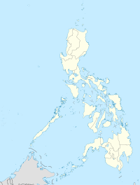
 Mahayag
Coordinates: 8°08′N 123°23′E / 8.133°N 123.383°ECoordinates: 8°08′N 123°23′E / 8.133°N 123.383°E Country  Philippines
Region Western Mindanao (Region IX) Province Zamboanga del Sur District 1st District of Zamboanga del Sur Founded March 9, 1960 Barangays 29 Government – Mayor Lorna Saycon Espina Area – Total 194.90 km2 (75.3 sq mi) Population (2007) – Total 44,087 – Density 226.2/km2 (585.9/sq mi) Time zone PST (UTC+8) ZIP code 7026 Income class 3rd class town; Partially Urban Mahayag is a 3rd class municipality in the province of Zamboanga del Sur, Philippines. According to the 2000 census, it has a population of 42,462 people in 8,026 households.
Contents
History
The town's name is derived from the Cebuano term "mahayag" (ma=to become + hayag=bright) which means to become bright or sunny. When the Visayan migrants first trickled into the area after WW-II, the place was heavily forested, which, to some looks dark and forbidding. Local historical sources had it that when a large "Dao" tree which stands in the townsite was felt, the place becomes bright, hence the expression "mahayag".
Mahayag used to be sitio of barangay Molave of the municipality of Aurora. Early settlers of the area had endeavored for the creation of another municipality to fast-track development which is possible only by having a distinct political subdivision from the municipality of Molave. The town site for the new municipality was donated by Messrs Zacarias dela Torre and Pedro Alquizar.
The municipality of Mahayag was officially created on March 9, 1960, pursuant to Executive Order No. 393 by former President Carlos P. Garcia , with Saturnino Mendoza as its first appointed and subsequently elected Municipal Mayor. Hon. Lorna Saycon Espina, the incumbent Municipal mayor, is the 9th Municipal Mayor of the Municipality of Mahayag. Past mayors include Hon. Paulino P. Fanilag, Hon. Carlito A. Lumacang as OIC-Mayor following the EDSA I Revolution, and Hon. Perpetuo C. Apale, the appointed Officer-in-Charge in the Office of the Municipal Mayor during the first election after the ratification of the 1987 Constitution.
Barangays
Mahayag is politically subdivided into 29 barangays.
- Bag-ong Balamban
- Bag-ong Dalaguete
- Boniao
- Delusom
- Diwan
- Guripan
- Kaangayan
- Kabuhi
- Lourmah (Lower Mahayag)
- Lower Salug Daku
- Lower Santo Niño
- Malubo
- Manguiles
- Marabanan (Balanan)
- Panagaan
- Paraiso
- Pedagan
- Poblacion (Upper Mahayag)
- Pugwan
- San Isidro
- San Jose
- San Vicente
- Santa Cruz
- Sicpao
- Tuboran
- Tulan
- Tumapic
- Upper Salug Daku
- Upper Santo Niño
Education
In addition to the daycare centers in each barangay, at least one (1) public elementary school exists in each of the 29 barangays in the municipality.
There are four (4) public high schools and one private highschool run by the Catholic Church in the municipality.
Although permitted to operate and offer Collegiate courses since the later part of the 1990s, no tertiary courses had been offered by the Santa Maria Goretti College except during the time when it served as an extension campus of the Saint Columban College (Pagadian).
College students who cannot afford to obtain their education from far places like Ozamiz or Pagadian, may still attend college at the Pagadian Institute of Technology (PIT) campus in Mahayag, and Josefina H. Cerilles State College.
Municipal officials
- 2010-2013 Municipal officials
- Mayor: Lorna S. Espina
- Vice Mayor: Paulino P. Fanilag Sr.
- Councilors
- Kristoffer Dan Lambatan
- Teotimo Aclon
- Jeffrey Artiaga
- Rodulfo Caylan
- Judandre Apale
- Felipe Capadngan
- Felpa Naval
- Raquel Frasco
Tourist destinations
Mahayag is also rich in naturals resources reserve. Tuburan, a remote barangay on the eastern part of the town, is famous for its cold and freezing natural springs. Three private resorts and swimming pools were put up to cater adventurous spirits.
External links
Municipalities Component city - Pagadian
Categories:- Municipalities of Zamboanga del Sur


Wikimedia Foundation. 2010.