- Milton Keynes
-
For Milton Keynes, the original village, see Milton Keynes Village.
Coordinates: 52°02′10″N 0°46′12″W / 52.036°N 0.770°W
Milton Keynes 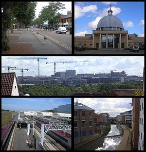
Clockwise from top left: Bletchley's high Street "Queensway", Christ the Cornerstone Church, the Central Milton Keynes skyline, former railway works and new housing in Wolverton and Milton Keynes Central railway station.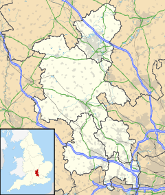
 Milton Keynes
Milton Keynes shown within BuckinghamshireArea 89 km2 (34 sq mi) Population 195,687 (2008 estimate)[1] - Density 2,199 /km2 (5,700 /sq mi) OS grid reference SP841386 - London 47.9 miles (77.1 km) Unitary authority Milton Keynes Ceremonial county Buckinghamshire Region South East Country England Sovereign state United Kingdom Post town MILTON KEYNES Postcode district MK1–15 Dialling code 01908 Police Thames Valley Fire Buckinghamshire Ambulance South Central EU Parliament South East England UK Parliament Milton Keynes North Milton Keynes South Website http://www.milton-keynes.gov.uk List of places: UK • England • Buckinghamshire Milton Keynes (
 i/ˈkiːnz/ keenz), sometimes abbreviated MK, is a large town in Buckinghamshire, in the south east of England, about 49 miles (79 km) north-west of London. It is the administrative centre of the Borough of Milton Keynes. It was formally designated as a new town on 23 January 1967, with the design brief to become a 'city' in scale.
At designation, its 89 km2 (34 sq mi) area incorporated the existing towns of Bletchley, Wolverton and Stony Stratford along with another fifteen villages and farmland in between. It took its name from the existing village of Milton Keynes, a few miles east of the planned centre.
At the 2001 census the population of the Milton Keynes urban area, including the adjacent Newport Pagnell, was 184,506, and that of the wider borough, which has been a unitary authority independent of Buckinghamshire County Council since 1997, was 207,063 (compared with a population of around 53,000 for the same area in 1961[2]). The Borough’s population in 2009 is estimated to be nearly 241,000,[3] with almost all the increase arising in the urban area.
History
Main article: History of Milton KeynesBirth of a "New City"
In the 1960s, the UK Government decided that a further generation of new towns in the South East was needed to relieve housing congestion in London.
 Population trend of Borough and Urban Area 1801–2001
Since the 1950s, overspill housing for several London boroughs[4][5][6] had been constructed in Bletchley. Further studies[7][8] in the 1960s identified north Buckinghamshire as a possible site for a large new town, a new city,[9] encompassing the existing towns of Bletchley, Stony Stratford and Wolverton. The New Town (informally, "New City") was to be the biggest yet, with a target population of 250,000,[10] in a 'designated area' of 21,850 acres (34.1 sq mi; 88.4 km2).[11] The name "Milton Keynes" was taken from the existing village of Milton Keynes on the site.[12]
The site was deliberately located equidistant from London, Birmingham, Leicester, Oxford and Cambridge with the intention[13] that it would be self-sustaining and eventually become a major regional centre in its own right. Planning control was taken from elected local authorities and delegated to the Milton Keynes Development Corporation (MKDC).
The Corporation's strongly modernist designs featured regularly in the magazines Architectural Design and the Architects' Journal. MKDC was determined to learn from the mistakes made in the earlier New Towns and revisit the Garden City ideals. They set in place the characteristic grid roads that run between districts, as well as the intensive planting, lakes and parkland that are so evident today. Central Milton Keynes was not intended to be a traditional town centre but a business and shopping district that supplemented the Local Centres in most of the Grid Squares.[12] This non-hierarchical devolved city plan was a departure from the English New Towns tradition and envisaged a wide range of industry and diversity of housing styles and tenures across the city. The largest and almost the last of the British New Towns, Milton Keynes has stood the test of time far better than most, and has proved flexible and adaptable.[14] The radical grid plan was inspired by the work of Californian urban theorist Melvin M. Webber (1921–2006), described by the founding architect of Milton Keynes, Derek Walker, as the "father of the city".[15] Webber thought that telecommunications meant that the old idea of a city as a concentric cluster was out of date and that cities which enabled people to travel around them readily would be the thing of the future achieving "community without propinquity" for residents.[16] With both car ownership and ever more emphasis on e-commerce, his ideas, launched in the 1960s, have proved far-sighted.
The Government wound up MKDC in 1992, 25 years after the new town was created, transferring control to the Commission for New Towns (CNT) and then finally to English Partnerships, with the planning function returning to local authority control (since 1974 and the Local Government Act 1972, the Milton Keynes Borough Council, which was subsequently made a unitary authority in the 1990s). Since 2004 a Government quango, the Milton Keynes Partnership, has development control powers to accelerate the growth of Milton Keynes.
Along with many other towns and boroughs, Milton Keynes competed for formal city status in the 2000 and 2002 competitions, but was not ultimately successful. Nevertheless, the terms 'city' and 'city centre' are widely used by its citizens, local media and bus services to describe itself, perhaps because the term 'town' is taken to mean one of the constituent towns.
Prior history
Main article: History of Milton Keynes
The area that was to become Milton Keynes encompassed a landscape that has a rich historic legacy. The area to be developed was largely farmland and undeveloped villages, but with evidence of permanent settlement dating back to the Bronze Age. Before construction began, every area was subject to detailed archaeological investigation: doing so has provided a unique insight into the history of a large sample of the landscape of south-central England. There is evidence of Iron Age, Romano-British, Anglo-Saxon, Anglo-Norman, Medieval and Industrial revolution settlements. Collections [3] of oral history covering the 20th century completes a picture that is described in detail in another article.
When the boundary of Milton Keynes was defined in 1967, some 40,000 people[17] lived in three towns and seven villages in the "designated area" of 21,863 acres (88.48 km2).
Urban design
- The concepts that heavily influenced the design of the town are described in detail in article urban planning – see 'cells' under Planning and aesthetics (referring to grid squares).See also article single-use zoning.
Since the radical plan form and large scale of Milton Keynes attracted international attention, early phases of the town include work by celebrated architects, including (Sir) Richard MacCormac, (Lord) Norman Foster, Henning Larsen, Ralph Erskine, John Winter, and Martin Richardson.[18] The Corporation itself attracted talented young architects led by the young and charismatic Derek Walker. Though strongly committed to sleek "Miesian" minimalism inspired by the German/American architect Mies van der Rohe they also developed a strand of contextualism in advance of the wider adoption of commercial Post-Modernism as an architectural style in the 1980s. In the Miesian tradition were the Pineham Sewage Works, which Derek Walker regarded as his finest achievement, and the Shopping Building designed by Stuart Mosscrop and Christopher Woodward, which the Twentieth Century Society inter alia regards as the finest twentieth century retail building in Britain. The contextual tradition that ran alongside it is best exemplified by the Corporation's infill scheme at Cofferidge Close, Stony Stratford, designed by Wayland Tunley, which carefully inserts into a historic stretch of High Street a modern retail facility, offices and car park. The Development Corporation also led an ambitious Public art programme.
Grid squares
The geography of Milton Keynes – the railway line, Watling Street, Grand Union Canal, M1 motorway – sets up a very strong north-south axis. If you've got to build a city between (them) it is very natural to take a pen and draw the rungs of a ladder. Ten miles by six is the size of this city – 22,000 acres. Do you lay it out like an American city, rigid orthogonal from side to side? Being more sensitive in 1966-7, the designers decided that the grid concept should apply but should be a lazy grid following the flow of land, its valleys, its ebbs and flows. That would be nicer to look at, more economical and efficient to build, and would sit more beautifully as a landscape intervention.
Professor David Lock, MBE[19]Main article: Milton Keynes grid road system, and List of districts in Milton KeynesMilton Keynes Development Corporation planned the major road layout according to street hierarchy principles, using a grid pattern of approximately 1 kilometre (0.62 mi) interval, rather than on the more conventional radial pattern found in older settlements. Major internal roads run between communities, rather than through them: these distributor roads are known locally as grid roads and the spaces between them – the districts – are known as grid squares.[20] Intervals of 1 kilometre (0.62 mi) were chosen so that people would always be within walking distance of a bus stop. Consequently each grid square is a semi-autonomous community, making a unique collective of 100 clearly identifiable neighbourhoods within the overall urban environment. The grid squares have a variety of development styles, ranging from conventional urban development and industrial parks to original rural and modern urban and pseudo-rural developments. Most grid squares have Local Centres, intended as local retail hubs and most with community facilities as well. Originally intended under the Master Plan to sit alongside the Grid Roads, the Local Centres were mostly in fact built embedded in the communities and some are becoming unviable as a result of this and pressure from the new hypermarkets.[citation needed]
Roads and cycleways
Main articles: Milton Keynes redway system and Segregated cycle facilitiesRoundabout junctions were built at intersections because the grid roads were intended to carry large volumes of traffic: this type of junction is efficient at dealing with these volumes. The major roads are dual carriageway, the others are single carriageway. Along one side of each single-carriageway grid road there is a (grassed) reservation to permit dualling or additional transport infrastructure at a later date. The edges of each grid square are landscaped and densely planted, some additionally have berms. The purpose of the berms is to reduce traffic noise for adjacent residents, but traffic noise can be significant at many locations even some distance from the grid roads.[citation needed] Traffic movements are fast, with relatively little congestion since there are alternative routes to any particular destination. The national speed limit applies on dual carriageway sections of the grid roads (70 miles per hour (113 km/h)) and most single carriageway grid roads (60 miles per hour (97 km/h)), although some single carriageway speed limits have now been reduced to 40 mph (64 km/h). Consequently the risk to unwary pedestrians and turning traffic is significant, although pedestrians rarely need to cross grid roads at grade, as underpasses exist in several places along each stretch of all of the grid roads. However, the new districts to be added by the expansion plans for Milton Keynes will depart from this model, with less separation and using 'at grade' crossings. Monitoring station data[21] shows that pollution is lower than in other settlements of a similar size. This can be partially attributed to the large number of trees, especially as trees line grid roads in most places.
There is a separate cycleway network (the "redways") that runs through the grid-squares and sometimes runs alongside the grid-road network. This was designed to segregate slow moving cycle and pedestrian traffic from fast moving motor traffic. In practice, it is mainly used for leisure cycling rather than commuting, mainly because the cycle routes include many underpasses beneath the grid-roads and because they take meandering scenic routes rather than straight lines. Despite what appears to be a desirable facility, rates of cycle commuting in Milton Keynes are well below the national average for urban areas. The detailed article includes a critical appraisal.
Height
 Two of the towers of the Hub: MK development, completed in 2008. The taller building is 14 floors high.
The original design guidance declared that "no building [be] taller than the tallest tree". However, the Milton Keynes Partnership, in its expansion plans for Milton Keynes, believes that Central Milton Keynes (and elsewhere) needs "landmark buildings" and has lifted the height restriction for the area. As a result, 14-storey buildings have been built in the central business district. Some of the pedestrian underpasses have been closed in order to 'normalise' the streetscape of Central Milton Keynes and the character of the area is set to change under government pressure to increase densities of development. These changes are being opposed by pressure groups such as Urban Eden and the Milton Keynes Forum.
Recent large-scale building includes The Pinnacle MK on Midsummer Boulevard. The Pinnacle is the largest office building to be constructed in Milton Keynes in 25 years. Other developments in the pipeline include a 20-storey tower as part of the West End One development and a casino tower adjacent to the Xscape centre.[22]
Linear parks
 Caldecotte Lake, Milton Keynes
The flood plains of the Great Ouse and of its tributaries (the Ouzel and some brooks) have been protected as linear parks that run right through Milton Keynes. The Grand Union Canal is another green route (and demonstrates the level geography of the area – there is just one minor lock in its entire 10-mile (16 km) route through from Fenny Stratford to the "Iron Trunk" Aqueduct over the Ouse at Wolverton. The Milton Keynes redway system of cycleways and footpaths uses these and other routes. The Park system was designed by landscape architect Peter Youngman, who also developed landscape precepts for the whole town: groups of grid squares were to be planted with different selections of trees and shrubs in order to give them distinct identities. However the landscaping of parks and of the grid roads was evolved under the leadership of Neil Higson, who from 1977 took over as Chief Landscape Architect and made the original grand but not entirely practical landscape plan more subtle. A policy of creating "settings, strings, beads" for landscape features was introduced: 'settings' for historic villages and landscape features, 'strings' of landscape to make the linear parks hang together and 'beads' of public space where residents might linger. Higson also made the landscaping of the Grid Roads, one of the features of Milton Keynes, more subtle, with 'windows' cut into the roadside planting so that motorists travelling through had a sense of the major town they were in; early critics had said of Milton Keynes 'there is no there there', as the town could not be seen by the motorist just passing through. Now that the trees and shrubs have matured, the skill and lavish scale of the Grid Road planting makes a dramatic and welcome change from the monotony of many British towns and cities.[citation needed]
"City in the forest"
The original Development Corporation design concept aimed[15] for a "forest city" and its foresters planted millions of trees from its own nursery in Newlands in the following years. As of 2006, the urban area has 20 million trees. Following the winding up of the Development Corporation the lavish landscapes of the Grid Roads and of the major parks were transferred to The Parks Trust, a charity which is independent from the municipal authority and which was intended to resist pressures to build on the parks over time. The Parks Trust is endowed with a portfolio of commercial properties, the income of which pay for the upkeep of the green spaces, a maintenance model which has attracted international attention.[23]
Further development plans
Main article: Expansion plans for Milton KeynesIn January 2004, Deputy Prime Minister John Prescott announced[24] the Government's plan to double the population of Milton Keynes by 2026. He appointed English Partnerships to do so, taking planning controls away from Milton Keynes Borough Council and making EP the statutory planning authority. Their proposal for the next phase of expansion moves away from grid squares to large scale, mixed use, higher density development. The more detailed article expands on the details of their proposals. As the first stage in that plan, the Government expanded[25] the boundaries of the designated area, adding large green-field expansion sites to the east and west that are to be developed by 2015.
In June 2004 Milton Keynes Partnership Committee (MKPC), was created by the Government and is a committee of the Homes and Communities Agency (HCA), the national housing and regeneration agency for England. MKPC was created to ensure a co-ordinated approach to planning and delivery of growth and development in the ‘new city’.
The Partnership brings together Milton Keynes Council, HCA, Local Strategic Partnership representatives from the health, community and business sectors and independent representation.The role of MKPC is to co-ordinate and implement the delivery of growth and ensure that homes, infrastructure, jobs and community facilities are provided as part of a joined up approach.
The day-to-day activities of MKPC are carried out by its staff of management, professional and technical experts, known collectively as Milton Keynes Partnership (MKP).
Culture

The open air National Bowl is a 65,000 capacity venue for large scale events.
The 1,400 seat Milton Keynes Theatre opened in 1999. The theatre has an unusual feature: the ceiling can be lowered closing off the third tier (gallery) to create a more intimate space for smaller scale productions. There are further performance spaces in Bletchley, Wolverton, Leadenhall, Shenley Church End, Stantonbury and Walton Hall.
 Milton Keynes Gallery, surface by Michael Craig-Martin
The town's public art gallery (Milton Keynes Gallery beside the main theatre) presents free exhibitions of international contemporary art.
In Wavendon, on the southeast edge of the town, The Stables provides a venue for jazz, blues, folk, rock, classical, pop and world music. It is closely associated with jazz artists Cleo Laine and John Dankworth. The venue also hosts an annual summer camp for young musicians.
Another music venue is The Pitz Club in the Woughton Centre, Leadenhall. It usually features a mixture of punk, alternative rock, and heavy metal.
There are two museums, the Bletchley Park museum of wartime cryptography, and the Milton Keynes Museum, which includes the Stacey Hill Collection of rural life that existed before the foundation of the new town.
The town also has a literature scene, with groups like Speakeasy meeting regularly and hosting performance events, and the town's only poetry magazine, Monkey Kettle coming out twice a year. In addition, two performance poetry groups exist in the town – Poetry Kapow!, an offshoot of Monkey Kettle though now independent of the parent organisation, specialising in live, multi-discipline, interactive poetry/ art/ music events, usually featuring slams; and Tongue in Chic, a regular open mic poetry event which features headline poets such as Rachel Pantechnicon and John Hegley. Between them, the two groups supply members of Bardcore, a semi-professional group of 4–6 poets who work collaboratively on performance poetry projects.
In May 2011, the outgoing Mayor, Debbie Brock announced the appointment of Mark Niel as the first official Milton Keynes' Poet Laureate (http://www.bbc.co.uk/news/uk-england-beds-bucks-herts-13502872).
In July 2010, Milton Keynes' first independent Central Arts Centre was opened by Radio One DJ Jo Whiley. The centre is regenerated from the disused Central Bus Station and former Chicago Rock Cafe. It is home to the existing "Buszy" Skate Plaza, which is where the name for the regenerated venue has come from. It is managed and operated by Make a Difference a community interest company which in 2011 was awarded a "Big Society" award for their positive activities and opportunities for young people and the wider community. The Buszy is the social enterprise arm of Make a Difference. All profits raised by the cultural activity at the venue are re-invested into Make a Difference. The venue hosts independent cinema, live performance, gigs, art shows/exhibitions, dance activity, a thrift shop, office and conference facilities and the city's only social enterprise hub.
Milton Keynes also boasts several choirs – the OU Choir, the Milton Keynes Chorale, the New English Singers, the Cornerstone Choir, Quorum, and others, along with a variety of amateur drama groups, and amateur musical theatre groups.
In 1981, the main shopping area in the town centre was used as the filming location for the music video to Cliff Richard's hit Wired for Sound.[4]
Milton Keynes Forum is the registered civic society for the town.
Public sculpture
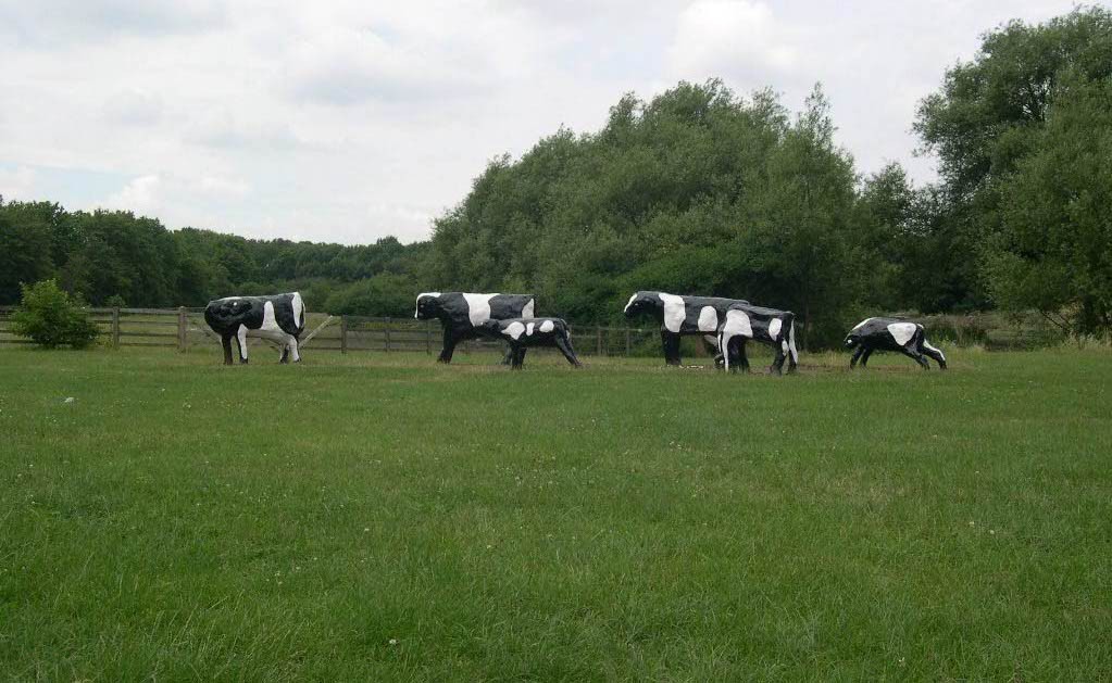
 Liz Leyh's iconic "Concrete Cows"
Public sculpture in Milton Keynes[26] includes work by Philip Jackson, Nicolas Moreton, Ronald Rae and Elisabeth Frink.
Education
 University Centre Milton Keynes.
The Open University's headquarters are based in the Walton Hall district, though as this is a distance learning institution, the only students resident on campus are approximately 200 full-time postgraduates. Cranfield University, an all-postgraduate institution, is in nearby Cranfield, Bedfordshire. Milton Keynes College provides further education up to foundation degree level, however a Postgraduate Certificate in Education[27] course is available; run in partnership with and accredited by Oxford Brookes University.
In the early-1990s a purpose built polytechnic was opened at Kents Hill in Milton Keynes, opposite the Open University's Walton Hall site. At around the time the existing Polytechnics converted to Universities, "MK Poly" merged with the former Leicester Polytechnic, De Montfort University and the site was rebranded the DMU MK site. However in recent years, DMU closed the MK site and the Open University has expanded to take over the buildings.
Although the town does not yet have its own conventional local university, its founders hope that the new University Centre Milton Keynes will be the seed for a future 'Milton Keynes University'. It is currently the UK's largest population centre without its own university proper.
Like many parts of the UK, the state secondary schools in Milton Keynes are Comprehensive schools, although schools in the rest of Buckinghamshire still use the Tripartite System. Results are above the national average, though below that of the rest of Buckinghamshire – but the demography of Milton Keynes is also far closer to the national average than is the latter. Access to selective schools is still possible in Milton Keynes as the grammar schools in Buckingham and Aylesbury accept some pupils from within the unitary authority area, with Buckinghamshire County Council operating bus services to ferry pupils to the schools.
The Safety Centre is a purpose-built interactive centre which provides safety education to visiting schools and youth groups via its full-size interactive demonstrations known as Hazard Alley.
Communications and media
Milton Keynes has two commercial radio stations, Heart Home Counties, covering Buckinghamshire, Bedfordshire, Hertfordshire and Northamptonshire and MKFM, which started in June 2011 covering Milton Keynes and the surrounding areas. BBC Three Counties Radio is the local BBC Radio station, covering Buckinghamshire, Bedfordshire and Hertfordshire, but has different programming from the Bow Brickhill transmitter at breakfast. CRMK Online is a voluntary station broadcasting on the Internet.
For television, the area is in the overlap between the Oxford and the Sandy transmitters and so receives BBC South and BBC East, and ITV Central and Anglia. Signal quality is weak in many areas due to distance and "terrain shadow".[28] It was for this reason among others that Milton Keynes has one of the first Cable TV networks in the UK. However, the cable network is now ageing and in need of modernisation to cope with the imminent digital TV switchover; many residents have already opted for roof-top aerials and satellite dishes. All homes in the post-designation and/or post expansion areas of Milton Keynes are already on-net cable homes – but (as of Jan 2011) is analogue only. Virgin Media, which leases the cable network from Openreach until 2012, have yet to announce any plans for the service thereafter. The digital switchover for the Sandy transmitter took place in two phases over March/April 2011.
Milton Keynes has two free-to-residents local newspapers, the Milton Keynes Citizen, which is twice-weekly in some areas, and the MK News, a weekly.
In the early days of land-line broadband, parts of Milton Keynes were so far from the BT exchanges as to have a poor or no service.[29] Recent work by BT to enhance its network (including FTTC and FTTP – BT Infinity) should see the issue resolved for up to 33% of customers before end of 2012[30] – but the Eastern & Western Expansion Areas, plus rural exchanges such as Woburn Sands are in the "final third of roll-outs", meaning upgrades there won't occur until the 2017 time frame at the earliest.[31]
A survey in spring 2011 reported that the performance of the broadband-over-3G service provided to customers in Milton Keynes was the slowest of the towns/cities surveyed.[32]
Sport
 The Milton Keynes Xscape seen from across Secklow Gate
 View towards the North Stand as of 9 June 2009 in an England U21 international at stadium mkMain article: Sport in Milton Keynes
Milton Keynes has professional teams in football (Milton Keynes Dons F.C.), ice hockey (Milton Keynes Lightning), and in basketball (Milton Keynes Lions), and the Formula One motor-racing team (Red Bull Racing) is based in the town. It is represented at amateur level in many sports, some at national level. For details see Sport in Milton Keynes. Milton Keynes is also home to the Xscape indoor ski slope.
Senior football is a new arrival in Milton Keynes. There had been several non-league teams based in the area over the years, but these proved unpopular and it was not until the late 1990s that it looked as though Milton Keynes would have a senior side. Local businessman Pete Winkelman approached several senior clubs in and near London about a move to Milton Keynes as part of the proposed construction of a new retail development. He got his wish in May 2002 when Wimbledon FC were given permission by the F.A. to relocate to Milton Keynes – 56 miles (90 km) away from their home borough of Merton. Wimbledon moved into the National Hockey Stadium in September 2003 as a temporary home until a new, larger stadium could be built. A year later, Wimbledon FC became Milton Keynes Dons, and three years after that they moved into a new 22,000-seat stadium known as stadium mk in the Denbigh district of south Milton Keynes.
In December 2009, the English FA awarded 'Candidate Host City' status to Milton Keynes, as part of the English 2018 and 2022 FIFA World Cup bid. Had England been selected for the tournament, stadium MK would have hosted some games. For this to have happened, the stadium capacity would need to be have been increased to 44,000.[33] The right to host the FIFA World Cup 2018 was won by Russia.
Centre
 The Point in CMKMain articles: Central Milton Keynes, Milton Keynes Shopping Centre, and Milton Keynes Central railway station
As a key element of the New Town vision, Milton Keynes has a purpose built centre, with a very large "covered high street" shopping centre, theatre, art gallery, two multiplex cinemas, hotels, business district, ecumenical church, Borough Council offices and central railway station.
Other amenities
 Part of the Blue Lagoon
- Milton Keynes has a 125-mile (200-km) network of cycleways/footpaths for pedestrians and cyclists called the Redway system, generally surfaced with red tarmac, which criss-cross most of town. The national Sustrans[34] cycle network runs to and through the town. The Swan's Way long distance path does the same.
- Central Milton Keynes is home to the National Badminton Centre and was formerly home to the National Hockey Stadium. There is a new football stadium in the Denbigh district near Bletchley, home of Milton Keynes Dons F.C.
- Near the station, the "Planet Ice" ice rink is used for professional and amateur ice hockey plus leisure skating and amateur figure skating. See Sport in Milton Keynes Ice hockey.
- Also near the station there is a covered "urban skateboarding" arena known as the Buszy, but the wide expanses and slopes of the station plaza remain very popular among skaters.
- There is a high security prison, HMP Woodhill, on the western boundary of the town.
- Willen Lakeside Park hosts watersports, and the North Lake is a bird sanctuary.
- The Blue Lagoon Local Nature Reserve in Bletchley.
- Milton Keynes is covered by a high speed WiMax network; which allows access to the internet from anywhere with signal coverage in Milton Keynes.[35] and the central area additionally has a free WiFi.[36]
Original towns and villages
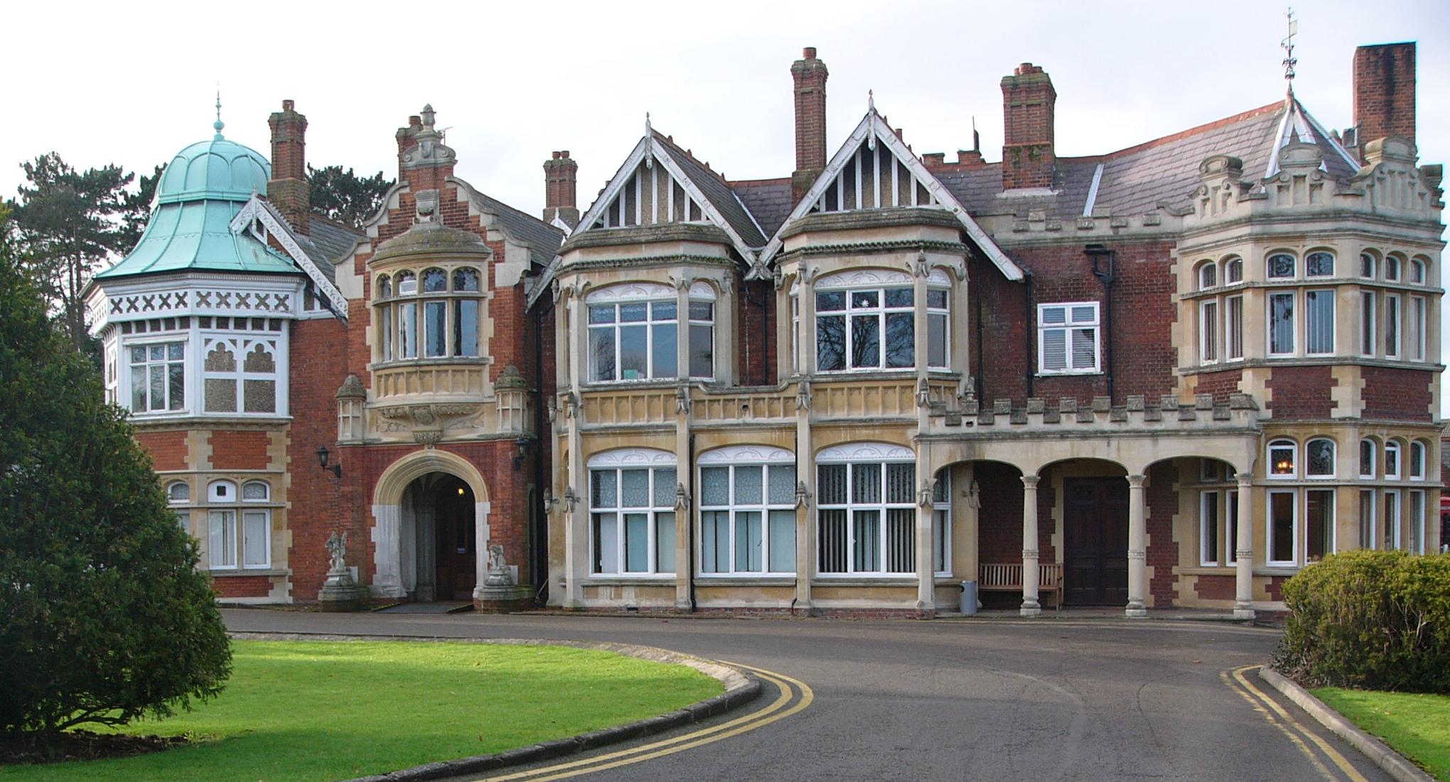
 During World War II, British, Polish and American cryptographers at Bletchley Park broke a large number of Axis codes and ciphers, including the German Enigma machine.
 The 1815 windmill near New Bradwell village, beside the playing fields
 Stony Stratford high street in festive mood
 The Peace Pagoda
The remainder of the designated area outside the four main towns (Bletchley, Newport Pagnell, Stony Stratford, Wolverton) was largely rural farmland but included many picturesque North Buckinghamshire villages and hamlets: Bradwell village and its Abbey, Broughton, Caldecotte, Fenny Stratford, Great Linford, Loughton, Milton Keynes Village, New Bradwell, Shenley Brook End, Shenley Church End, Simpson, Stantonbury, Tattenhoe, Tongwell, Walton, Water Eaton, Wavendon, Willen, Great and Little Woolstone, Woughton on the Green. The historical settlements have been focal points for the modern development of the new town. Every grid square has historical antecedents, if only in the field names. The more obvious ones are listed below and most have more detailed articles.
Bletchley was first recorded in the 12th century as Blechelai. Its station was a major Victorian junction (the London and North Western Railway with the Oxford-Cambridge Varsity Line), leading to the substantial urban growth in the town in that period. It expanded to absorb the villages of Water Eaton and Fenny Stratford.
Bletchley Park was home to the Government Code and Cypher School during the Second World War. The famous Enigma code was cracked here, and the building housed what was arguably the world's first programmable computer, Colossus. The house is now a museum of war memorabilia, cryptography and computing.
The Benedictine Priory of Bradwell Abbey at Bradwell was of major economic importance in this area of north Buckinghamshire before the Dissolution of the Monasteries. The routes of the medieval trackways (many of which are now Redways or bridleways) converge on the site from some distance. Nowadays there is only a small medieval chapel and a manor house occupying the site.
New Bradwell, to the north of the medieval Bradwell (Abbey) and just across the canal and the railway to the east of Wolverton, was built specifically for railway workers. It has a working windmill, although technically this lies just a few yards outside of the parish boundary. The level bed of the old Wolverton to Newport Pagnell Line ends here and has been converted to a Redway, making it a favourite route for cycling.
Great Linford appears in the Domesday Book as Linforde, and features a church dedicated to Saint Andrew, dating from 1215. Today, the outer buildings of the 17th century manor house form an Arts Centre, and Linford Manor is a prestigious recording studio.
Milton Keynes Village is the original village to which the New Town owes its name. The original village is still evident, with a pleasant thatched pub, village hall, church and traditional housing. The area around the village has reverted to its original name of Middleton, as shown on old maps of the 1700s. The oldest[37] surviving domestic building in the area, a 14th century manor house, is here.
There has been a market in Stony Stratford since 1194 (by charter of King Richard I). The Rose and Crown Inn at Stratford is reputedly the last place the Princes in the Tower were seen alive.
The manor house of Walton village, Walton Hall, is the headquarters of the Open University and the tiny parish church (deconsecrated) is in its grounds.
The tiny Parish Church (1680) at Willen contains the only unaltered building by the architect and physicist Robert Hooke. Nearby, there is a Buddhist Temple and a Peace Pagoda. The district borders the River Ouzel: there is a large balancing lake here, to capture flash floods before they cause problems downstream on the River Great Ouse. The north basin is a wildlife sanctuary and a favourite of migrating aquatic birds. The south basin is for leisure use, favoured by wind surfers and dinghy sailors. The circuit of the lakes is a favoured "fun run".
The original Wolverton was a medieval settlement just north and west of today's town. The Ridge and Furrow pattern of agriculture can still be seen in the nearby fields and the Saxon (rebuilt in 1819) Church of the Holy Trinity still stands next to the Norman Motte and Bailey site. Modern Wolverton was a 19th century New Town built to house the workers at the Wolverton railway works (which built engines and carriages for the London and North Western Railway).
Economy, demographics, geography and politics
Main article: Milton Keynes (borough)Data on the economy, demographics and politics of Milton Keynes are collected at the Borough level and are detailed at Economy of the Borough and Demographics of the Borough. However, since the urban area is predominant in the Borough, it is reasonable to assume that, other than for agriculture, the figures are broadly the same. For the borough as a whole, the service sector (including energy and construction) is the largest, followed by manufacturing (which includes hunting and forestry).
Milton Keynes is one of the more successful (per capita) economies in the South East, with a gross value added per capita index that was 47% higher than the national average (2005 data).[38] Service industries dominate the economy, making it susceptible to economic downturn.
The population is significantly younger than the national averages. According to 2005 estimates, the ethnic makeup of the Borough is 88.0% White, 4.7% South Asian, 3.5% Black, 2.1% Mixed Race, 1.7% Chinese or other.[39]
Marshall valve amplifiers and some speaker cabinets are hand-built in Bletchley, Milton Keynes.
Modern parishes and districts
The Borough of Milton Keynes is fully parished. These are the parishes, and the districts they contain, within Milton Keynes itself. For a list of parishes in the Borough, see Borough of Milton Keynes (Rest of the borough)
- Bletchley and Fenny Stratford: Brick fields, Central Bletchley, Denbigh North, Denbigh East, Denbigh West, Fenny Lock, Fenny Stratford, Granby, Mount Farm, Water Eaton
- Bradwell: Bradwell, Bradwell Common, Bradwell village, Heelands, Rooksley
- Bradwell Abbey: Bradwell Abbey, Kiln Farm, Stacey Bushes, Two Mile Ash, Wymbush
- Broughton and Milton Keynes (shared parish council): Atterbury, Brook Furlong, Broughton, Fox Milne, Middleton (including Milton Keynes Village), Northfield, Oakgrove, Pineham
- Campbell Park: Campbell Park, Fishermead, Newlands, Oldbrook, Springfield, Willen and Willen Lake, Winterhill, Woolstone
- Central Milton Keynes
- Great Linford: Blakelands, Bolbeck Park, Conniburrow, Downs Barn, Downhead Park, Great Linford, Giffard Park, Neath Hill, Pennyland, Tongwell, Willen Park
- Kents Hill, Monkston and Brinklow: Brinklow, Kents Hill, Kingston, Monkston
- Loughton: Loughton, Loughton Lodge, Great Holm, Knowlhill (including the Bowl)
- New Bradwell
- Shenley Brook End: Emerson Valley, Furzton, Kingsmead, Shenley Brook End, Snelshall, Tattenhoe, Tattenhoe Park, Westcroft
- Shenley Church End: Crownhill, Grange Farm, Hazeley, Medbourne, Oakhill, Oxley, Shenley Church End, Woodhill
- Simpson: Ashland, Simpson, West Ashland
- Stantonbury: Bancroft/Bancroft Park, Blue Bridge, Bradville, Linford Wood, Stantonbury, Stantonbury Fields
- Stony Stratford: Fullers Slade, Galley Hill, Stony Stratford
- Walton: Brown's Wood, Caldecotte, Old Farm Park, Tilbrook, Tower Gate, Walnut Tree, Walton, Walton Hall, Walton Park, Wavendon Gate
- West Bletchley: Far Bletchley, Old Bletchley, West Bletchley, Denbigh Hall
- Wolverton and Greenleys: Greenleys, Hodge Lea, Stonebridge, Wolverton, Old Wolverton
- Woughton: Beanhill, Bleak Hall, Coffee Hall, Eaglestone, Elfield Park, Leadenhall, Netherfield, Peartree Bridge, Redmoor, Tinkers Bridge, Woughton on the Green, Woughton Park, Woughton village.
Closest cities, towns and villages
Destinations from Milton Keynes 
Deanshanger, Towcester, Daventry, Coventry
Roade, NorthamptonNewport Pagnell, Olney, Wellingborough Cranfield, Bedford, Cambridge Buckingham, Brackley, Banbury 
Woburn Sands, Ridgmont, Ampthill  Milton Keynes

Bicester, Oxford Leighton Buzzard or Winslow, Aylesbury Toddington, Dunstable, Luton, London Notable people
- Alan Turing, played a significant role in the creation of the modern computer. He lodged at the Crown Inn, Shenley Brook End, while working at Bletchley Park.
- Andrew Baggaley, English table tennis champion
- Sam Baldock, professional footballer for Milton Keynes Dons
- Errol Barnett, an anchor and correspondent for CNN is from Milton Keynes. He lived in Crownhill and attended Holmwood First School and Two Mile Ash Middle School before moving to the U.S..
- Capdown, the ska punk band, come from and formed in Milton Keynes in 1997
- Chris Clarke, English sprinter.
- Fellsilent, the metal band, come from and formed in Milton Keynes in 2003
- Adam Ficek, drummer of London band Babyshambles
- Lee Hasdell, professional Mixed martial artist and Kickboxer, and Pioneer of Mixed martial artist in the UK.
- James Hildreth, cricketer who plays for Somerset and has played for England
- Liam Kelly, professional footballer for Kilmarnock F.C.
- Shelly McErlaine and Karen Poole of Alisha's Attic lived in Milton Keynes, and their parents still live in Neath Hill
- Gordon Moakes, the bassist for the London-based rock band Bloc Party.
- Clare Nasir, the meteorologist, TV and radio personality, was born in Milton Keynes in 1970
- Craig Pickering, English sprinter
- Sarah Pinborough, English horror writer
- Mark Randall, professional footballer for Chesterfield
- Greg Rutherford, English long jumper
- Sam Tomkins, Wigan Warriors and England international rugby league player, was born in Milton Keynes.
- Ian Poulter, PGA & European Tour golf professional. Member of the 2010 European Ryder Cup Team.
- Jack Trevor Story, novelist, was a long-term resident of Milton Keynes.
- Kevin Whately, actor, is a resident of Milton Keynes
- Jo Whiley, DJ for BBC Radio 2, is a resident of Milton Keynes.
- Dan Wheldon, Indy car driver
- Pete Winkelman, Chairman of Milton Keynes Dons Football Club and long term resident
Transport
 the Grand Union Canal passes over Grafton Street at Bradwell via the modern Bradwell Aqueduct
The Grand Union Canal between London and Birmingham provides a major axis in the design of Milton Keynes.
Milton Keynes is served by five railway stations, of which Milton Keynes Central is the one served by inter-city services. Wolverton, Milton Keynes Central and Bletchley stations are on the West Coast Main Line, whilst Fenny Stratford and Bow Brickhill are on the Marston Vale Line. Woburn Sands railway station, also on the Marston Vale line, is just outside the urban area in the small town of Woburn Sands, but is still within the Borough of Milton Keynes.
The M1 motorway runs to the east of the town, and is served by junctions 13, 14, and 15A. The A5 road runs through the west of the town. Other main roads include the A509, which links Milton Keynes with Wellingborough and Kettering, and the A421 which goes west to Buckingham and east to Bedford.
Many long-distance coaches stop at the Milton Keynes coachway,[40] (beside M1 Junction 14), some 3.3 miles (5.3 km) from the centre (or 4 miles (6.4 km) from Milton Keynes Central station).[41] There is also a park and ride car park on the site. Regional coaches stop at Milton Keynes Central.
The main bus operator is MK Metro, providing a number of routes which mainly pass through or serve Central Milton Keynes. Milton Keynes is also served by Arriva (which owns MK Metro but runs Arriva-branded services from Aylesbury) and Stagecoach Group which operates routes to Oxford, Cambridge and Peterborough. See Buses in Milton Keynes for more information.
Milton Keynes is served by routes 6 and 51 on the National Cycle Network.
The nearest international airport is London Luton Airport which is accessible by route VT99 from MK Central station, this service runs with wheelchair accessible coaches. There is a direct rail connection to Birmingham International Airport. There is an aerodrome at Cranfield, 6 miles (10 km) from the centre. Although Milton Keynes is allocated an International Air Transport Association airport code of KYN,[42] it does not actually have an airport. (There were proposals in 1971 for a third London airport at nearby Cublington.[43] Parliament rejected the recommendation in favour of a site at Maplin Sands, Foulness).[44]
Twin towns
 Bernkastel-Kues, Germany[45]
 Almere, Netherlands[46]
Climate
Milton Keynes experiences an oceanic climate (Köppen climate classification Cfb) similar to almost all of the United Kingdom. Recorded temperature extremes range from 34.6 °C (94.3 °F)[47] during July 2006, to as low as −20.6 °C (−5.1 °F)[48] on 25 February 1947. More recently the temperature fell to −16.3 °C (2.7 °F)[49] on 20 December 2010
The nearest Met Office weather station is in Woburn,[50] located just outside the south eastern fringe of the Milton Keynes urban area.
Climate data for Milton Keynes Month Jan Feb Mar Apr May Jun Jul Aug Sep Oct Nov Dec Year Average high °C (°F) 7
(45)8
(46)11
(52)13
(55)17
(63)19
(66)22
(72)23
(73)19
(66)14
(57)10
(50)7
(45)14 Average low °C (°F) 2
(36)2
(36)4
(39)4
(39)7
(45)10
(50)12
(54)12
(54)10
(50)8
(46)5
(41)3
(37)7 Precipitation mm (inches) 45.1
(1.776)33.9
(1.335)28.7
(1.13)43.9
(1.728)34.9
(1.374)46.6
(1.835)42.1
(1.657)46.9
(1.846)54.9
(2.161)56.8
(2.236)48.0
(1.89)49.8
(1.961)531.6
(20.929)Source: MSN.com[51] See also
References
- ^ Milton Keynes Population Bulletin 2008/09. Milton Keynes Council. p. 5. http://www.mkiobservatory.org.uk/Download/Public/1026/DOCUMENT/9103/Population%20Bulletin%202009-10.pdf. Retrieved 24 August 2010.
- ^ Vision of Britain: historic census populations for modern Milton Keynes UA Accessed 11 October 2006
- ^ MKi Observatory: Population Estimates – Miltonkeynes.gov.uk. Accessed 11 March 2011
- ^ Clutch.open.ac.uk Accessed 10 October 2006
- ^ Clutch.open.ac.uk Accessed 10 October 2006
- ^ Need for more planned towns in the South-East.The Times. 2 December 1964 Accessed 21 September 2006
- ^ South East Study 1961–1981 HMSO 1964, cited in The Plan for Milton Keynes. Accessed 25 September 2006
- ^ Urgent action to meet London housing needs. The Times, 4 February 1965. Accessed 21 September 2006
- ^ Volume 1 of The Plan for Milton Keynes (Milton Keynes Development Corporation March, 1970 ISBN 0-903379-00-7 begins (in the Foreword by Lord ("Jock") Campbell of Eskan): "This plan for building the new city of Milton Keynes ..." (page xi) Accessed 25 September 2006
- ^ Area of New Town Increased by 6,000 acres (24 km2). The Times. 14 January 1966. Accessed 21 September 2006
- ^ "MK Council General Statistics.". Milton Keynes Council. http://www.milton-keynes.gov.uk/statistics/DisplayArticle.asp?ID=11407. Retrieved 10 April 2008.
- ^ a b Llewelyn-David et al. The Plan for Milton Keynes 1968. Accessed 11 January 2007
- ^ The South East Study 1961–1981 HMSO London, 1964: "A big change in the economic balance within the south east is needed to modify the dominance of London and to get a more even distribution of growth". Accessed 27 November 2006
- ^ Jeff Bishop Milton Keynes – the Best of Both Worlds? Public and professional views of a new city. University of Bristol School for Advanced Urban Studies 1981. Accessed 13 February 2007
- ^ a b Walker The Architecture and Planning of Milton Keynes, Architectural Press, London 1981. Accessed 13 February 2007
- ^ M Webber (1963) 'Order in Diversity: Community Without Propinquity, in L Wingo (ed.) 'Cities and Spaces Hopkins, Baltimore. Accessed 13 February 2007
- ^ MKweb.co.uk Subsequent census data is 1971:46,500; 1981:95,800; 1991:144,700; 2001:177,500. Accessed 21 May 2006
- ^ Jef Bishop Milton Keynes – the Best of Both Worlds? Public and professional views of a new city. University of Bristol School for Advanced Urban Studies. Accessed 13 February 2007.
- ^ Kitchen, Roger; Hill, Marion (2007). 'The story of the original CMK' … told by the people who shaped the original Central Milton Keynes (interviews). Milton Keynes: Living Archive. p. 17. ISBN 978 090484734 – 5. http://www.livingarchive.org.uk/. Retrieved 26 January 2009. (Professor Lock is visiting professor of town planning at Reading University. He was the chief town planner for CMK.) (Ten miles is about 16km and 18,000 acres is about 7,300 hectares),
- ^ Walker, Derek (1982). The Architecture and Planning of Milton Keynes. London: Architectural Press. pp. 8. ISBN 0851397352. cited in Clapson, Mark (2004). A Social History of Milton Keynes: Middle England/Edge City. London: Frank Cass. pp. 40. ISBN 0714684171.
- ^ MKweb.co.uk Accessed 16 August 2006
- ^ Milton Keynes Partnership
- ^ Theparkstrust.com Accessed 30 October 2006
- ^ Society.guardian.co.uk Accessed 27 March 2006
- ^ Accessed 2006-12-08 OPSI.gov.uk
- ^ MKweb.co.uk
- ^ Milton Keynes College, UCMK. Postgraduate Certificate in Education, in partnership with and accredited by Oxford Brookes University Retrieved 6 August 2009
- ^ Based on tests using http://www.megalithia.com/elect/terrain.html
- ^ What's the issue in MK? – Milton Keynes Broadband Action Group
- ^ [1] – Analysis Mason report March 2010, pages 3 and 33, archived in the MK BAG Document Library
- ^ [2] – Think Broadband
- ^ UK's worst towns and cities: Milton Keynes in the slow lane for mobile broadband speeds – TOP10.COM (A price-comparison and click-thru site. The size of the sample is no given).
- ^ Milton Keynes in dreamland after being selected for World Cup bid The Times, 17 December 2009
- ^ Sustrans.org
- ^ Miles, Stuart (18 August 2006). WiMax in MK "Milton Keynes to get blanket WiMax coverage". Pocket-lint.co.uk. http://www.pocket-lint.co.uk/news.php?newsId=4384 WiMax in MK. Retrieved 3 April 2007.
- ^ Head, Will (19 October 2006). "Milton Keynes sets Wi-Fi free". vnunet.com. http://www.vnunet.com/vnunet/news/2166772/free-wi-milton-keynes. Retrieved 3 April 2007.
- ^ MKweb.co.uk Accessed 11 March 2006
- ^ Regional Gross Value Added pp 240–253 pub. Office of National Statistics
- ^ However they are significantly different in 2011.Milton Keynes Ethnicity
- ^ Services to and from Milton Keynes Coachway, Park & Ride – National Express Coaches
- ^ Google Maps then 'Get directions'.
- ^ Airport codes starting with K – World-airport-codes.com
- ^ Parliamentary Debates, House of Commons, 4 March 1971.
- ^ Patterson, Walt (1973) Airports, Concorde in trouble Environment: London Report Retrieved 19 May 2011
- ^ Milton Keynes Council. "Town twinning". Milton-Keynes.gov.uk. http://www.milton-keynes.gov.uk/council-democracy/DisplayArticle.asp?ID=25870. Retrieved on 29 October 2008.
- ^ http://cordis.europa.eu/fetch?CALLER=FP6_PROJ&ACTION=D&DOC=608&CAT=PROJ&QUERY=0124f6c835a9:79bd:137665bc&RCN=85715
- ^ "2006 Maximum". http://www.metoffice.gov.uk/climate/uk/interesting/july2006/MaxTemp1907Points_jpeg.JPG. Retrieved 3 March 2011.
- ^ 1947 minimum. doi:10.1002/wea.66.
- ^ Rogers, Simon (21 December 2010). "2010 minimum". The Guardian (London). http://www.guardian.co.uk/news/datablog/2010/dec/20/winter-weather-coldest-places-britain. Retrieved 3 March 2011.
- ^ Synoptic and climate stations, July 2011 – Met Office
- ^ "Averages for Milton Keynes". August 2011. http://weather.msn.com/monthly_averages.aspx?&wealocations=wc%3aUKXX0268&q=Milton+Keynes%2c+GBR&setunit=C.
External links
- Milton Keynes at the Open Directory Project
- The Official Visitor Website for Milton Keynes
- Milton Keynes Council
- City Discovery Centre (MK urban studies centre)
- Milton Keynes Article Concept For Living Magazine, March 2008[dead link]
- Urban Design magazine – "Milton Keynes at 40"
- Milton Keynes Broadband Action Group
Ceremonial county of Buckinghamshire Unitary authorities Boroughs or districts - Aylesbury Vale
- Chiltern
- South Bucks
- Wycombe
Major settlements Rivers Topics - Boundary changes
- Grade I listed buildings
- High Sheriff
- History
- Lord Lieutenant
- Monastic houses
- Museums
- Parliamentary constituencies
- Places
- Places of interest
- Railways
- Schools (Bucks)
- Schools (Milton Keynes)
- Sites of Special Scientific Interest
- Transport
River Great Ouse, England Counties Flows into Towns
(upstream to downstream)Brackley · Buckingham · Old Stratford · Milton Keynes (Stony Stratford • Wolverton • New Bradwell) · Newport Pagnell · Olney · Kempston · Bedford · St Neots · Godmanchester · Huntingdon · St Ives · Ely · Littleport · Downham Market · King's Lynn
Major tributaries
(upstream to downstream by confluence)River Tove · River Ouzel (or Lovat) · River Ivel · River Kym · Old Bedford River · New Bedford River · River Cam · River Lark · River Little Ouse · River Wissey
Major bridges
(upstream to downstream)Harrold bridge · A428 Turvey bridge · A428 Bromham bypass · A6 Bedford Town Bridge · A421 Bedford bypass · Great Barford Bridge · A428 Bridge St Neots · St Neots Town Bridge · Godmanchester Chinese Bridge · A14 bridge, River Great Ouse · Huntingdon Old Bridge · St Ives Bridge
Categories:- Populated places on the River Great Ouse
- Towns in Buckinghamshire
- Milton Keynes
- New towns in England
- Populated places established in 1967
- Planned cities


Wikimedia Foundation. 2010.