- Commercial Building (Dayton, Ohio)
-
Commercial Building

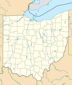

Location: Dayton, Ohio Coordinates: 39°45′29″N 84°11′36″W / 39.75806°N 84.19333°WCoordinates: 39°45′29″N 84°11′36″W / 39.75806°N 84.19333°W Built: 1908 Architect: Peters, Burns & Pretzinger[1] Architectural style: Skyscraper Governing body: Private[1] NRHP Reference#: 82001477[1] Added to NRHP: December 2, 1982 The Commercial Building built is 1908 is an historic skyscraper located at 44 South Ludlow Street in Dayton, Ohio. It was designed by architects Peters, Burns and Pretzinger.
On December 2, 1982, it was added to the National Register of Historic Places.
See also
References
- ^ a b c "National Register of Historic Places". National Park Service. http://www.nationalregisterofhistoricplaces.com/OH/Montgomery/state.html. Retrieved 2009-01-07.
U.S. National Register of Historic Places Topics Lists by states Alabama • Alaska • Arizona • Arkansas • California • Colorado • Connecticut • Delaware • Florida • Georgia • Hawaii • Idaho • Illinois • Indiana • Iowa • Kansas • Kentucky • Louisiana • Maine • Maryland • Massachusetts • Michigan • Minnesota • Mississippi • Missouri • Montana • Nebraska • Nevada • New Hampshire • New Jersey • New Mexico • New York • North Carolina • North Dakota • Ohio • Oklahoma • Oregon • Pennsylvania • Rhode Island • South Carolina • South Dakota • Tennessee • Texas • Utah • Vermont • Virginia • Washington • West Virginia • Wisconsin • WyomingLists by territories Lists by associated states Other  Category:National Register of Historic Places •
  Portal:National Register of Historic PlacesCategories:
- Ohio Registered Historic Place stubs
- Commercial buildings on the National Register of Historic Places in Ohio
- Buildings and structures in Dayton, Ohio


Wikimedia Foundation. 2010.