- U.S. Route 44 in New York
-
This article is about the section of U.S. Route 44 in New York. For the entire length of the highway, see U.S. Route 44.
U.S. Route 44

Map of New York with US 44 highlighted in redRoute information Maintained by NYSDOT and New York State Bridge Authority Length: 65.98 mi[3] (106.18 km) Existed: ca. 1935[1][2] – present Major junctions West end: 
 US 209 / NY 55 in Wawarsing
 US 9 in Poughkeepsie
 NY 22 in Millerton
East end:  US 44 at the Connecticut state line in Amenia
Location Counties: Ulster, Dutchess Highway system United States Numbered Highways
List • Bannered • Divided • ReplacedNumbered highways in New York
Interstate • U.S. • N.Y. (former) • Reference • County←  NY 43
NY 43NY 45  →
→U.S. Route 44 (US 44) in the state of New York is a major east–west thoroughfare in the Hudson Valley region of the state. Its entire 65.98-mile (106.18 km) length is maintained by the New York State Department of Transportation, with the exception of the Mid-Hudson Bridge, which is maintained by the New York State Bridge Authority. The portion of the route in New York begins at an intersection with US 209 and New York State Route 55 (NY 55) near the hamlet of Kerhonkson and ends at the Connecticut state line near the village of Millerton. The road passes through rural parts of Ulster and Dutchess Counties before crossing into Litchfield County, Connecticut.
Most of the route in Dutchess County was once part of the Dutchess Turnpike, an early road interconnecting Poughkeepsie to various settlements in Dutchess County. US 44 was designated ca. 1935 and had no major changes in alignment until 2007, when it was relocated onto New York State Route 44A, a highway that bypassed the village of Millbrook to the northwest. The NY 44A designation was deleted as a result of the relocation, and signage for NY 44A was taken down in April 2008. US 44's original alignment through Millbrook became NY 984P, an unsigned reference route.
Contents
Route description
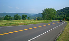
 US 44 and NY 55 in orchards near downtown Plattekill
US 44 begins at an intersection with US 209 and NY 55 west of the hamlet of Kerhonkson in the town of Wawarsing in Ulster County. NY 55, concurrent with US 209 southwest of this point, turns east onto US 44, forming an overlap as the two routes proceed eastward across Ulster County. Midway between Kerhonkson and Gardiner and just north of NY 299, US 44 and NY 55 traverse a hairpin turn made necessary by the surrounding Shawangunk Ridge.[4]
Farther east, the road passes through the hamlets of Gardiner and Clintondale, and meets US 9W in the hamlet of Highland. Just inside of Gardiner, the highway passes through Minnewaska State Park, a large state park in the Hudson Valley. US 44 and NY 55 join US 9W for roughly a half-mile southward along the western bank of the Hudson River before separating at a trumpet interchange south of Highland. One mile east of US 9W, US 44 and NY 55 cross the Hudson on the Mid-Hudson Bridge.[4]
On the opposite bank in Dutchess County, US 44 and NY 55 enter the city of Poughkeepsie. In the downtown area, US 44 and NY 55 connect with US 9 by way of an interchange before splitting into a pair of parallel one-way streets. At the eastern end of the parallel roadways in Arlington, just outside of Poughkeepsie, US 44 and NY 55 split upon meeting Main Street at an interchange. NY 55 continues southeast through the junction as Manchester Road; US 44, however, joins Main Street to the northeast along what becomes the Dutchess Turnpike. West of the interchange, state maintenance continues along Main Street for an additional 0.19 miles (0.31 km) to County Route 38 (CR 38, named Fairmont Avenue). This segment of Main Street is designated as NY 983W, an unsigned reference route.[3][5] Past CR 38, Main Street becomes CR 114.
From Arlington, Route 44 bends first to the north, then after 1.5 miles northeast, through intermittently developed areas, woodlots, and farms to the next settlement along its route, Pleasant Valley. In its commercial center the road widens to include a center turn lane. After crossing Wappinger Creek, it returns to two lanes.
The road returns to a more easterly course for two miles, then straightens out as it climbs steadily past the Newcomb-Brown Estate. It crests just before the interchange with the Taconic State Parkway. A mile past it, at the state police Troop A barracks, NY 82 joins from the north and the two roads overlap.
This concurrency ends after another mile, when US 44 diverges along the route of the former NY 44A, going around the village of Millbrook past the Mary Flagler Cary Arboretum, home to the Institute of Ecosystem Studies. The highway returns to a more due-east orientation as it passes north of the village, then gradually curves to the northeast again as it passes through a heavily farmed area.
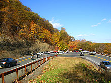
 Harlem Valley from hairpin turn near Amenia
Route 44 gradually descends into the upper Harlem Valley, with a sharp hairpin turn providing a panoramic view to the south. A gradual descent takes it into downtown Amenia. At the center of town, the highway turns north and replaces NY 343 as NY 22's overlap.
A seven-mile (11 km) journey over increasingly rolling and open terrain takes the two highways into the town of North East and towards Millerton. Just south of the village, NY 199 reaches its eastern terminus. The road enters Millerton on South Elm Street, making a sharp turn north that necessitates a concrete barrier and lower speed limit just south of downtown.
At the traffic light just north of that bend, US 44 leaves NY 22 and turns right through Millerton's historic downtown. Maple Avenue on the south marks the former northern terminus of NY 361. After that junction, Route 44 leaves the village. It passes some strip development on the south, bends slightly to the north and crosses the Connecticut state line just past a car dealership on the south.[4]
History
 The exit for US 44 and NY 55 near the Mid-Hudson Bridge from US 9
The portion of US 44 between Poughkeepsie and Amenia was the main line of an early toll road known as the Dutchess Turnpike.[6] The turnpike continued past Amenia into the Connecticut town of Sharon along modern NY 343. Between the Wallkill River near the hamlet of Gardiner and the hamlet of Ardonia, modern US 44 was also roughly located along another early toll road known as the Farmer's Turnpike.[7][8] The Farmer's Turnpike continued east past Ardonia to the village of Milton where a ferry across the Hudson River once existed.[9]
In 1924, when state highways were first marked by route numbers in New York, the main line of the Dutchess Turnpike was designated as NY 21.[10] Other portions of modern US 44, aside from the overlap with NY 22, were unnumbered in the 1920s.[11] In the 1930 renumbering of state highways in New York, the old NY 21 was partitioned into three numbered routes. Between Poughkeepsie and South Millbrook, old NY 21 became the western half of NY 200, which continued east to Dover Plains using the Dover branch route of the Dutchess Turnpike (modern NY 343). The section from South Millbrook to Amenia became part of NY 82A, which continued past Amenia to Pine Plains. The easternmost section from Amenia to the Connecticut line was designated as NY 343. West of the Hudson River, NY 55 was also designated in 1930 between Barryville and Pawling, running along the portion of modern US 44 between Kerhonkson and Poughkeepsie.[11][12]
 Signage for former NY 44A in February 2008; signs were not taken down for two more months
US 44 was assigned ca. 1935.[1][2] West of the Hudson River, it was overlaid on the pre-existing NY 55, with US 44 officially beginning at US 209, which was extended into New York ca. 1935. East of the river, US 44 was routed on the original Dutchess Turnpike main line from Poughkeepsie to Amenia, supplanting NY 200 west of South Millbrook, NY 82A west of Amenia, and a short portion of NY 343 between NY 82A and the hamlet of Amenia. US 44 left the turnpike at Amenia and followed NY 22 north to Millerton,[2][13] where it continued east on a short piece of former NY 199 into Connecticut.[9] The alignments of NY 200 and NY 343 were flipped as part of US 44's assignment.[2]
US 44 originally entered the village of Millbrook via NY 82, North Avenue, and Franklin Avenue.[2] On April 1, 1980, the state of New York assumed ownership of a highway bypassing Millbrook to the west and north as part of a highway maintenance swap between the state and Dutchess County.[14] The newly-acquired roadway was designated as NY 44A.[15] On June 5, 2007, the New York State Department of Transportation (NYSDOT) announced that US 44 would be permanently realigned onto NY 44A. All shields along NY 44A were replaced with US 44 signage,[16] and the NY 44A designation ceased to exist.[5] NYSDOT will continue to perform maintenance on US 44's former routing through Millbrook.[17] The portion of the routing that did not overlap NY 82 is now NY 984P, an unsigned reference route.[5]
Major intersections
County Location Mile[3] Destinations Notes Ulster Wawarsing 0.00 US 209 / NY 55 westWestern terminus of US 44 / NY 55 overlap Town of Gardiner 10.42  NY 299
16.30  NY 208
Hamlet of Ireland Corners Plattekill 17.76  NY 32
NY 32Hamlet of Modena Lloyd 27.68  US 9W north
Hamlet of Highland; northern terminus of US 9W / US 44 overlap 28.24 US 9W southInterchange; southern terminus of US 9W / US 44 overlap Dutchess City of Poughkeepsie 30.49 US 932.05  NY 115
Town of Poughkeepsie 32.46  NY 376
Census-designated place of Arlington 32.72 NY 55 eastEastern terminus of US 44 / NY 55 overlap Pleasant Valley 41.86  Taconic Parkway
Hamlet of Washington Hollow 42.57  NY 82 north
Western terminus of US 44 / NY 82 overlap Washington 43.71 NY 82 southEastern terminus of US 44 / NY 82 overlap Town of Amenia 56.39  NY 22 south / NY 343
Hamlet of Amenia; southern terminus of US 44 / NY 22 overlap North East 63.39  NY 199
Millerton 64.98 NY 22 northNorthern terminus of US 44 / NY 22 overlap North East 65.98 US 44Continues into Connecticut 1.000 mi = 1.609 km; 1.000 km = 0.621 mi See also
- New York State Bicycle Route 44
References
- ^ a b Texas Oil Company (1934). Road Map of New York (Map). Cartography by Rand McNally and Company.
- ^ a b c d e Sun Oil Company (1935). Road Map & Historical Guide – New York (Map). Cartography by Rand McNally and Company.
- ^ a b c "2008 Traffic Data Report for New York State" (PDF). New York State Department of Transportation. June 16, 2009. pp. 191–192, 367. https://www.nysdot.gov/divisions/engineering/technical-services/hds-respository/NYSDOT_Traffic_Data_Report_2008.pdf. Retrieved November 16, 2009.
- ^ a b c I Love New York (2007). 1977–2007 I Love New York State Map (Map).
- ^ a b c New York State Department of Transportation (January 2009) (PDF). Official Description of Highway Touring Routes, Bicycling Touring Routes, Scenic Byways, & Commemorative/Memorial Designations in New York State. https://www.nysdot.gov/divisions/operating/oom/transportation-systems/repository/2009%20tour-bk.pdf. Retrieved July 16, 2009.
- ^ Reed, Newton (1875). Early History of Amenia. De Lacey & Wiley, Printers. http://books.google.com/books?id=9QUCAAAAYAAJ&printsec=frontcover&dq=Early+history+of+Amenia&lr=&ei=pYdKSOCGKaPujAGZxdzmDQ#PPA103,M1. Retrieved June 7, 2008.
- ^ "Toll-Bridge and Turnpike Companies". The Revised Statutes of the State of New-York. 3. Printed by Packard and Van Benthuysen. 1829. pp. 587–624. http://books.google.com/books?id=KJEDAAAAQAAJ&pg=PA587#v=onepage&q=&f=false. Retrieved February 4, 2010.
- ^ Henry S. Tanner, 1823 and 1825 maps of New York, accessed via the David Rumsey Map Collection
- ^ a b Dutchess County Unit Federal Writers' Project (1937). American Guide Series: Dutchess County. William Penn Association of Philadelphia.
- ^ "New York's Main Highways Designated by Numbers". The New York Times: p. XX9. December 21, 1924.
- ^ a b Dickinson, Leon A. (January 12, 1930). "New Signs for State Highways". The New York Times: p. 136.
- ^ Automobile Legal Association (ALA) Automobile Green Book, 1930/31 and 1931/32 editions, (Scarborough Motor Guide Co., Boston, 1930 and 1931). The 1930/31 edition shows New York state routes prior to the 1930 renumbering
- ^ Gulf Refining Co. (1934). Rand McNally Official Road Map of New Jersey (Map).
- ^ New York State Legislature. "New York State Highway Law § 341". http://public.leginfo.state.ny.us/menugetf.cgi?COMMONQUERY=LAWS. Retrieved July 16, 2009.
- ^ State of New York (1981). I Love New York Tourism Map (Map). Cartography by Rand McNally and Company.
- ^ "NY 44 Being Rerouted to Bypass Village of Millbrook (Dutchess County)" (Press release). New York State Department of Transportation. June 5, 2007. https://www.nysdot.gov/news/traveler-advisories/2006/2007-06-05. Retrieved November 16, 2009.
- ^ Woyton, Michael (June 13, 2007). "Millbrook truck flow to decrease with reroute". Poughkeepsie Journal.
External links

Wikimedia Commons has media related to: - Alps' Roads – U.S. Route 44
- New York Routes – U.S. Route 44
- New York State Highway Termini – U.S. Route 44
- Interchange of the Week – Week 18
- New York Road Map Travel Guide: United States #44
U.S. Route 44Previous state:
TerminusNew York Next state:
ConnecticutCategories:- U.S. Highways in New York
- Transportation in Ulster County, New York
- Transportation in Dutchess County, New York


Wikimedia Foundation. 2010.